Wind Forecast is all over the place.
4:00PM
6:30PM
They ordered two type 1 helis to kernville airport. They also called it 60 acres.
I believe there are two separate fires up there. Each camera is on a different one…
Same fire. Both cams on the Trout.
There is also a packsaddle fire
More wind and lightning, pretty much all day and into the night. Could easily be a complex by tomorrow.
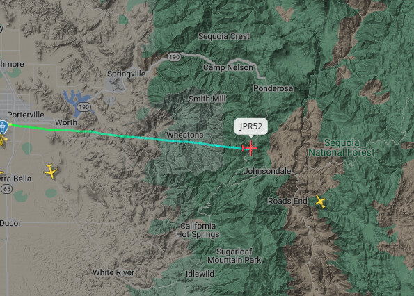
Jump 52 en route from porterville
Any intel on Packsaddle location?
All I heard was the name, I would assume that it is near packsaddle cave, if so, very rugged in there.
There is also a Packsaddle Meadow and Creek adjacent to Slate/Nelson that was inside the Windy burn 2021.
JPR52 inbound:

In my aging memory Packsaddle cave is too far east. May have been mentioning Packsaddle Grove which is further west.
Sounds like 538 is going to put their crew into the packsaddle.
Jumpers are on the ground. Trying to find a good anchor point
21 days flying on McNally as ATGS
Was an eye opener with many rotors timing out each day. IHC Crews spiked out there for weeks, supported by rotors.
FWAC does have two other reported incidents in the area.
Bone Fire. This looks like its pinned to the location where the cameras seemed to be looking at.
Job Corps E-642. Located to the west of where FWAC is pinning Trout Fire.
Maybe a trick of the eye, but putting the first cam in this thread back 6 hours, after the fire starts, the camera flips a couple frames to smoke on the slope below the camera. Maybe a different fire and why the cameras didn’t line up?
Wofford Heights is way south near the TUU/KRN line south of Posey. Don’t believe the cams were/are looking there??? The 2 initial cam views are of the same fire. I zoomed in and verified. Both cams have remained on same fire all this time.
162 acres per Firis