
It’s well established on to the SQF from the reservation
3 Likes
Another redwood grove in the crosshairs. Peyrone Grove is right there in the middle of the easterly front now. There is really no change in fuel model across this elevation and all the way up to Freezeout Meadow, and over to Mule Peak to the SE, nor to the NW towards Rogers/Solo Peak - White Fir, Cedar and Sugar Pines, with the typical heavy loading of dead White Fir and intermix of Redwood. With the change in weather and the fuels there things aren’t looking good.
Edit: Regenerative fire is a good thing, when done similar to the low level fires in YNP, for example. The Windy has the potential to reshape the South Fork Tule drainage and change the fuel model as has happened in the Middle Fork. The South Fork is the one are that has not had significant fire on it. It is choked with fuel, and is not natural for sure. But the damage and change to fuel model in the Middle Fork, and on Solo Peak, in the Alder Creek and Black Mountain Grove is substantial because of the intensity of fire.
10 Likes
There is no intel to gather from operations on SQF ch.2 or 4. The team is not using the repeaters for ops, plans or tactics.
Incident specific FTP data is not posted.
1 Like
Hope they have a good plan , that header today did not look good.
2 Likes
Active fire overnight shows growth on Caltopo, over the ridge near Onion Meadow, and onto the Kern drainage near Nobe Young Meadow. This area has seen some fuels reduction and logging which may slow things down. CalTopo - Backcountry Mapping Evolved
6 Likes
Todays Ops Map
2 Likes
Products are being posted. Still no IAP uploaded. Comms still not informative.
Crop of Topo of IR flight at 11pm 9-12-21:
20210913 Windy IRcrop .pdf (1.1 MB)
3 Likes
974 acres, 0% contained, CIIMT 11 in Unified with SQF and TIA as of 1230 hours today.
8 Likes
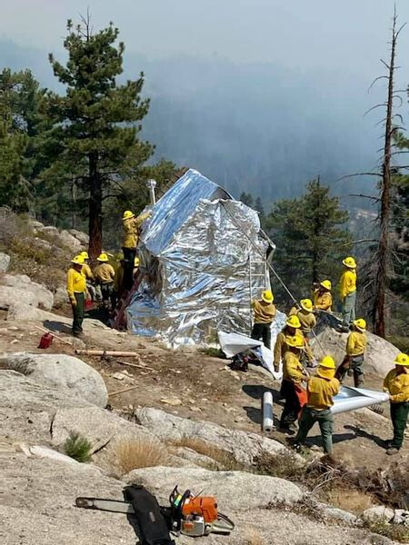
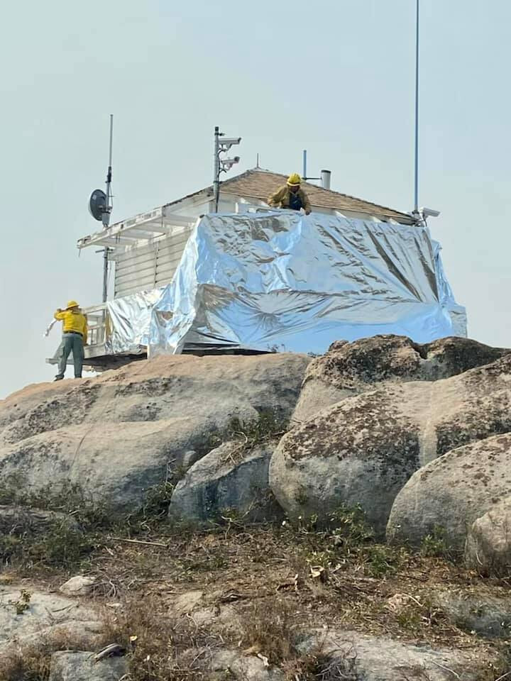
1,454 acres this morning. Significant possible expansion of the footprint based on Inciweb update. All Redwood groves in the area, along with Mule Peak lookout expected to be impacted. Looks like resources are timing out and this will have an impact on suppression activity. See bold type at the bottom. Not promising. From Inciweb:
Additional operational resources will be needed to make progress on this incident. As the incident continues to grow due to dry fuels and lack of resources more communities are being threatened by the fire spread. These communities include Camp Nelson to the North, Ponderosa to the Northeast and Johnsondale to the Southeast of the fire. These communities all have limited routes of egress and would require advance notice to evacuate safely. The Mule Peak lookout has a high likelihood of being impacted by the fire in the next 24 hours and a low probability of survival. Two high value Giant Sequoia Groves are being impacted by the fire and include Peyrone Grove, South Peyrone Grove numerous others including Red Hill Grove, Long Meadow Grove, Parker Peak Grove, North Cold Springs Grove and Trail of 100 Giants remain threatened. Major historical sites that are threatened include the scatted logging camps and mill sites and the Redwood Corral and associated structures. Additionally IA resources assigned from other fires will be timing out over the next 2 days leaving the incident with only one Type 1 Crew and two Type 2 Crews on 9/15. Without replacement crews and the additional critical resources requested by the incident has the potential to become a massive incident.
We will be losing these critical resources just as a trough of low pressure brings stronger and gustier winds over the fire area later in the week.
12 Likes
#WindyFire Update September 14, 2021
Acres: 1611
Containment: 0%
The fire is currently in an area with no recent fire history. Fire behavior may become very active while burning in areas of heavier fuels.
Via SQF FB page. About 15 mins ago.
3 Likes
Someone can come up with an IAP for frequencies for Command and Airops? That would be appreciated.
SQF ch.2 was command but, pretty void of comms.
No IAP’s online from these Teams. Or…in another folder not under the incident?
1 Like
It’s still on SQF2 for today.
2 Likes
I have a request for the COML to give me a call so I can get the IAP and Comm Plan.
6 Likes
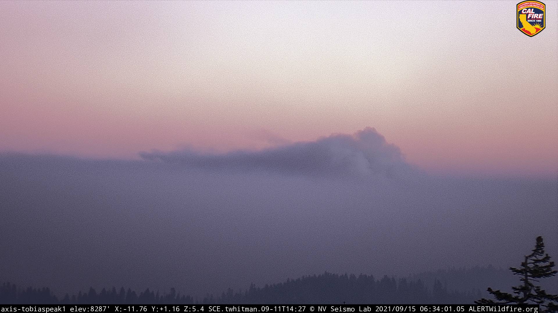
Winds from the NE for now, sending the smoke towards Pine Flat and California Hot Springs. NWS forecast has winds light from the SW in the area of the fire, and temps upper 70’s to near 80 and cooling as two troughs of low pressure move in this week. Fortunately, this area does not see significant daily air movement unless there is a change in pressure and hoping this helps suppression efforts.
7 Likes
2202 acres, 0% contained, and according to Inciweb, the fire in Peyrone Sequoia Grove was low intensity. Assessment of the grove not possible for a few days.
1425 EDIT: 3 in a row, not allowed to post new…
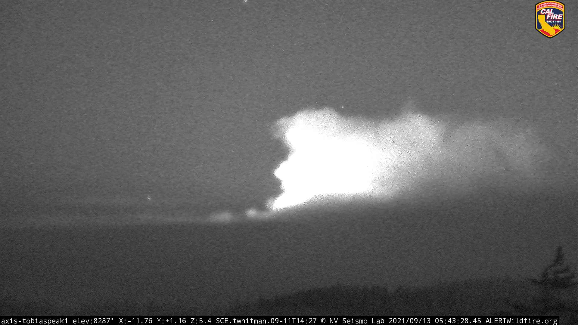
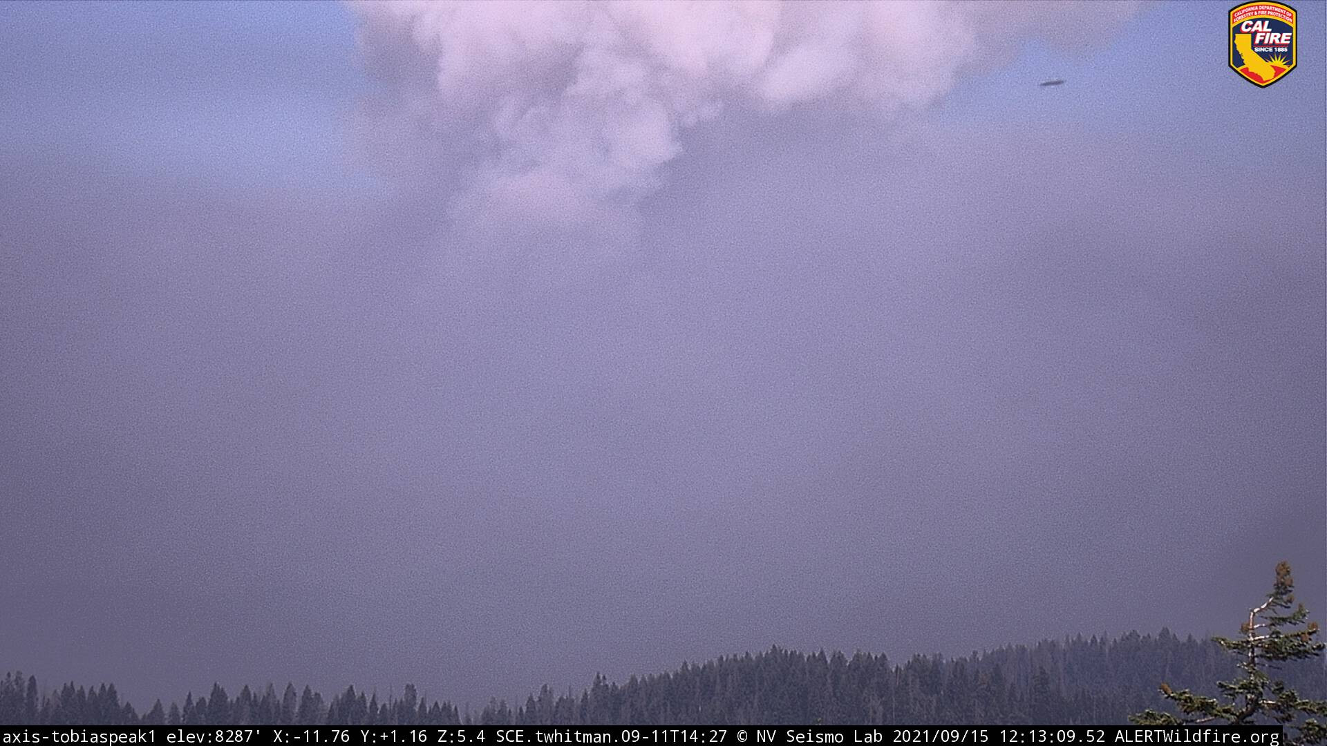
Watching the 6 hour timelapse from Tobias, it looks like the winds have pushed the east side of the fire well past Mule Peak lookout. Caltopo shows a 1336 flyby with heat in that area as well, but off a bit, showing heat on the Kern drainage side, but cams not supporting that data “if” I am reading it right.
https://caltopo.com/map.html#ll=36.01585,-118.58574&z=13&b=t&o=f16a%2Cr&n=1,0.25&a=mba%2Cfire%2Cmodis_mp
7 Likes