State ID: CA
3 letter designator: SQF
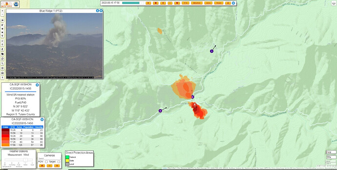
Fire name: Wishon
Location: Google Maps
Reported acres: 5-6 acres burning upslope potential for 50 acres
Rate of spread: Moderate/Rapid
Report on Conditions:
Structure threat:
Resources:
Hazards:
Weather:
Radio channels: SQF Channel 4, NIFC Tac 3, AG-24
Scanner link: Sequoia and Sierra Nat'l Forests & Kings Canyon Nat'l Park Live Audio Feed
Webcam link: ALERT Wildfire
ALERT Wildfire
Agency Website:
Rapid building and SQF Chief asking for evacuations to the area.
Per AA 20 acres moderate/rapid ROS
I would say a bit bigger than first report
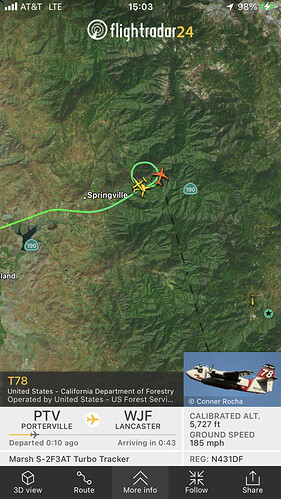
AA requesting 2 additional tankers any type for a total of 6.
Showing on GOES satellites already:
Very small orange dot center screen: (shows up @ 21:50 UTC)
Not currently but, Should show here soon (once it reaches 21:50 UTC) seems about 30 minutes behind:
https://rammb-slider.cira.colostate.edu/?sat=goes-17&sec=conus&x=8001&y=3882.25&z=4&angle=0&im=18&ts=1&st=0&et=0&speed=130&motion=loop&maps[borders]=white&lat=0&p[0]=cira_natural_fire_color&opacity[0]=1&pause=0&slider=-1&hide_controls=0&mouse_draw=0&follow_feature=0&follow_hide=0&s=rammb-slider&draw_color=FFD700&draw_width=6
that should be by the Wishon Powerhouse road near Coffee Camp off of Hwy 190., Will Get to SRA pretty quick.
Yep. And almost right where the 2017 Pier started from the dumped stolen vehicle.
TUU chief about 10-20 ago called it 50-80 acres. Advised ECC to expect a big order from SQF shortly.
If I heard right, 3 Type 1 and 2 Type 2 helos ordered so far.
And to add to the local resource impact, TLC has a structure fire in Lindsay, fully involved with reports of exposures and explosions per PD. EDIT: 2nd alarm requested for that structure, Lindsay IC.
EDIT at 1605, Wishon AA stating 200 acres.
AA410 was passing off to relief AA and states 200 acres and jumped northern dozer line.
AA requesting 2 VLAT’s
4:17PM 8/15/2022 VEGETATION FIRE #WishonFire Hwy 190 × Wishon Dr - Springville, Tulare County. There are no evacuations in place at this time. Highway 190 is closed at the White Barn in Springville. Wishon Fire Information - InciWeb the Incident Information System [INCIWEB]
FIRIS just flew it and mapped at 270 acres. Looks like fire is burning uplsope from the 190. This is an area that has burned many times in the last 10+ years so fuels are heavily modified and thinned. In fact so many recurrent fires in that stretch that SCE invested significant time and money in converting the wooden flume that provided water to a penstock and hydro plant above Springville, to a steel encased tube. The flume was impacted by the 2017 Pier Fire and has been out of commission since.
914 load and hold MCC
The other VLAT is responding out of Medford OR. Will make one drop and return to Medford.
that will be TNK912

