https://ops.alertcalifornia.org/cam-console/1800
Anyone have any info on this smoke? It looks too far South to be Shelly Fire.
https://ops.alertcalifornia.org/cam-console/1800
Anyone have any info on this smoke? It looks too far South to be Shelly Fire.
Could it be last night’s Hill fire?
Based on WD Map and Aircraft activity in the last hour, I’d say you were spot-on @DogBone
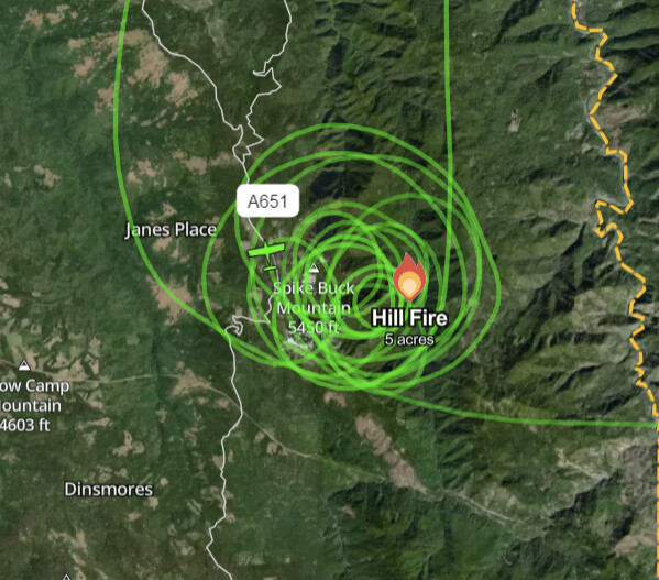
It is the SRF-Hill Fire, 30 acres and judging by the smoke, more than that now. . Multiple air tankers, and helicopters working it. The Shelly Fire also gave up some crews to respond.
Update on Conditions. 70 acres with a 1/2 acre spot on the wrong side of the river. Will be completing a complexity analysis and will probably be ordering a team to complex the SRF Fires.
I think they are managing it as a complex as there were several starts after lightning went through yesterday afternoon. I started a CA-SRF/HUU-July Complex thread Q&A thread yesterday.
125 acres, active fire behavior with short range spotting.
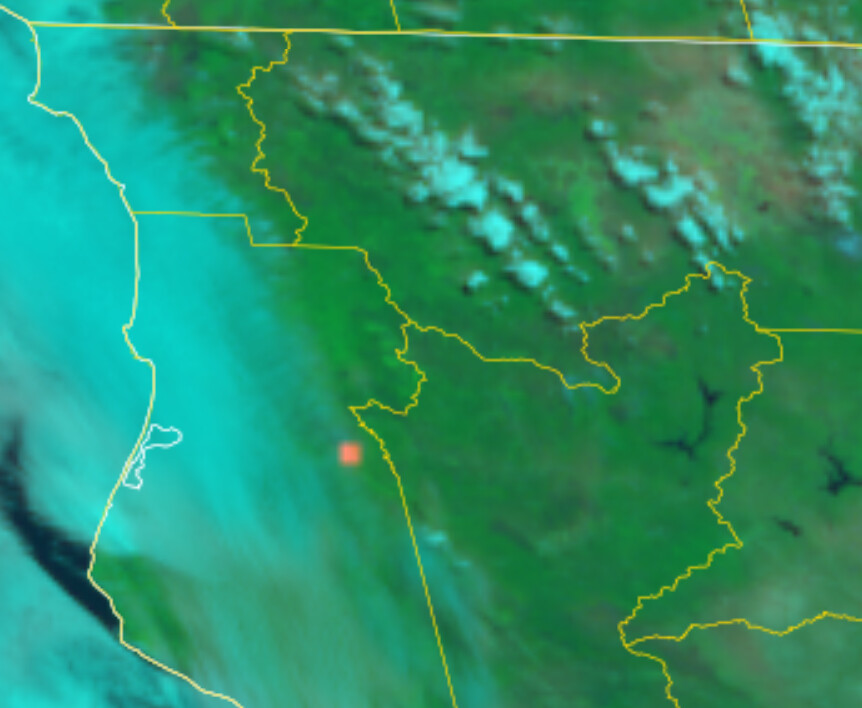
Looking like it found alignment on the cam…
https://ops.alertcalifornia.org/cam-console/1800
Yeah, popping an icecap on this cam:
https://ops.alertcalifornia.org/cam-console/1811
Similar to some of the August 2022 SRF Lightning complex fires these strikes were just slightly farther west/closer to the coast with less fire history in some of those spots. Right near the ridges where the marine layer pushes inland most nights. edit: The link above that pyro just posted shows that well.
SRF-Hill fire extended frequencies assigned today:
Air Tactics FM: 167.0625
Air/Ground: 170.3125 and 159.450 t192.8 (CDF A/G13). Not sure if they’re taking both for A/G CMD and A/G TAC, or SRF and HUU both put in duplicate orders and they’re only using one.
AM Victors: 118.775, 120.025
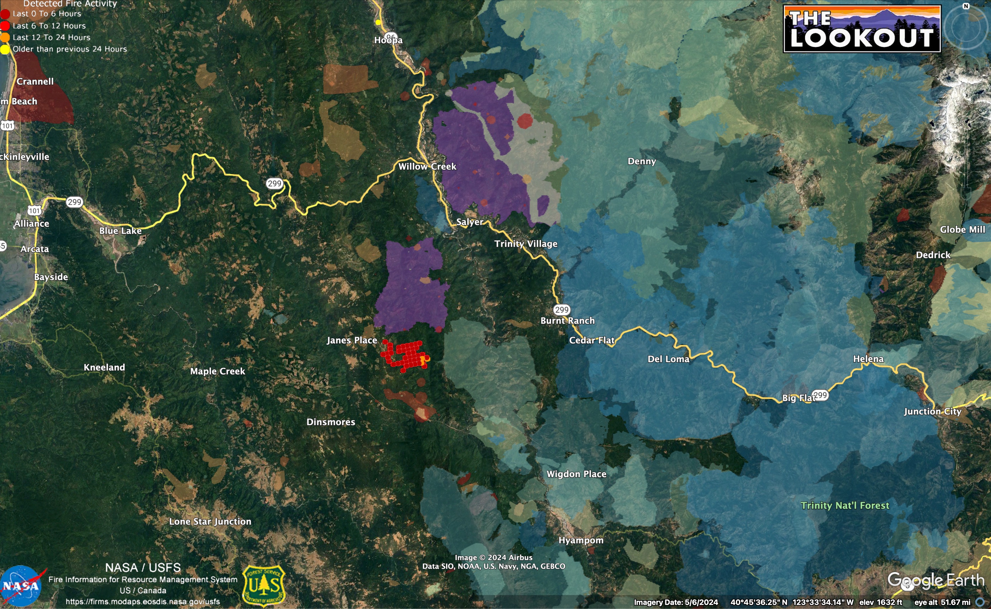
With the rapid spread of this fire to the North, would Willow Creek be the biggest threat for impact to communities? I don’t see a ton of large towns in the area.
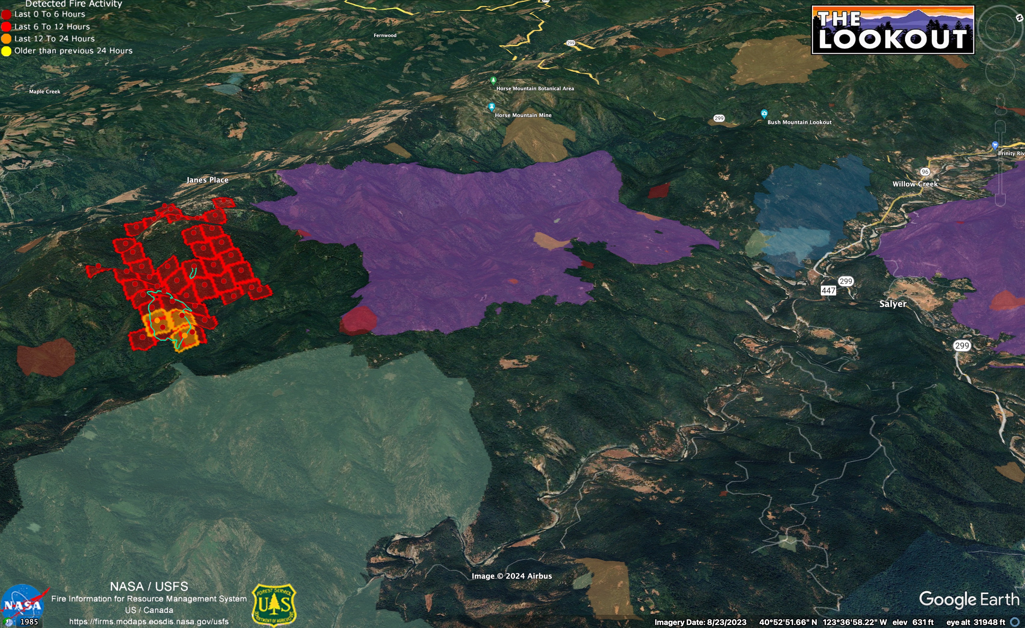
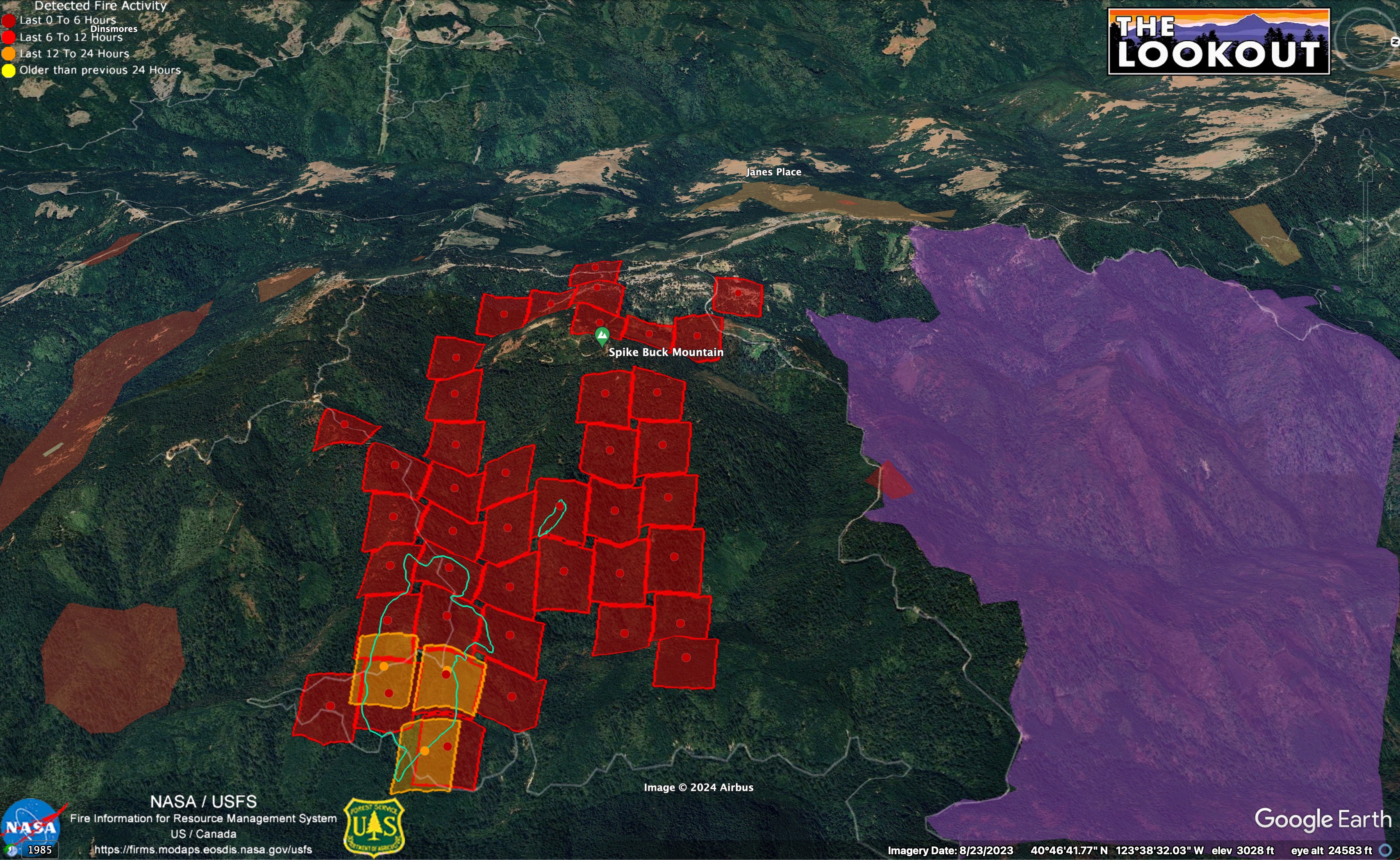
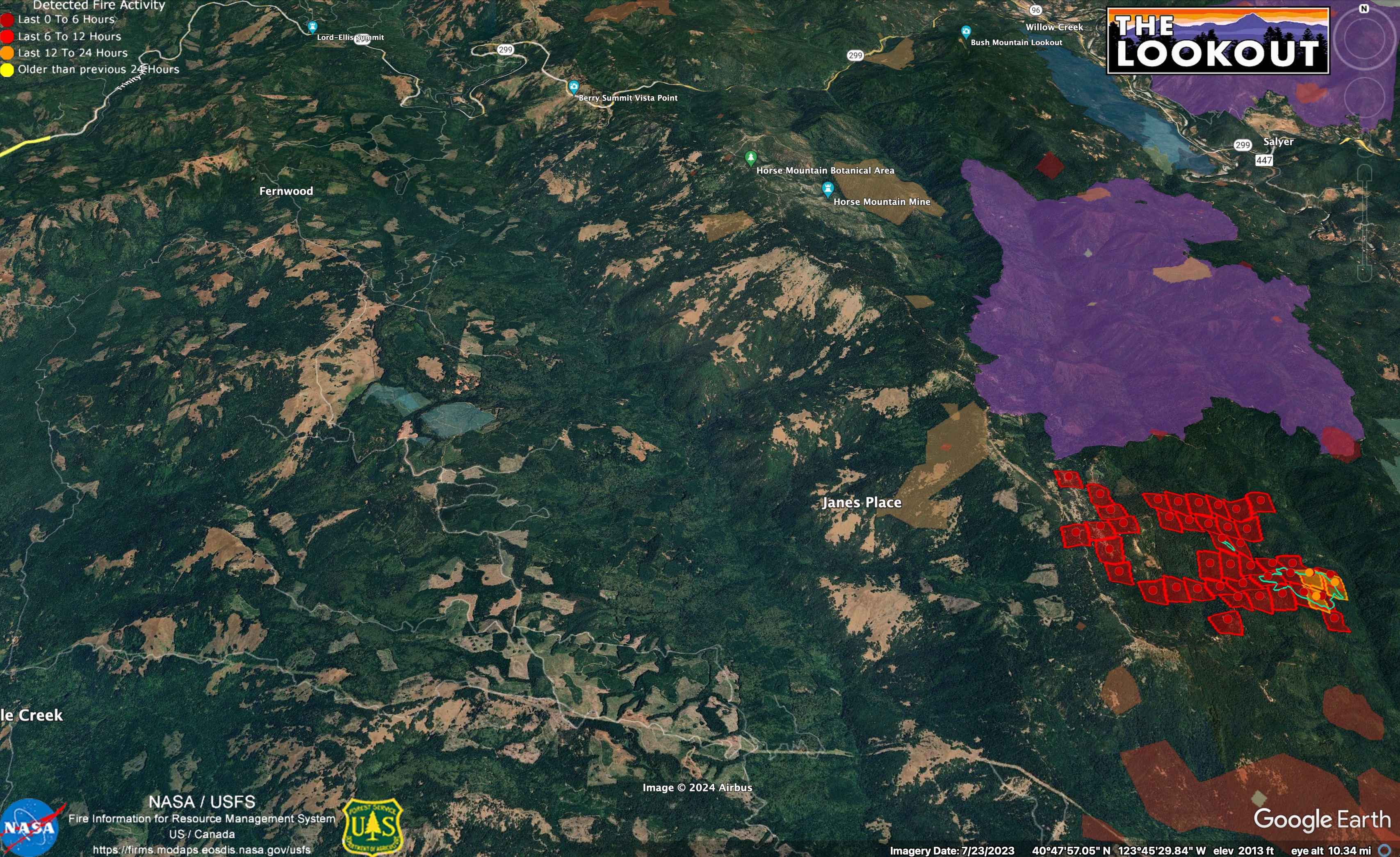
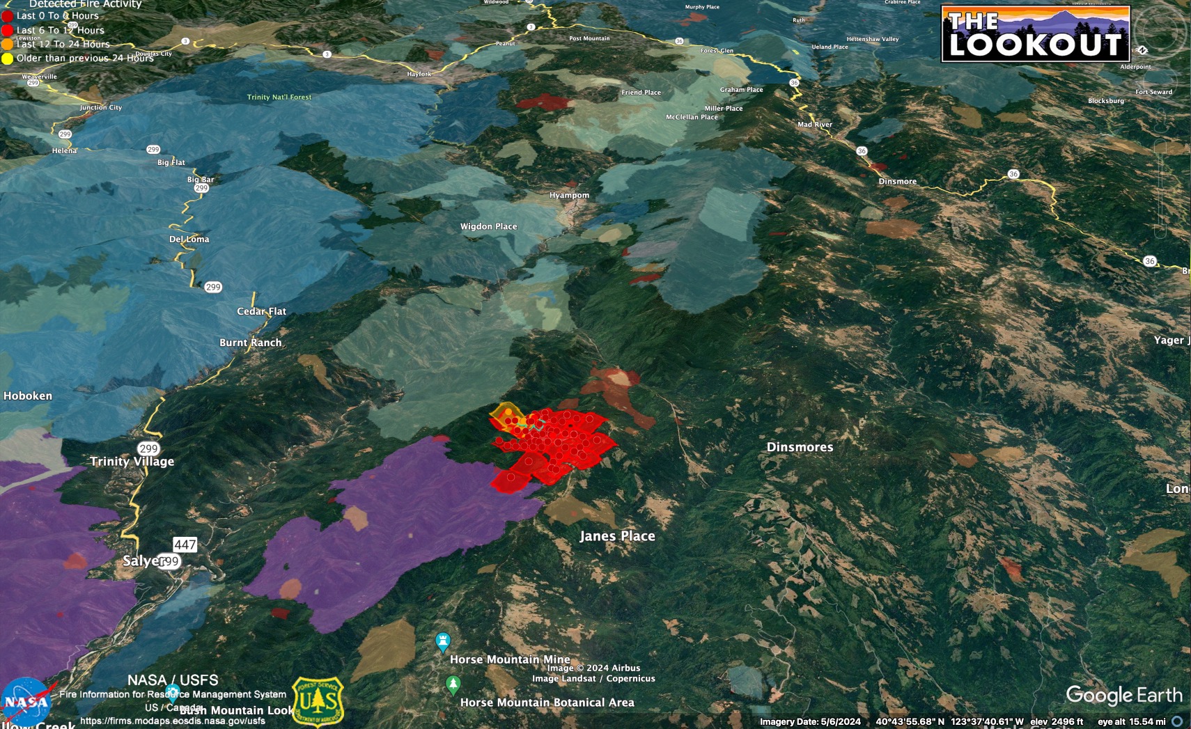
The fire (red squares) is bounded to north by 2022 Ammon Fire (purple). The area to the east burned in the 2008 Hell’s Half Fire (light blue).
Willow Creek is in the right side of this view. South Fork Trinity River is foreground.
The 2021 Knob Fire is also between this fire and Willow Creek.
I’m only judging this on satellite heat and perimeters, but it appears to be pushing west, not north.
Anyone know where base camp is?
Yes willow creek would be threatened.
Or north and west. I agree. The fire history info doesn’t show northwest.
Some very rugged land out there.
Yeah, the fog influence shows up really clearly on the fire history map, I think.
Once you get into the grassy/prairie ridgetops, tankers and dozers have been really effective here in the past, too.
Fingers crossed for that marine layer smackdown on this one asap…