State ID:CA
3 letter designator:STF
Fire name:Donnell
Location:Highway 108 west of Dardanelle
Reported acres:30+
Rate of spread:
Report on Conditions:
Structure threat:
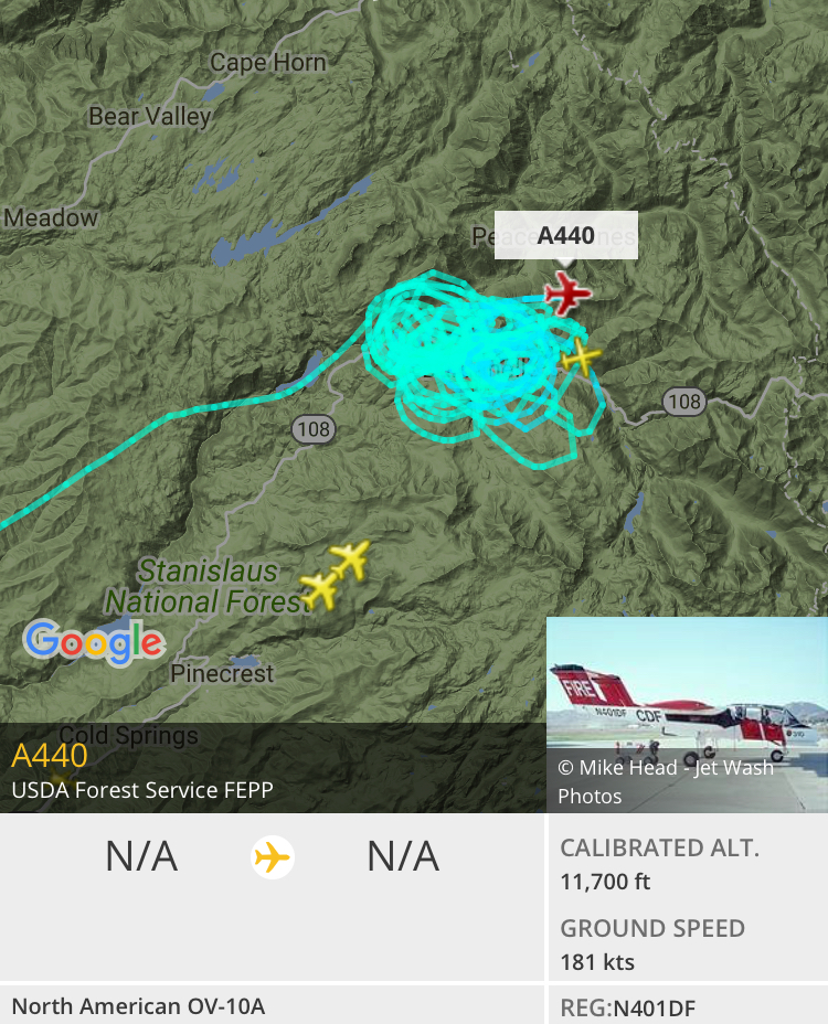
Resources:BAT11 CH2 CRW20 E333 FUELS31 PAT11 SHILOH ENG
Hazards:
Weather:
Radio channels:
Scanner link:
Webcam link:
Agency Website:

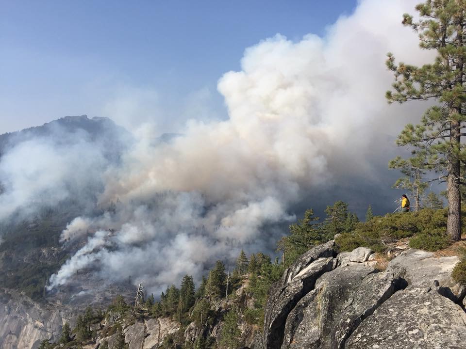
Plume at the top of the image.
350+ acres now
Be surprised if fed have any teams left
There is still 5 Type 2 Cali Fed teams available. Plus, CIIMT 1 will be available in a day or so after they reset from Cranston.
5 Likes
CCIIMT (Central Coast) Type 2 Team activated for this one. In-brief 8/4 @ 1600.
7 Likes
700 acres and 1.5 miles from Clark’s fork road
3 Likes
Mandatory evacuations for all cabins and campgrounds on Clarks Fork Rd and Highway 108 from Clarks Fork Rd to Kennedy Meadows, including Kennedy Meadows Resort and Pack Station. Unsure if Highway 108 is closed.
Fire is 1100 acres and zero percent contained
3 Likes
Per CHP Cad: Hwy 108 eastbound hard closure at Eagle Meadows Rd. HWY 108 Westbound closed at Kennedy Meadows
1 Like
Anymore updates on the Donnell?
Updates will become more readily available now that the IMT2 is transitioning in. May even be a GACC update tonight
1 Like
Read on another site based on satellite photo’s, its taking off big time…
1 Like

Any threat to sra
Take it for what it is, but from my vantage point in South Lake Tahoe I can see this fire plume for the first time and it is rapidly expanding.
2 Likes
No SRA that high up in the forest that I know of
3 Likes
Visible from sacramento
What side of the river canyon is this in?