
Both. Looks to be on both sides of 108 also.
1 Like
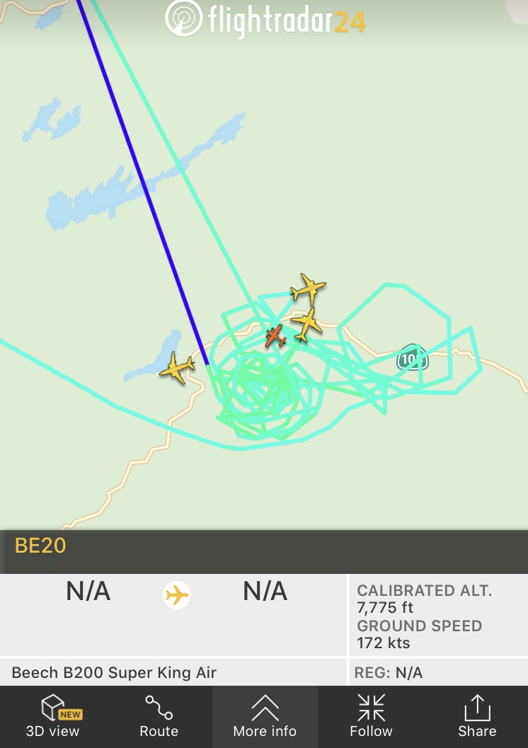
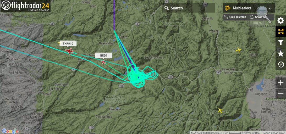
AA51 (N40Y) is currently over the fire doing mapping and recon.
1 Like
It’s pretty steep with lots of granite there. Hoping the modis return on the south side of the highway was a reflection
From GACC: 5,800 acres and 0% contained. The FTP site is up but no maps in it yet.
2 Likes
As of this morning, roughly 5900 acres 0 containment.
2 Likes
Today’s ops map
Per Parrots AA, releasing airtankers to the Donnell incident. 2 S2s and a type 1 that was on load and hold at Columbia. “sounds like the Stanislaus has a dire need for a type 1 to help hold whats left of 108”
Thanks For The Map.
Your name is reminiscent of the old Wildland Fire group and Abs.
1 Like
Looks like it’s a safe bet that the fire has either jumped or spotted over Highway 108 at the Brightman Dump
1 Like
Sounds like the 747 is on the way
Any distance to SRA
Just pulled into Utica res. Two good columns are showing east to west of each other. Attempted pyrocumulus production to its put out some heat today.
Closest SRA is 20 air miles west of the incident
1 Like
There’s zero SRA up there… just a bunch of beautiful land and improvements that’ll never be the same.
1 Like
So about 3 days they way things have been burning
1 Like
Going to Mendo with 910 trailing
Along way away. All STF
1 Like
Did feds but another type 1 team yet
Do you know how far out? We are probably going to lose a historic Dardanelles Tesort and all the old cabins from the 1930’s forward,
Thanks