I was just on the Ops.alertcalifornia and no cameras for Mt. Lewis and Strawberry. Icons gone.
Info?
Thanks Be Safe
3 Likes
Both cameras went dark at 0357
6 Likes
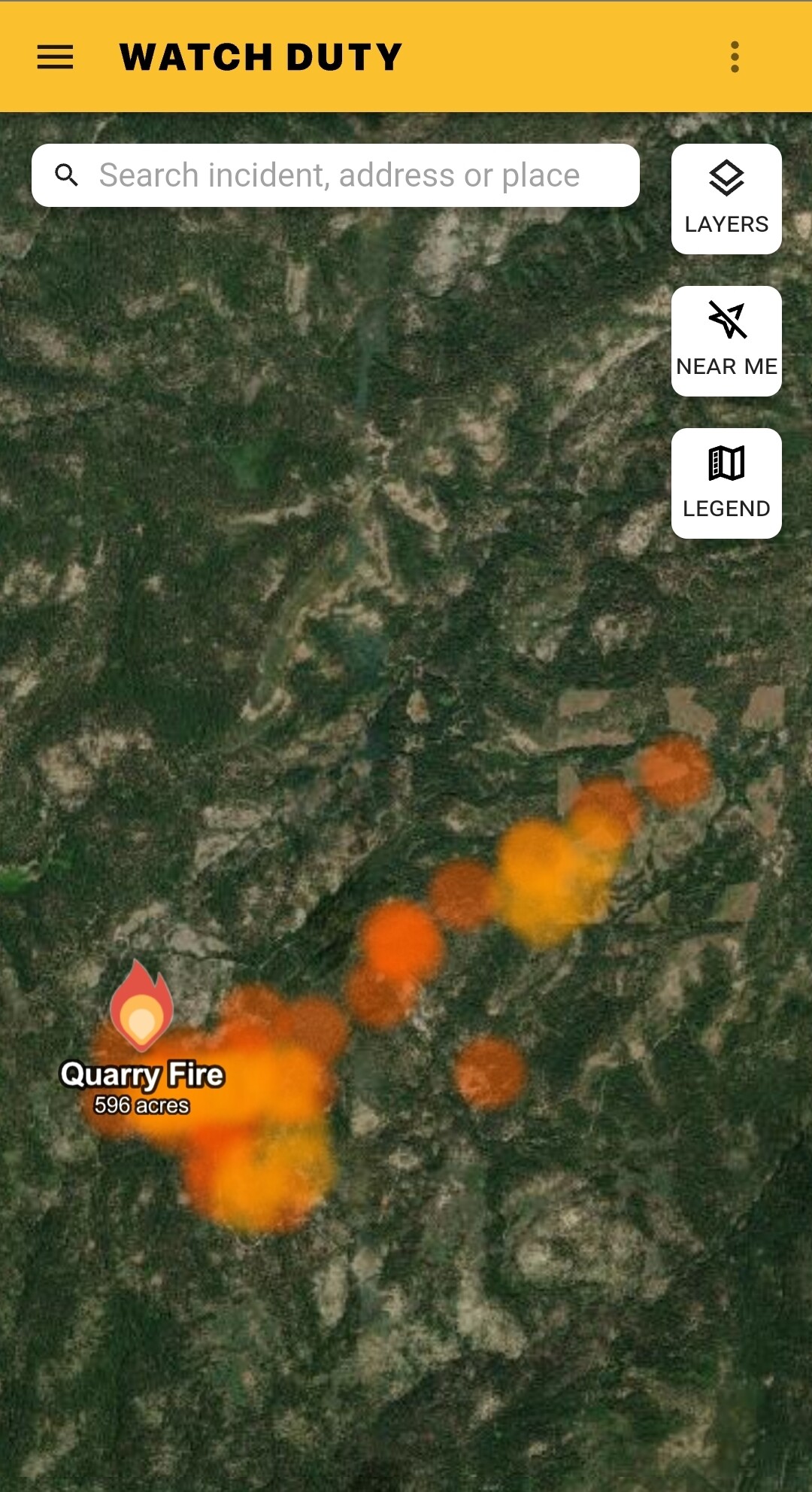
136 acres for the quarry this morning a division chief and a additional hand crew has been assigned sounds like a type 3 team will mobolize
7 Likes
They’re back online.
6 Likes
4 Likes
Quarry Fire Update
Thursday, September 21, 2023
Stanislaus National Forest
Incident Management Team (Type-3)
PIO Contacts: Phyllis Ashmead, phyllis.ashmead@gmail.com and Eugenie Moore, eugenie.moore@usda.gov
Fire Statistics:
Location: The Quarry Fire is located on the Miwok Ranger District, Stanislaus National Forest, off Forest Road 3N01, east of Bourland Creek and approximately four miles west of the Emigrant Wilderness Border.
Acres burned to date: 596 acres.
Cause: Lightning
Total Personnel: 74 Injuries: 0
Background: The Quarry fire was one of many fires ignited by lightning strikes across the forest on September 9, 2023. District fire managers immediately worked to ensure these naturally ignited fires stayed within predetermined boundaries. Fire personnel with the Stanislaus National Forest are currently managing the Quarry Fire to achieve multiple resource objectives.
These objectives include benefits such as reducing concentrations of dead ground fuels, re-establishing multigenerational timber stands, improving wildlife habitat, promoting vegetation diversity, and re-introducing fire into fire adapted ecosystems.
Today’s Activities:
Today, favorable weather conditions allowed crews to expand the fire area, burning east along Forest Road 3N01, southwest from the ridge near Forest Road 3N45Y and east along Forest Road 3N21.
By the afternoon the fire started consuming well, resulting in a mosaic effect of burned and unburned vegetation which will increase habitat diversity on the landscape.
Crews also scouted and prepped other areas to protect natural and cultural resources in future burn areas.
With hunting season in full swing, the public is asked to avoid active fire areas. Watch for signs that indicate the roads in the area may be temporarily closed.
Crew 2, Crew 3, Engine 332 will be onsite all night.
6 Likes
looking like a real good burn in my uneducated opinion. temps are in the low 70s the next few days too. I’ve had condensation on my car the past few mornings. Just my personal observations.
5 Likes
Quarry 900 acres
5 Likes
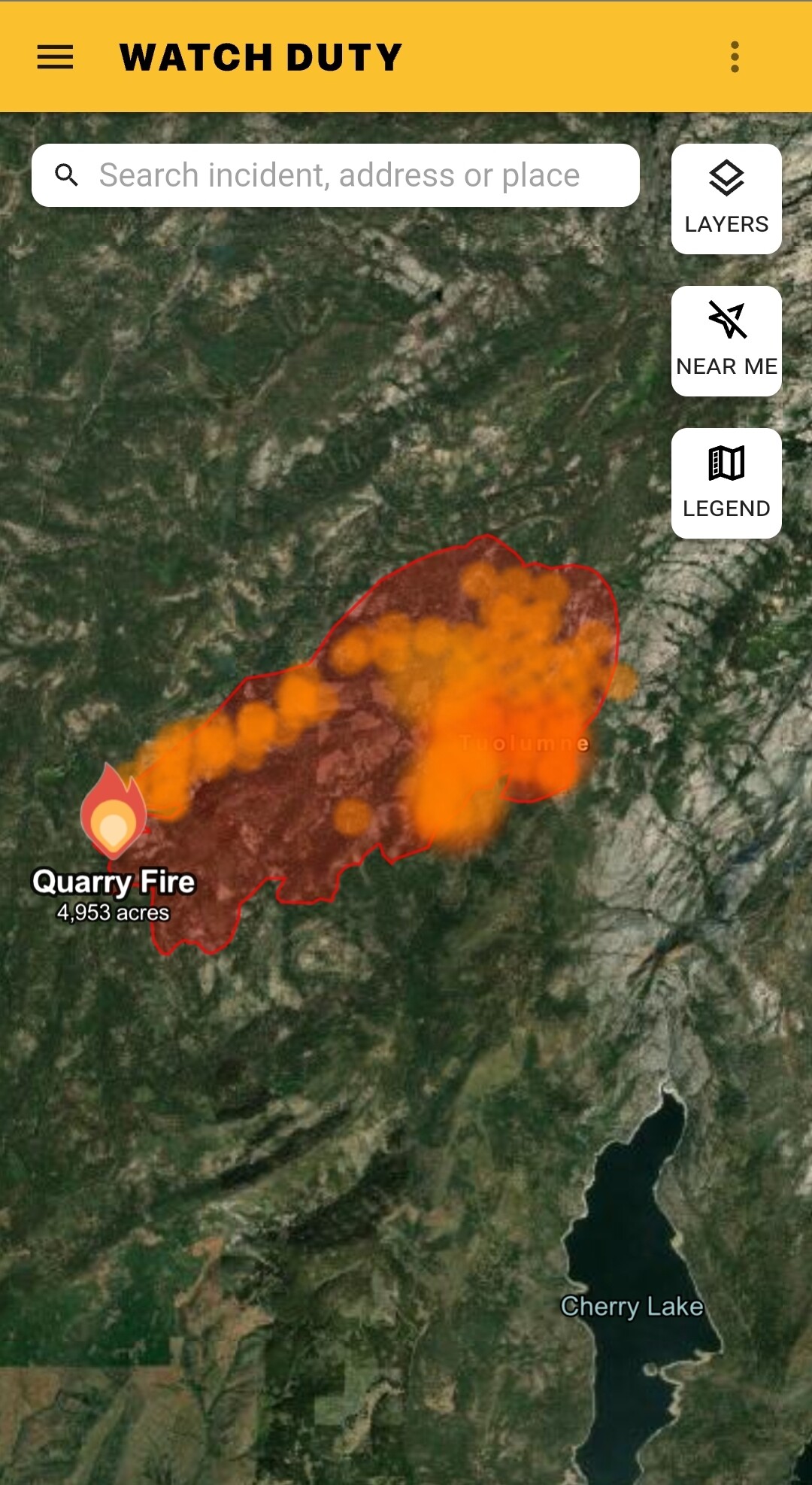
Quarry is now 1532 acres.
4 Likes
Is it out? Over 4.6 inches of rain on Cooksie Mountain.
3 Likes
No Ariel ignitions planned for tomorrow
3 Likes
Quarry is now 2157 acres with 123 personnel.
4 Likes


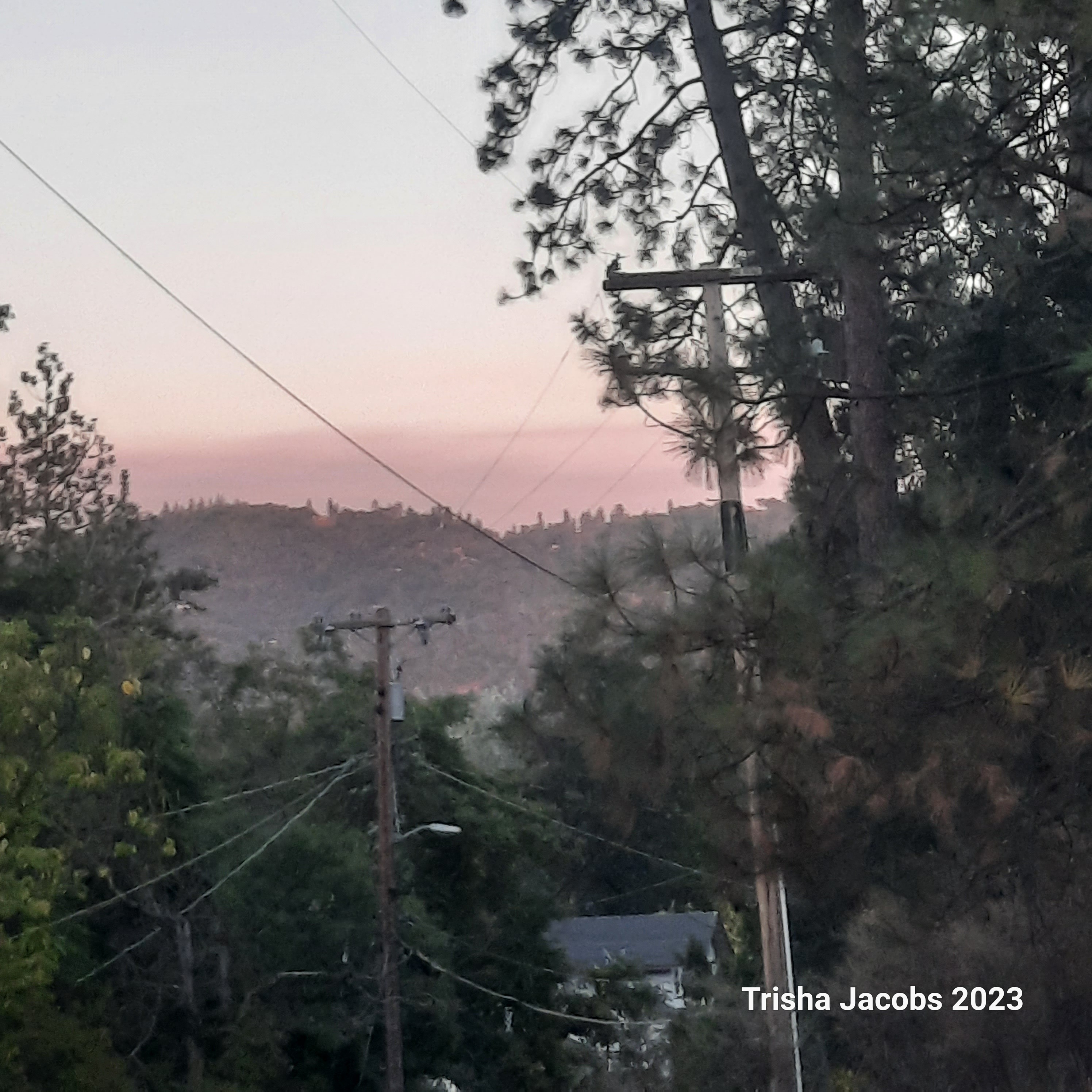
Great shot, this pic is from my house yesterday afternoon in Sonora. It put up a pretty good smoke. This morning on my hike could see the drift smoke and a little boil starting to happen.
7 Likes
https://ops.alertcalifornia.org/cam-console/2419
Is the fire on the Strawberry Cam related to Quarry or is this something different? You can see Quarry beyond the ridge line, but this appears to not really be moving around like it should if it was planned ignition. And it doesn’t appear to have suppression action being taken either.
3 Likes
Prescribed burn.
https://www.weather.gov/spot/php/forecast.php?snumunum=2321349.2&lat=38.18191849970637&lon=-119.99842496121964&z=14
3 Likes

Hard to see but it has two little boils on it . Feds are getting with it today. I got a steady 10mph plus breeze out of the north this afternoon.
5 Likes
experimental fire according to radio traffic
2 Likes