This wind will offset some of the fuel moisture in the fuels. This is not a normal temp day it’s almost chilly for this time of year. When I worked Copper(Cal Fire) this time of year in the high 90’s. Hottest place in the county.
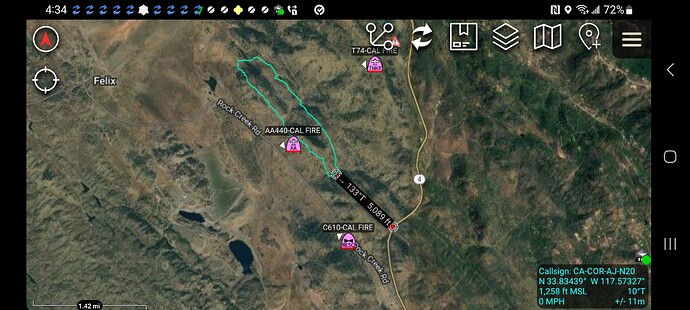
Not sure if able to hold fire at Hwy 4. Starting evacuations from Copper Cove to Obyrnes ferry rd, Rock Creek Road, and Reeds Turnpike. Fire is 400-500 Acres dangerous rate of spread. Moving ICP to town square per radio traffic
Lots of annual fire history from Copper to Angels camp. No where near rim fire burn. Lower country grass oak woodland with mixed brush pockets on slopes
This fire going to hit some lighter fuels from prevoius fires in the area. The RROS it going to blow right threw them. It’s burning grass and oak woodland with some brush fields mixed in. Get on those ridges
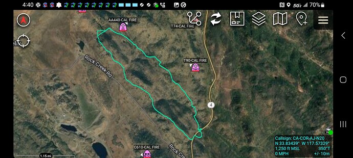
and some rock issues for dozers. It just crossed Hwy 4.
Intel 12 now saying 972 acres
IC requesting 4 division group supervisors, 8 crews, 25 Type 3 engines.
KCRA has live video right now showing fire behavior and fuel types. Although they are staying well to the west.
There going to opportunity if they have the resouces to make some headway if it gets down into the grass in the flats of base of the hills. We have a ST in RRU on there way back. This thing running hard. Between the RROS and the terrian and structures dotted all over that area. The troops have their hands full. The smoke column telling a good story.
Don’t know if PG&E shut it down or if the fire impacted the line going through Copper but power is out in Murphys
Before kcra went offline it looked like the fire had impacted the transmission lines above town.
Intel just mapped at 932 acres.
Pge weather station
Location: Hodson Road
Current Temperature: 79°F
Relative Humidity: 22%
Current Wind Speed: 21 MPH
Wind Gust: 32 MPH
Observation Timestamp: 17:00 June 17, 2024 (Pacific Daylight Time)
The fire has a ways to go but it’s headed towards the old abandon Asbestos Mine toward the river across from Baseline. Also looking at the live copter three video looks like the oaks still had some fuel mosture in them. Jumping across HWY 4 on the ridge the soils are rockier and the fuels tend to dry a little faster.
Also a lot of spotting with this wind.
They were deenergizing some lines in heard on radio traffic
Is the asbestos area a “no suppression” area, like in Monterey County, Idria area? They don’t want the soil disturbed.
Looking at Live Copter 3 shot they are doing a great job on this fire. They have a long way to go but looks like headway is being made in a lot of areas.
I have had small fires from lighning strikes around the mine and we made access and surpressed them.
It was mine for years then closed, used as a dump for asbestos and that was shut down years ago.
Never been restricted to go in. Nothing like east BEU or west FKU.

