FB briefing. Ops briefing starts at 6:36 minutes. Pine Flat update @ 9:00 mark. Good FBAN briefing @ 12:00 mark. Forecast fire progression is to the east with winds predicted from the west. With the smoke being scoured out better chances for aircraft to be inserted. Only structure losses mentioned are in Sugarloaf.
https://www.facebook.com/SequoiaNF/videos/2643175372643634
A recent FIRIS Flight showed @1530ish a amall spot fire south of Baker Peak in bull run creek sec 22
Newbie here thanks for education last couple weeks. First post for me.
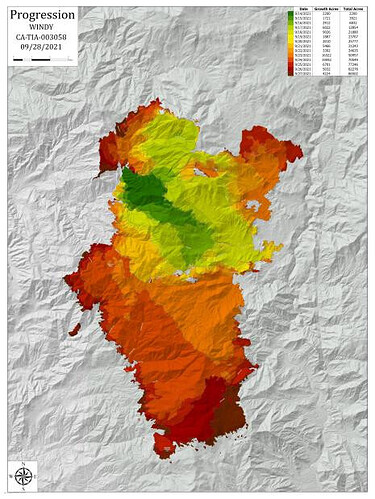
87,318 acres, 4% contained this morning. Evac “warning” posted for the M99, Kern coridor yesterday. Progression map:
Morning FB briefing. Things seem kind of quiet for now.
10 to 12 mph SW winds since this am here at Lake Isabella. Sustained 18 gusting to 25. About 2 hrs. ago 20 semis rolled in at Camp 9 and started setting up a fire camp. Looks like they are going to have a second camp on “The Windy”’. There was a map added to the IAP today that shows one.
Otherwise it is quiet here.
.
RH around most of the fire is 50-90%, in the Kern river canyon it’s 40-60% and temperatures are going to get nippy tonight.
Quiet day in Pine Flat area. Socked in with clouds today and some drizzle with a few sprinkles. Cool temps with a low tonight expected to be near 40. Fire for the moment is taking a “nap”. Things looking good for now. No structures lost in Pine Flat or in the White River summer home area.
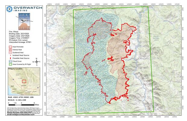
87,901 acres and 25% contained today, a big jump from the 6% containment of yesterday. Only growth was from firing ops, especially on the NW corner on the Tule Reservation. Weather was cool, foggy and windy along the crest which helped. Weather forecast has easterly winds coming and drying things out which may test things a bit.
Todays IR map:
Do not even detect any heat showing on the RAMMB satellite page for heat detections. Yesterday afternoon it was showing. Why post the link, nothing to see. Great time to engage direct line construction, terrain dependent.
0900 EDIT:
Firewatch 51 flew IR mapping.
29 Sept Update.
Seeing a lot more black line on the map.
Tulare County has announced that effecftive Thursday, September 30th, at noon, the evacuation order for the communities of Camp Nelson, Pierpoint, Sequoia Crest, Alpine Village, Coy Flat, Cedar Slope, Quaking Aspen, and Ponderosa, will be downgraded to an evacuation warning. This means that residents may return to the area, but should remain prepared to leave in case conditions change.
The areas of Mountain Aire and Rogers Camp will remain under evacuation order at this time.
For more information or resources, visit the Tulare County Emergencies Page, see Tulare County social media pages, or call 2-1-1.
AA07 up over the fire and Firewatch 51 enroute for IR mapping mission.
Very strong out flow of wind direction to the north resulting heavy smoke drift
from this and KNP over the Fresno and San Joaquin valley.
Morning update. Lots of black. Smoke pushing out into the SJV due to east winds. Repopulation of parts of Sugarloaf, Panorama, Idyllwild today. Still evaluating Pine Flat and Hot Springs.
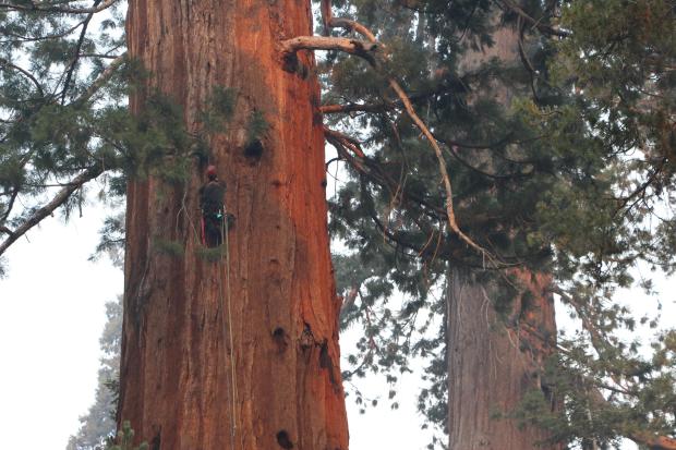
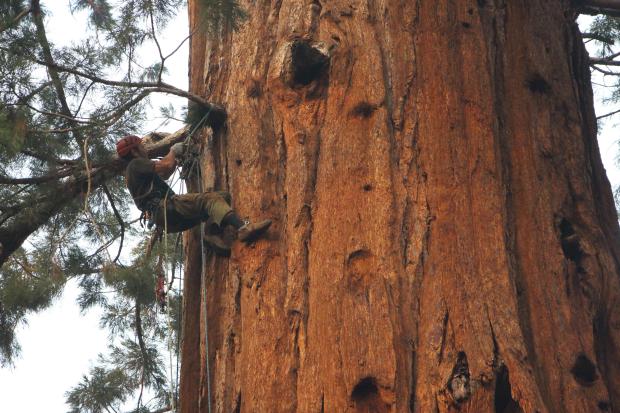
In an effort to save some of the Giant Sequoia trees, Region 5 Jumpers are climbing the trees to try and extinguish fire in the Boles.


AA in comms with Div. D & E getting requests for copters to support flareup issues.
Div. K requesting a copter as well.
Firing ops in Div.Y, I believe I heard. Very weak signals sometimes.
Ops update
Evac Order reduced to Warning for Pine Flat and Hot Springs…
AA was working several copters along with the scoopers were doing runs picking up where the retardant drops left off from fix wing yesterday (south end but, missed the division).

