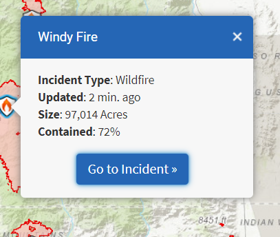
This morning 10-5


This morning 10-5

New team. (Same team that was on the French fire last month I believe)
Update
https://fb.watch/8uTXsTT0MO/
92,554 acres and 82% contained this morning. The only CDEC station showing accurate precip from the frontal passage within the footprint of the fire is Rogers Camp on the NW corner with .001 inches of rain. Very spotty. Potential significant increase in fire behavior due to forecast wind event for Monday. Wind driven runs, spotting, and occasional torching/crowning possible from Inciweb.
AA making a trip around the fire along with the cobra ship.
A pleasant site:
http://beta.alertwildfire.org/region/sierra/?camera=Axis-TobiasPeak2;
hopefully the reason for no updates on facebook on Windy and KNP…also ???why siteprt has been down for a few days…???
BLUF: EVACUATION ORDERS AND WARNINGS LIFTED
#Windy Fire is approximately 97,554 acres (no increase from the Wednesday morning estimate) and 88 percent contained.
CURRENT CONDITIONS: Firefighters are removing hazard trees and suppressing fire near containment lines and in sequoia groves. Hazards in the fire area include fire-weakened trees, smoldering stump holes, and rocks or debris that could fall from steep slopes onto trails and into roadways. These hazards present dangers to the public long after a fire is considered controlled. Drivers should be aware of fire personnel and equipment on the ground and on access roads.
Firefighters are also using frequent infrared flights to monitor open sections of the Windy Fire containment line. These areas are in steep, remote terrain, where it’s unsafe for firefighters to use direct suppression tactics. This strategy allows crews to respond quickly if the fire begins to spread, and it could continue until significant precipitation falls over the forest.
EVACUATION ORDERS AND WARNINGS LIFTED: The Tulare County Sheriff’s Office lifted all Evacuation Orders and Warnings for the Windy Fire effective Wednesday.
Sounded like the Forest took the fire back. Several comms on fire net about tactical fire resources needs around the fire lines. Or in transition to very soon…
EDIT UPDATE: I checked the 21st IAP and its mostly repair groups. Still shows NIFC Command repeaters up and some mopup in Div. P/R. North and West areas.
Crews doing mopup and repair in the Black Mountain Grove along 21S94 and near 21S12 roads. No smokes on the Middle Fork Tule from Coy to the Crawford Road, south west side of Nelson. About 1-2 inches of snow on the ground above 5000 feet, middle fork drainage. Still lots of smokes on the South Fork drainage and not as much precip. Flash Flood Watch now in effect for Sunday and Monday fro all burn areas in the Sierra from the Creek fire south to the French. High snow levels (above 9,000 feet).
https://forecast.weather.gov/wwamap/wwatxtget.php?cwa=hnx&wwa=flash%20flood%20watch
When the Windy started my first thought was that there will be significant impact on the Sequoias, specifically in the Peyrone Grove, especially after seeing what happened in the Black Mtn Grove after the Pier in 2017, and the Alder Creek grove after the SQF in 2020. Burn severity to Sequoias on the Windy from Wildfire today, article link here: Officials estimate hundreds of giant sequoias were killed in the Windy Fire - Wildfire Today
i will take a walk thru there once the forest opens back up, curious to see the fire effects after the work we did in there in the late 1900’s…!
(have some good new growth pics on a lightning fire in 2020 from the pier fire showing seedlings about a foot tall)
Inciweb now stating the Windy is 100% contained at 97,528 acres as of November 18.