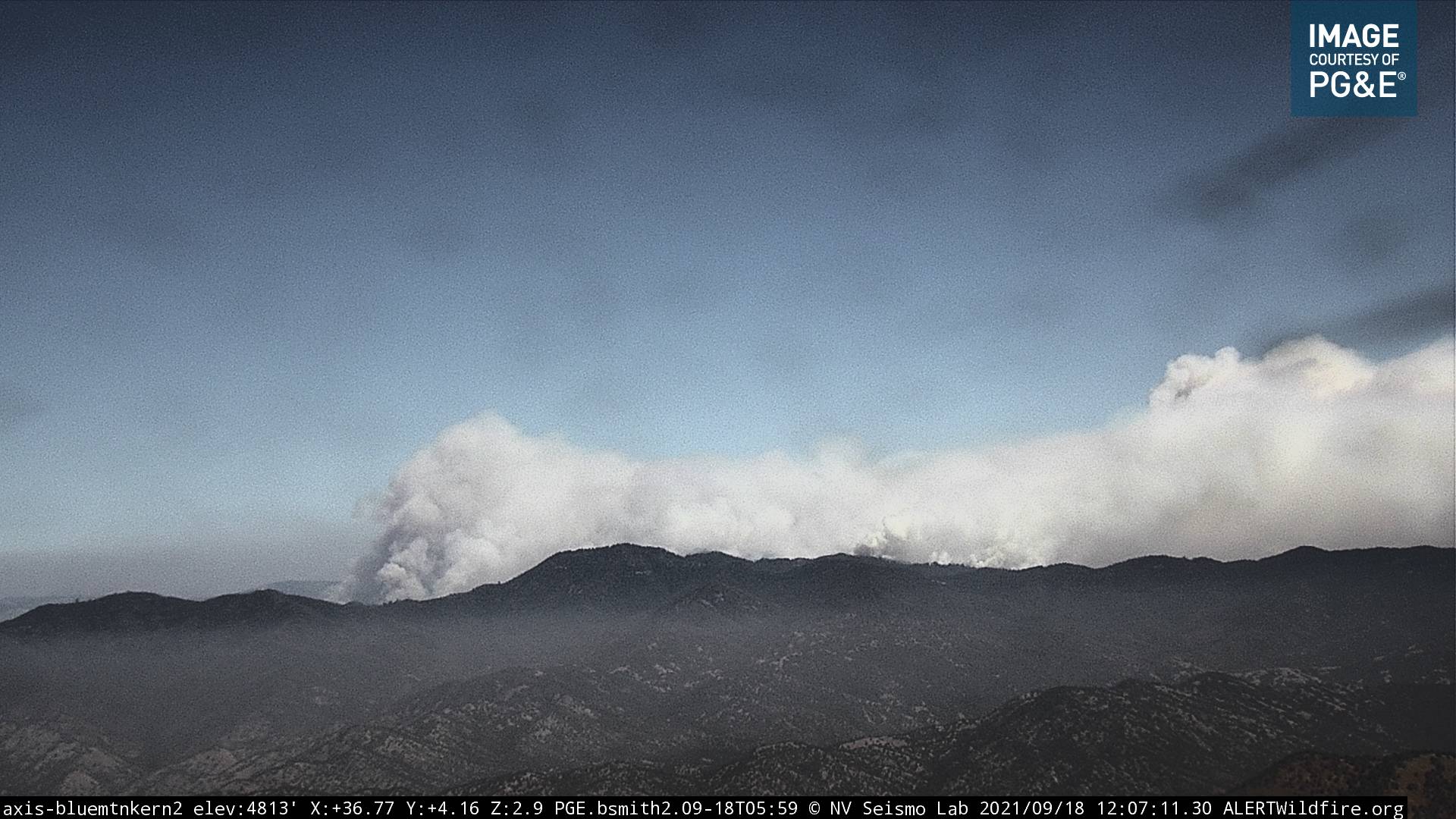
Just now looking at the Windy from Blue Mountain in Kern county… Looking up the M90 - M50 corridor. Once the projected winds hit it later it’s gonna be a mess.
2 scoopers on scene will be working an unknown smokey ridgetop down hill. Dip out of Issabella on round robin load and return. Calling them like a boat comm’s with “skipper 281”.
More fixed wing on order… 76, 78. Dropping in Johnsondale area structures. Though I wonder about Whittset camp structures??
Winds have started to change. Yesterday at Peppermint they were out of the ESE all day. Now, out of the West/WNW 3-5 with gusts to 15. RH in the teens and 20’s. Benchmark for what is coming.
Overnight winds have yet to materialize at Peppermint. Temp 49 F with RH at 45%, winds S 2, G9 this morning. EDIT: Looks like other nearby ridges do have wind on them though. Sherman Peak, east of the fire shows sustained winds at 22 mph. The Tobias cam on timelapse indicates decent winds from the SW.
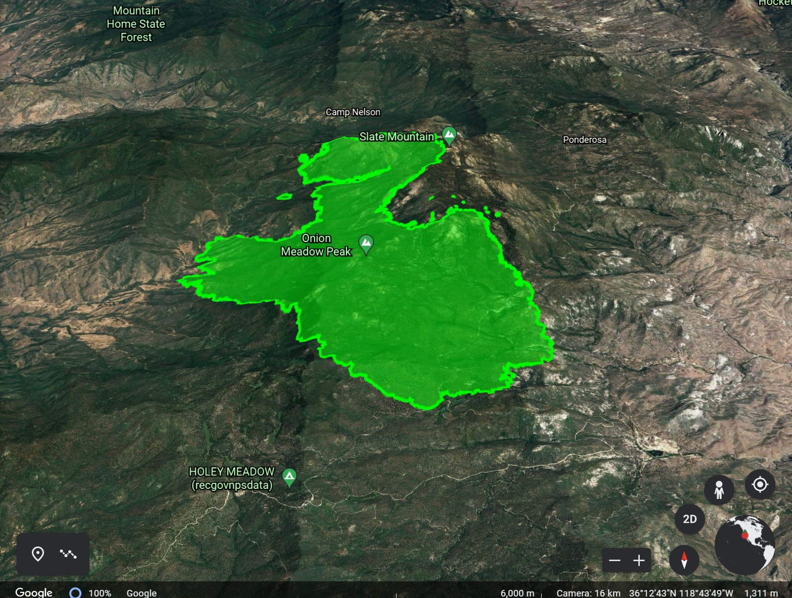
Courtney IR flight shows most of yesterdays growth was to the east. Looks like fire pushed out into the Kern Drainage near Sentinel Peak and Elephant Knob near R-Ranch, SE corner. North of that on the east side a push eastward along Nobe Young Creek, Alder Creek and near Dome Rock. Some growth on the SW corner near Mule Peak, but not significant. No real growth along the top of Slate above the Coy Drainage, N side. A decent burn on the NW side around Red Hill, towards Packsaddle Creek, burning back into the Indian Reservation. 20210919_Windy_IR_Topo_11x17.pdf (1.2 MB)
AA relief were discussing priorities for aircraft and Ponderosa is Top as it has a trigger point to bring out fixed wing. Peppermint has a portable tank for copters to dip from and a mobile retardant base is being set up…I didn’t catch the location.
3 to 4 copters are supporting ground crews around the incident.
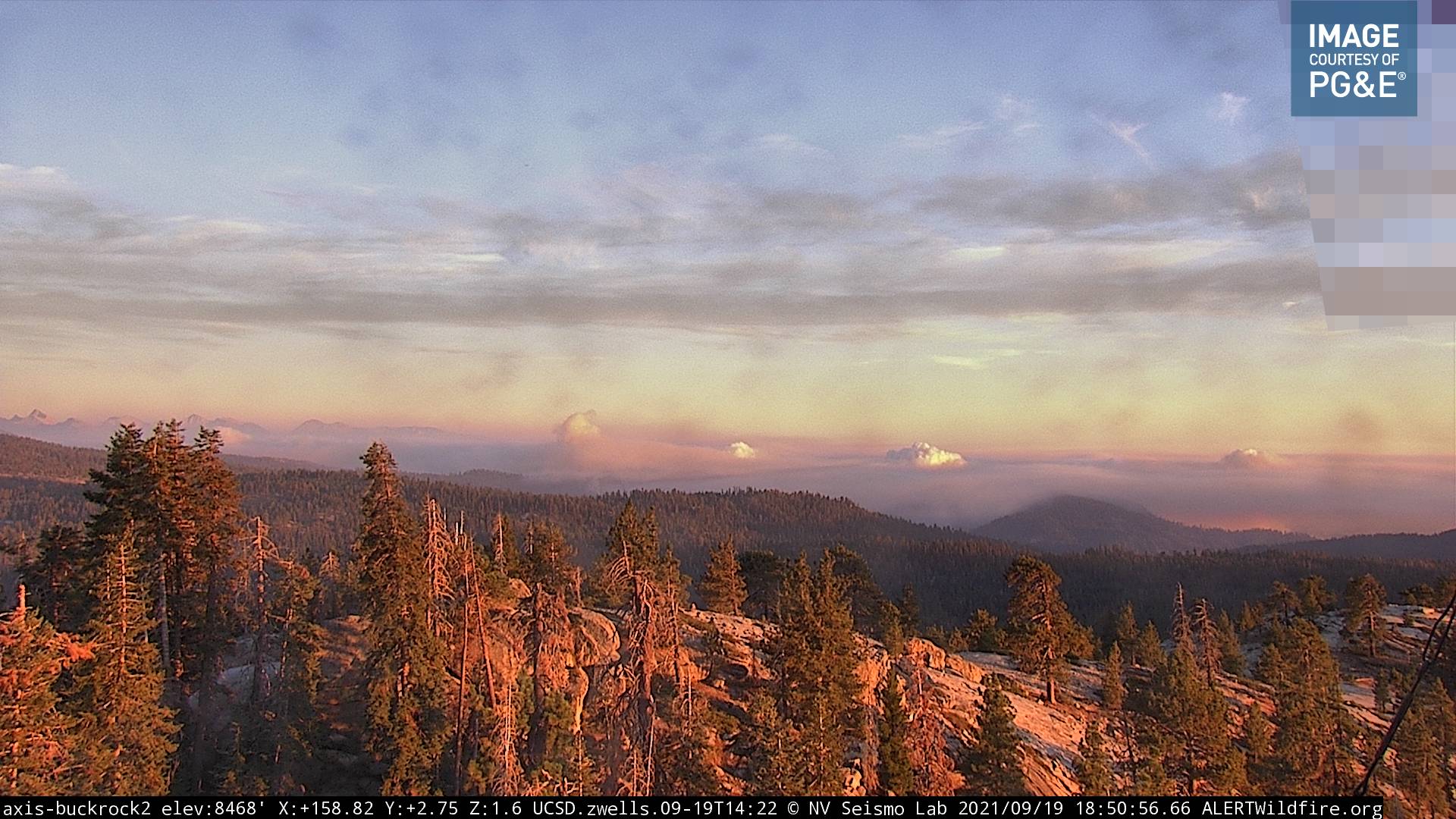
Smoke is drifting in from the KNP complex smoking out peppermint end of the fire.
FIRIS flew the Windy again. Spot fires in the Freeman Creek area and below Quaking Aspen in the Middle Fork Tule. Spots are small. All of them are well inside the SQF Complex perimeter. Don’t imagine them being able to run with fuels so well consumed.
12,598 acres, 3% contained as of @ 1300 update in Inciweb. Red Flag till 2000 hours today. Tobias cams were down for a few hours this afternoon down so unable to gauge intensity.