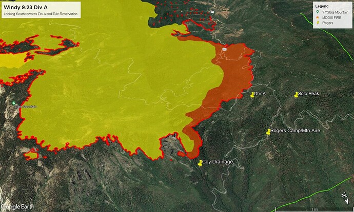
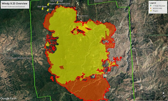
Nooo, that’s going to be Mt Aire/ Rodgers Camp in the path 
Per Ponderosa Lodge:
As of 3:45PM, the fire is barely around the east side nose of Dome Rock.
The winds are now calm.
The D6r dozer did more work to the east amd north side of the community.
They are now sending the dozer to dome rock road for construction.
Crews down from Setinel Peak are having a hard time with brush fires. Fire heading down to the Kern river now at area over there.
Winds are gusting to 25 out of the west in the area.
https://www.wrh.noaa.gov/mesowest/timeseries.php?sid=SE488&num=72&banner=gmap&raw=0&w=325
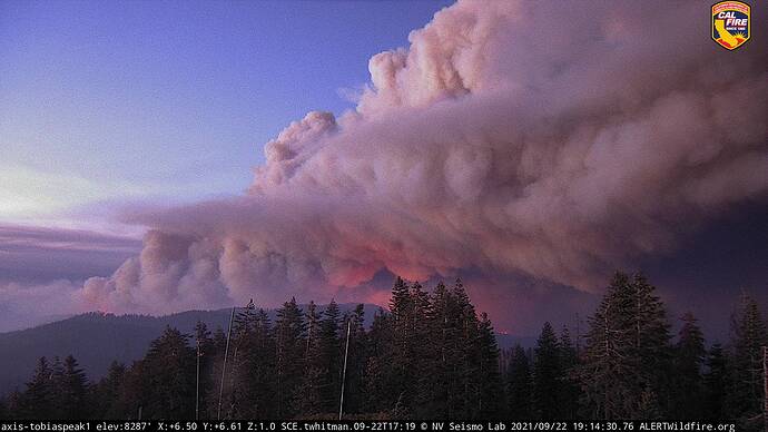
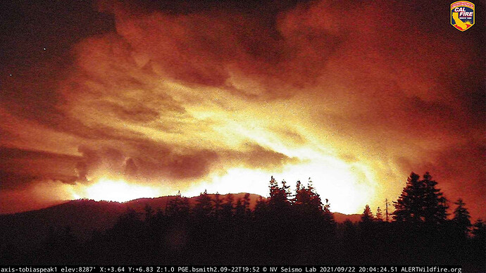
Fire responded accordingly per the cams right now. Holy Smoke!!
View from blue mountain is showing some serious intensity.
http://www.alertwildfire.org/sierra/index.html?camera=Axis-BlueMtnKern2&v=81e003f
And its moving quickly towards baker peak just off the screen and probably spots out that way already. I hope johnsondale is ok.
Me also…sounded like in morning briefing they were preparing for this event…hope all stay safe
http://beta.alertwildfire.org/region/sierra/?camera=Axis-TobiasPeak1
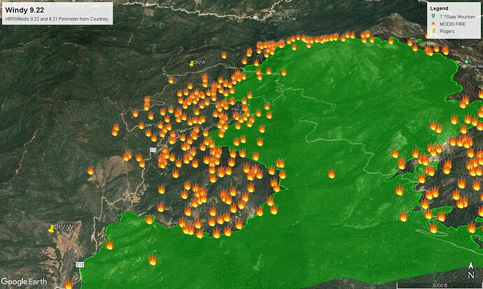
Taking a stab at KML files in Google Earth pro. Green is yesterdays Fire Perimeter. Red flames are MODIS and VIIRS data mostly from @ 1400 today according to the NASA FIRMS site. If the Modis and VIIRS are correct then that would explain the blowout APX8000 was talking about. Div A and Div W labels are applied left side of image.
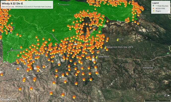
Div E, east side into Kern drainage near Dome Rock. Again, if IR data is correct from Nasa the flames are todays growth, green is yesterdays perimeter.
New ‘Evac Orders’ for for the communities of Camp Nelson, Pierpoint, Coy Flat, Mountain Aire, Cedar Slope, Alpine Village, Rogers Camp, and Sequoia Crest due to the Windy Fire.
It is being reported a backfiring operation has begun at Needlerock road (Holby) near the Ponderosa; this follows burnout operations near Dome Rock last night.
Just issued…
Sheriff Issues Issues New Evacuation WARNING for the Windy Fire
Sheriff Boudreaux has now issued an EVACUATION WARNING for the communities of California Hot Springs and Pine Flat. The evacuation warning includes M-504 at Tyler Creek, Southeast to Pine Flat, West to M-56 and Fire Control Road, North up Tyler Creek Road. This will continue to include structures, side roads, and attached roads.
A road closure is in effect for M107 from HWY 190/M90 to M50 at Parker Pass. There will be a roadblock at HWY 190 and Redwood – only residents of Cedar Slope will be allowed through with proof of residency.
FB update. Fire growth was significant as seen on all the Alert Cams. Winds were on it. Over 43,000 acres so far. It grew by 12,000 acres yesterday.
https://fb.watch/8c-PtHsqSb/
With that growth, will there be any additional resource requests?
Additional resources have been requested and orders are being filled.

