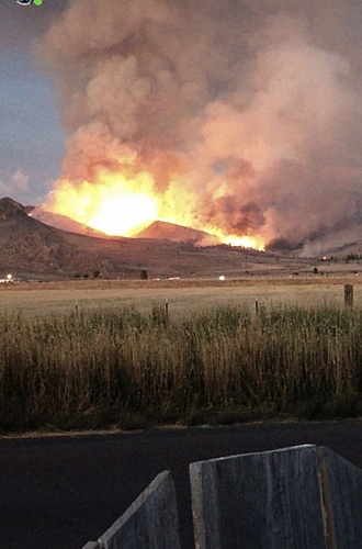
Would an ICP be set up this quick? Or possible tomorrow? Checking to see if a kitchen would be called out tonight to prepare my crew
Not much of an inversion. She’s waking up early this morning
IMT 10 is Old Norcal 2
Used to work engine crew on the HTF outside of Verdi.
Resources are far and few. Maybe the lighter fuel loading can limit spread.
Babbit is looking right into it.
http://www.alertwildfire.org/shastamodoc/index.html?camera=Axis-Babbitt&v=81e004f
The 6 hour timelapse from Beckworth Peak is remarkable in capturing the wind dynamics of the morning.
http://www.alertwildfire.org/shastamodoc/index.html?camera=Axis-Beckworth&v=81e004f
Any update on resource needs?
From Babbitt, it looks like it burned thru their retardant line and is headed south again. Looks like granite with lite fuels not far away.
2
Around 2500 acres now
It looks like things just went completely to hell on the southeast side of the fire.
http://www.alertwildfire.org/shastamodoc/index.html?camera=Axis-Babbitt&v=81e004f
http://www.alertwildfire.org/shastamodoc/index.html?camera=Axis-Sagehen5&v=81e004f
9220H and 1 Dozer assigned.
Grew up in the area that this is burning in, and have fought many fires there. It’s headed towards the Chilcoot Complex from 2001 (I believe), and then down to Long Valley and onto the Humboldt-Toyiabe NF. It’ll burn hot and fast downhill and through Long Valley
LMU sending a Charlie to the incident.
Immediate need. Must be close or hit the SRA.
Limited resources in the state, immediate need strike teams coming in for structure protection on the Eastside 395 area
View from the Reno side; run it back an hour:
http://www.alertwildfire.org/blmnv/index.html?camera=Axis-Constantia&v=81e004f
Highway camera 395 north at stateline:
https://oss.weathershare.org/?clat=39.7075&clng=-119.9964&zoom=12#
Here is a recent (this week) satellite image showing this year’s fires in the area (reddish).

