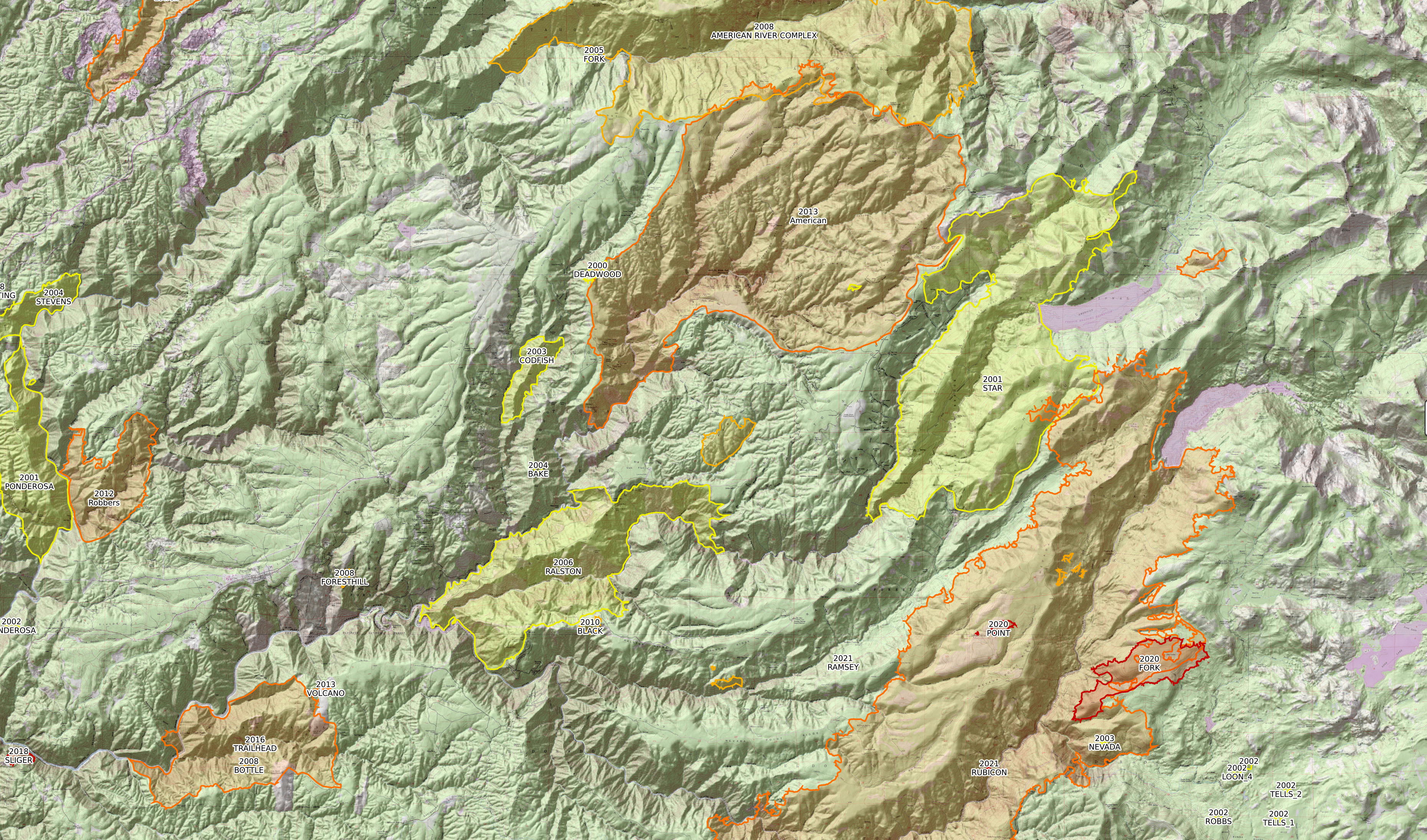
Some Fire History for reference:
Found a scanner covering this incident exclusively
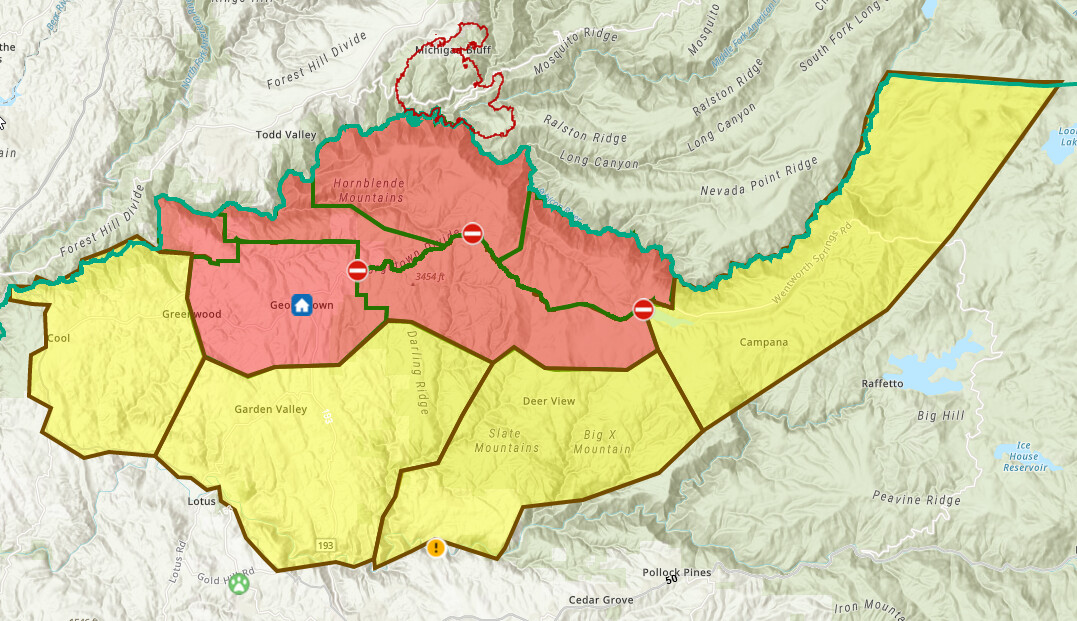
Fire is impacting Volcanoville Rd. and there are spots south of Volcanoville Rd.
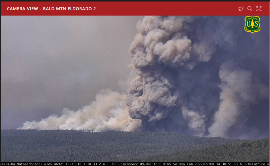

That’s a scary amount of energy
Northern California Major Incident Feed is now live with Command, Air to Ground, Air Tactics and MCC Base Victor
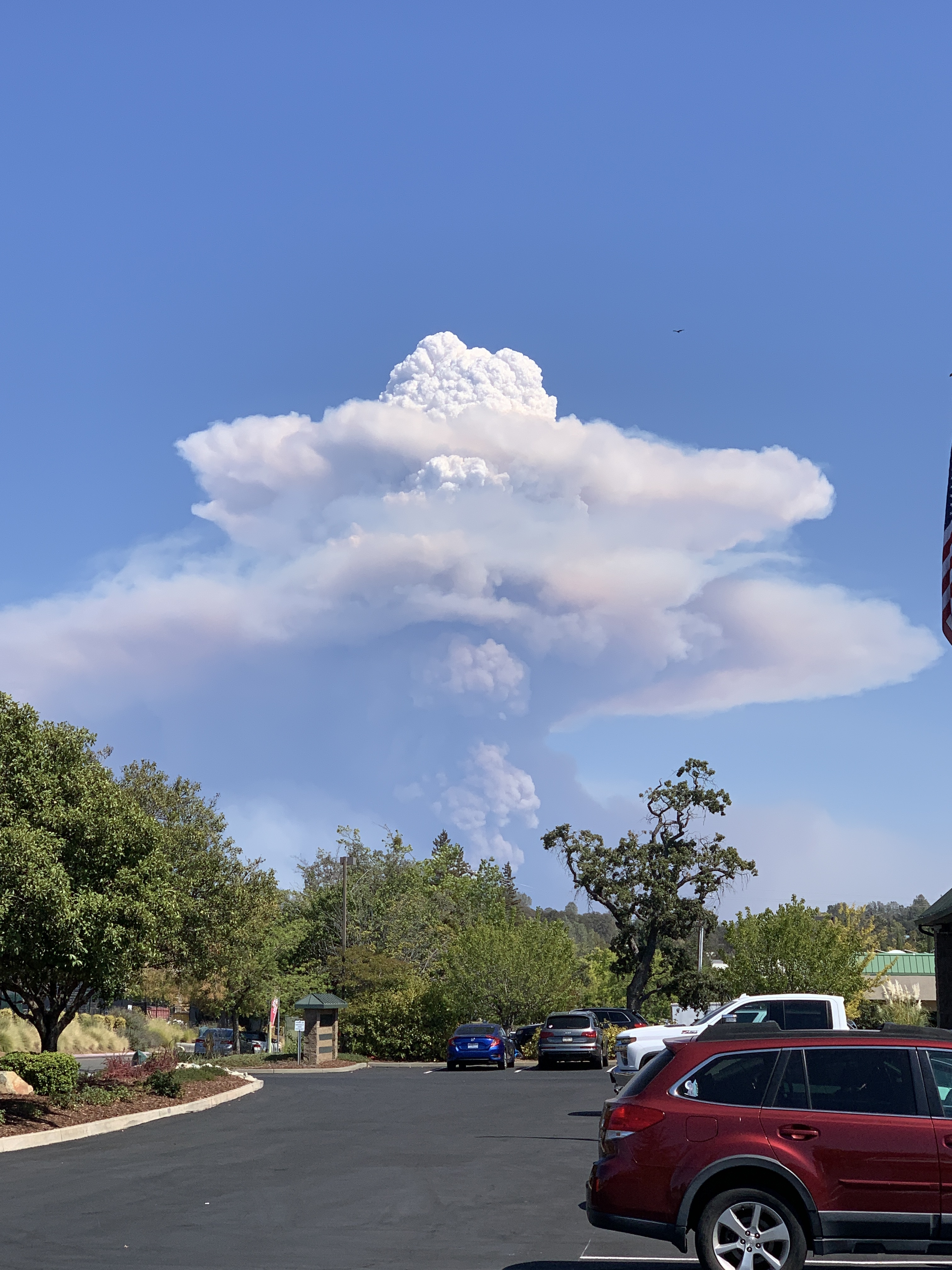
Topped 40,000 ft. Watch out for lightning.
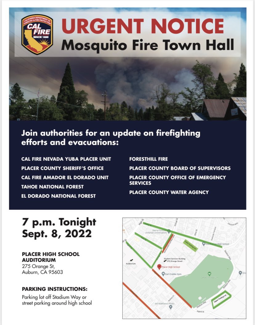
Eldorado SO, Branch 20, Div T strongly considering upgrading Georgetown evacuation from “warning” to “ order” due to reflex tine to get people our.
Foresthill Road closed @ I80 in Auburn.
Not a bad Idea, gives them the time to evac with the lack of fixed and rotor wing support in the area.
Per NOPS 1900 update:
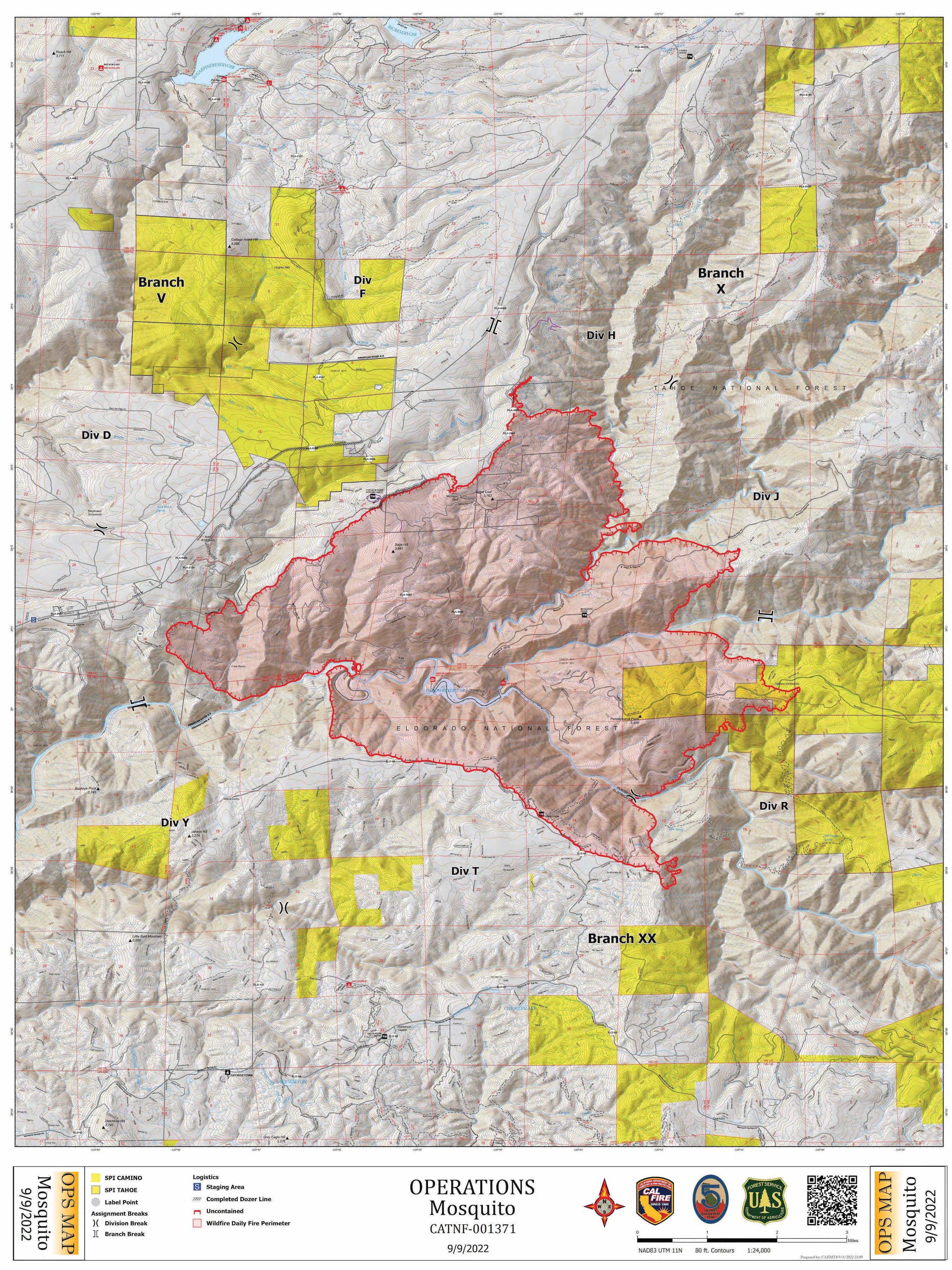
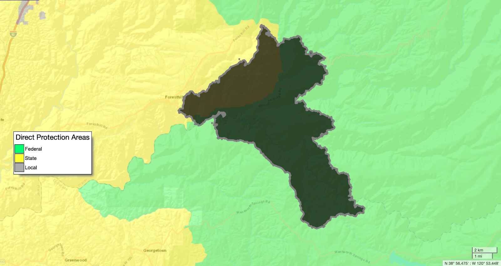
CA-TNF Mosquito Fire: 13,704 acres brush and timber, 0% contained. Fire is in Unified Command between Type 1, CAIIMT 5 (Young) and CAL FIRE.
@05:46 Watch Duty is reporting fire activity picking up in Foresthill with additional engines responding for structure protection. PCSO in area with hi lo sirens making sure everyone is out.