Night ops delta just ordered more firing supplies to be delivered ASAP to station 11 on Foresthill Rd which is above town near Bath Rd. Guessing there will be more firing near Chicken Hawk Rd to keep up with the fire spread on that flank
3 Likes
As of this AM:
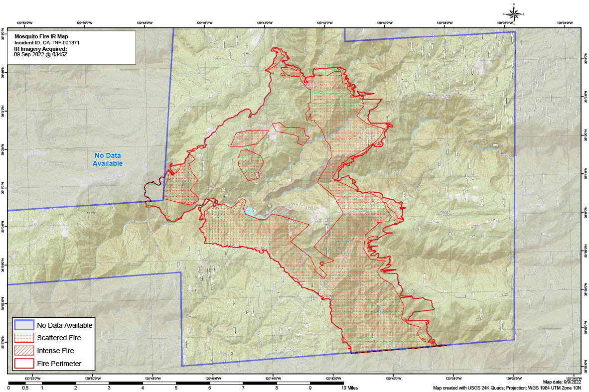
14250 Acres (calculated at 0345z) @ 0% Contained
Critical Resource Needs: 10 Tac Water Tenders, 18 T3 Engine Strike Teams, 6 DIVS, 10 T1 Handcrews
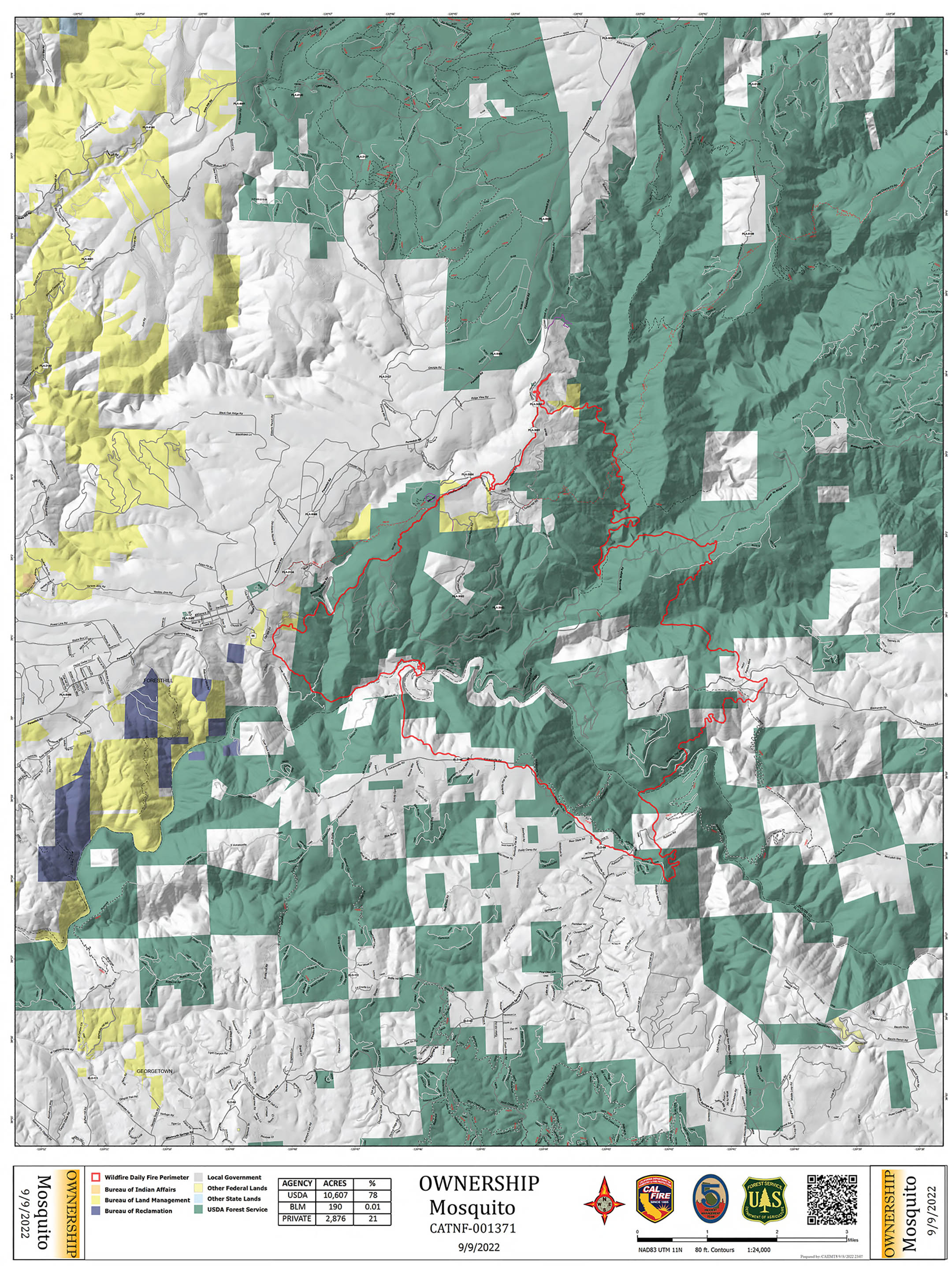
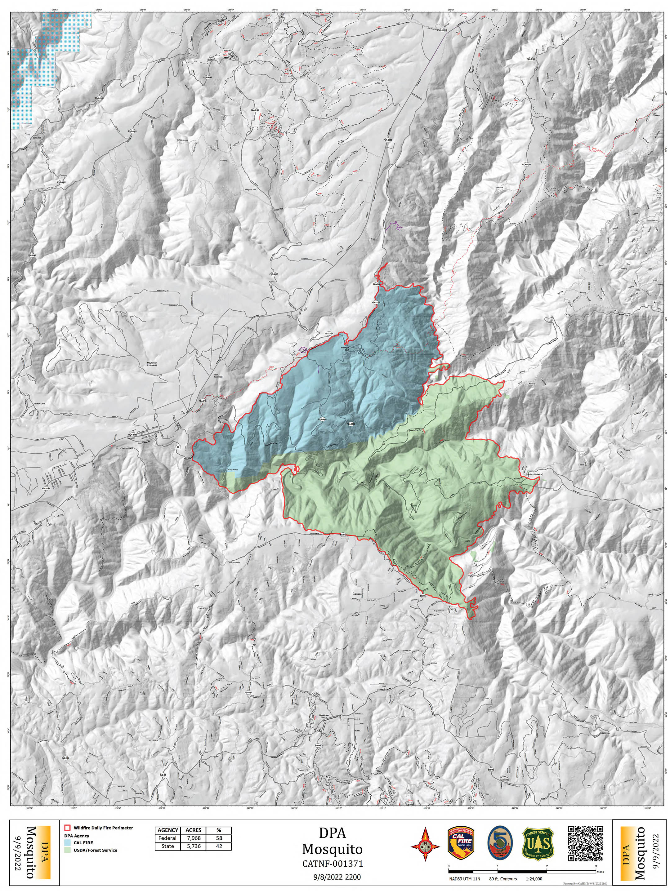
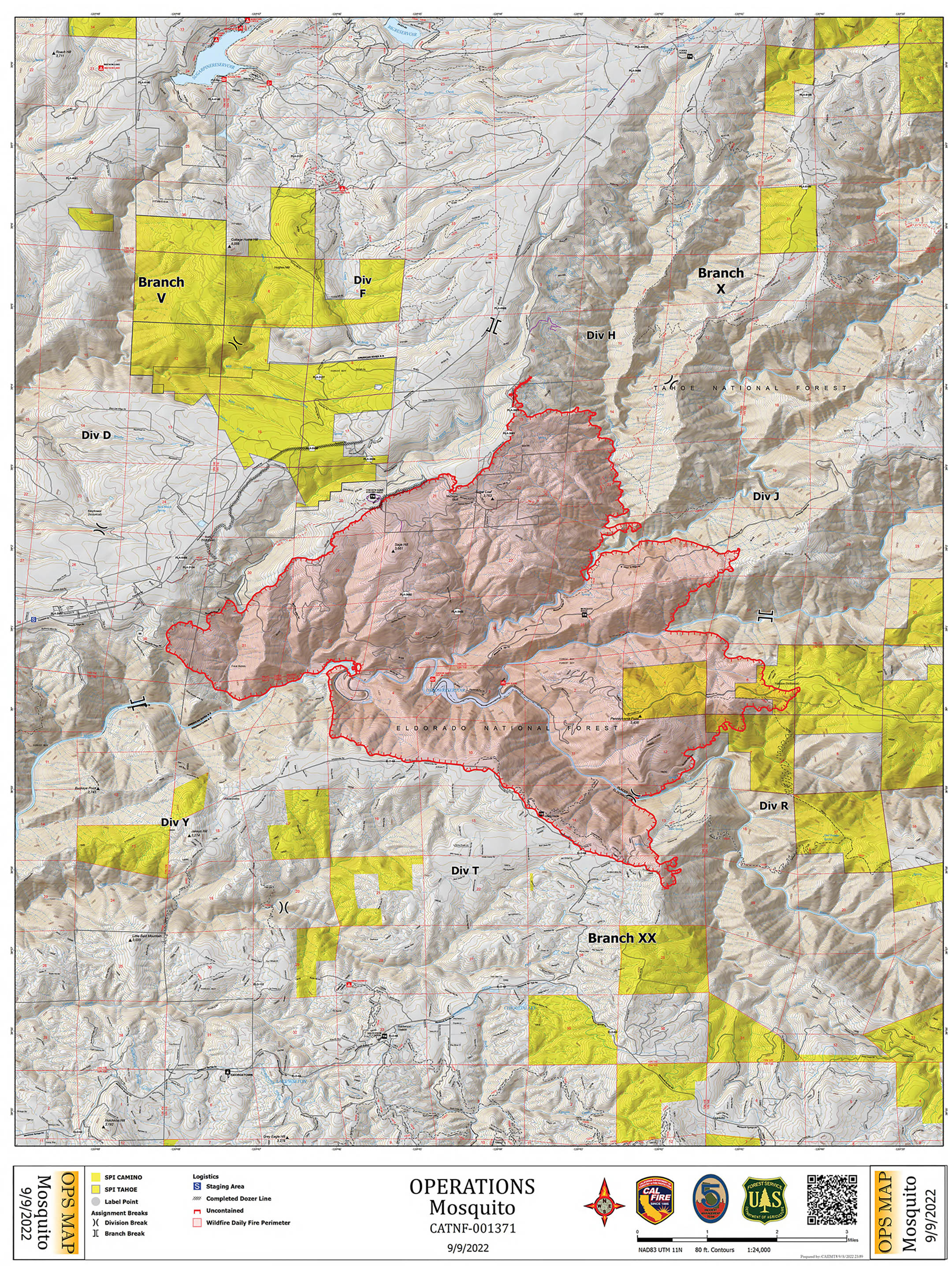
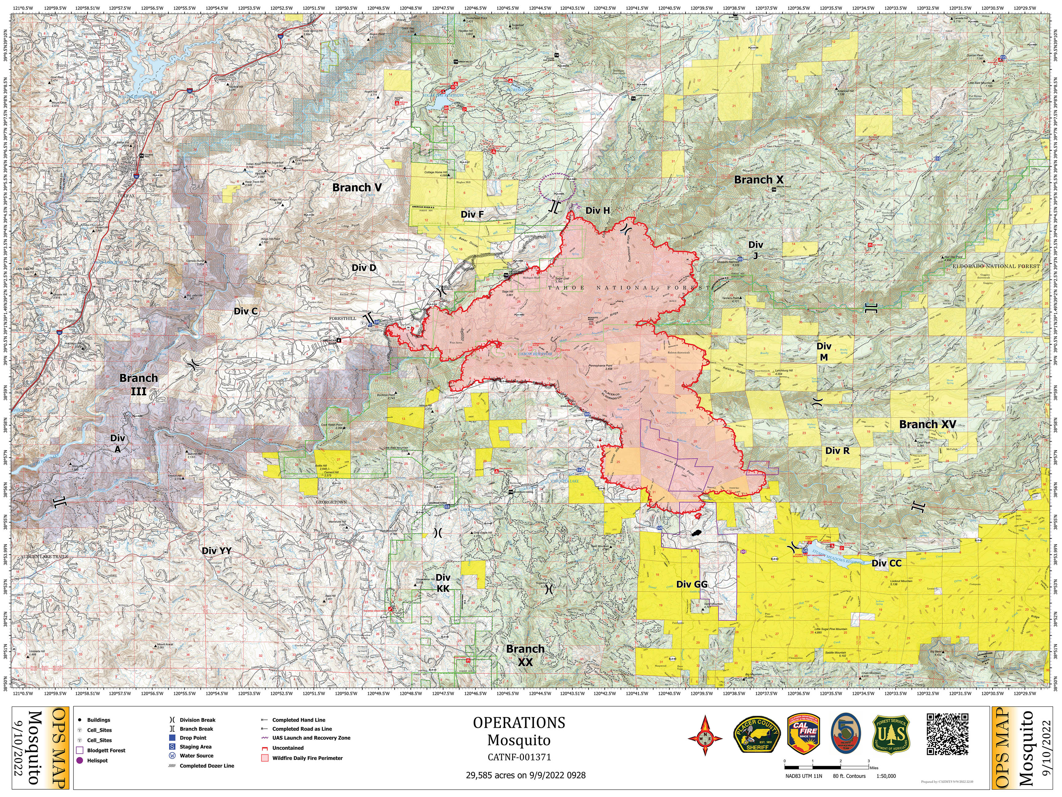
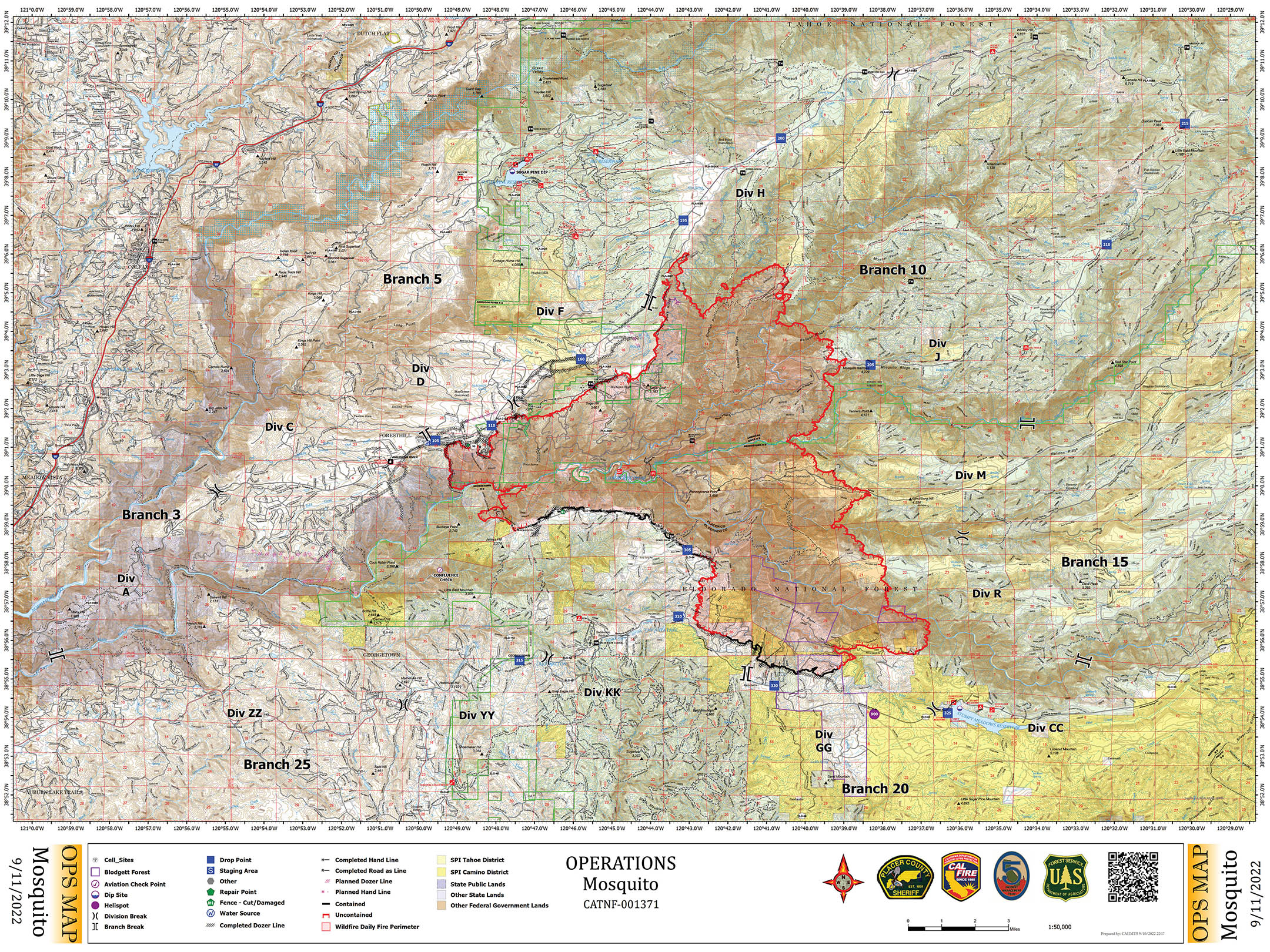
Ownership (SPI- yellow shaded on this map is “Sierra Pacific Industries, private timber”), DPS, OPS and NIROPS IR flown at 0345z, Maps for Today:
!
2 Likes
Yes they are 25,108 ac.
2 Likes
Branch 20 reported that a Georgetown PUD rep is saying their canal has been compromised and something about the Divide. . . (Transmission was cutoff) this may be the raw water source for the treatment plants?? which will certainly be an issue for hydrants and customers on the Divide.
2 Likes
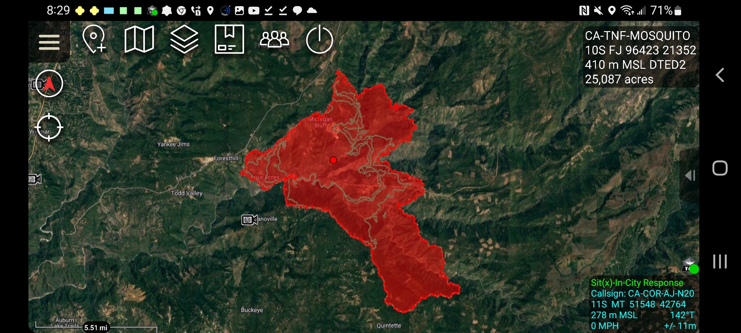
TNF FB page reports Mosquito incident is 29,585 acres 0% containment as of 12:40 today
3 Likes
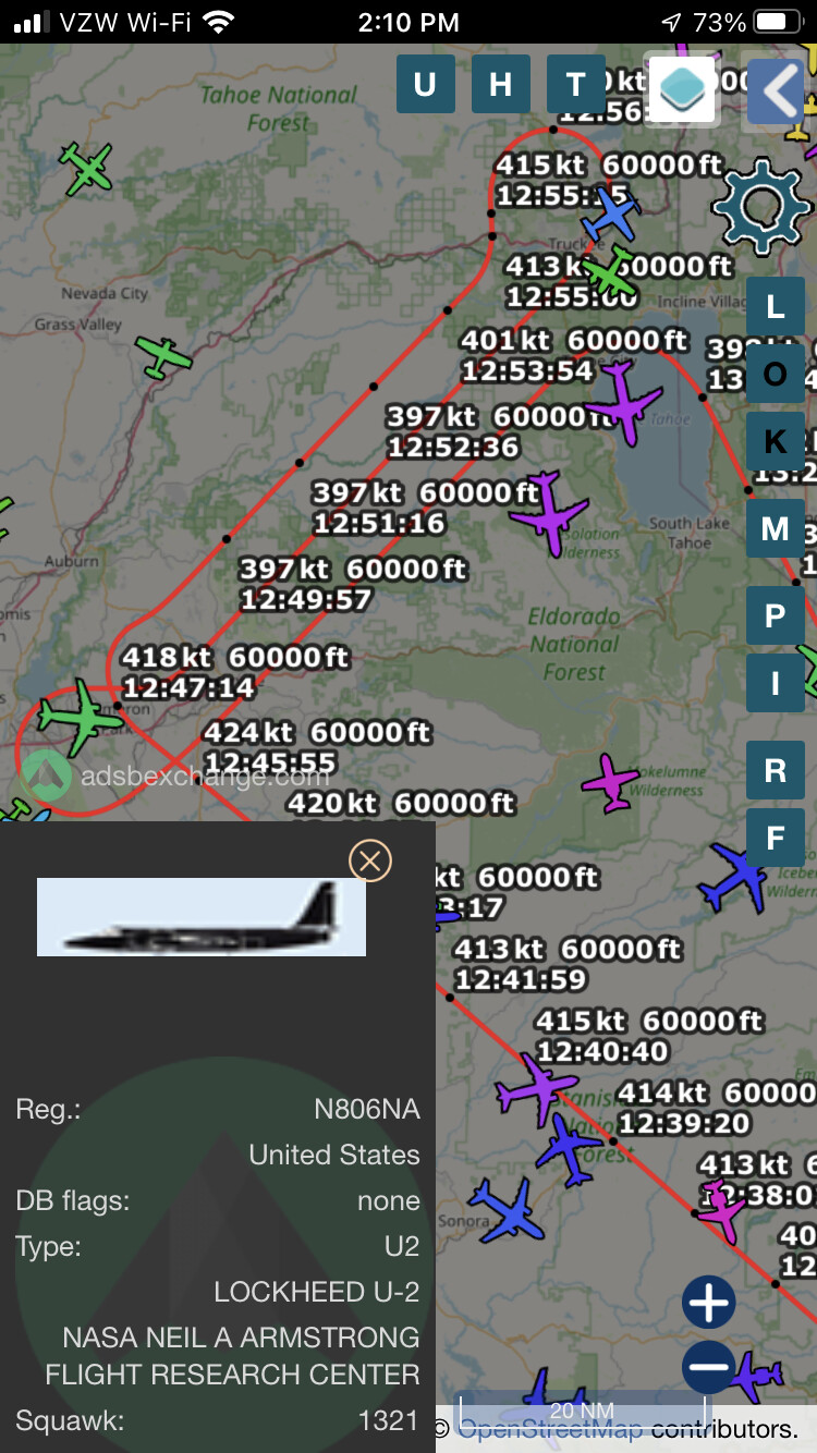
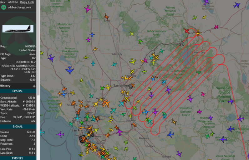
NOAA57 isn’t a mapping aircraft. It is conducting atmospheric sampling, smoke studies, etc…
10 Likes
29,585 Acres @ 0% Containment as of 1346hrs.

Link to updated evacuation information from Placer County Sheriff.
3 Likes
It appears the rep was referring to the irrigation canal. There’s a series of canals and ditches which run from Stumpy meadows through the Georgetown divide area. There is one on my place, and it’s barely trickling right now.
6 Likes
North Ops at 1855:
CA-TNF Mosquito Fire: 29,585 acres brush and timber, 0% contained. Moderate fire behavior with torching, uphill runs and flanking. Evacuation Orders and Warnings in place with additional orders in progress. Structures and multiple communities remain threatened. Continued threat to power, water, timber and communication infrastructure. Fire is in Unified Command between Type 1, CAIIMT 5 (Young) and CAL FIRE.
2 Likes
New FIRIS Update: Acreage increased to 33,754
4 Likes
Data package posted at maps.takserver.us
2 Likes
North Ops at 0720:
CA-TNF Mosquito Fire: 33,754 acres brush and timber, 0% contained. Moderate fire behavior with torching, uphill runs and short range spotting. Evacuation Orders and Warnings remain in effect. Structures and multiple communities remain threatened. Continued threat to power, water, timber and communication infrastructure. Fire is in Unified Command between Type 1, CAIIMT 5 (Young) and CAL FIRE.
1 Like
Some of the updated intel this morning
Critical Resource Needs have been bumped up:
15-T3 engines, 4-T1 IHC crews, 3-T2IA crews, 10-T2 Excavators with mastication and bucket with thumb attachments, 8-T2 dozer, 4-HEQB, 4-TFLD, 8-WT T2 tactical, 4-Supression Modules, 5-SOFR, 3-SOF2
Todays Ops Map post Deluxe Fire Map Resizer Machine:
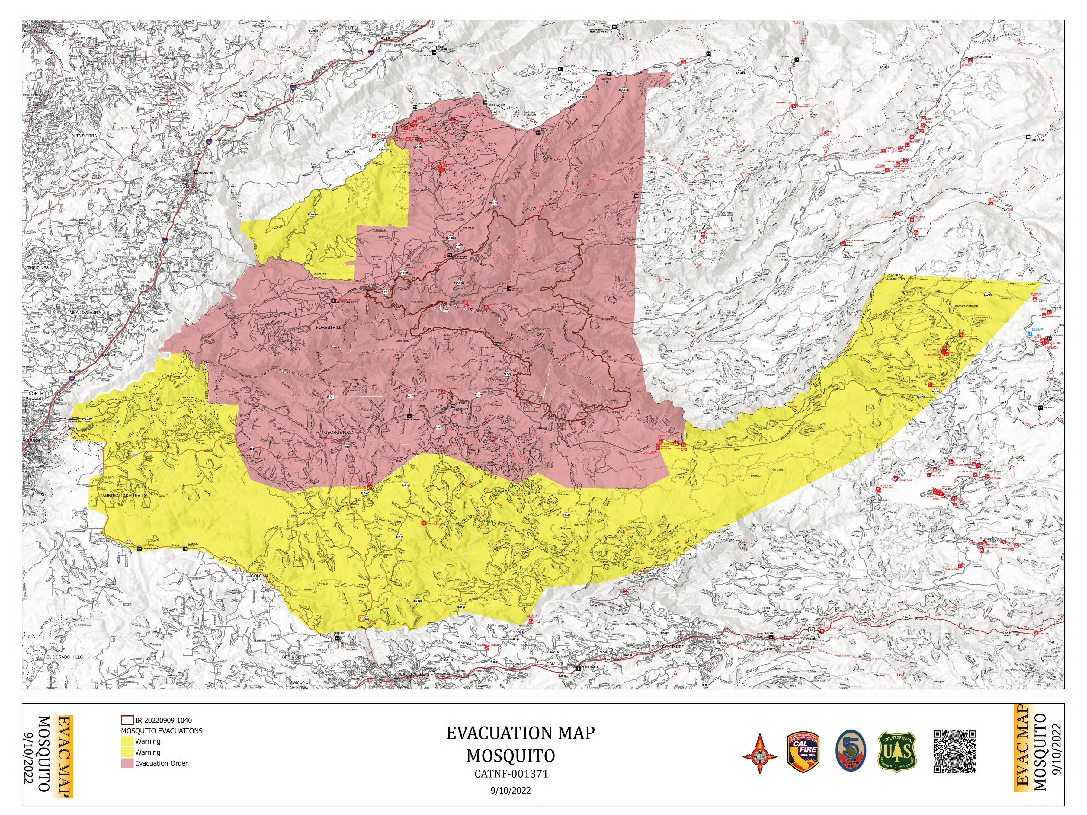
Evacuation Map:
6 Likes
A post was merged into an existing topic: CA-TNF-Mosquito??
data package for the mosquito 091122 posted at maps.takserver.us
1 Like
Non enough coffee this AM, was originally posted to the Q&A. At least it was the right info for the right fire!
AM Intel:
41,443 Acres @ 10% Containment
11,117 Persons Evacuated
1808 Personnel Assigned to Incident
Critical Resource Needs:
15-T3 engines, 6-T1 IHC crews, 3- T2IA crews, 10-T2 Excavators with mastication and bucket with thumb attachments, 8-T2 dozer, 4-HEQB, 4-TFLD, 4-Supression Modules, 6-Feller bunchers, 8-Skidgens, 1-INCM, 2-RADO, 1-COMT, 1-PCST
Ops Map:
14 Likes
XLC Alpha STEN 1202 A demobed from Fairview and en route to Mosquito now.
E12 BRK, E15 BRK, E21 GLN, E22 GLN, E91 SNM, BC3 PAS leader.
6 Likes