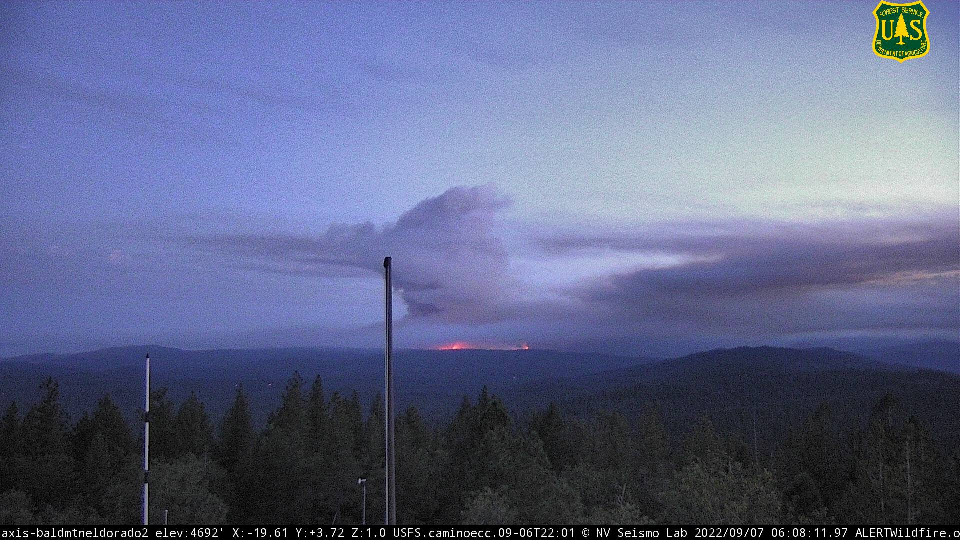
Here is FIRIS mapping from about 4:45am.
6 Likes
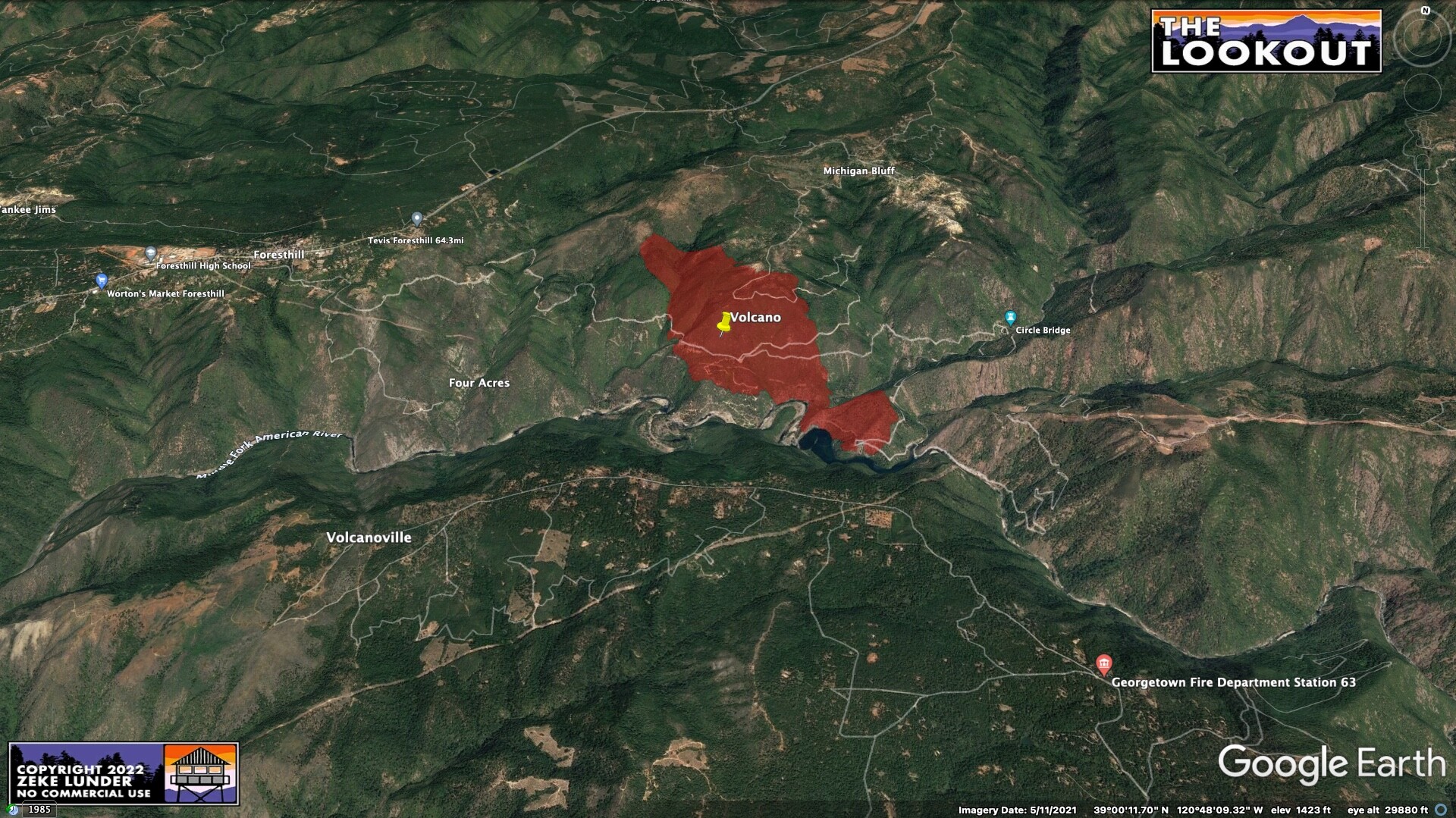
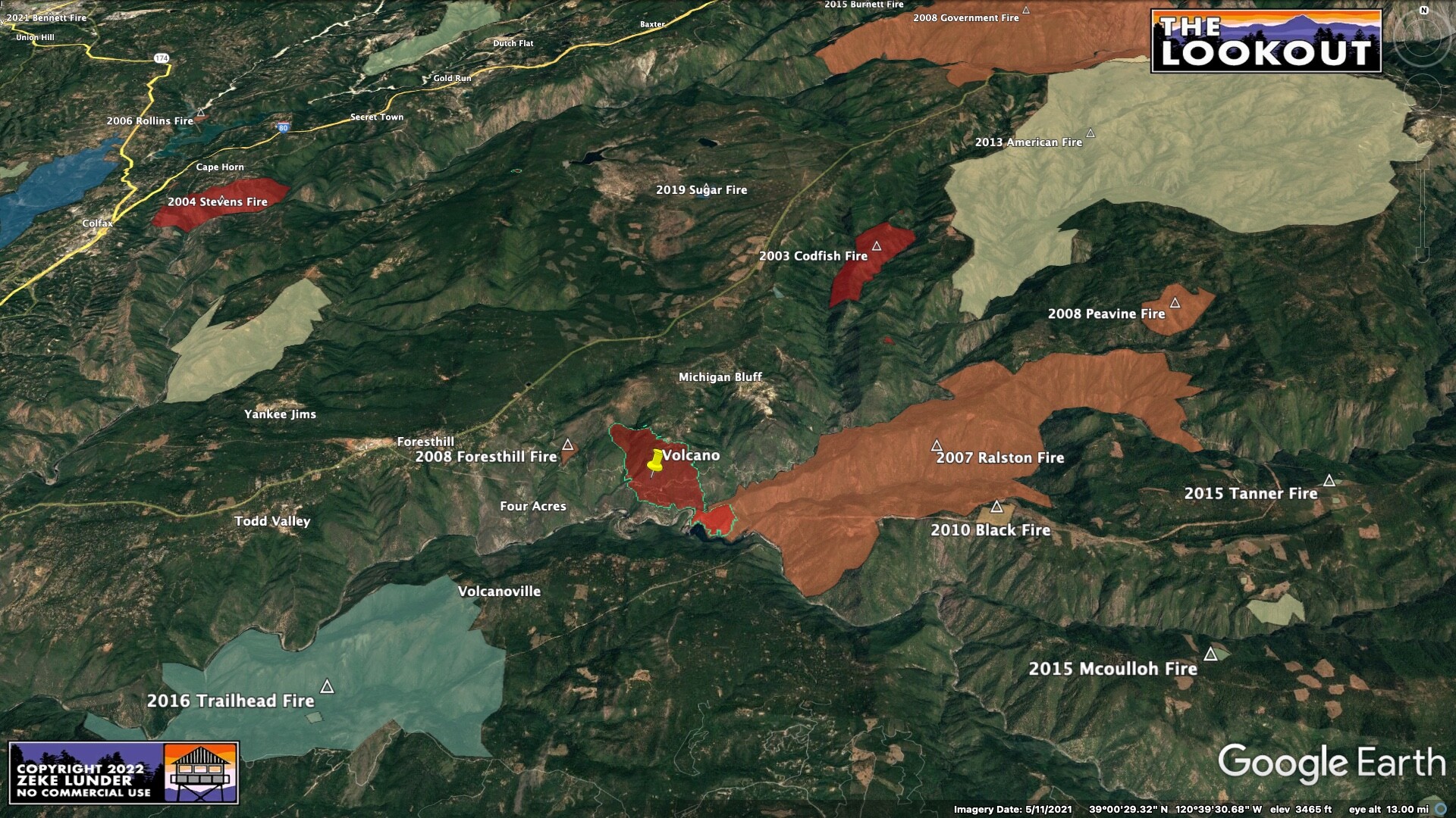
Hopefully the dozers are able to cut a few blades wide along both ridges flanking Volcano canyon in the near term to give crews some opportunities to establish anchor points before the sun gets on it.
3 Likes
Isn’t this a FED fire? What is this T3 team you speak of?
2 Likes
There are several Type 3 teams that are local government staffed. Sacramento. North Bay. East Bay. South Bay and so on. Very capable, almost like an initial attack team even thought they’re capable of handling incidents far more complex than a type 3 incident. They can ramp up and go to work quickly, within hours. They add management and organization while often waiting for a larger team to move in if the incident continues to expand. In busier times, they’ll keep the whole thing. Teams are made up of local fire, state and federal fire agencies, law enforcement and emergency management. They’re diversely staffed and operational.
14 Likes
Sac Co Regional IMT…its been used quite a few times over the last couple of years in support of fires in the NEU and AEU. So I’m speculating that this is getting set up in anticipation of perhaps this going multi jurisdictional
13 Likes
2 Likes
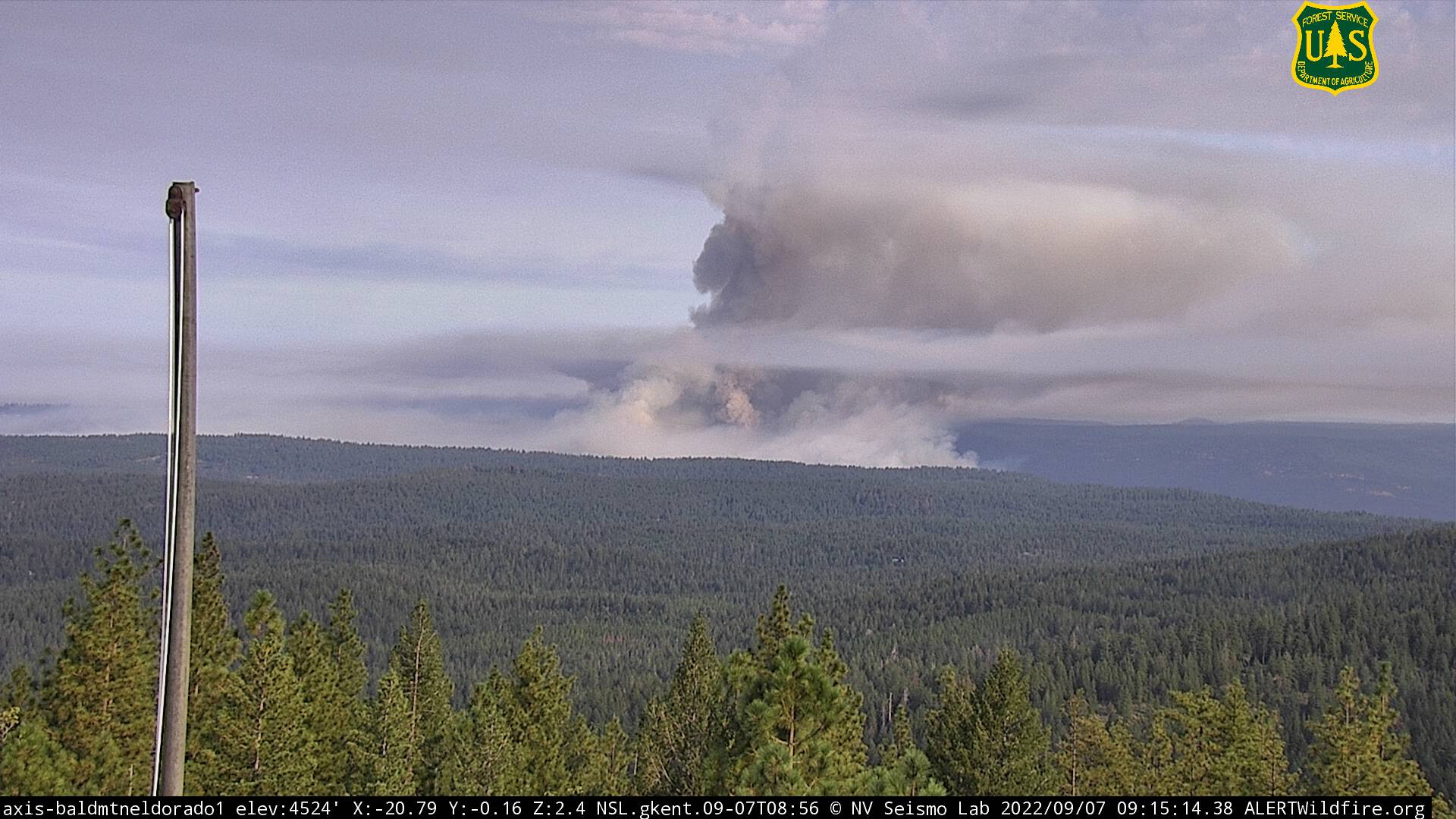
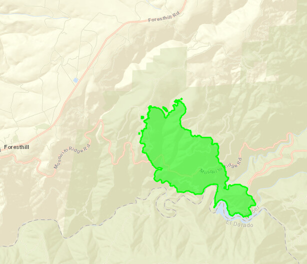
#MosquitoFire 9.7.2022 6:42am update: With more accurate mapping the #MosquitoFire is 822 acres and 0% contained. The fire is in Placer County with no extention into El Dorado County at this time.
CAL FIRE NEU is in Unified Command with the Tahoe National Forest and Placer County Sheriff. NEU FB page
Evac map
https://pcsogis.maps.arcgis.com/apps/webappviewer/index.html?id=34e6172213b540c8b8b064d8a7da4f76
3 Likes
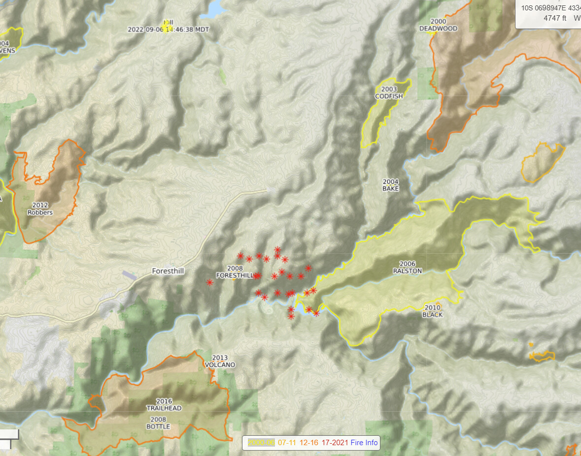
Call me crazy, but if this thing doesn’t get checked up to the east I could easily see it running to French meadows within a few burn periods the way it’s behaved through the night. Alignment & fuels. Pretty familiar with that area and it’s overdue. Especially seeing what the King & Caldor were capable of.
4 Likes
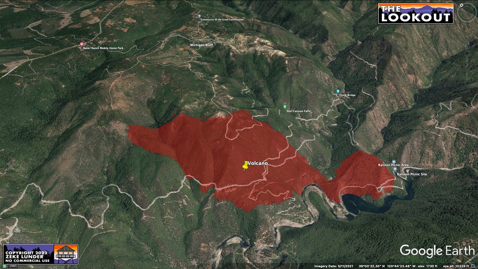
There has been a lot of fuels treatment work done further up the FH divide heading out towards Deadwood recently, hopefully that helps if it comes into play.
4 Likes
Agreed. But when incident priority is focused to the North WUI threat it’s gonna remain unchecked in that oxbow drainage & start flanking to the East up those drainages that are hard to access. Add that with reported spotting over a mile yesterday evening. Could get pretty interesting whitching hour
10 Likes
I don’t know if spotting to that degree actually happened, I remember the report of a spot near Circle Bridge but AFAIK the mapping this morning didn’t bear that out? That said, after last year I don’t think anyone is willing to make guesses about where a fire won’t make it to.
It’s got some similarities to Caldor and McKinney - both popped late in the day such that tankers couldn’t wrangle them in time, they got established in the bottom of significant drainages, burned actively through the night. McKinney even got the outflow winds in the evening, too. Every fire is different and so far this one has behaved itself compared to those two, but it’s just a bad spot to have a big fire.
But we have seen some heroic stops. The River Fire last year near Colfax was in similar territory and could have gotten even uglier but for a lot of airpower. And has anyone heard from the Mountain Fire lately? Crews seem to be kicking its ass. Guess we’ll find out in the next couple of days… wishing everyone luck out there.
10 Likes
Priority is certainly the WUI on the FH divide, the Volcanoville region, and drainages leading into Georgetown. My hope is that the treated fuels provide time to prevent the fire from outflanking crews as diurnal winds push it to and fro.
4 Likes
I felt like it had a few similarities to the creek fire the way it was burning at 1am and the way it’s acting so far, one can only hope thats where the similarities stop.
5 Likes
Air resources currently over the fire:
AA
Tankers 88&89
Choppers '3RF, '6WL
Edit: Looks like a mapping flight being flown by N57B at the moment.
3 Likes
948 acres 0% contained per calfire NEUVideo update
4 Likes