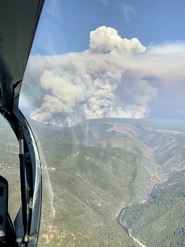
I believe I just copied a conversation that they are losing structures in Volcanoville. Unknown location.
Edit: Just confirmed “No Divert” on air tankers–life/safety threat and losing structures.
AA Just advised continuing the No Divert on Tankers due to life safety… “We are losing structures in Volcanoville”
Depends on what the Agreement says. Most are based on percentages of fire damaged areas.
I was contingency structure group in Valcanoville on the Ralston 2007? They had done lots of fire wise work but had a long way to go. The George Town divide is not a good place to have a traffic jam with fire in the area. They recognized the threat back then and do today. Hope everyone listens.
DIVS T & R swapping some resources and moving folks up to Quintette.
FYI…Georgetown is the correct spelling
Could I get a rundown of the fixed wing assigned? Thanks
Ralston was 2006. The fire history map showing 2007 is wrong.
They closed Foresthill Road @ I80 in Auburn.
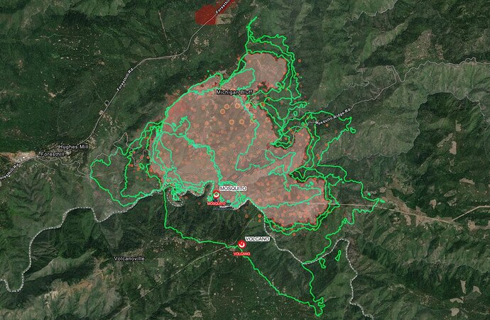
We’ve got updated 16:45 FIRIS maps on Twitter.
Looks like fire is still mainly in the canyon. https://twitter.com/wildland_zko/status/1568029095560359937?s=20&t=UpWsUEJz8-_oftJW_7yYeQ
Compass in top-right corner.
Not a dumb question! Those are previous perimeters from when FIRIS (a California OES program) has mapped the fire over the past 48 hours. I.e. the outermost green line is the latest perimeter from 4:45 today, the next one inside that is the perimeter from around 1 PM, and so on. I suggest tuning into the Youtube livestream @pyrogeography will do at 8 PM tonight on this fire, he displays and analyzes mapping data w/ much more context and pizzazz than the raw FIRIS output.
GVECC advising AT that there are no type 1 tankers available per north ops. Also sounds like they are struggling filling the relief AT.
Bald mountain cam has some pretty epic progression on the 15min loop. @pyrogeography which drainage is that looking at…
Thought they just assigned one out of McClellan


