
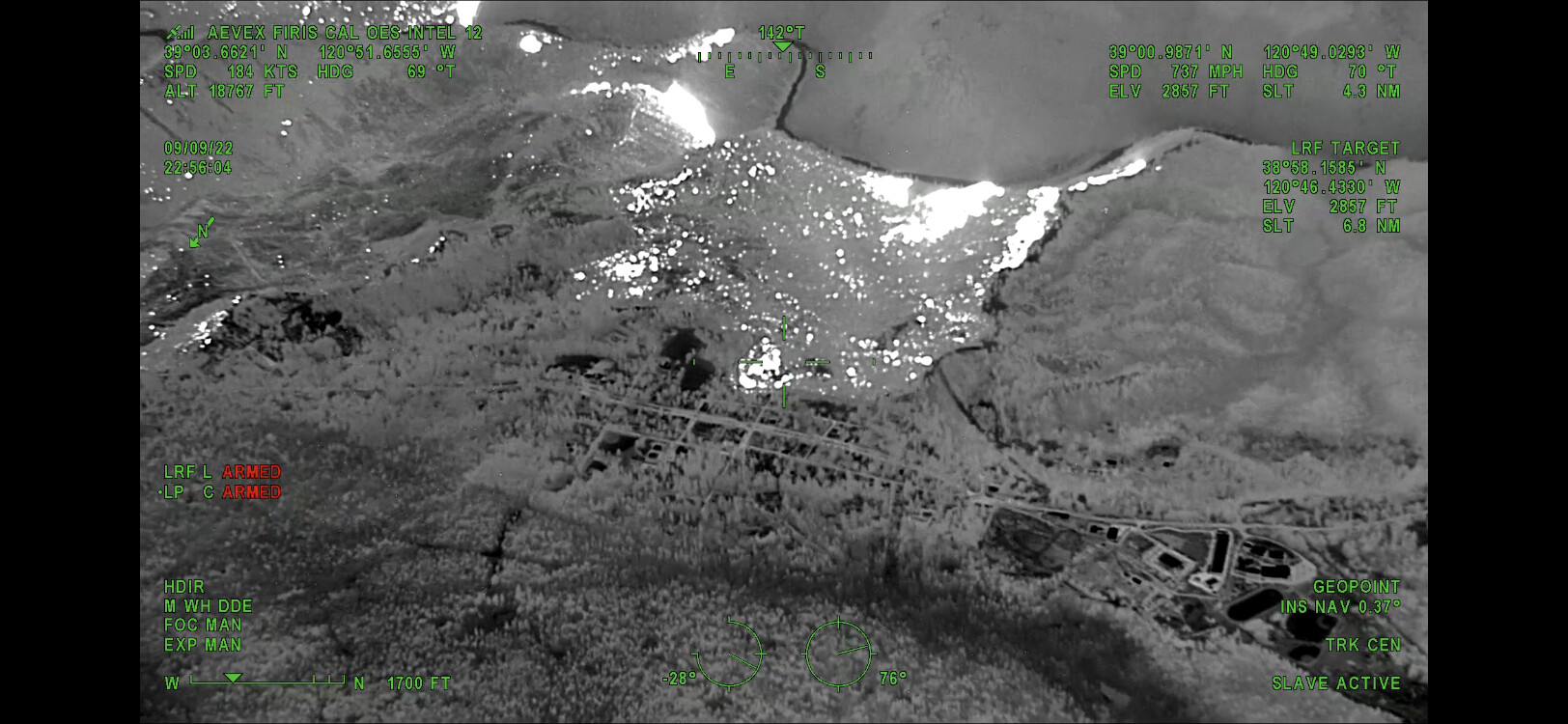
Last night’s 10:30pm FIRIS flight shows a large area of heat/spot fire in the canyon bottom southwest of Foresthill. I can’t find any other intel showing this actually exists, so any other mapmakers out there may want to find confirmation before posting the FIRIS as-is.
4 Likes
Disregard, it does
1 Like
@pyrogeography are you talking compared to the ops map?
I watched the video from INTEL-12 and tthe fire is right up to the dozer line that runs south from town, from Baltimore Mine Rd towards the river.
2 Likes
Can you give me a CAN?
2 Likes
I didn’t catch the entire report, but it sounds like the plan on the east side is to tie control lines in from Chicken Hawk back to Foresthill Rd. up to Hog’s Back, then out towards Canada Hill along the 13 road.
From significant personal experience along the 13 and spurs:
-
Significant dead standing snags, downed timber, and hazardous trees remain along the entirety after the American fire.
-
Regrowth of manzanita has become very significant in the past several years, making hiking difficult and obscuring hazards.
-
Many very large trees (40"+ dia) were cut and left on the slopes in a manner that they could be released and slide if the ground or vegetation below them is disturbed. Take extra precaution in the vicinity of Manila Creek, numerous widow makers remain that I haven’t been able to remove personally.
-
There are areas of the paved road which have been undermined by erosion and pose a risk of collapse under the weight of a 'dozer - I’d strongly recommend having a spotter running ahead before bringing equipment down
-
I’ve nearly hit very large bears on several occasions on the flats.
-
There are numerous mines in the area which are not mapped, some of which have uncollared vertical shafts or open stopes exposed, but are now overgrown with manzanita.
-
Large rocks to boulders the size of a small car regularly fall into the roadway.
Be careful out there, and feel free to contact me with questions.
12 Likes
Branch XX, div KK request going out for additional 2 Charlies and a Golf to the vicinity of Wentworth Springs & Volcanoville. Fire activity picking up, looking to put fire on the ground to protect the structures in the area.
2 Likes
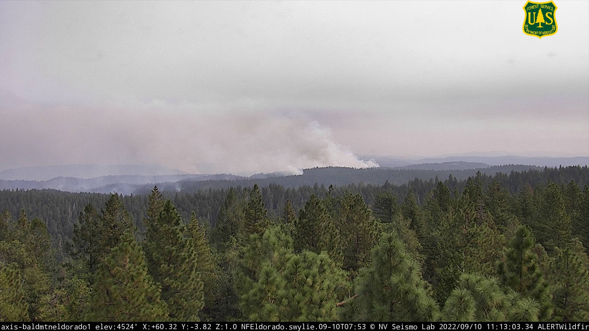
Our Mosquito Fire livestream from this morning is live on our website. We cover fire spread thru 10pm last night, and also look at the Cedar Creek Fire, in Oregon.
Skip to 1:30 if you want to miss me shaking my head over technical disasters.
8 Likes
Watchduty put out last night that there are thermal cameras up now pointed at this fire.
https://alertca.live/cam-console/2705
https://alertca.live/cam-console/2704
@jhiggins can shed more light on them and the whole alertca website
3 Likes
We just posted updated maps on The Lookout from this morning’s NIROPS (contractor) IR flight.
Some minor overnight developments, no big movements.
7 Likes
At the moment I don’t see many air assets over the fire. Is the majority of the fire smoked in.
2 Likes
It sounds like they’re starting to line up for retardant drops in the vicinity of Peavine Pt. and Div. KK if I caught that right.
2 Likes
Copy thanks, with this weather change seems like a great time to hammer it.
2 Likes
It sounds like they’re also about to run a UAS mission from Baltimore Mine area.
2 Likes
Request for intel in the Big Oak Flat area to determine feasibility of evacuating a bunch of cattle.
3 Likes
Copter '6HT tasked to Div D to work with American River Hotshots.
Update:
Someone asking about snagging one of the copters to support Wyoming Hotshots in the Greek area.
~11:35 – AA17 over the fire
2 Likes
AA calling in a ~5ac spot fire in the vicinity of the Seed Orchard (Div. H) at branch break.
Note: This is a very high priority.
Update: ASM & 2 super scoopers inbound.
(Related query: Is Sugar Pine or Big Reservoir a qualified scoop site?)
2 Likes
Do you have the tail numbers of the Super’s?
1 Like
I missed the tail numbers, but they were around Winnie at the time I caught the traffic – not immediately spotting them on flighradar24 though.
2 Likes
Sounds like they’re looking to order 3 VLATs and 4 LATs for retardant operations, with Placerville Airport as the IP (after letting people there know so as not to freak them out with the overflights) (Edit: Now “Placer IP” just south of PVille airport)
Plan sounds like it is to start treating from Stumpy and filling back.
5 Likes