Any uploaded IAP’s yet?
3 Likes
Look’s like they burned off of Volcanoville Rd last night on the map, and it held pretty well? I also heard they hope to catch it on Wentworth to turn it, but that’s coming up very soon.
1 Like
Post above says 25k acres ?
1 Like
Fairview or Mosquito Fire?
1 Like
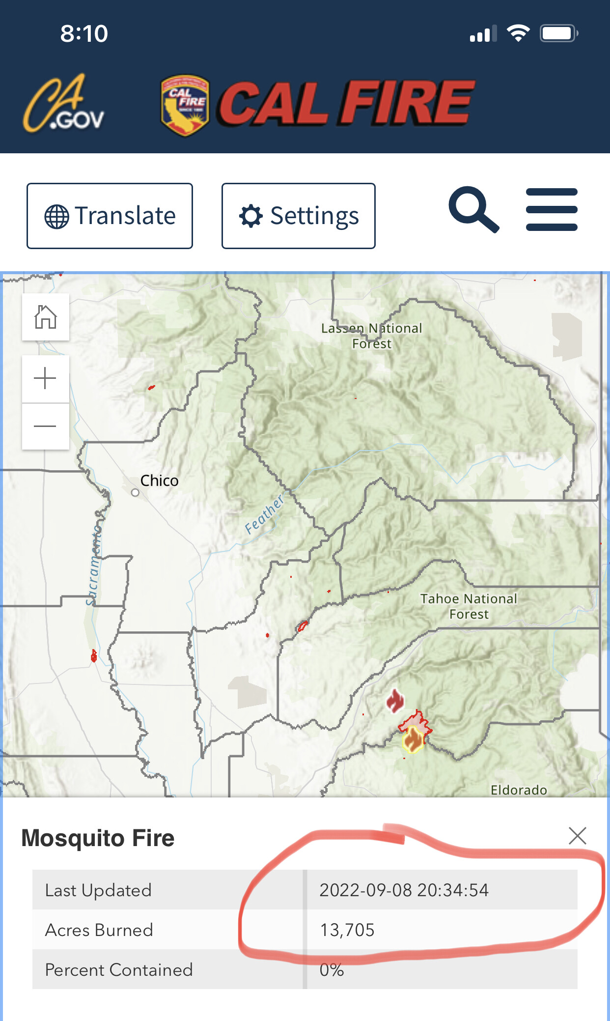
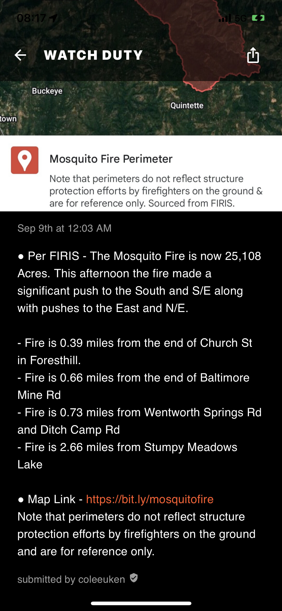
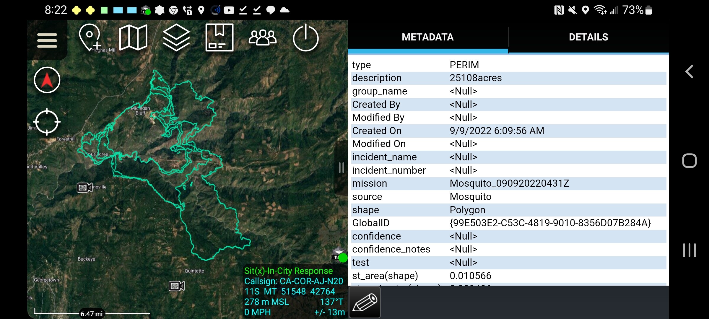
The fire was mapped at 25,108 acres by FIRIS around 11 PM last night. That’s where Watch Duty is getting it from.
5 Likes
Correction, that was just them holding it as it came over the ridge. No burn ops.
I’m looking for the Mosquito IAP as well. My department type 6 is Enroute to that fire. Thanks in advance!
1 Like
@9270 im confused this is the Oxbow/Mosquito disussion correct? Both fires are about the same size.
@TSG its a fed incident so ymmv on public access.
1 Like
Thank you. I’ve checked all the avenues and nothing so far. What is ymmv?
“your mileage may vary”
6 Likes
I was just making a comparison no need to panic sorry if I confused anybody
3 Likes
I have the IAP but it’s too big to upload here. Trying to figure out a way.
2 Likes
Thank You!
2 Likes
