Requesting units to evac Hidden Treasure.
3 Likes
Updated evacs from Bath to Hidden Treasure, south side of Foresthill Rd
Edit: Updated evacs also along Mosquito Ridge Rd. east of Soap St.
2 Likes
The town of Foresthill is now under an evacuation warning. Never seems like a good sign when your evacuation center is placed under an evac warning. Likewise for the ICP.
5 Likes
Agreed. Believe it’s time to move the evac center to Auburn
4 Likes
Ask and ye shall receive… New Evac center being opened up at Bell Rd Baptist on Bell Road near the airport
6 Likes
EDSO has been going door to door in the Volcanoville area on the El Dorado County side. Alert has been sent for Voluntary Evacs of Volcanoville.
El Dorado County side is in ENF.
El Dorado County has not updated evacuation map, but here is link.
2 Likes
Sounds like a possible UAS mission in the offing?
1 Like
Very early in this incident, near dark, one of the helicopter crews could not be picked up due to turbulence, shortly thereafter this thing blew up. Does anyone know the status of that crew?
2 Likes
Cool Community Church, 863 Cave Valley Rd is open as evac center on Eldorado side.
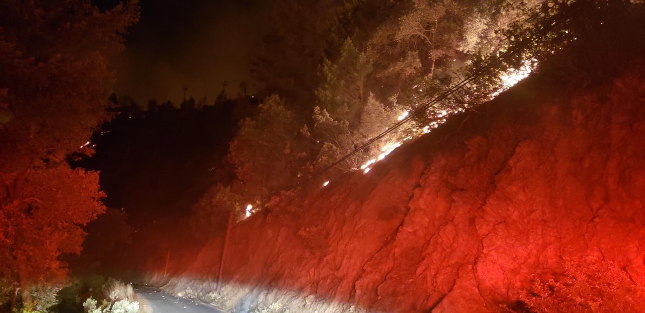
Also heard that they are staging some incoming resources on PCWA property, at the oldmill site in Foresthill. This is the usual ICP for TNF fires in this area. IE Ralston, American and the last days of the 2014 King fire
3 Likes
2 Likes
Looks like we may have just had a mapping flight of the fire (N57B - INTEL12?), hopefully updated acreage and perimeter are available ASAP.
Update: Looks like the data is available, here’s a link to a map:
2 Likes
822 acres via firs
4 Likes
XSA T3 IMT getting stood up this AM for 10am in-brief
4 Likes
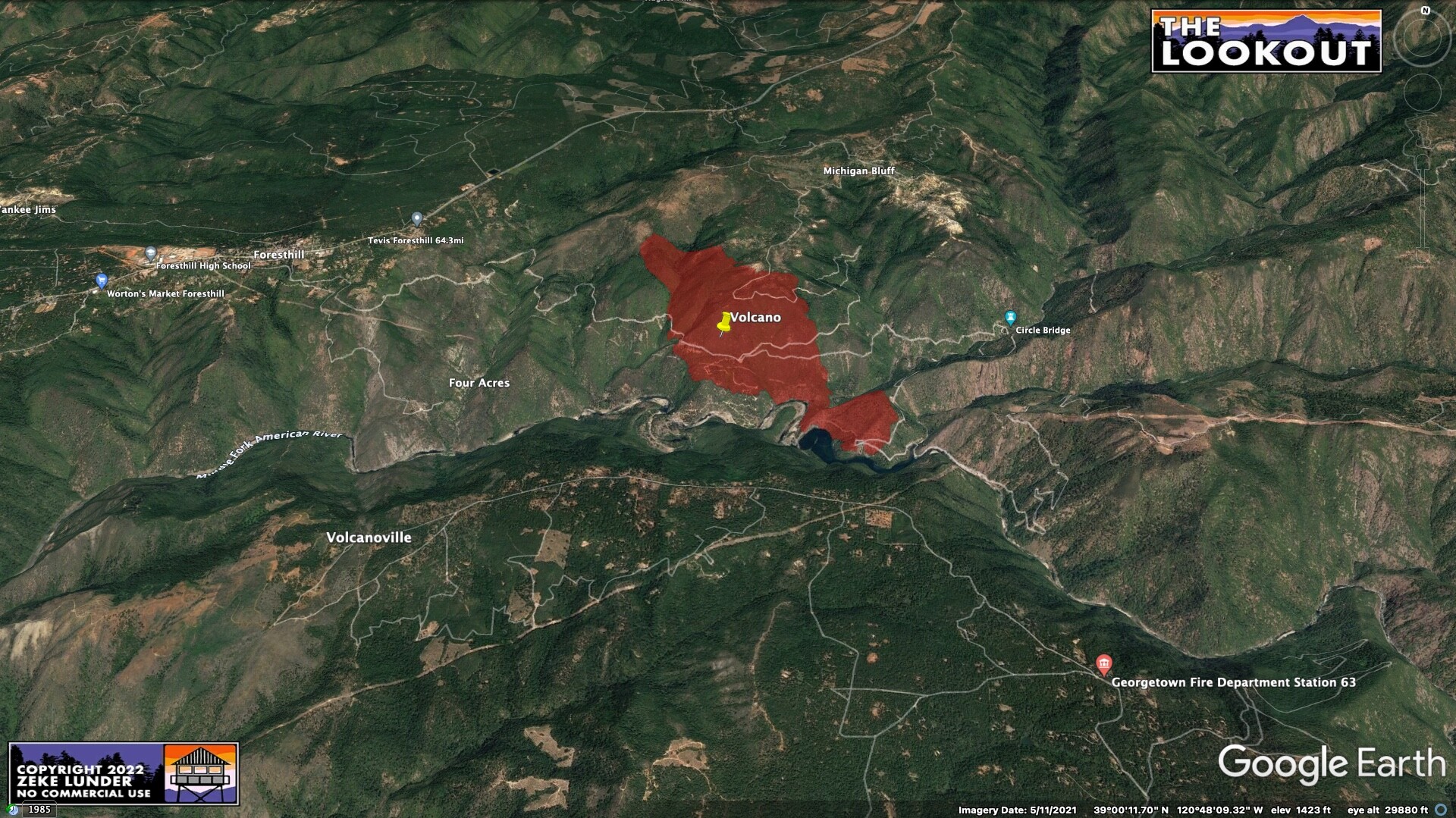
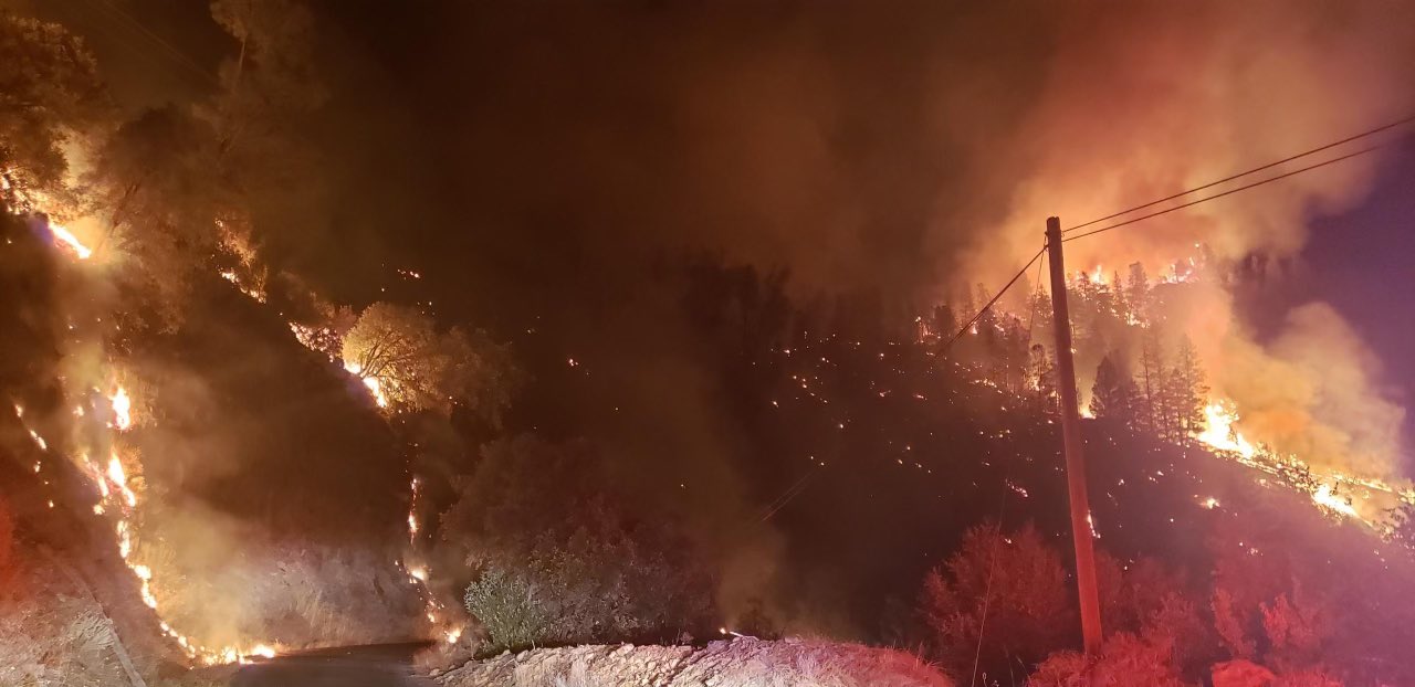
Hopefully the dozers are able to cut a few blades wide along both ridges flanking Volcano canyon in the near term to give crews some opportunities to establish anchor points before the sun gets on it.
3 Likes
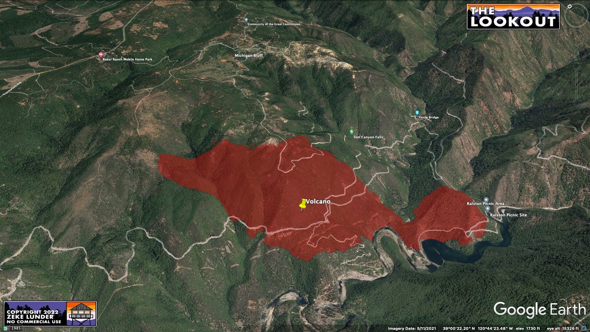
From CalTopo - Limited fire history for the area.
5 Likes
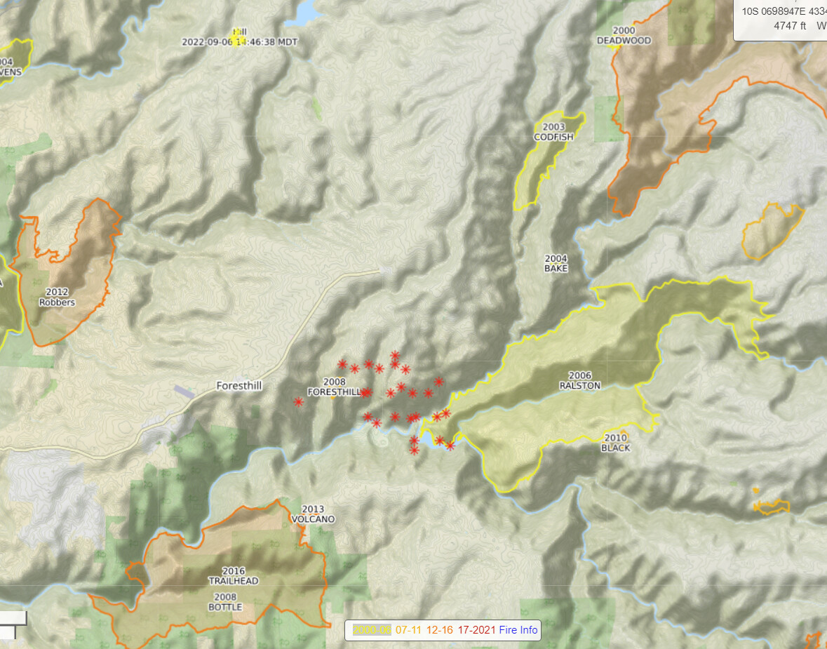
Fire history in 3d, per request from @baldy. Sorry H20nBTU, not trying to show you up!
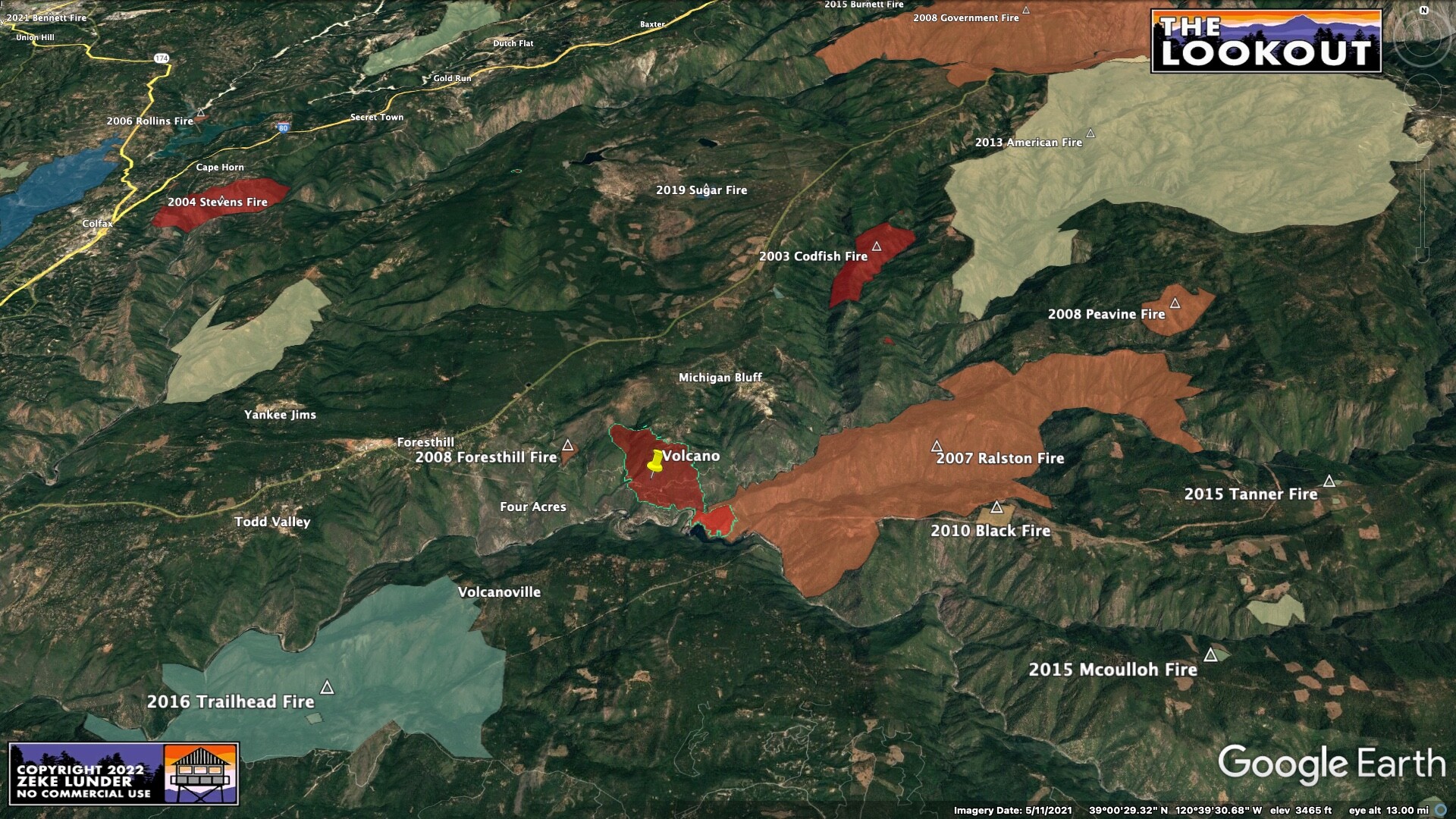
9 Likes
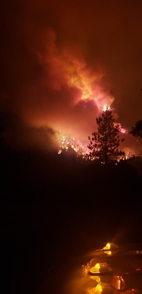
View from Bald Mountain 2 at dawn:
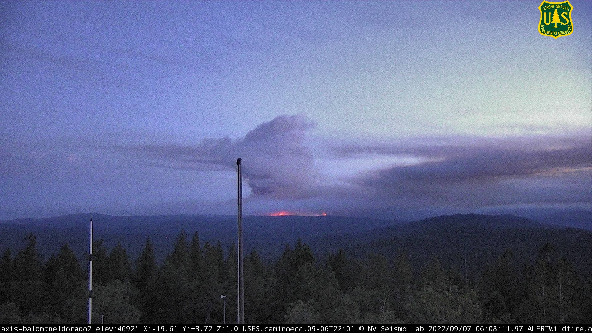
6 Likes
Isn’t this a FED fire? What is this T3 team you speak of?
2 Likes