One behind eagle mountain casino on cow mountain.
http://www.alertwildfire.org/sierra/index.html?camera=Axis-KingGeorge2&v=fd40729
One outside of porterville.
http://www.alertwildfire.org/sierra/index.html?camera=Axis-RockyHill&v=fd40729
One behind eagle mountain casino on cow mountain.
http://www.alertwildfire.org/sierra/index.html?camera=Axis-KingGeorge2&v=fd40729
One outside of porterville.
http://www.alertwildfire.org/sierra/index.html?camera=Axis-RockyHill&v=fd40729
Blue ridge showing a fire on black mountain. Almost dead center screen, right side is the fire behind eagle mountain.
http://www.alertwildfire.org/sierra/index.html?camera=Axis-BlueRidge1&v=fd40729
BDU ALABAMA Fire
200+ moderate ROS
Grass & Brush
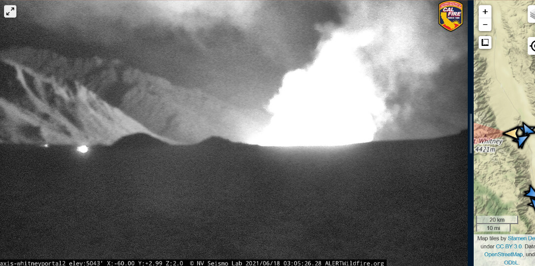
Whitney Portal 1mi NW of Lone Pine
Temp 76, RH 20, Wind W10 G15
This is the CABDU Alabama incident outside of Lone Pine
Smoke building on the Colvin/crooks cam:
http://www.alertwildfire.org/sierra/index.html?camera=Axis-Crook1&v=81e003f
and hear command traffic on SQF fire net for logistics orders for food and water
to their fire. I believe I heard “Nettle” fire.
SBC sending ST 9322C (B11,312,315,326,330 338) and SBC Crew 10 to the Piedra Inc in TUU.
SQF getting tankers 94, 76 and Air-Attack out of Paso.
Using AG41
Confirmed “Nettle” fire.
I haven’t figure out the details, location, size, etc.
Crook camera is showing the antelope fire.
AA15 tanker 105 are committed to the antelope.
I wasn’t tying to two together. I just heard traffic on SQF and search the cams this morning and didn’t see any post for TUU incidents and the smoke on the cam I know is low elevation.
I did confirm the Nettle fire on SQF. Checking wildweb cad for location.
APX, looks like the Nettle is a BIA fire from resources committed and incident number being a TIA on Wildcad. Am curious about the Black Mountain incident. SQF has resources assigned as of today.
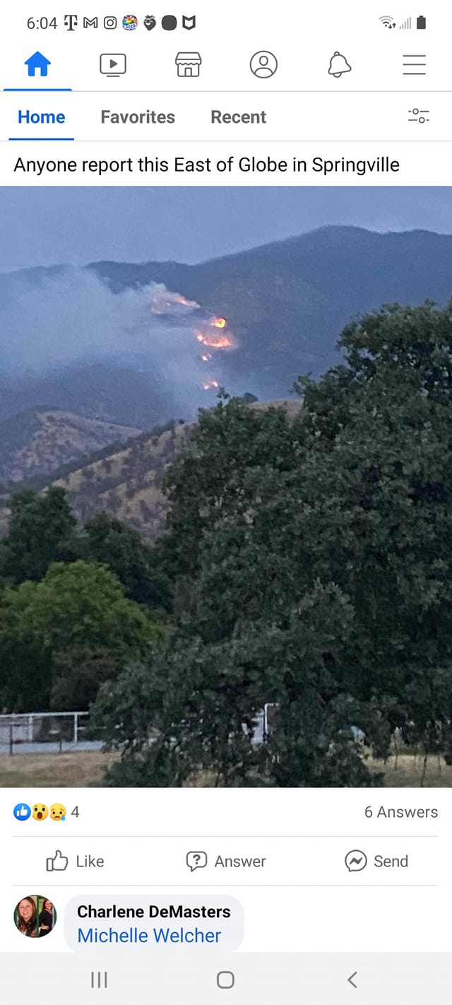
Cal Fire has the Success Fire as 400 acres and that is west of the reservation and would not be the screenshot pic above Springville.
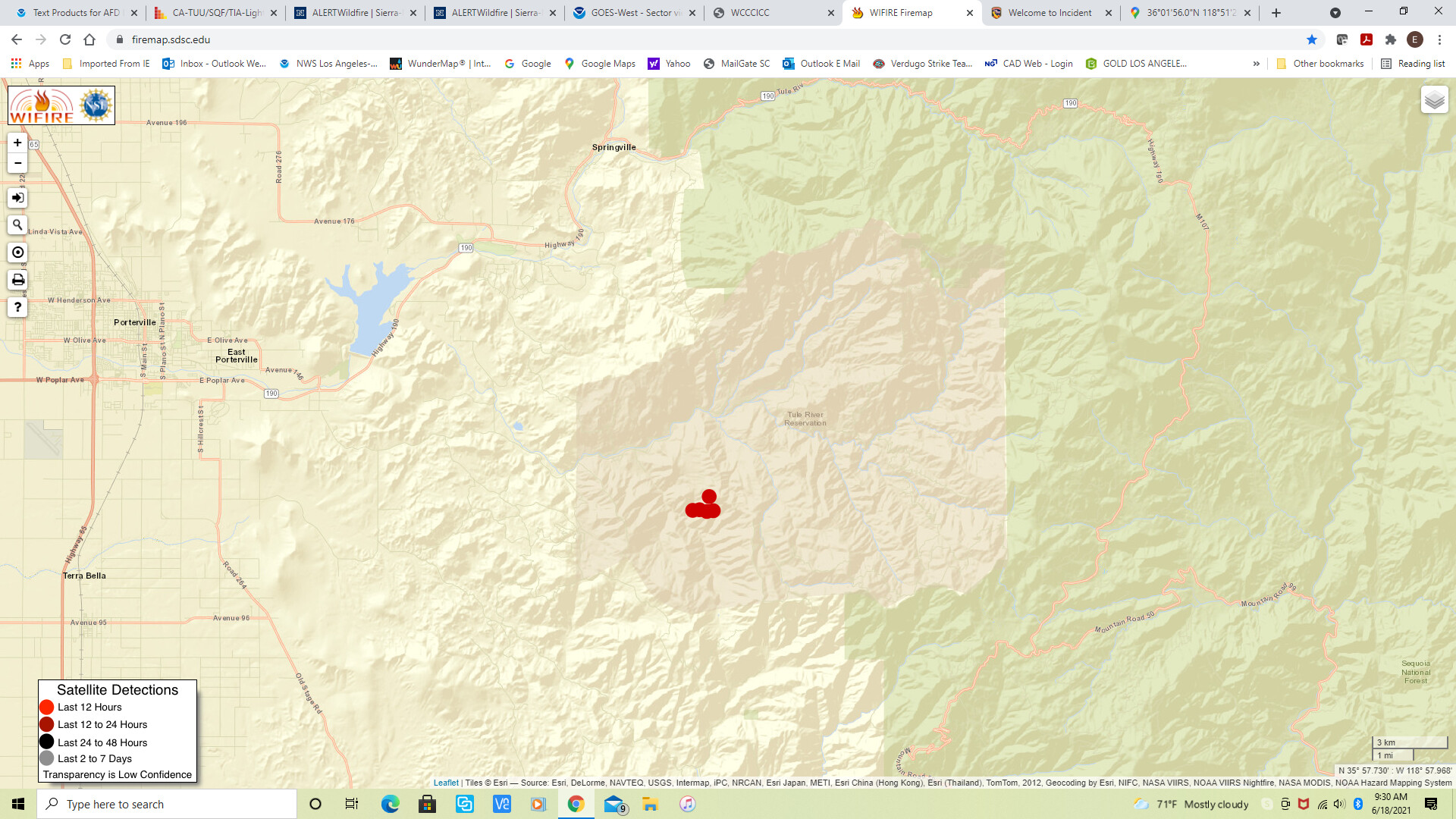
Heat signature of the Nettle, but nothing else (am wondering if cloud cover obscuring?):
Anybody seeing anything in the area of Hwy201 and Piedra ave outside Visalia ?
It was blocked by cloud cover or not hot enough, the mountain fire also didn’t get picked up. The mountain fire is visible on the the blue ridge camera closer a little left of the nettle fire.
Are these going to get there own IA thread, or just stick to the question forum
Nettle AA is taking all 3 fires. The CDF one in the reservation another one on the reservation (one of those is called “Success” maybe) and the Nettle which must be on SQF. It’s sounds like Nettle is near camp nelson, or maybe that’s a fourth.
SQF is sending a hand crew Scorpion, engine and patrol to investigate Camp nelson residences calling in a fire nearby.
AA states I see two other fires on the Reservation apart from the Nettle. Relief AA ordered.
Now SQF is sending an engine and WT to Balch Park to investigate calls of fire there.
Aircraft is Helitanker (fresno), 4 tankers 94-76-105-TBD, copter. Air Tactics 41.
SQF ch.4 the fire net is command.
There is a few lighting fires here and the engine crews are reporting cloud cover.
Maybe can find this on wildweb cad??
This is all from the traffic on SQF’s fire net.
I still don’t know the exact location of Nettle. Crews are accessing it through Johnsondale.
Nettle is on the reservation. Incident # TIA-1624 N259
Success is outside the reservation - Welcome to Incident
Mountain is above Springville, north of Nettle (thanks Slasher!) Incident # SQF-1625 N26B
Curious to hear what is in Balch and Camp Nelson.
So, on WildCAD I am seeing the TIA Inc# from other WCC’s as resource orders and the Lat and Long are placing way east. Where is SQF WCC page?
TNF prepositioned resources to SQF this week and currently Owens region has a lighting plan today.
SNF is sending resources to “willow” on the LPF. I do see the LPF IA on their WCC.
Success Fire shown in Blue Ridge 1 cam:
http://www.alertwildfire.org/sierra/index.html?camera=Axis-BlueRidge1&v=81e003f