20 acres on south Mtn.
KTLA live showing 2 dozer transports trying come down oil Field Road with Fire right next to the road. Not looking good
2 Likes
Visible on Laguna 1, butler hill, and decker cameras.
http://www.alertwildfire.org/orangecoca/index.html
1 Like
incident is being run on VNC C-8
150 acres now
1 Like
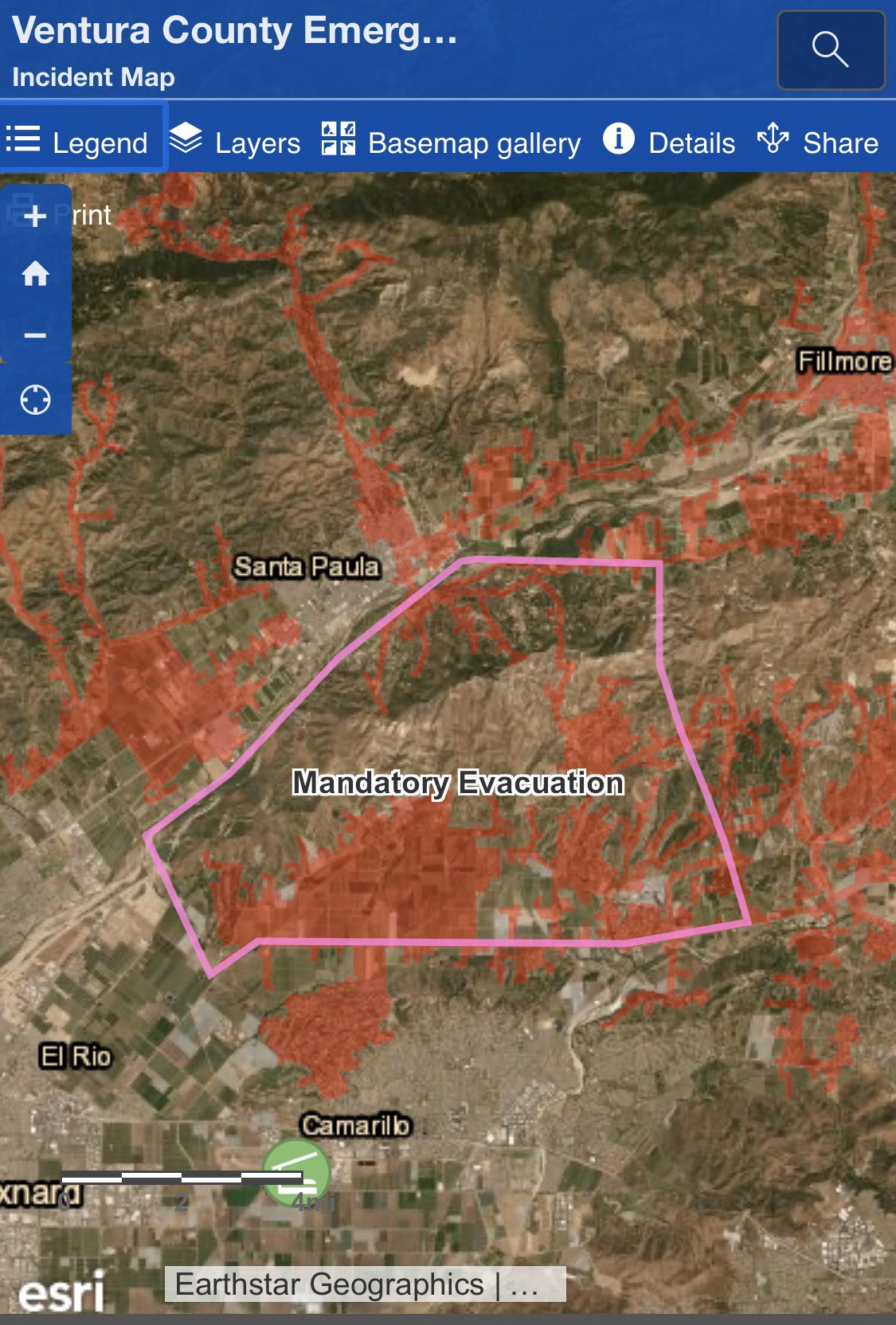
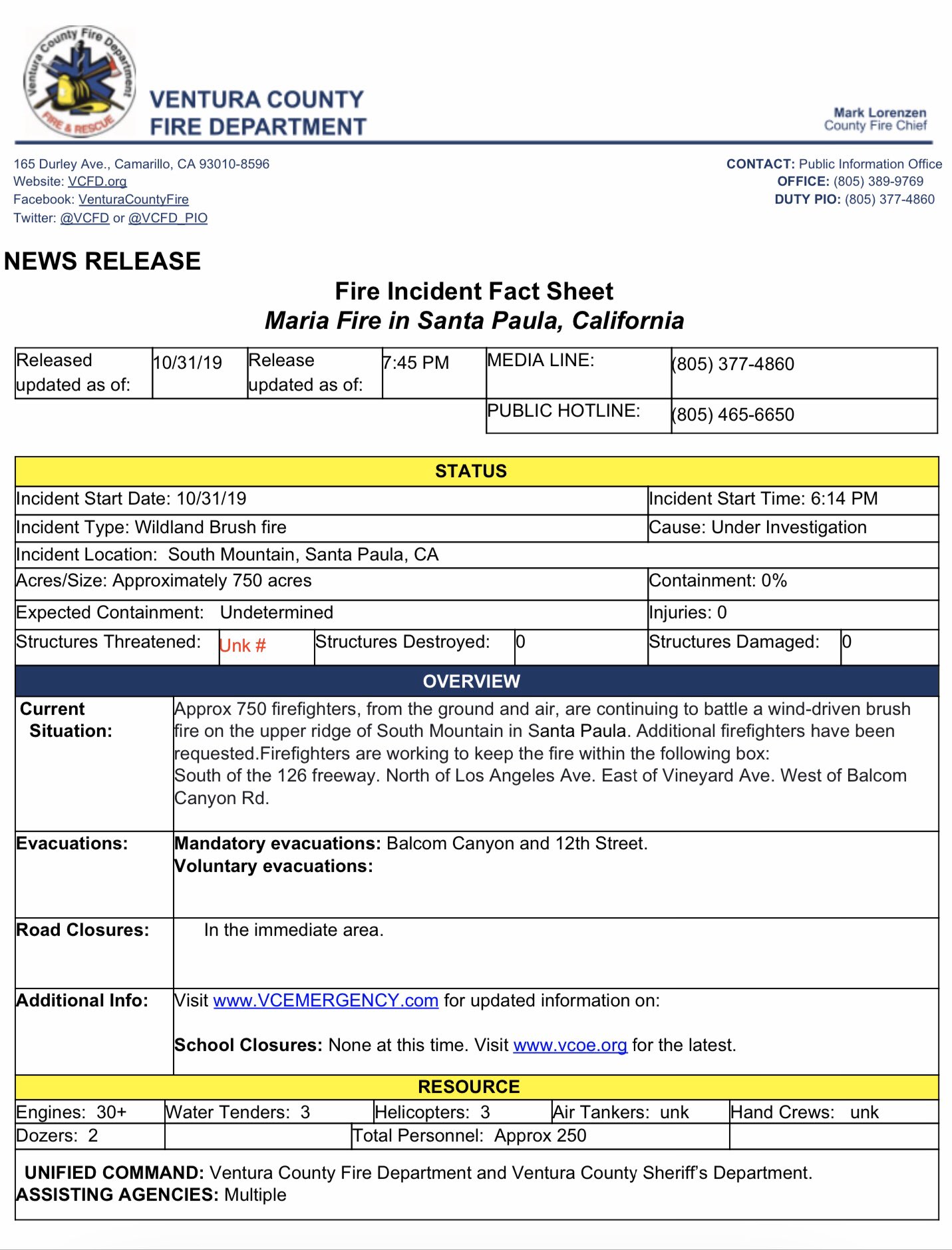
Per VCFD PIO:
Firefighters are working to keep the fire within the following box:
S of 126 fwy
N of LA Ave
E of Vineyard
W of Balcom
Update Per VCFD PIO:
Mandatory evacuations within box
2 Likes
Any word on the Patrol/Dozer Tenders and Dozers?
1 Like
ANF AA 51 (night air attack) & ANF H 531 (night flying helicopter) off of WJ Fox Field enroute.
2 Likes
Update 750 acres
1 Like
They drove through with fire on both sides of the road look like 25’ to 30’ flames and made it out, may need new paint. It was scary to watch.
5 Likes
LPF E44 E51 E53 E54 E 352 assigned
Also showing well Castro Hil cam.
9322C en route from Santa Barbara county
2 Likes
Per VCFD
Updated size is 750 acres and expanding. Fires will impact agricultural properties with houses on them. Structure protection groups established. Moderate winds from the east pushing the fire west
1 Like
Fox LA has started live video:
1 Like
Anyone know when the last time this area had fire - for a relatively mild wind event (comparatively) it is chewing up terrain awfully fast.
Scanner link?
Per VCFD PIO:
Updated size is just under 4000 acres still rapidly expanding. Firefighters are protecting homes as the fire progresses towards them. Slow rate of spread on Santa Paula side. Moving westward rapidly.
I’m listening to “Ventura County Fire, Los Padres NF, Lockwood Valley Sheriff” using the Scanner Radio app, you can listen to it by going to https://scannerradio.app/?l=OTUxMQ
1 Like