
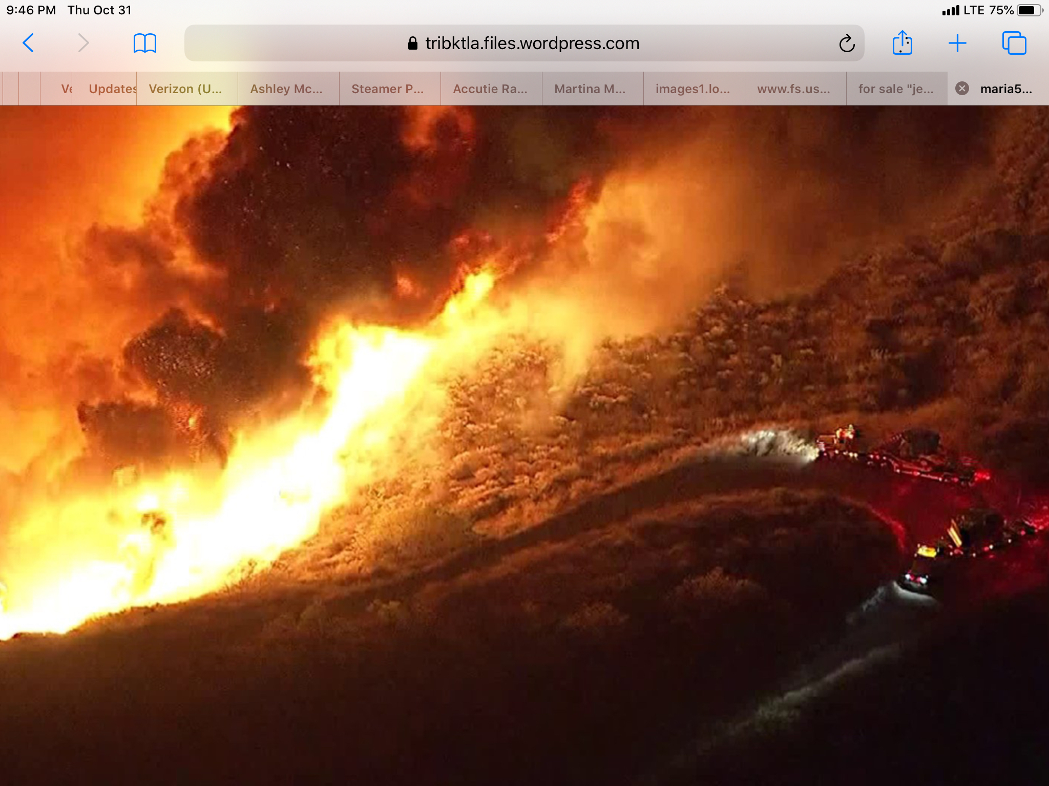
4,000+ acres
Watching Fox Live 11 and hearing the priorities from the Operations to AA. We have another mountain-top threatened with Comm sites being #1. I’ve advocated as an AA to these agencies that control sites of high value in these areas, we risk using costly aerial assets to defend/ protect. But in turn require everyone to maintain a defensible space. With these high values at risk, many should take their own advice.
Tight spot
If their releasing the copters, then the IC muct be feeling good about the fire. Seems like the fire wants to go west, but the winds wants to go east. Looks like the ROS has slowed down a lot and become a terrain drive fire despite the east wind.
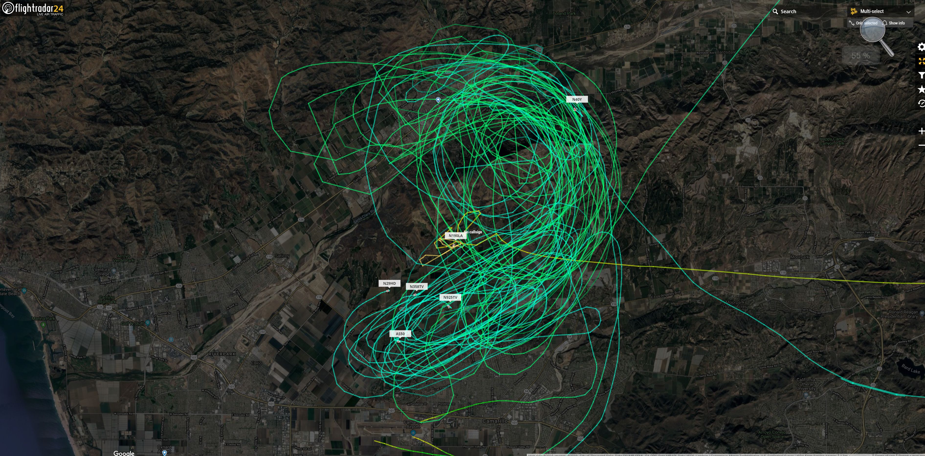
Reports of a drone on the fire. They are pulling aircraft off due to safety issues. They are waiting for the all clear to get back to work.
Shows how much i know!
News Conference the IC stated about 5k acres with a max 12k footprint. Feels its going to run out of fuel based on its direction
I have seen this mountain burn about 12 times in my time on this Earth. And nearly every time it will burn out of the fuel in the south, west and north. Tommorow when the wind shifts to the onshore it usually starts burning good to the east. I know that they have about 12 dozers working tonight to keep it from moving east tomorrow.
Cal Fire IMT activated.
Any pending STEN orders?
Any resource order for am ?
8,300 acres
LPF Los Padres & ANF Little Tujunga IHCs assigned
ANF S/T 1613C & Texas Canyon IHC Enroute
Not so sure about the IMT. Team 1 is up and they haven’t been activated for this yet…that came from a team member
Agreed. The only reason I could see Ventura requesting a Type 1 team is because they got their hands full with the Easy fire.
One minute into video is a final fire size prediction.