Yeah I tried to post this the other day but I couldn’t cause the “3” rule
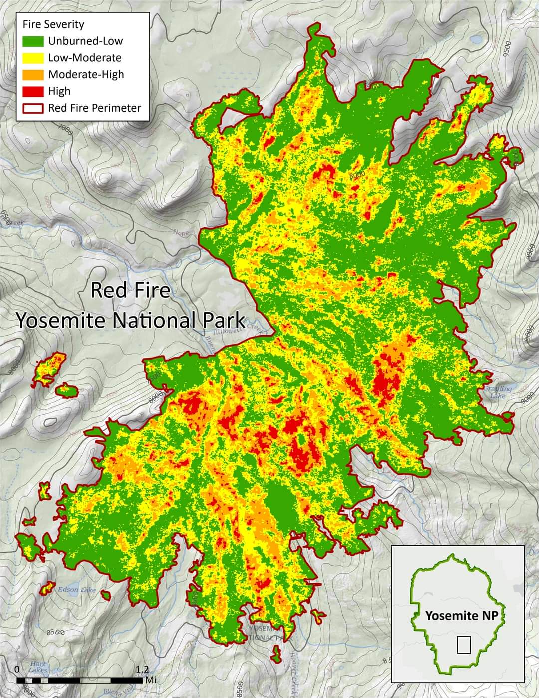
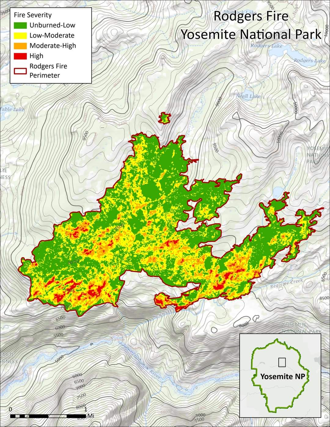
These satellite imagery maps from September 23 show the majority of the #Redfire (8,410 acres) and #Rodgersfire (2,825 acres) with low to moderate fire severity effects (green and yellow), with small patches of moderate-high (orange) to high-severity (red) effects. Fire severity refers to the ecosystem impacts of a fire such as tree mortality or loss in biodiversity.
Severity mapping from satellite imagery detects changes in vegetation cover from before to after a fire, low-severity means there has been little change in the vegetation cover, while high-severity means much of the vegetation cover in that area has been temporarily lost. The areas showing high-severity effects in these maps are dominated by shrubfields, which naturally burn at higher intensities when conditions are very dry. These extreme drought conditions are increasingly common in Yosemite and the surrounding Sierra Nevada mountains with climate change, and above average temperatures exacerbate dry conditions.
The patchwork of fire severities promotes heterogeneity, increasing multiple kinds of wildlife habitat and associated biodiversity, and reducing future risk of catastrophic wildfire.
We are fortunate to have a fire effects monitoring program and crew who study and conduct research to learn about ecological impacts in the forest. You can learn more here: Fire Ecology and Monitoring - Yosemite National Park (U.S. National Park Service)
#satelliteimagery #fireseverity #healthyforest