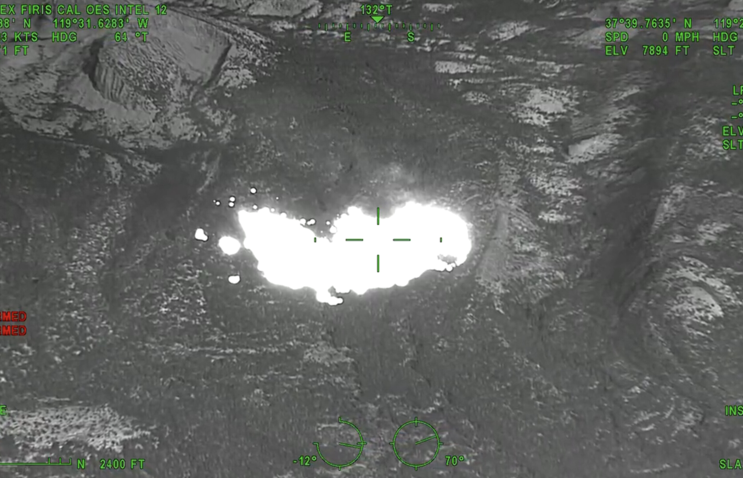
167 acres per SOPS. Active fire behavior, isolated torching and short range spotting.
6 Likes
Edit I stand corrected
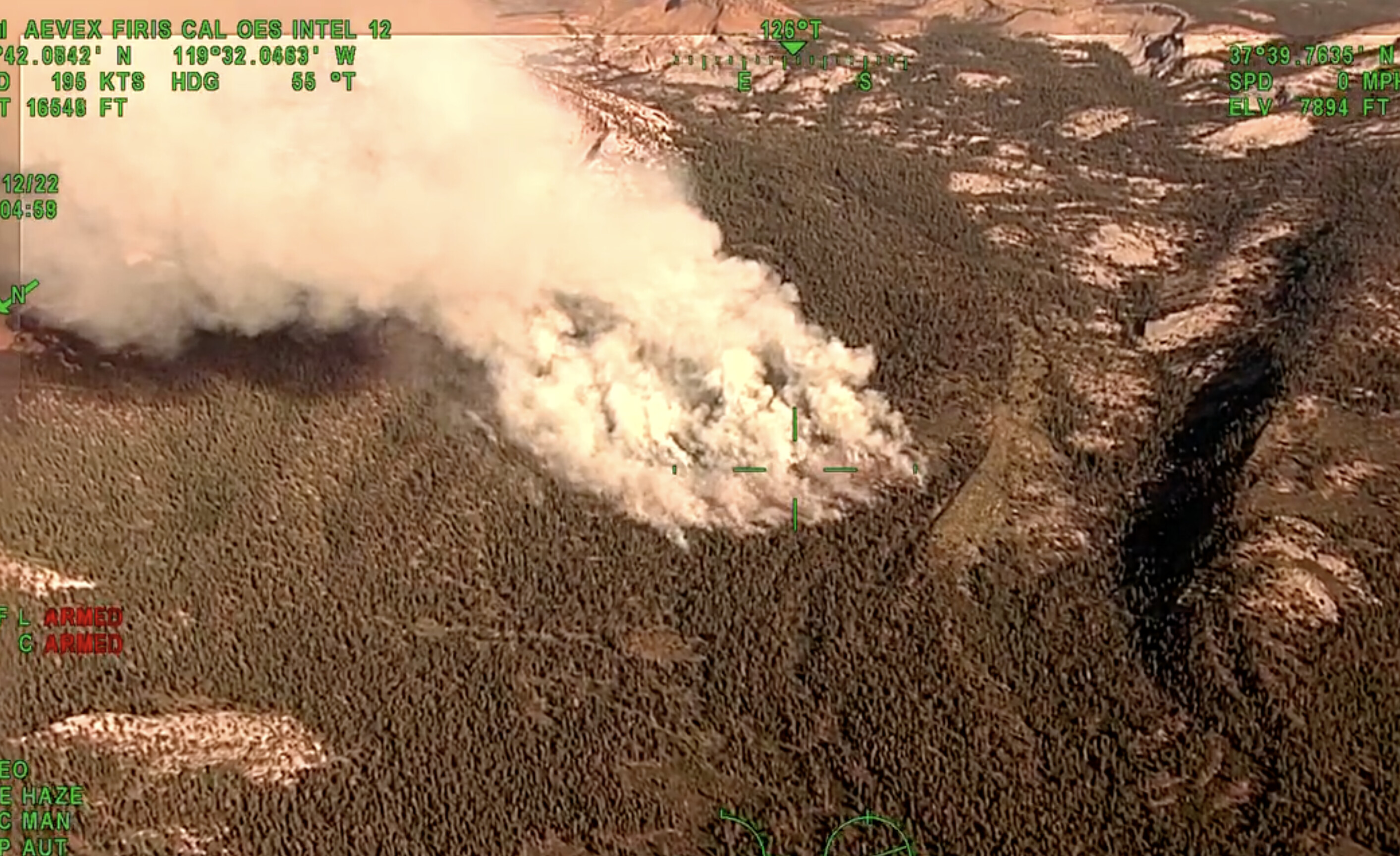
OES Intel 12, Aug 12th on the #RedFire, Yosemite National Park. Fire is mapped at 167 acres at 18:04 hours.
Interesting because Yosemite Fire and Aviation is estimating 50 acres and Scott Gediman put out 30 acres
Fire In Yosemite Fire In Yosemite | myMotherLode.com
2 Likes
3 Likes
I see that on the flight tracker now. I will correct my post, thanks.
1 Like
I thought that was the Dixie
3 Likes
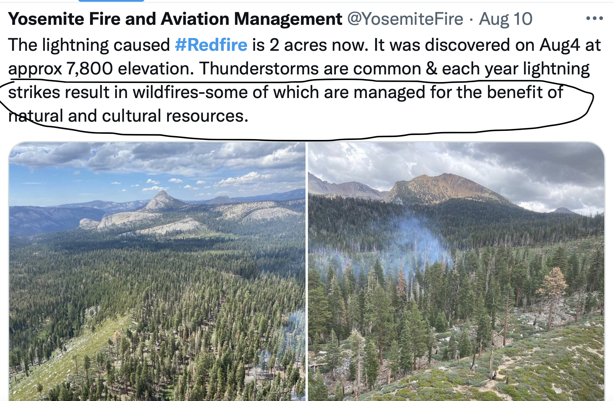
Peak tourist season for Yosemite and smoked out again: “Managed for the benefit of natural and cultural resources”
5 Likes
Seriously?
2 Likes
I thought it was the tamarack, or the Creek, or whatever fire some internet incident commander mentioned in a Facebook post.
6 Likes
Park Service has this map but it’s low on landmark details: (you can zoom in)
https://nps.maps.arcgis.com/apps/webappviewer/index.html?id=6e3a51b65876485ea1f63c377a57b7f3
Then Caltopo has this with landmarks and features:
https://caltopo.com/map.html#ll=37.66192,-119.45992&z=13&b=t&o=f16a%2Cr&n=1,0.25&a=mba%2Cfire%2Cmodis_mp
2 Likes
Tamarack. dixie was SRA they almost had dixie in IA but drone grounded aircraft early and a spot across caused everything else really. Creek was bad access and they had issues getting into it. Tamarack was monitored due to its location being in steep rock and it was deemed unsafe to put crews on the ground in the orgin.
12 Likes
#RedFire #YosemiteNationalPark. Map shows MODIS/VIIRS satellite heat detections. Map also has 20+ #GIS layers you can turn on/off/restack. For help see 2 links upper left corner. #Yosemite
Open #GISsurfer map: bit.ly/3dubDP2
1 Like
So much I’d like to say here but I don’t post my opinions 

6 Likes
I get the sense from many that they want the NPS to be punished for something, and I don’t understand why or what.
16 Likes
Smoke? In the Sierras in summer? Reality.
If tourists don’t want that go to Disneyland.
16 Likes
That’s interesting - this wasn’t on my radar. I was south of the area (in Sequoia NP) on August 4 and can confirm there was a fair amount of lightning during the day (I could hear the crackles on the radio) followed by a good overnight soaking. This was the same monsoon that wiped out Death Valley. I was unaware that system had started any fires.
I’ve hiked (cross-country) and camped within the area of this burn. It’s choked with brush and a maze of fallen trees on the ground, as you can see in some of the photos and video. Under normal conditions, this burn would be considered beneficial, at least so far, knock on wood.
It’s hemmed in by granite to the E and SE and there’s another couple walls slightly to the N. As long as it doesn’t jump Illilouette Creek, that would complete a manageable containment zone. Fingers crossed on this one. When Glacier Point Road reopens in 2024 it could make for some easier hiking.
12 Likes
4 Likes
#Redfire has grown to 167 acres and was active yesterday while burning through pockets of fuels from the 2001 Hoover fire (fuels being anything that can burn- leaves, twigs, grasses, trees). Fire behavior has diminished today as the fire moved into different fuel (red fir timber stand).
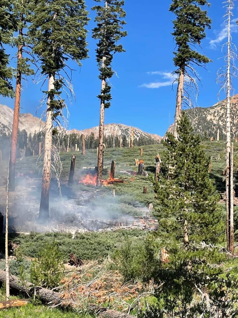
NPS photo showing flames from the lightning caused Red fire.
16 Likes
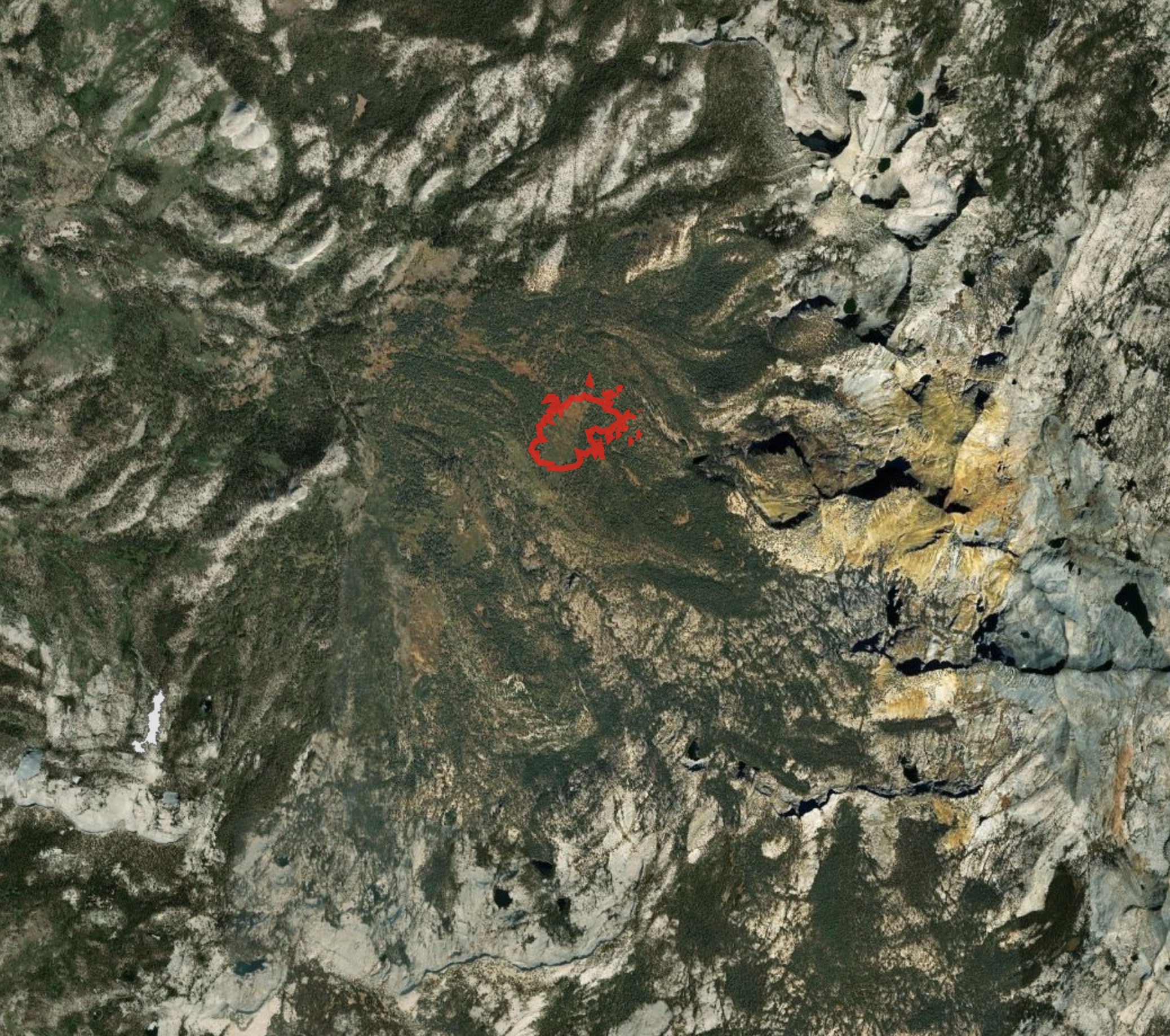
Thanks for your great work. That’s a really interesting shot. So that’s what I’ve been walking through. It took me a moment to figure it out. To the east of the fire, the darker spots that look like lakes are the shadows from the higher peaks. Water is fairly scarce in that area, even in a good year.
9 Likes