CA-YNP-Red & Rodgers & Sept Lightning???

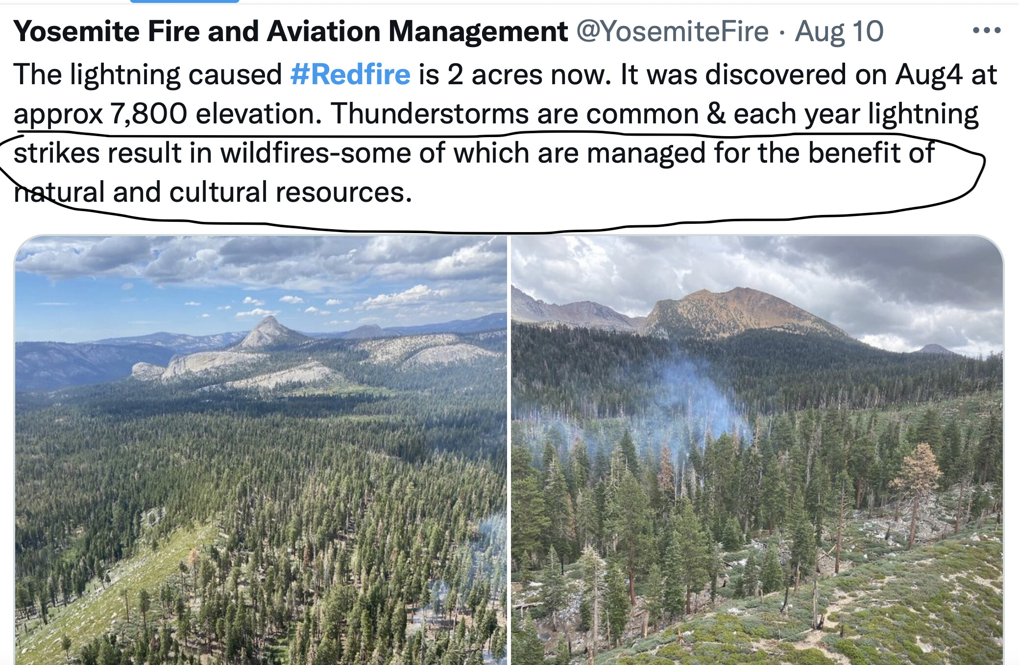
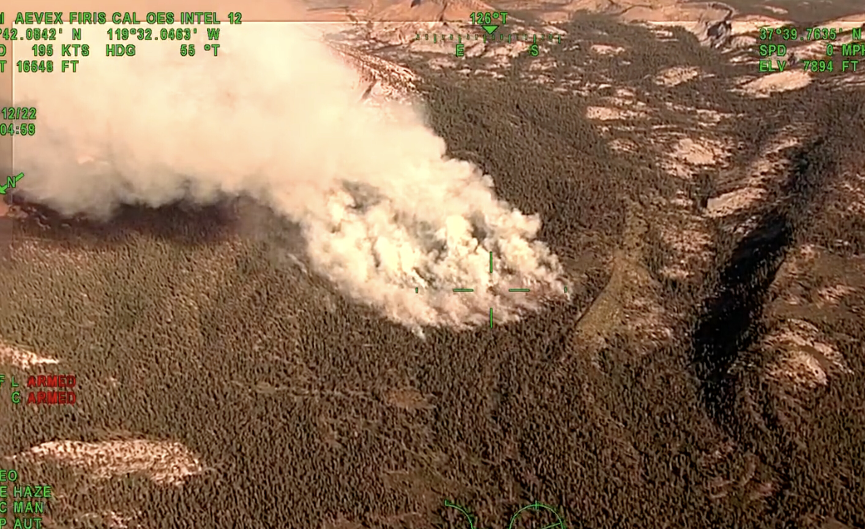
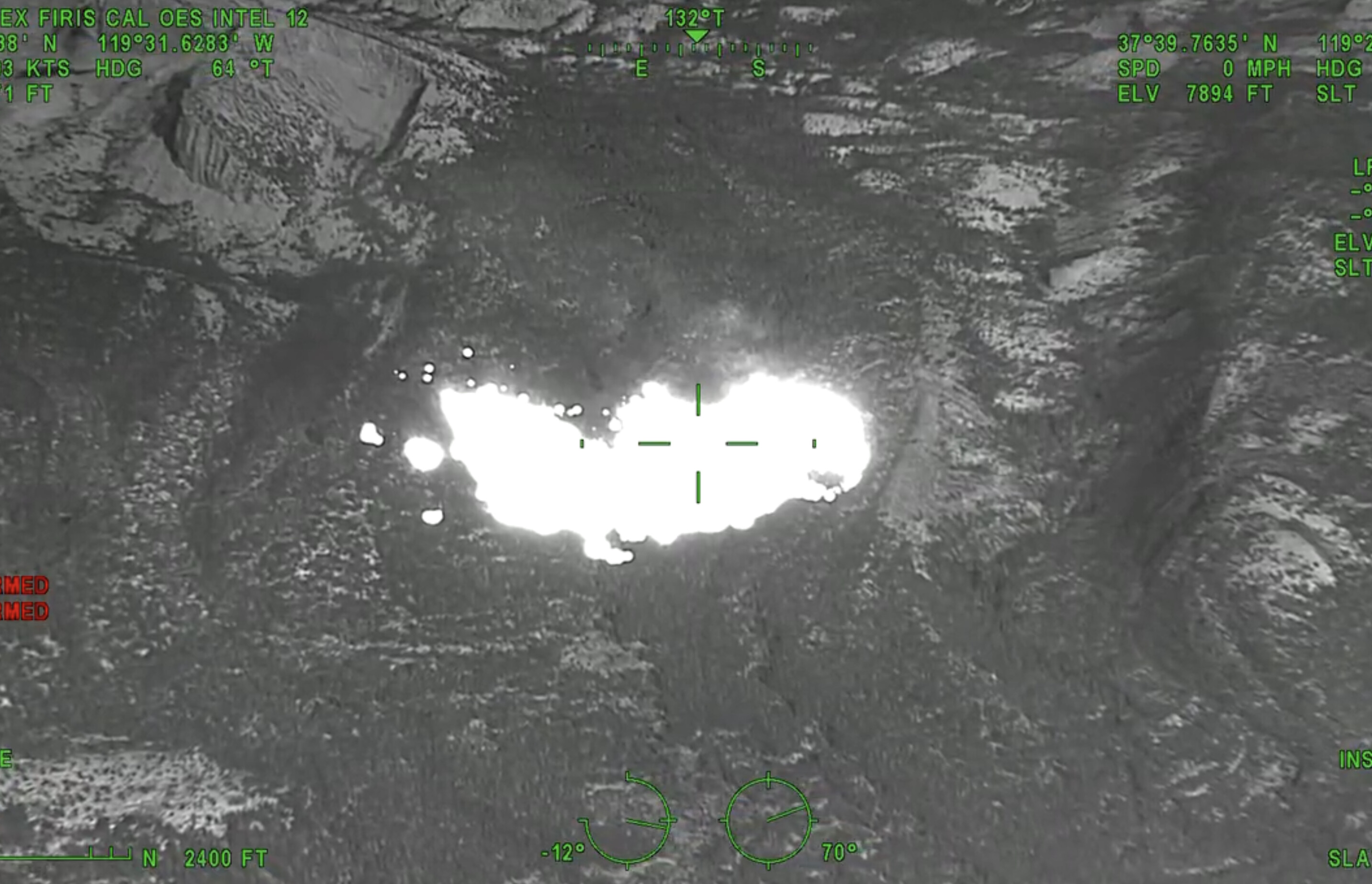
@Rfdadams, “monitor” is the status fire is in. Maybe watching by Cams like we are, maybe a flight now that it has made an appearance, but probably only on YNP channels and no resources to chat about it… Yet. Maybe it is deserving of one stick, we’ll see.

Years ago I would say “no way it’s surrounded by granite.” Now-a-days I keep those words to myself.

11 Likes

I should just make the Mt. Bullion cam my homepage with how many fires it’s on this summer.

13 Likes

A bit more information showing up. Yosemite Fire Mgmt. Twitter stating 50 acres and also has a time lapse video.

3 Likes

Also a brief local news story here:

1 Like

I’ve backpacked around reds peak and triple forks and it’s a very rugged area. Fly in

3 Likes

They were anticipating this last night because they had turned the meadow lakes camera towards shuteye and Madera peak. Its turned to shaver now because of a vehicle fire that’s out now.

H520 did recon the Madera fire two completely different strategies at work with in 10 miles of each other, Madera north of beasore road at the base of Madera peak in the creek fire scar in a spot that had a crown fire that just has bear clover coming up was full suppression fire while right over the hill a ways this one is monitored and will be doing some good work.

4 Likes

Interested to see how things go with the weather coming in the next few days.

5 Likes

167 acres per SOPS. Active fire behavior, isolated torching and short range spotting.

6 Likes

Edit I stand corrected

OES Intel 12, Aug 12th on the #RedFire, Yosemite National Park. Fire is mapped at 167 acres at 18:04 hours.

Interesting because Yosemite Fire and Aviation is estimating 50 acres and Scott Gediman put out 30 acres

Fire In Yosemite Fire In Yosemite | myMotherLode.com

2 Likes

3 Likes

I see that on the flight tracker now. I will correct my post, thanks.

1 Like

I thought that was the Dixie

3 Likes

Peak tourist season for Yosemite and smoked out again: “Managed for the benefit of natural and cultural resources”

5 Likes

Firis Cal OES 12 plane over the fire today:

6 Likes

Seriously?

2 Likes

I thought it was the tamarack, or the Creek, or whatever fire some internet incident commander mentioned in a Facebook post.:grin:

6 Likes

Park Service has this map but it’s low on landmark details: (you can zoom in)
https://nps.maps.arcgis.com/apps/webappviewer/index.html?id=6e3a51b65876485ea1f63c377a57b7f3

Then Caltopo has this with landmarks and features:
https://caltopo.com/map.html#ll=37.66192,-119.45992&z=13&b=t&o=f16a%2Cr&n=1,0.25&a=mba%2Cfire%2Cmodis_mp

2 Likes

Tamarack. dixie was SRA they almost had dixie in IA but drone grounded aircraft early and a spot across caused everything else really. Creek was bad access and they had issues getting into it. Tamarack was monitored due to its location being in steep rock and it was deemed unsafe to put crews on the ground in the orgin.

12 Likes

#RedFire #YosemiteNationalPark. Map shows MODIS/VIIRS satellite heat detections. Map also has 20+ #GIS layers you can turn on/off/restack. For help see 2 links upper left corner. #Yosemite

Open #GISsurfer map: bit.ly/3dubDP2

1 Like

So much I’d like to say here but I don’t post my opinions :unamused::sweat_smile:

6 Likes