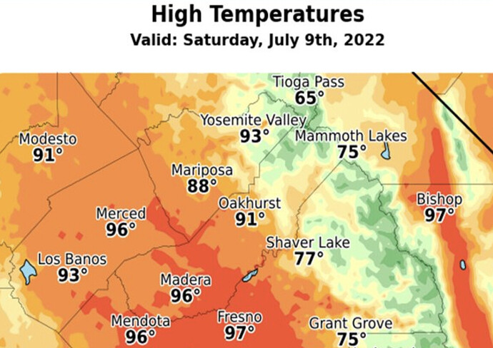
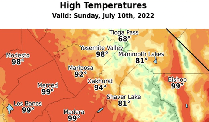
NWS Hanford: Sat 5:30 am
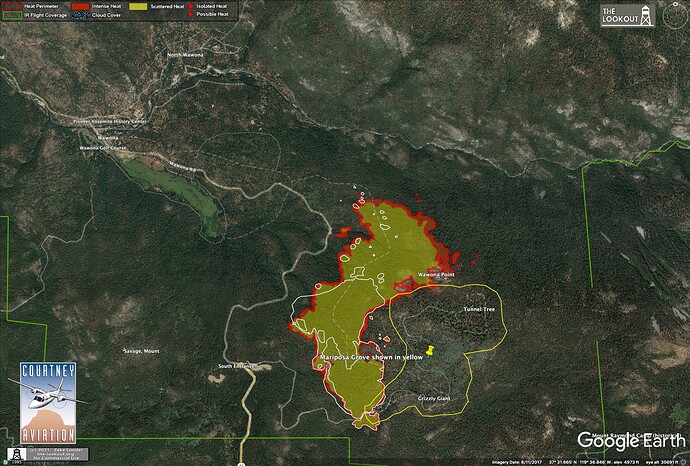
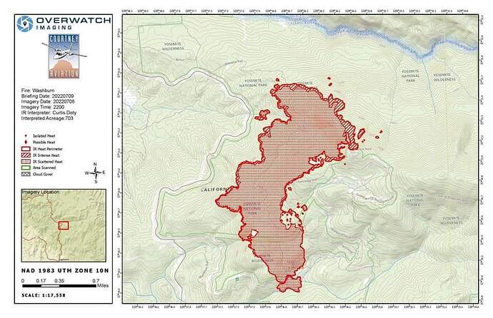
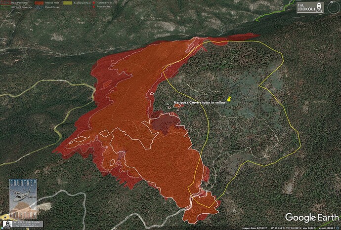
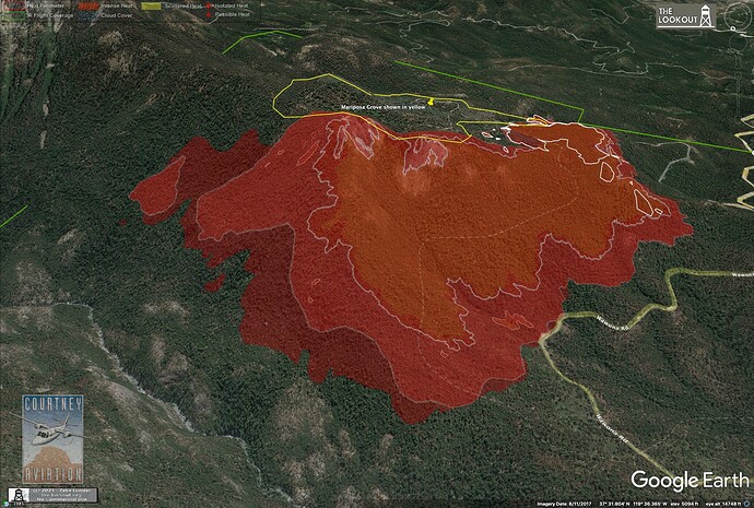
IR map from 10pm, 7/8/2022.
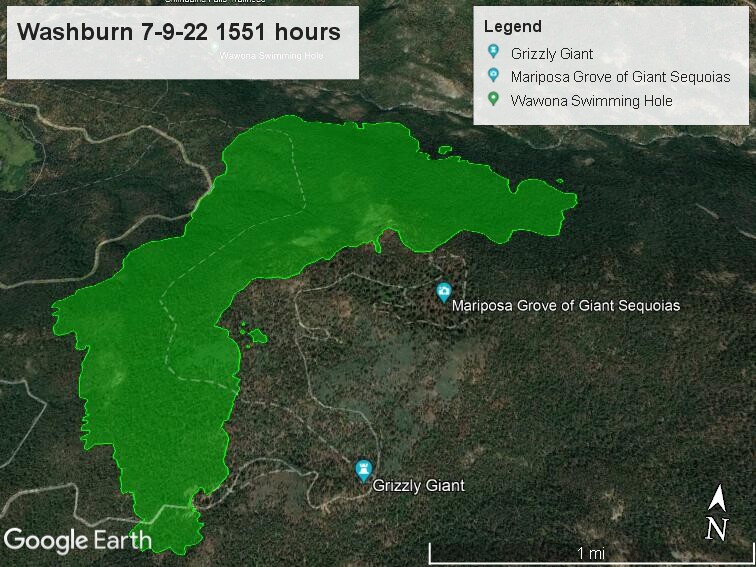
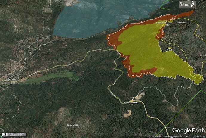
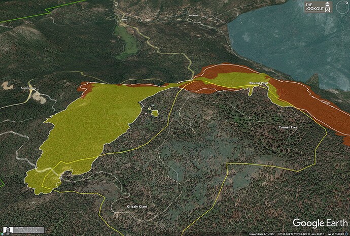
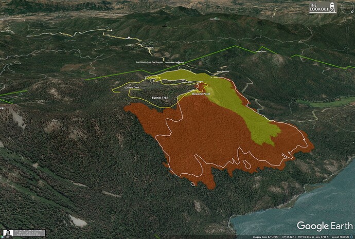
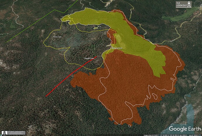
So far it hadn’t pushed too far into the Mariposa Grove, shown in yellow.
Nice progression maps above.
AA52 off Fresno enroute.
Sounds Like IC wants him to scout the North end of park/fire?? Found out that copter 551 being used in the north park.
EDIT UPDATE @08:50 : bringing in several copters to support left flank crews whom are engaging directly along the hwy 41 left flank. Might be some hose lays going in. If it gets hot the tankers will be used to help hold it.
EDIT UPDATE @10:00 : Helco is running the copter show which remains along holding the hwy 41 side of the fire. Merced river draining is a watch and wait to see if it spots across then they may run a line with tankers midslope. The grove has crews and dozers trying to control that spread.
Fire is on the server
intel24 overhead. hopefully have a new map soon. fire starting to really cap out at 15:23
I would say it’s real close now
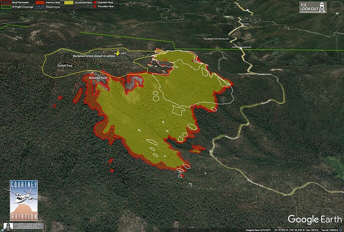
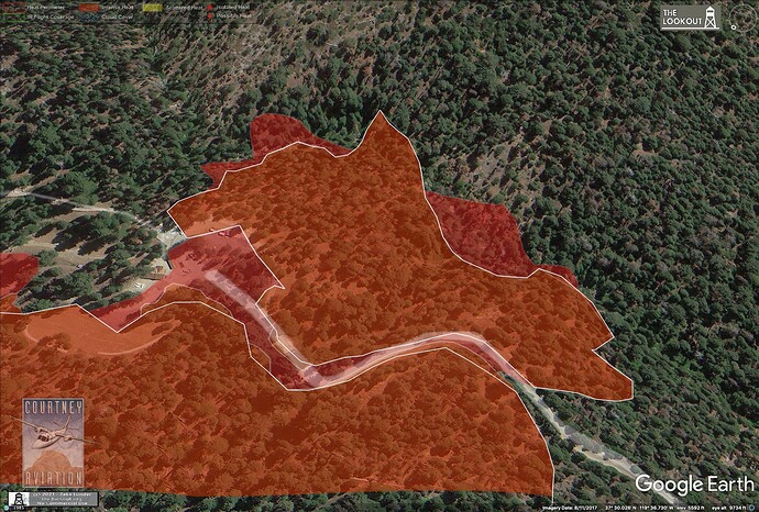
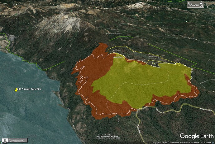
3:45pm, 7/9/22. Fire has not pushed much into the Mariposa Grove, has been steadily backing downhill into S. Fk. Merced Canyon. Minimal spread to west/Hwy 41 since noon today. No new growth on heel or most of SE flank, looks like strong work from the handcrews working on that part of the fire.
Lead plane and AA52 enroute to discuss with ground crews the use of several LATS to try to cool the fire coming out towards the Mariposa Grove. Crews are requesting protection. Copters can not keep it cooled down.
Lead 42 agrees on the plan… run retardant from Wawona Point Radio site along ridge eastward between the fire and Mariposa Grove. Road along that area and drops should support the control line.
4 LATS, 2 VLATS order placed @17:23.
EDIT UPDATE: 19:00 the air show was shut down due to poor visibility and intense fire activity. It was not completed to the furthest east side. Hope to continue that Sunday.
Line construction and holding work along hwy 41 and down in the Merced Drainage are progressing well. Unable to asses the north north-east head.
Copter show with ground crews until cut off.
Bring the mud…
Saturday night (10pm) mapping of #WashburnFire shows despite very heavy helicopter drops yesterday, generally along the white line (fire edge 7/9 3:45pm), fire continued to back steadily toward S. Fk. Merced River and Hwy 41. Very minor spread into Mariposa Grove (yellow line).
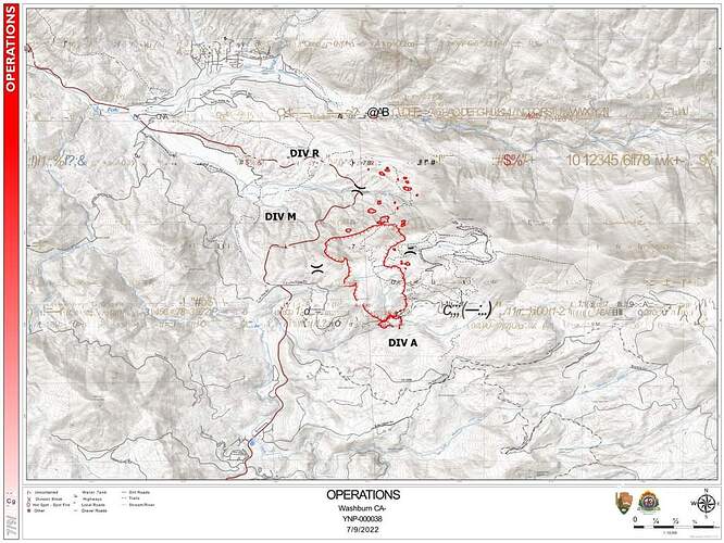
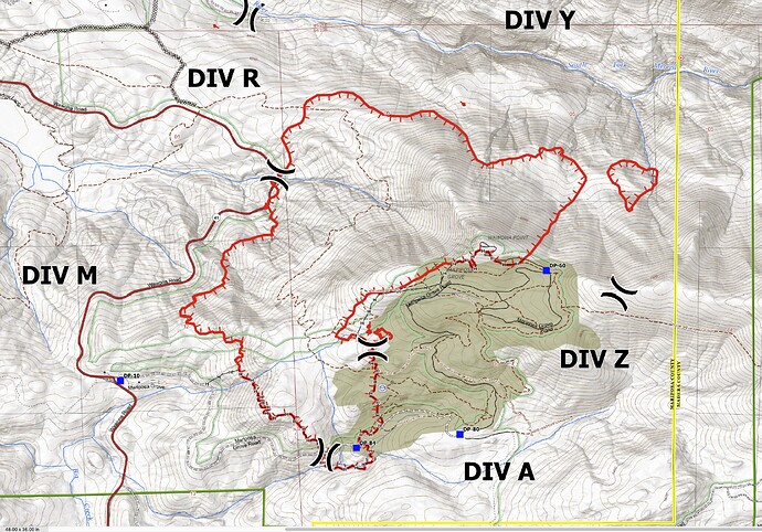
Yesterday’s airtanker show focused mainly on ridge E of DP-60, betw Mariposa Grove and Merced River Canyon. (Thanks@stacey_hb_for mapping this!). Fire pushed toward this line in evening. Ops map shows a lot of completed hand-line around Grove.
Inciweb is reporting 1591 acres this mornin. FIRIS is over the fire now
FireWatch51 is flying the fire and reports 1,821. Movement in Div.R and M and Y is the greatest.
Will return at 15:00.
Fire is laying down this morning.
AA52 off Fresno enroute. Don’t think there’s much to see with the smoke held to the ground.
EDIT UPDATE @ 09:30, AA52 departed and HelCo came up and patrolled and could not find targets due to smoke. No air ops this morning.
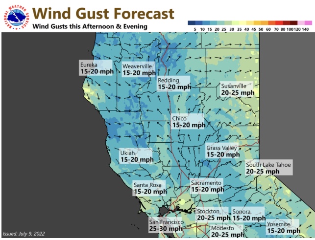
Increasing mid level moisture through Wednesday increases the chances of plume dominated Pyrocu fire behavior. In fact, dry low levels and sufficient moisture could produce a thunderstorm over the fire that produces lightning Monday/Tuesday.
All,
Please refrain from posting non incident questions or information that does not pertain to the current fire. If you need something specific from another member, send them a direct message. This helps the cause by members not having to scroll through the forum to seek out information that’s related to the fire.
Thank you,
MOD-FJ

