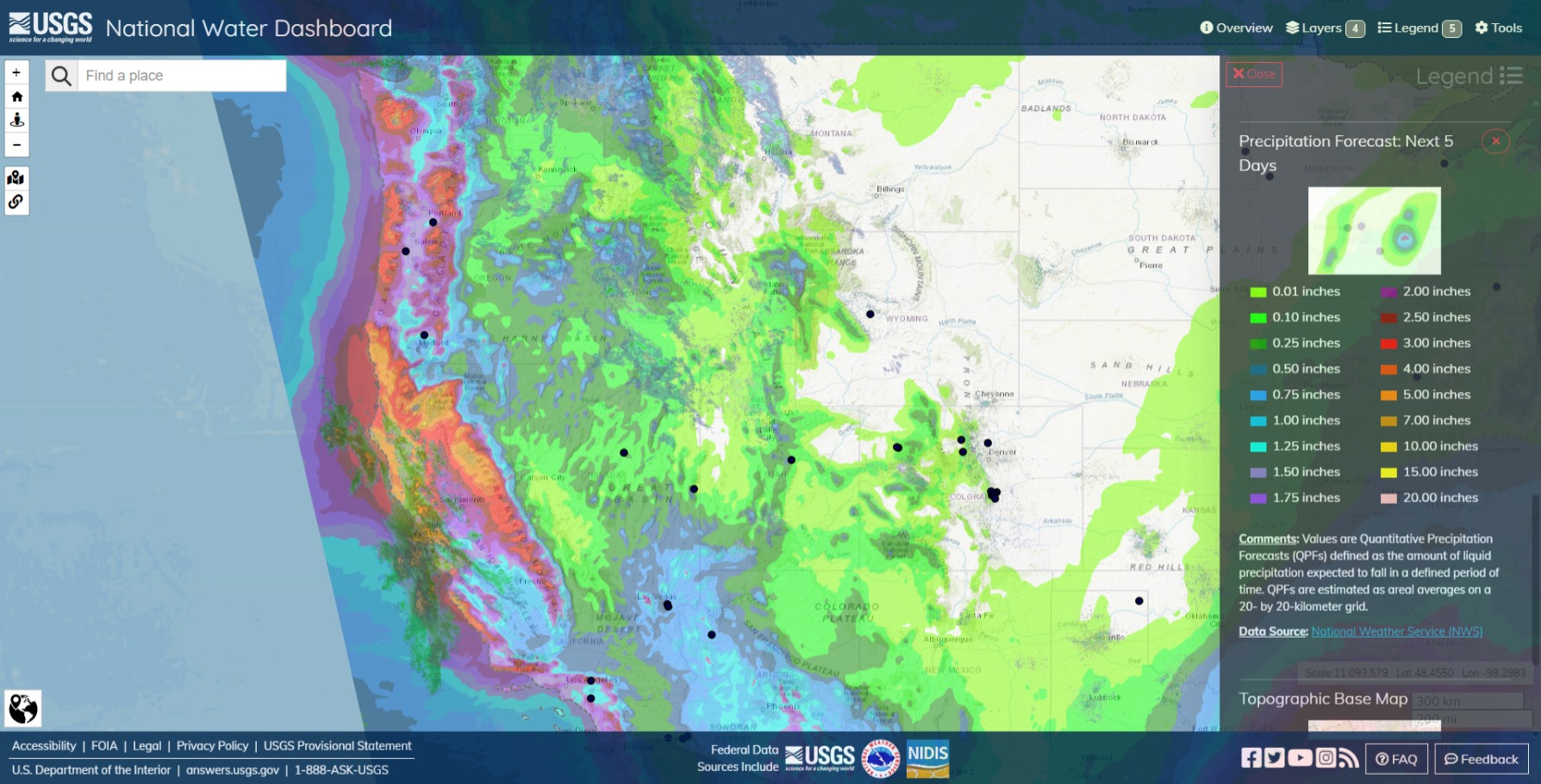
USGS Water Dashboard forecast precipitation totals for the week of 12/15 to 12/21.
5"-7" in the, more or less, usual locations. Mattole River Valley in Humbolt. Shasta Lake. Upper elevations of the Feather River. Fast drainages in the Walker River area. Russian River valley and outflow. Santa Rosa and Petaluma. San Lorenzo River and Santa Cruz (& Soquel Creek). Big Sur (Highway 1 is still closed in places from last winter). Still early in the winter to start picking the hot spots. I imagine we’re in much better shape than we were last year, this time.

Ventusky HRRR forecast winds for Monday Night 12/18.
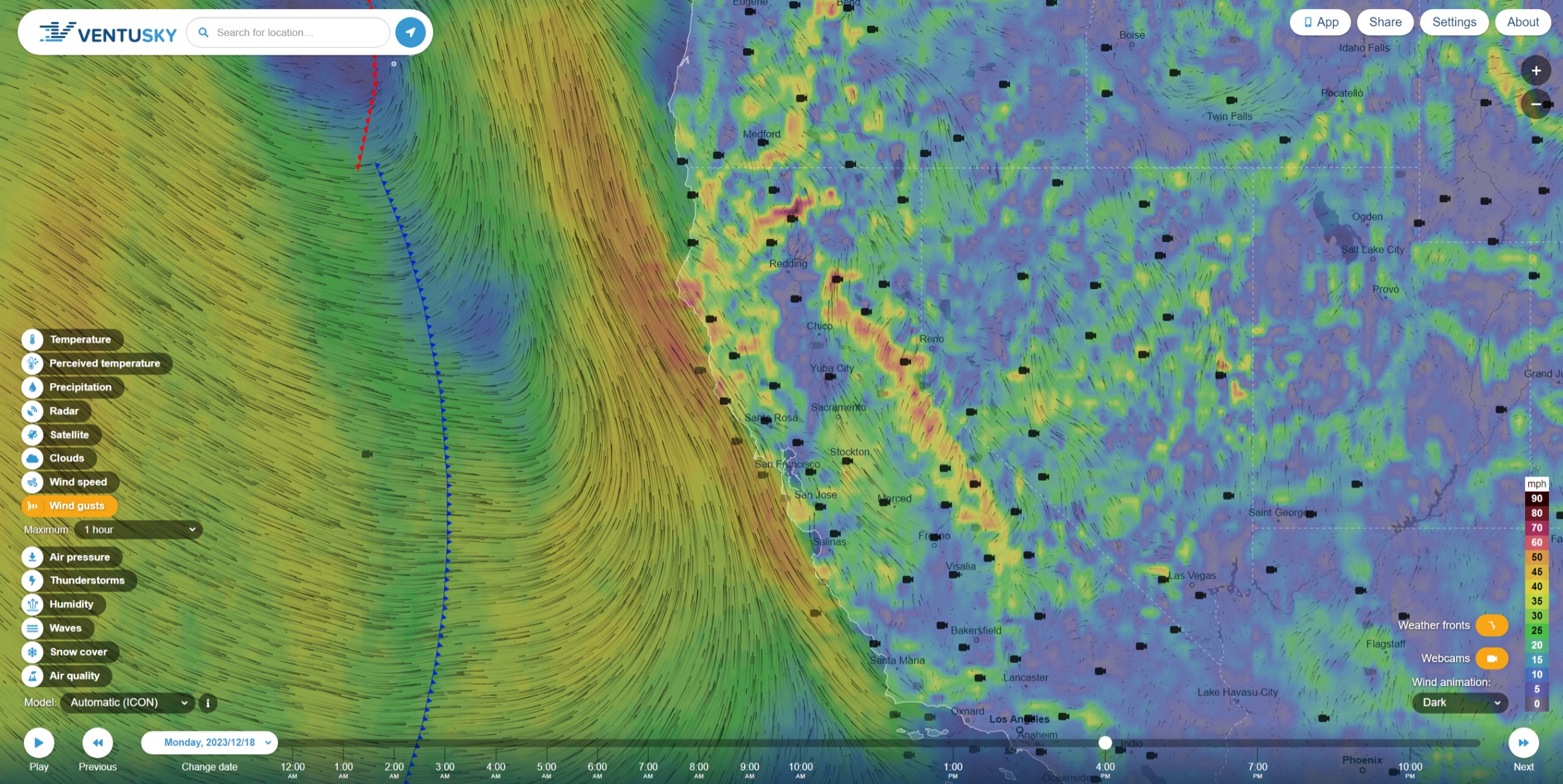
Gale force winds on the north coast. Over 85+mph(!) at Mount Shasta. 60+ at elevation in the north and central Sierra.
Ventusky ICON forecast winds and precipitation Thursday 12/21.

Rolls into SoCal Thursday morning with 1.5+" rain and winds to 65+mph in Ventura.
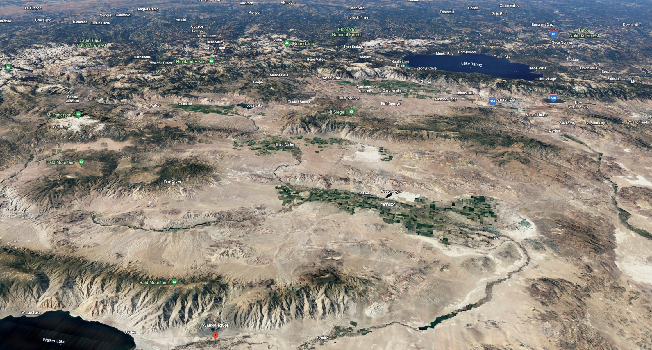
Walker River, NV. Facing West. I dunno if this image really captures it, but the Walker River complex is sort of an outlier. Between Lake Tahoe, Topaz Lake and Walker Lake there isn’t very much there to impound or restrain the rainfall falling on the center-eastern slopes of Stanislaus NF to Sonora Junction, Round Top, Lake Tahoe, Tahoe NF; downslope water plows its way down the main courses on the left, the center and the right, in this semicircular topographic ‘bowl’, down to Walker Lake. The drainage tends to be pretty fast, compared to the western slopes on the top edge of the image.
Fun Fact: Before all the water going to Walker Lake was siphoned off for other purposes. It held huge Cutthroat trout like Pyramid lake does. Trophy Cutthroat, but now the salinity is to high no more cutthroat.
Do your own localized assessments and be suspect of terrain features that encourage drifting, such as the leeward sides of ridgelines, alpine couloirs, gully features, and cross-loaded depressions. It is critical to remember that the distribution of wind slabs overlaps with our persistent slab problem. This means that even a relatively small avalanche breaking in the upper snowpack has the potential to step down into older snow, creating a much larger and more destructive avalanche.
…
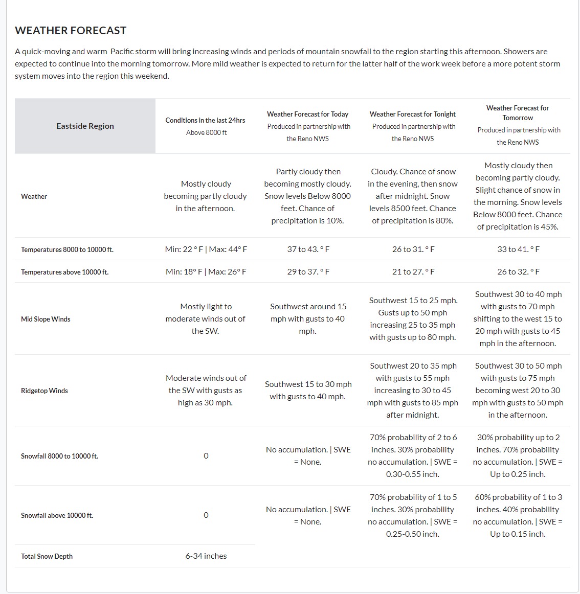
A quick-moving and warm Pacific storm will bring increasing winds and periods of mountain snowfall to the region starting this afternoon. Showers are expected to continue into the morning tomorrow. More mild weather is expected to return for the latter half of the work week before a more potent storm system moves into the region this weekend.
Eastern Sierra Avalanche Center » Avalanche Forecasts (esavalanche.org)