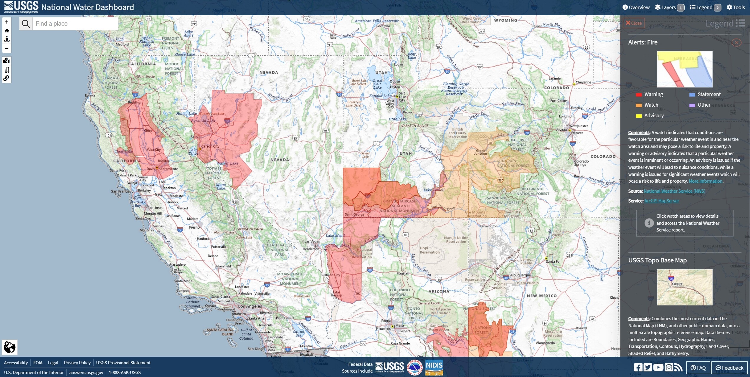
Odd there is no Red Flag for Santa Barbara area…it sounds like the Sundowners could be critical.
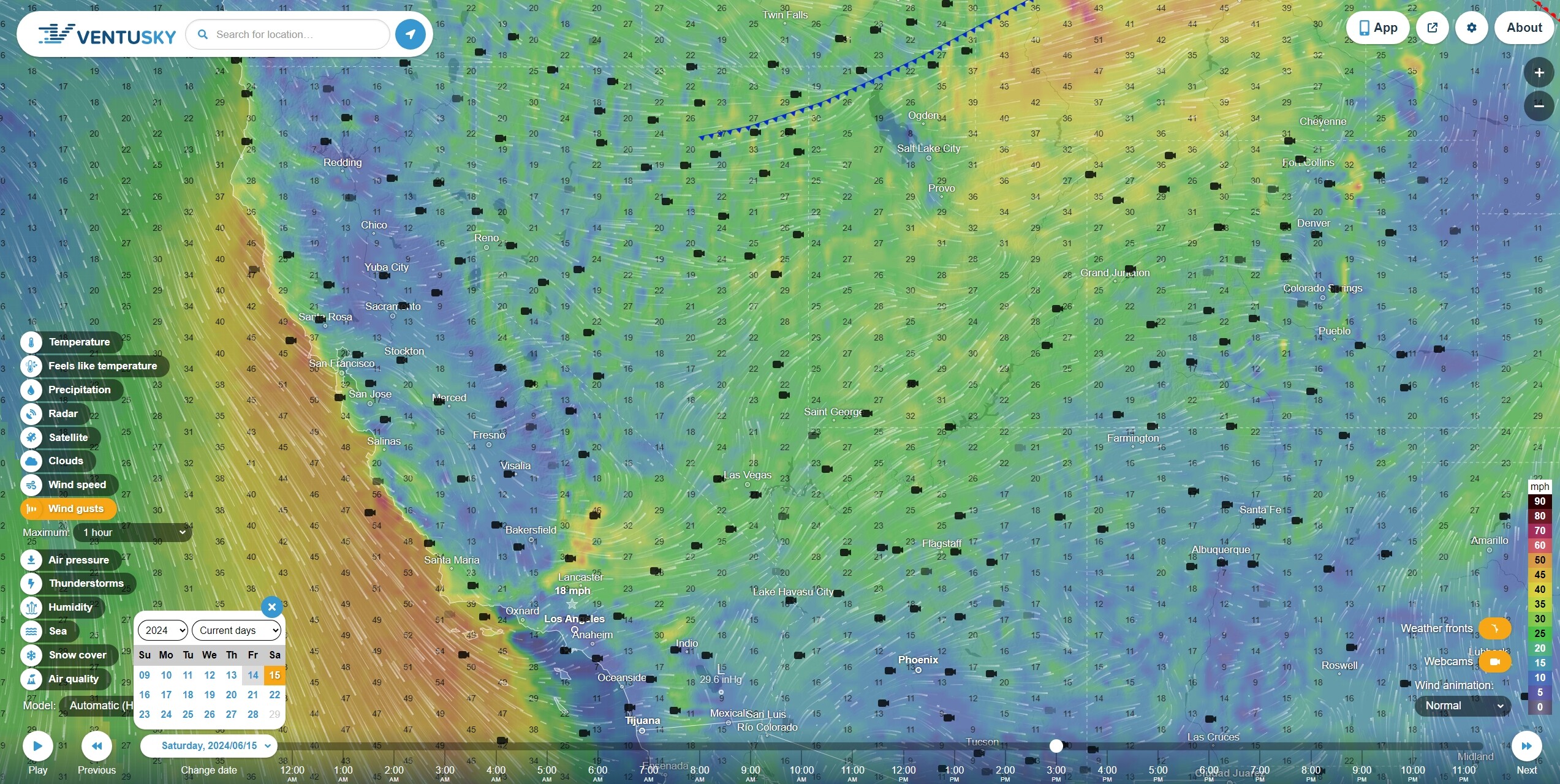
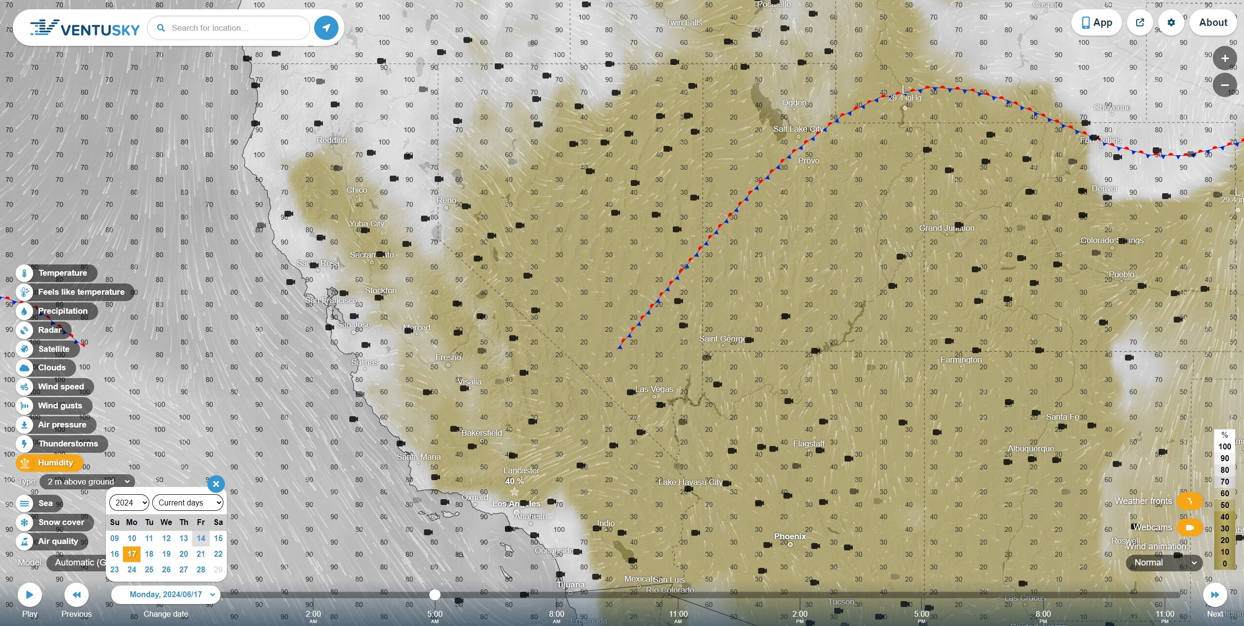
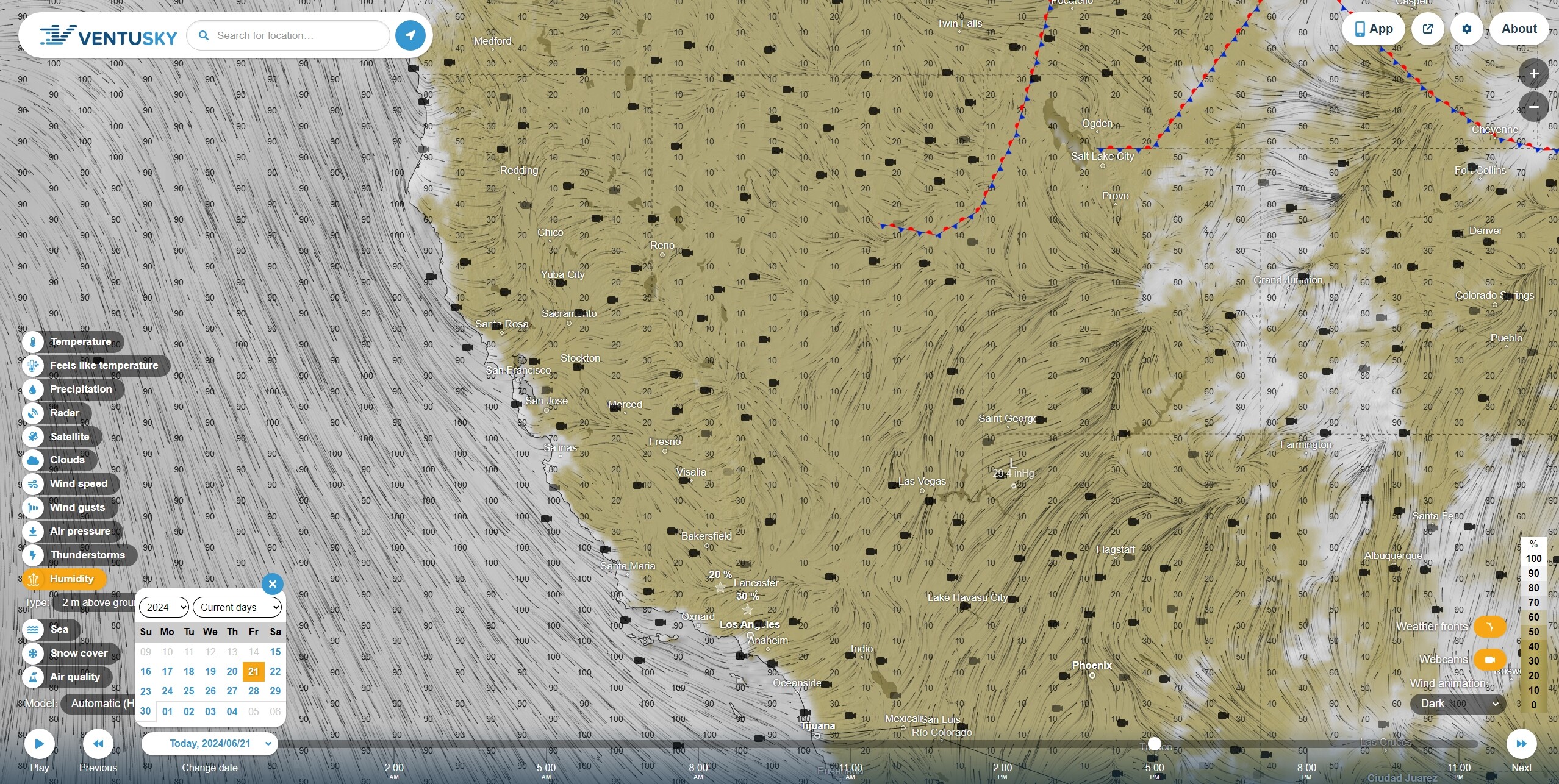
Saturday 2PM Humidity
Humidity to 20%. Ventusky uses 10% ruler marks and I think the criteria is 15%.
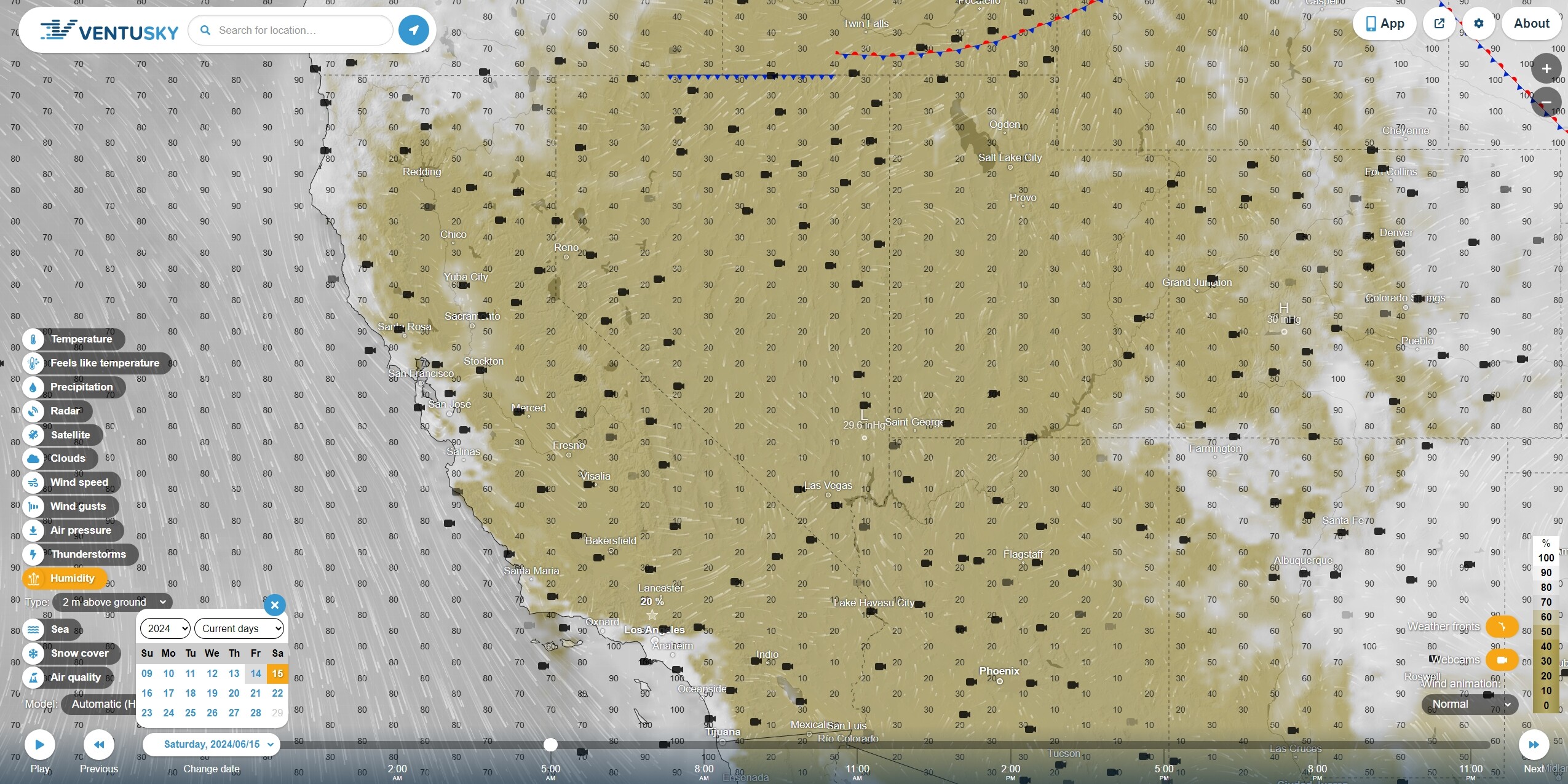
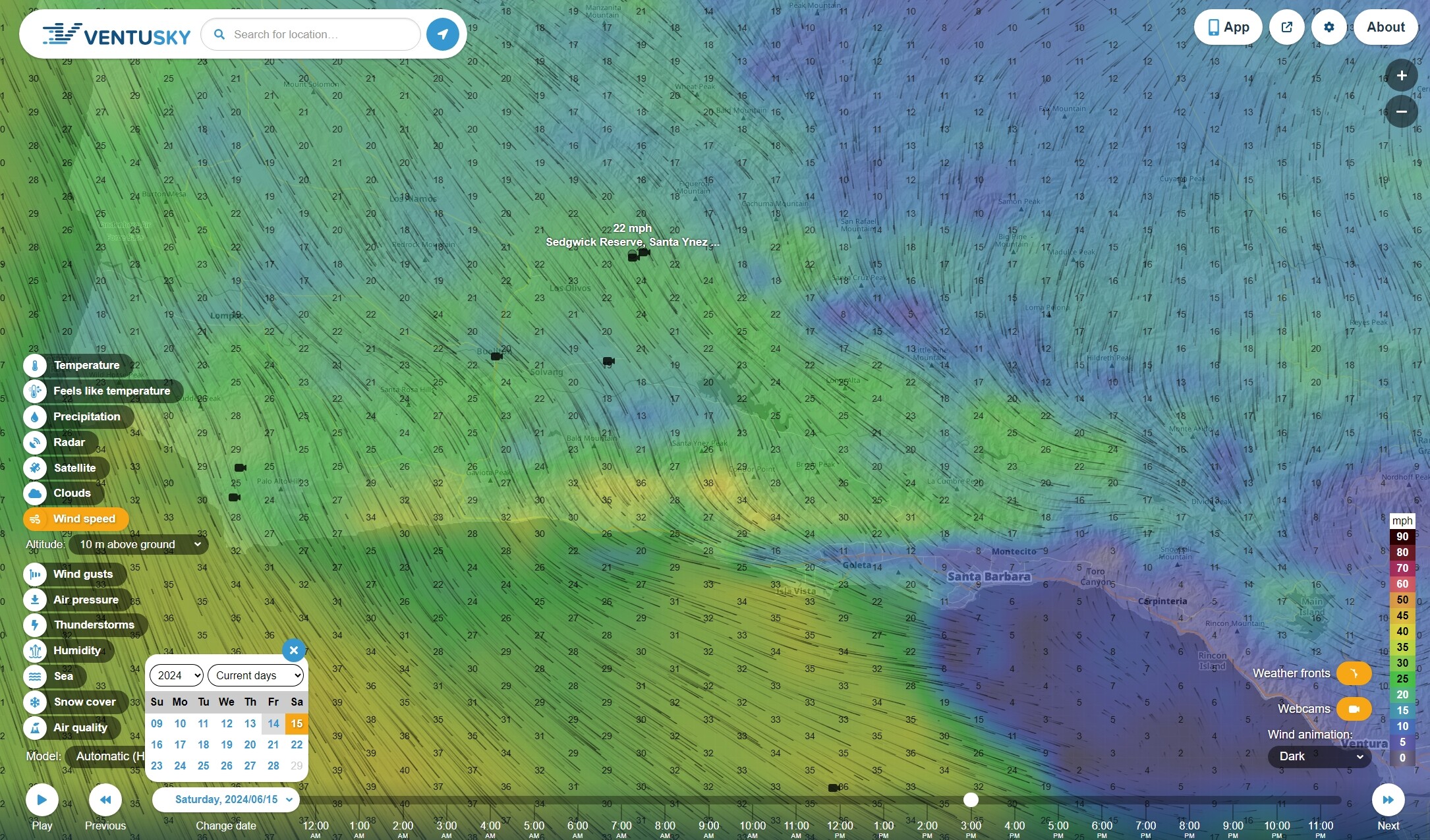
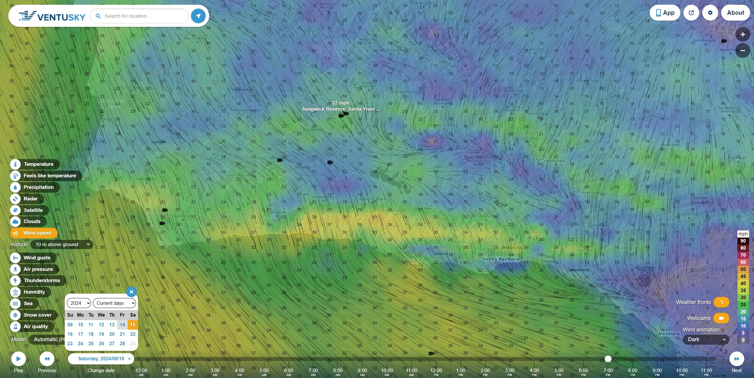
Saturday 3PM and 7PM Wind Speeds and they will sustain, more or less, through at least 1 three-hour interval.
Not sure about the fuels. The grass is certainly ready to go, and I’m sure a power line down in a drainage full of scrub will light it up. Edge case?
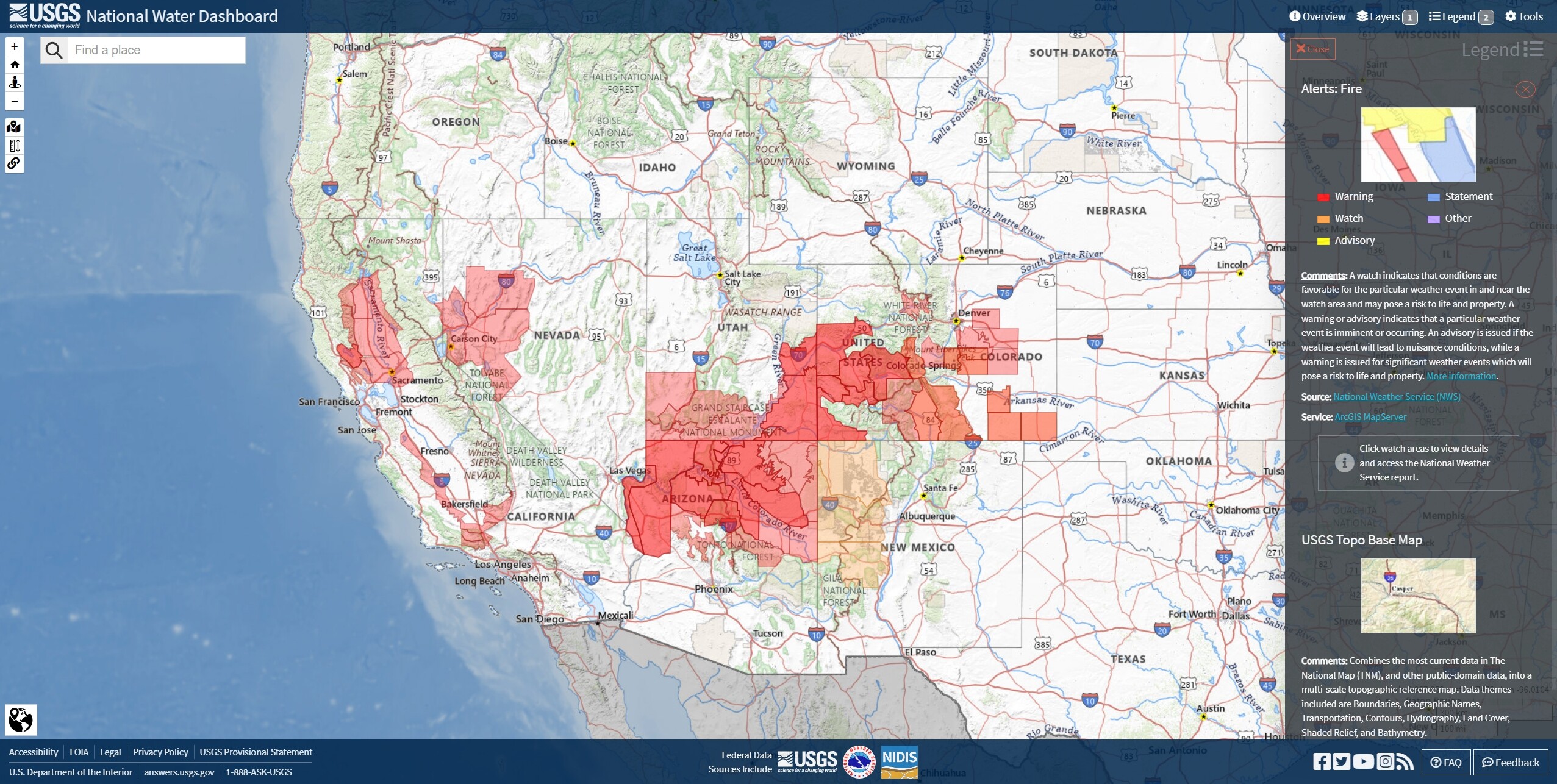
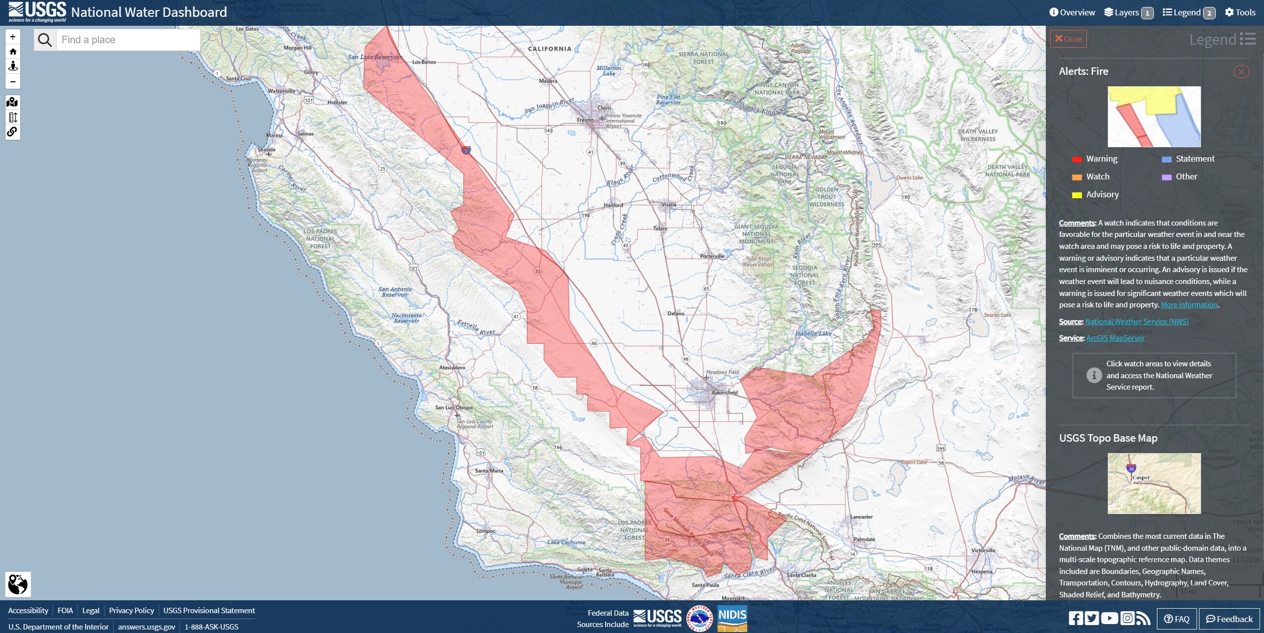
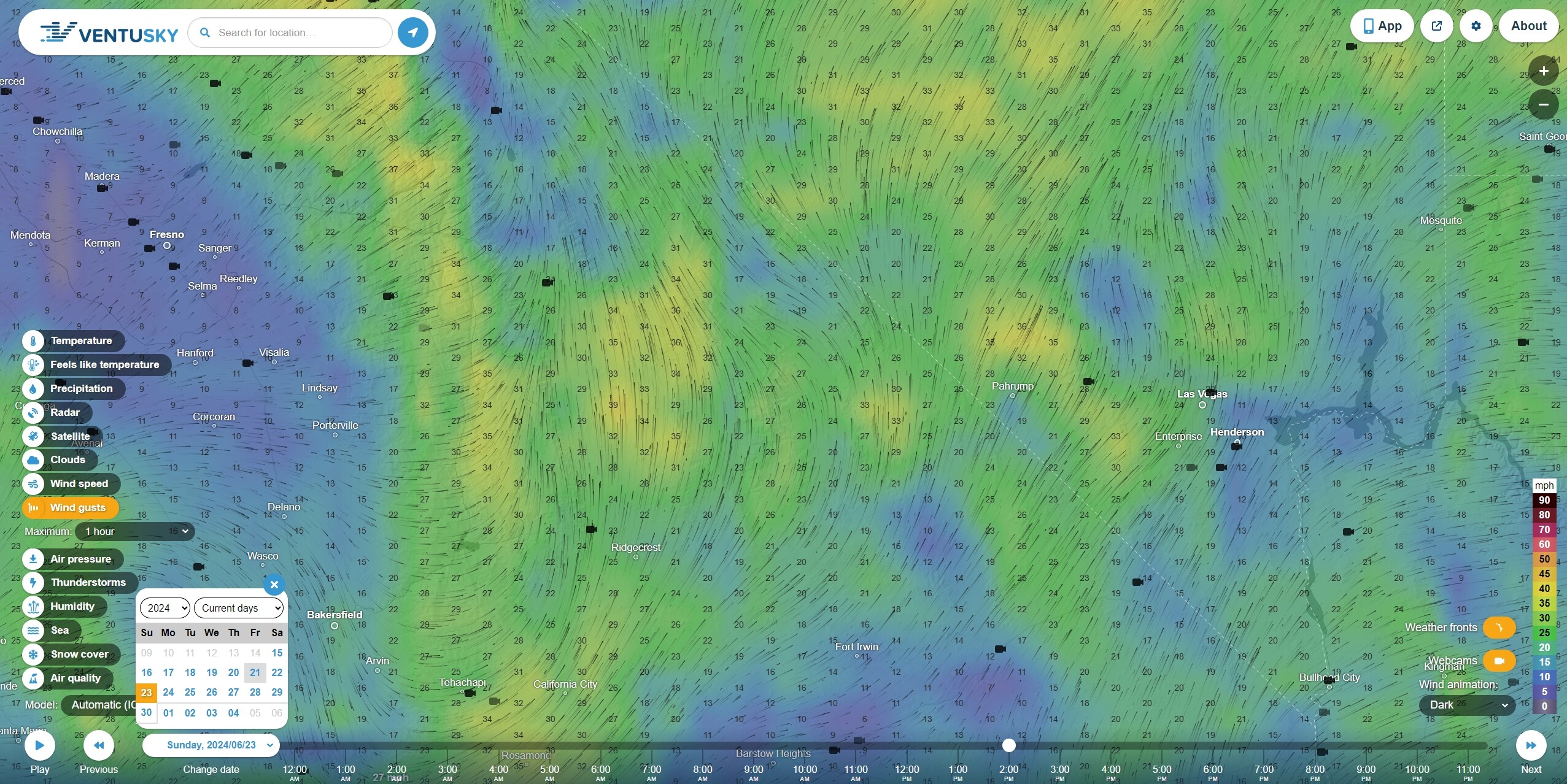
Update: Highway 5 central valley to LA, San Gabriels, Tehachapis, Pacific Crest Trail to Sequoia National Forest, Highways 58 and 14.
Riverine Attack?
Firefighters were focused on the fire’s southern edge near Pyramid Lake, a popular boating destination that has been closed as a precaution since Sunday.
Officials said firefighters were being ferried across the water and where then climbing into steep terrain to prevent flames from reaching the lake’s northern side.
One commercial property has been destroyed, and one injury has been reported.
Best firing op I ever did was from a boat with a pistol.
There was a wild video on social media of Fish and Game running a terra torch from a swamp fan boat south of the American River. Probably looks like more fun than it is. Maybe.
Can you please post a link?
What are you looking for?
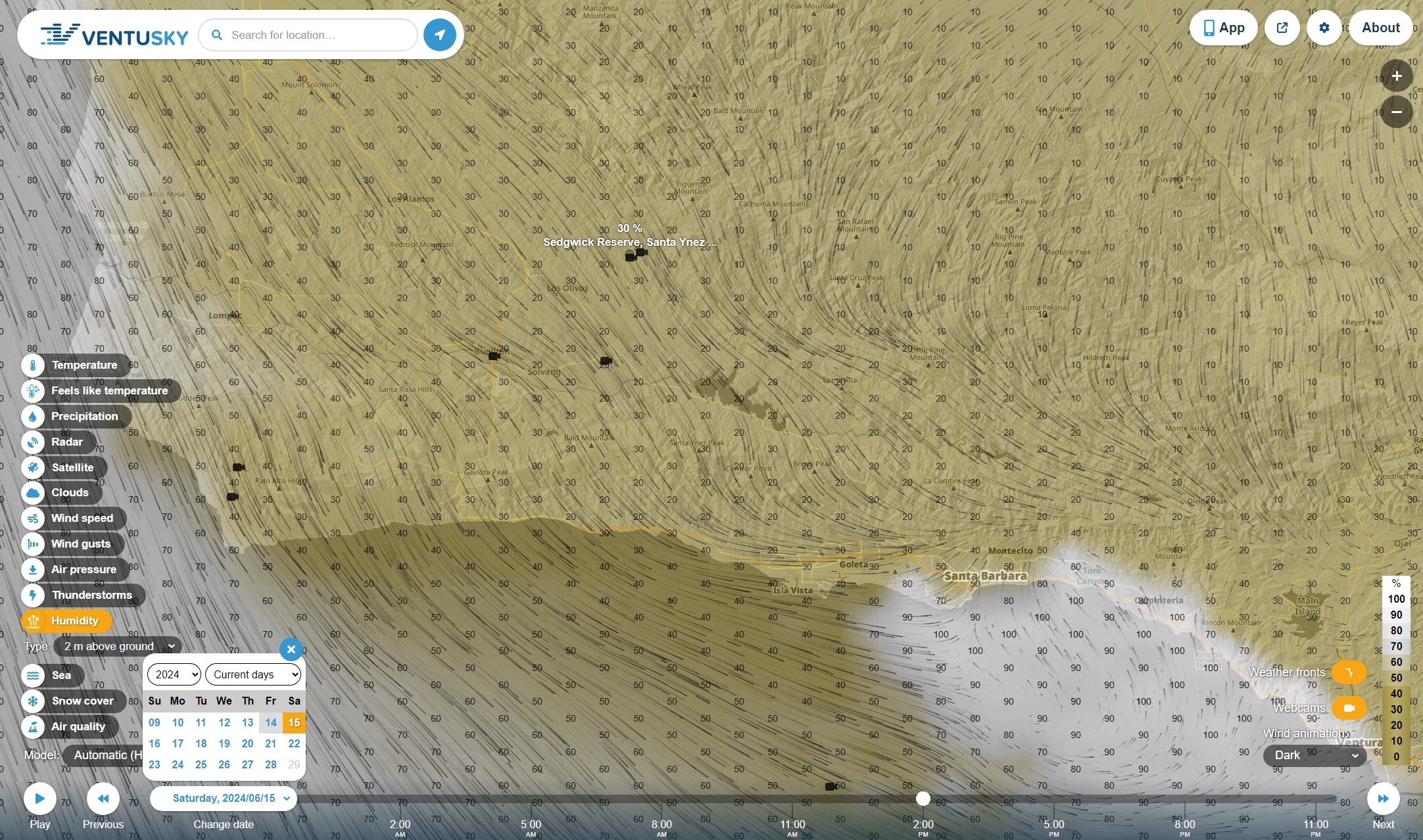
If they do it, or not, today? I don’t know. June gloom is in effect and the marine layer is fairly thick this morning, but that might not last. LPCC and the Vandenberg Hotshots are located at VSB. If its not on WildWeb, Pulsepoint or WD, it may have been called off. Santa Barbara County’s geography makes it an occasional outrider to statewide fire weather conditions.
Friday 5PM PT Humidity
Friday 5PM PT Air Pressure
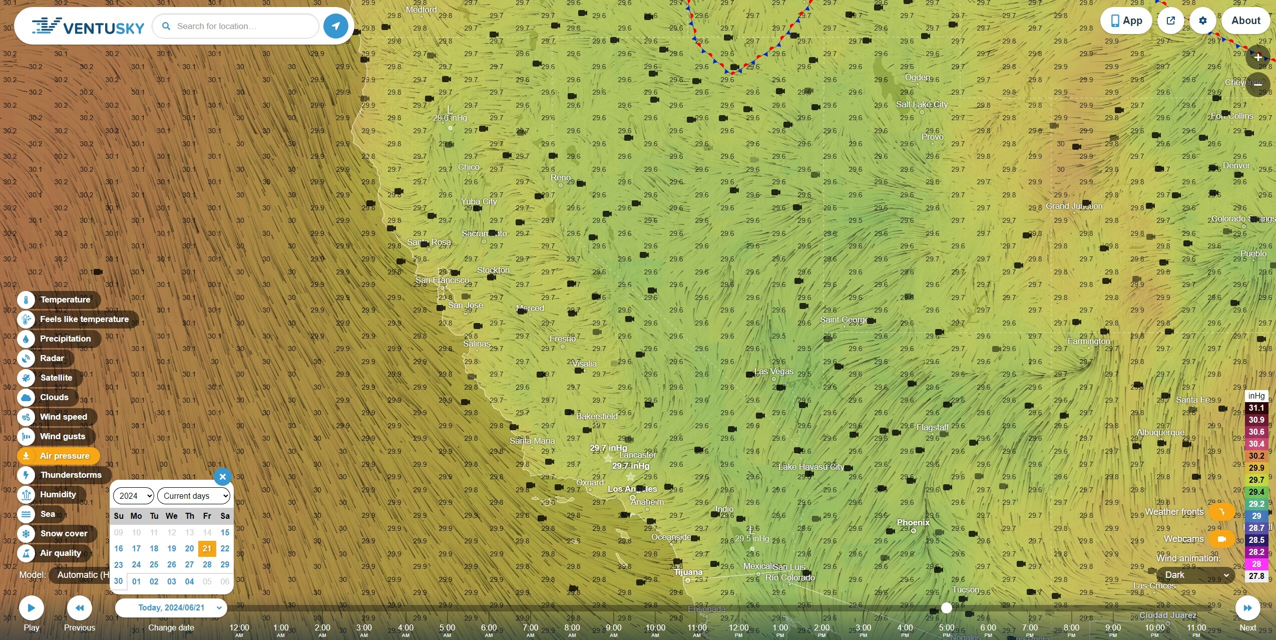
Today’s humidity and pressure gradients. Still in an onshore wind pattern, but without the steeper gradients that lead to higher wind speeds and gusts. You can see that near shore and the coastal ranges are allowing fairly robust marine layer penetration, although we all know that can change quickly, leading to unexpected fire behavior on both the western and eastern slopes.
The terms ‘May Grey’ and ‘June Gloom’ generally refers to when hotter and drier inland conditions lead people to expect the same on the beaches but arrive to find it cooler, breezier and more overcast. People who drive the grades over the Los Padres Mountains, Highways 101, 41 and 46, like SLU and LP, could probably tell you how dramatic the difference can be between San Luis Obispo and Paso Robles.
On the right side of the map, you can see the incoming weather event for the southwest illustrating higher air pressure and consequent wind in eastern AZ and NM. If, for instance, that high pressure were to move westward through AZ and NV into the southern California desert, then that could lead to a major shift in prevailing winds for Southern California and the Transverse Ranges, though, typically, dangerous wind conditions in SouthOps are associated with late season high pressure systems moving southward through the Great Basin and into the CA Central Valley.
Regardless of how inland high pressure arrives, as you may infer, when the pressure gradient is higher in the inland and lower in the near shore, winds turn offshore and lead to Santa Ana, Diablo and Sundowner conditions, and, again, these conditions might be outriders to prevailing conditions in other parts of the state.
Following this, an indicator that there is something to all this above may be the conditions that have led forecasters to project higher wind speeds and gusts for the upper Mojave and Owens Valley on Sunday, with winds in the southeast Tehachapis getting turned to a more southwesterly flow than has been the case for the last few weeks.
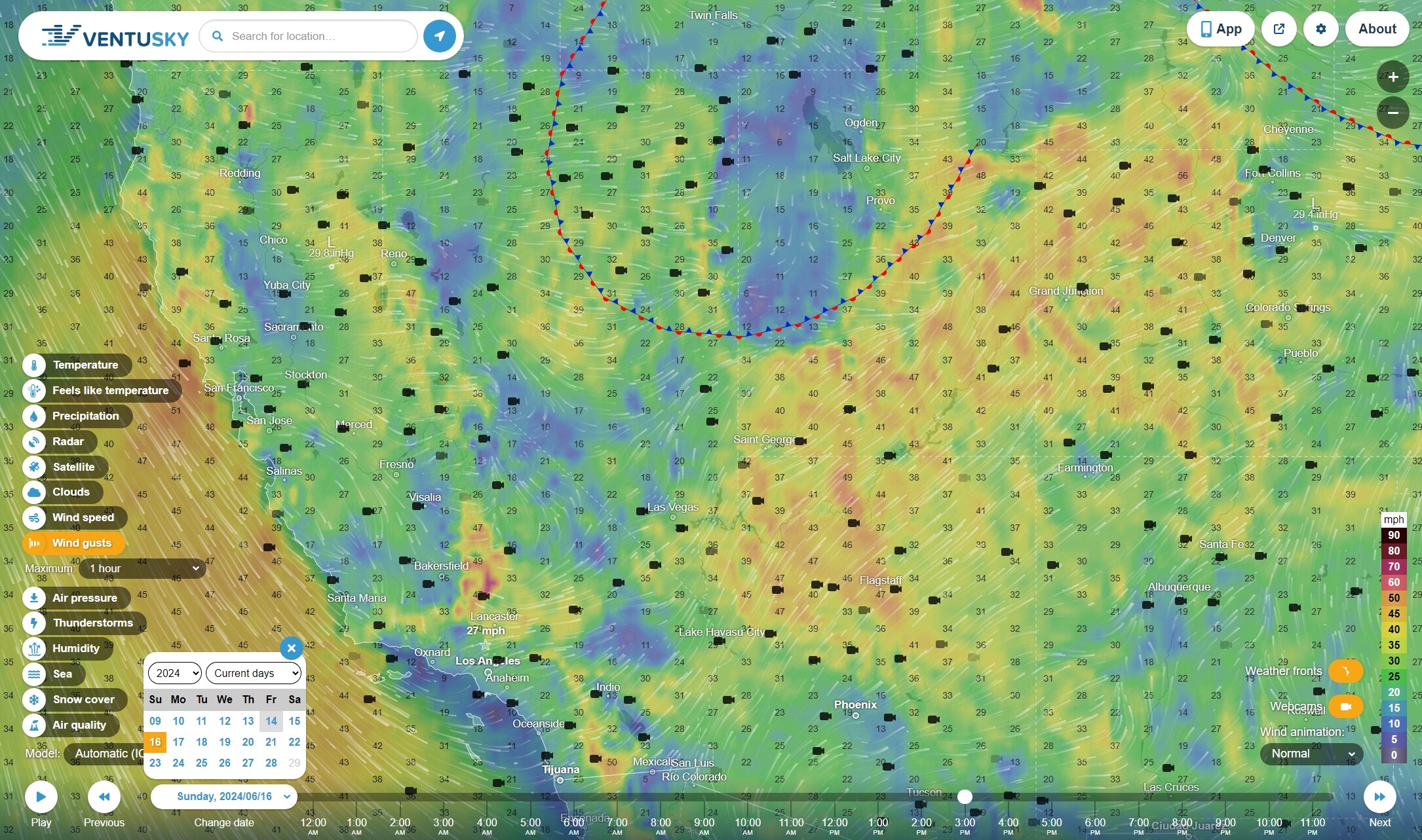
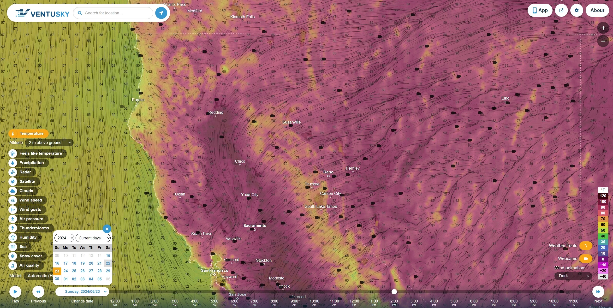
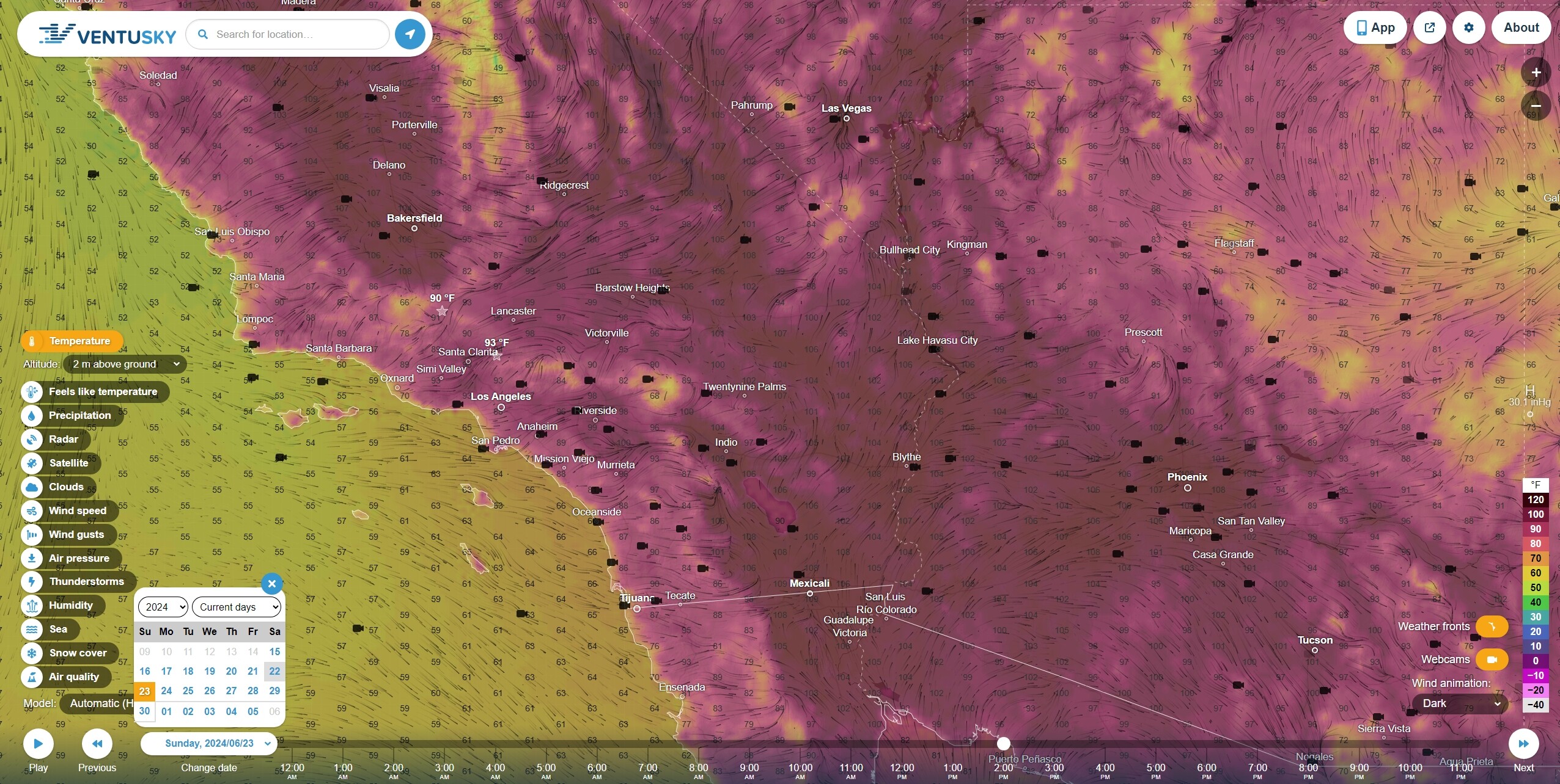
Sunday 2PM Temperatures
Fire ain’t waitin’ for September. That mad scientist theory that polyester under nomex saves everybody money, right?
Huh??? Dont understand