That’s a lot of land area with the 1-3+ years of grass. Half, or more, of chapparal country is grass and riparian drainage. When the grass is lighting up the oak scrub and manzanita, its gonna get real on the rancho. I hope people are starting to get the memo.
Also, Watch Duty, your doing a great job. Time may be coming when its going to be about not getting too exercised about incidents under 10, then 30, then maybe more acres. It’s a marathon, not a sprint.
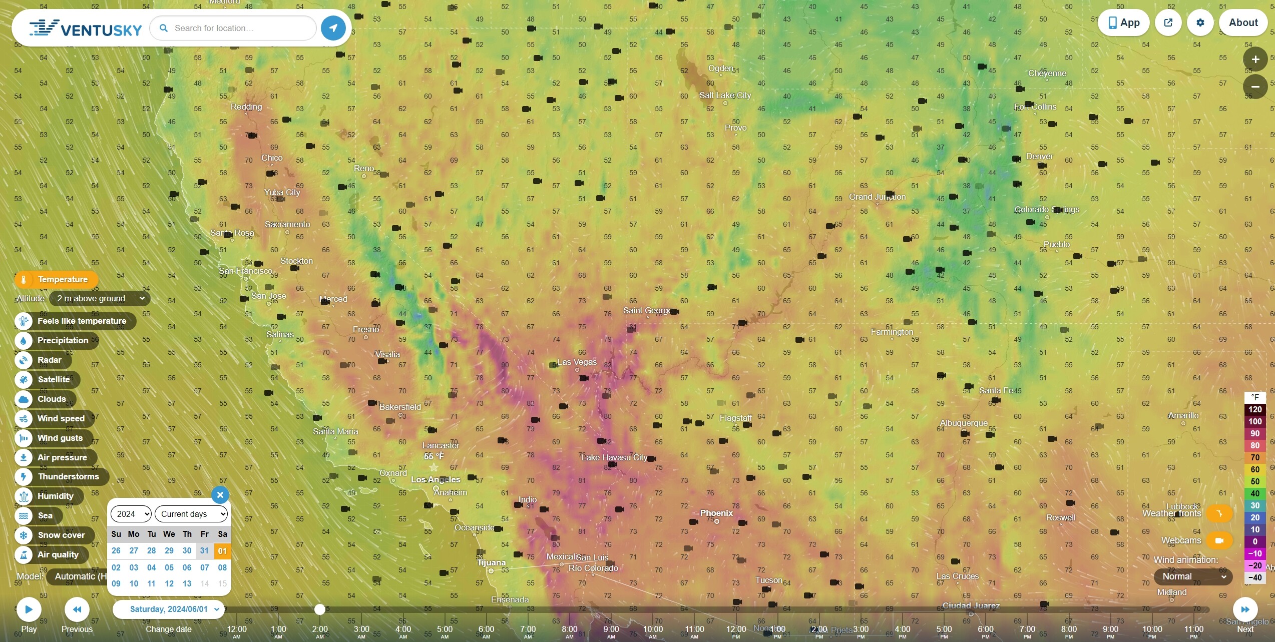
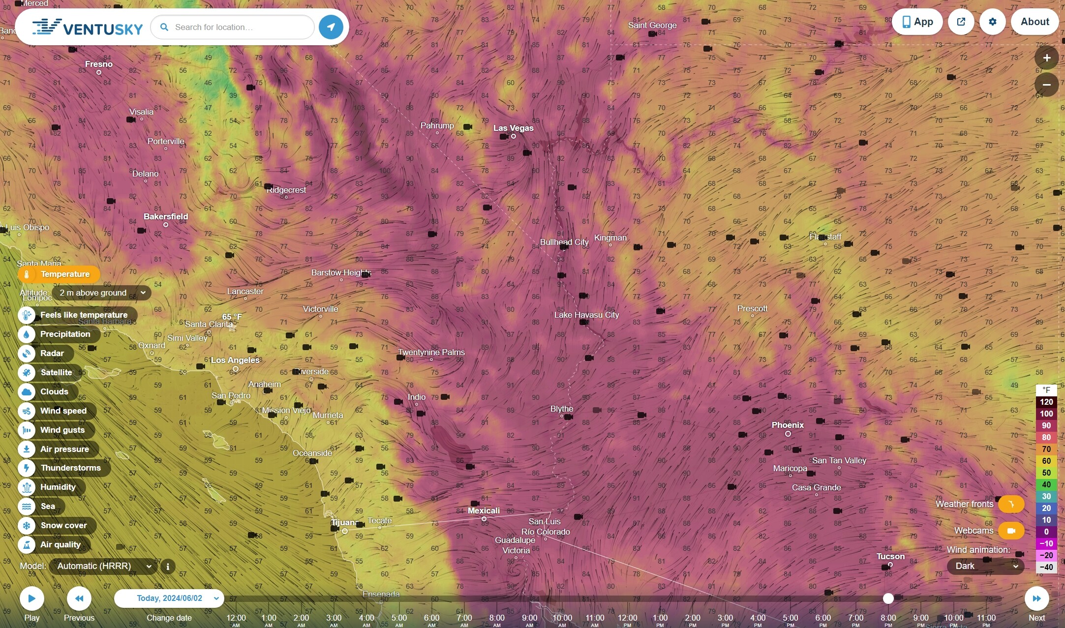
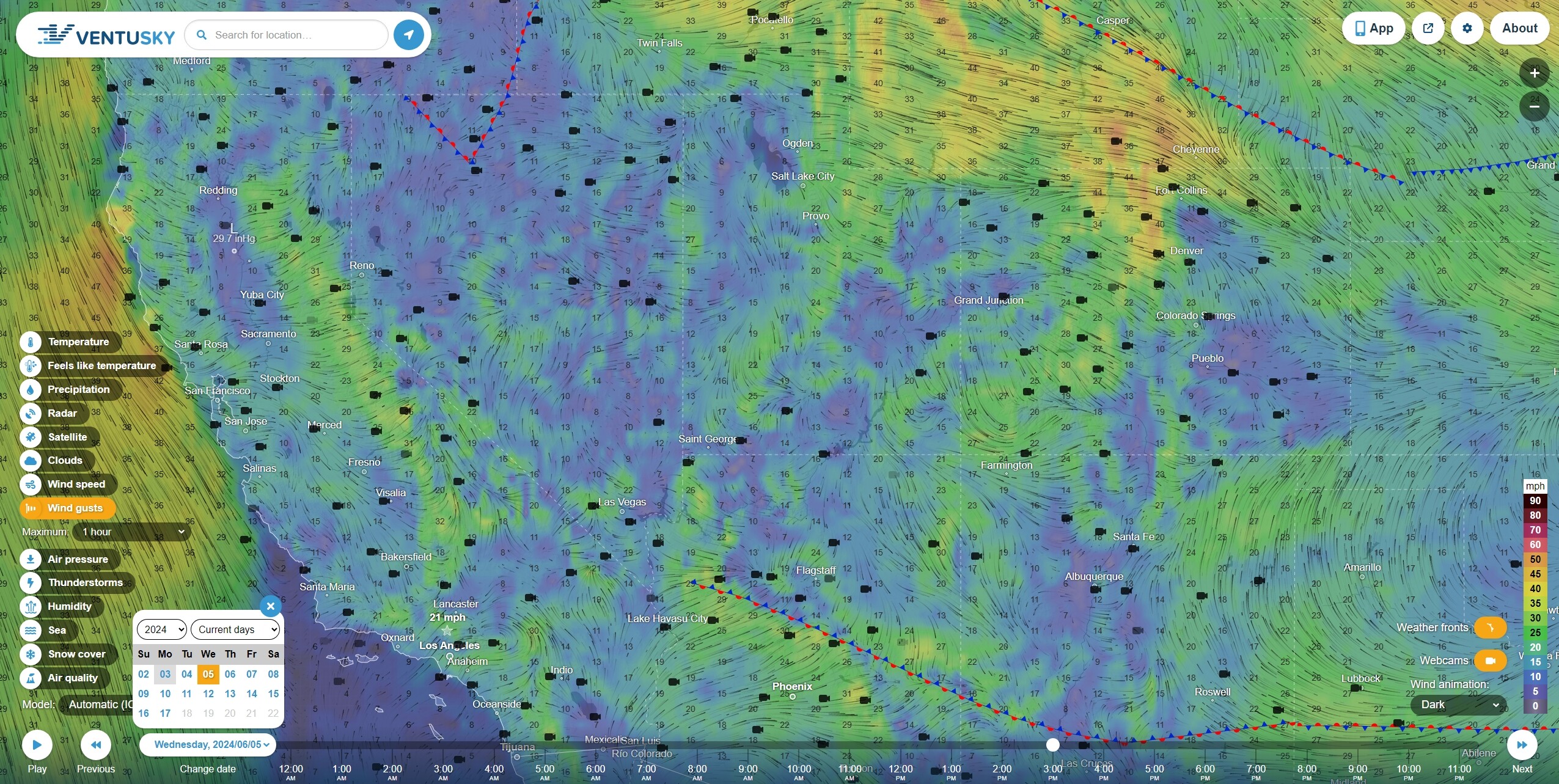
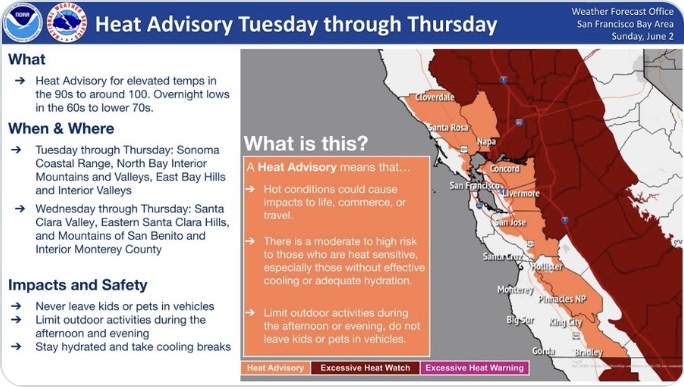
Excessive Heat Watch issued June 1 at 12:24AM PDT until June 6 at 8:00PM PDT by NWS Sacramento CA
WHAT…Dangerously hot conditions with temperatures 95 to 107 possible and widespread major Heat Risk. Limited overnight relief with low temperatures in the 60s to mid 70s.
WHERE…Carquinez Strait and Delta, Central Sacramento Valley, Motherlode, Mountains Southwestern Shasta County to Western Colusa County, Northeast Foothills/Sacramento Valley, Northern Sacramento Valley, Northern San Joaquin Valley, Shasta Lake Area / Northern Shasta County, and Southern Sacramento Valley.
WHEN…From Tuesday morning through Thursday evening.
IMPACTS…Heat related illnesses increase significantly during extreme heat events, particularly for those working or participating in outdoor activities.
ADDITIONAL DETAILS…Hottest temperatures are expected Wednesday. Area waterways will continue to run cold and fast, creating dangerous conditions for those seeking relief in rivers and lakes.
Instructions
Drink plenty of fluids, stay in an air-conditioned room, stay out of the sun, and check up on relatives and neighbors. Do not leave young children and pets in unattended vehicles. Car interiors will reach lethal temperatures in a matter of minutes. Monitor the latest forecasts and warnings for updates.
Shasta Lake Area / Northern Shasta County; Northern Sacramento Valley; Central Sacramento Valley; Southern Sacramento Valley; Carquinez Strait and Delta; Northern San Joaquin Valley; Mountains Southwestern Shasta County to Western Colusa County; Northeast Foothills/Sacramento Valley; Motherlode
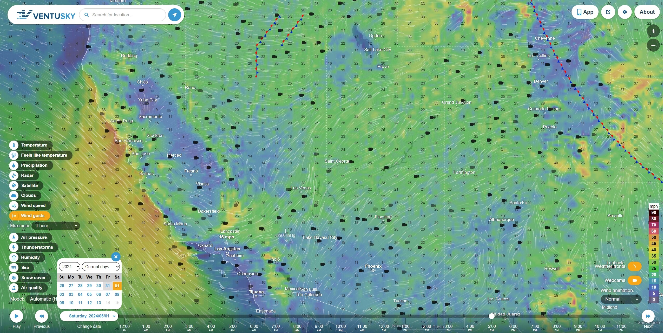
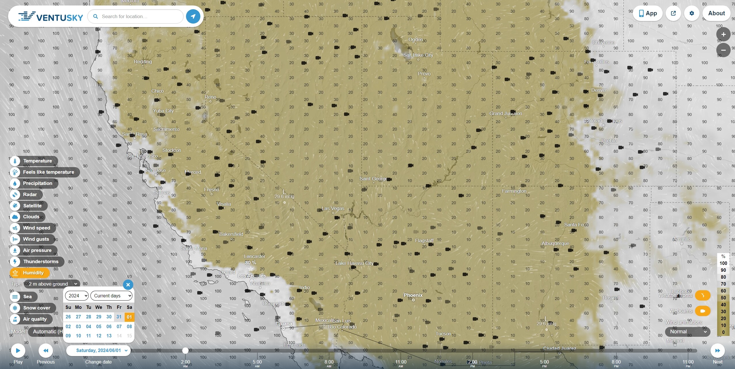
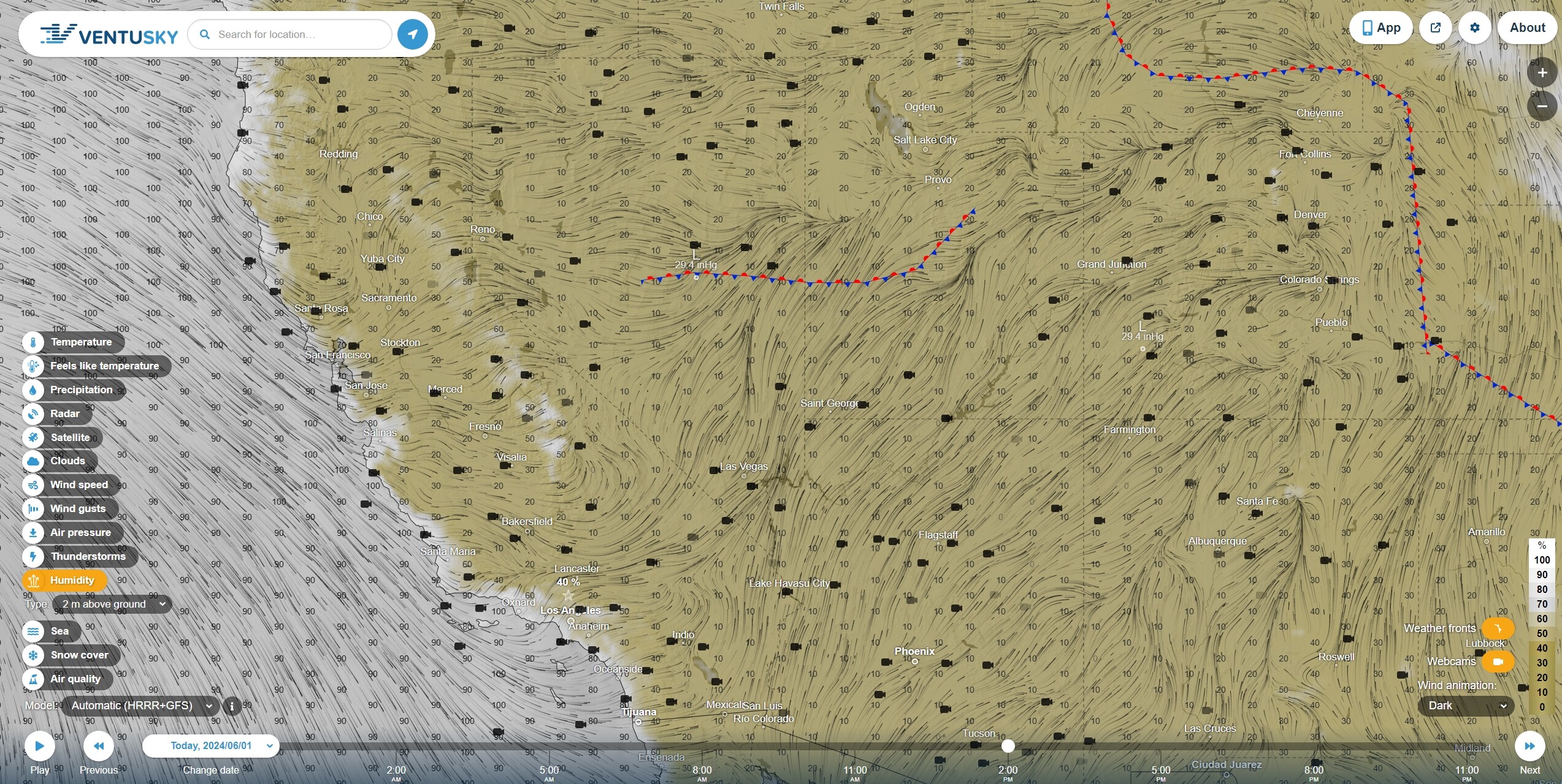
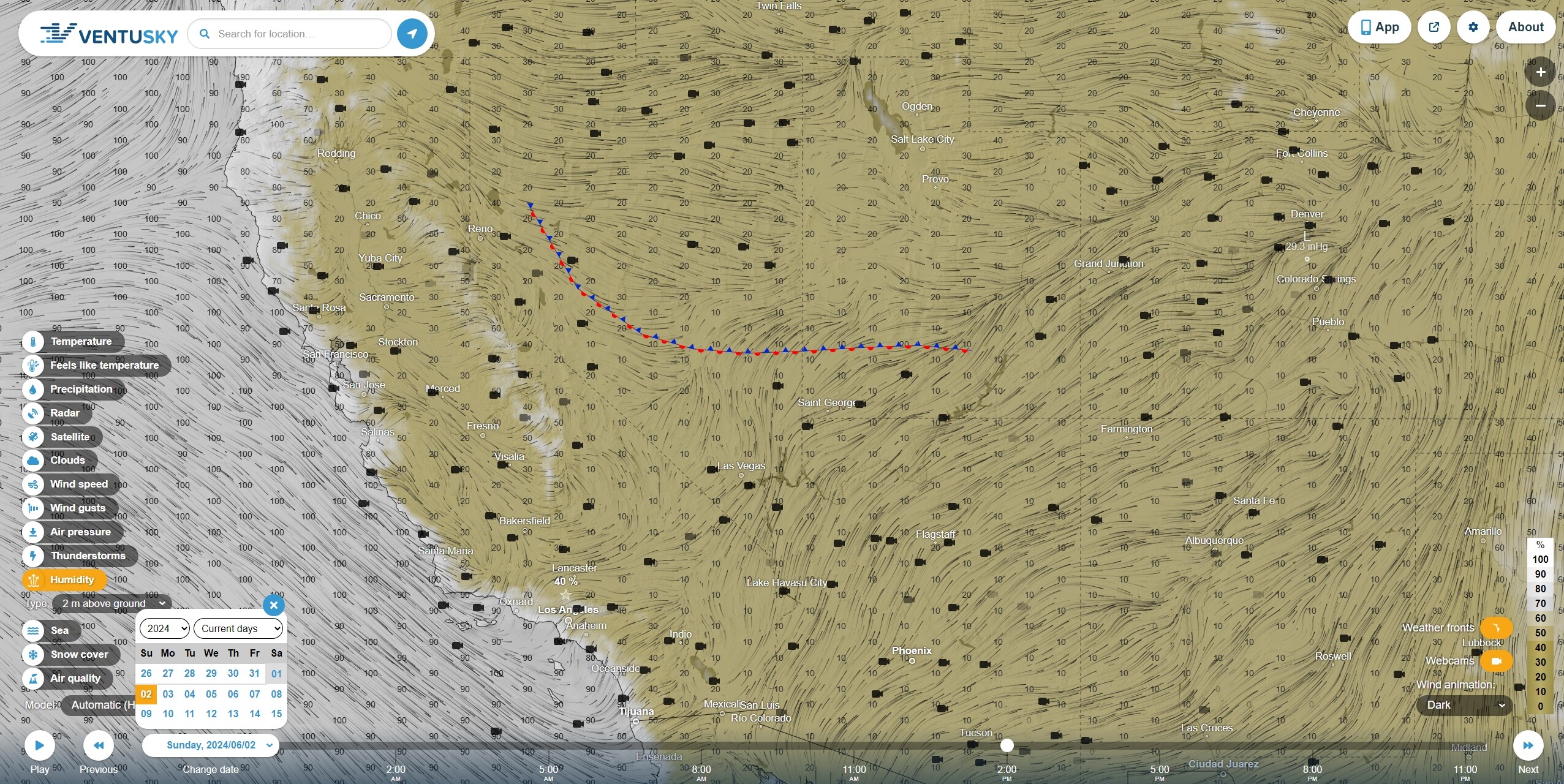
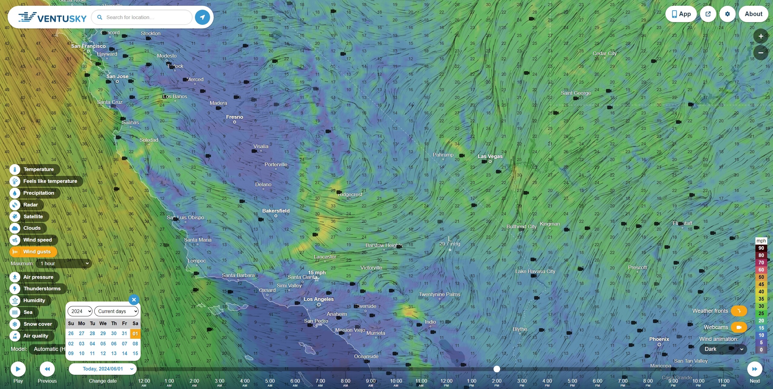
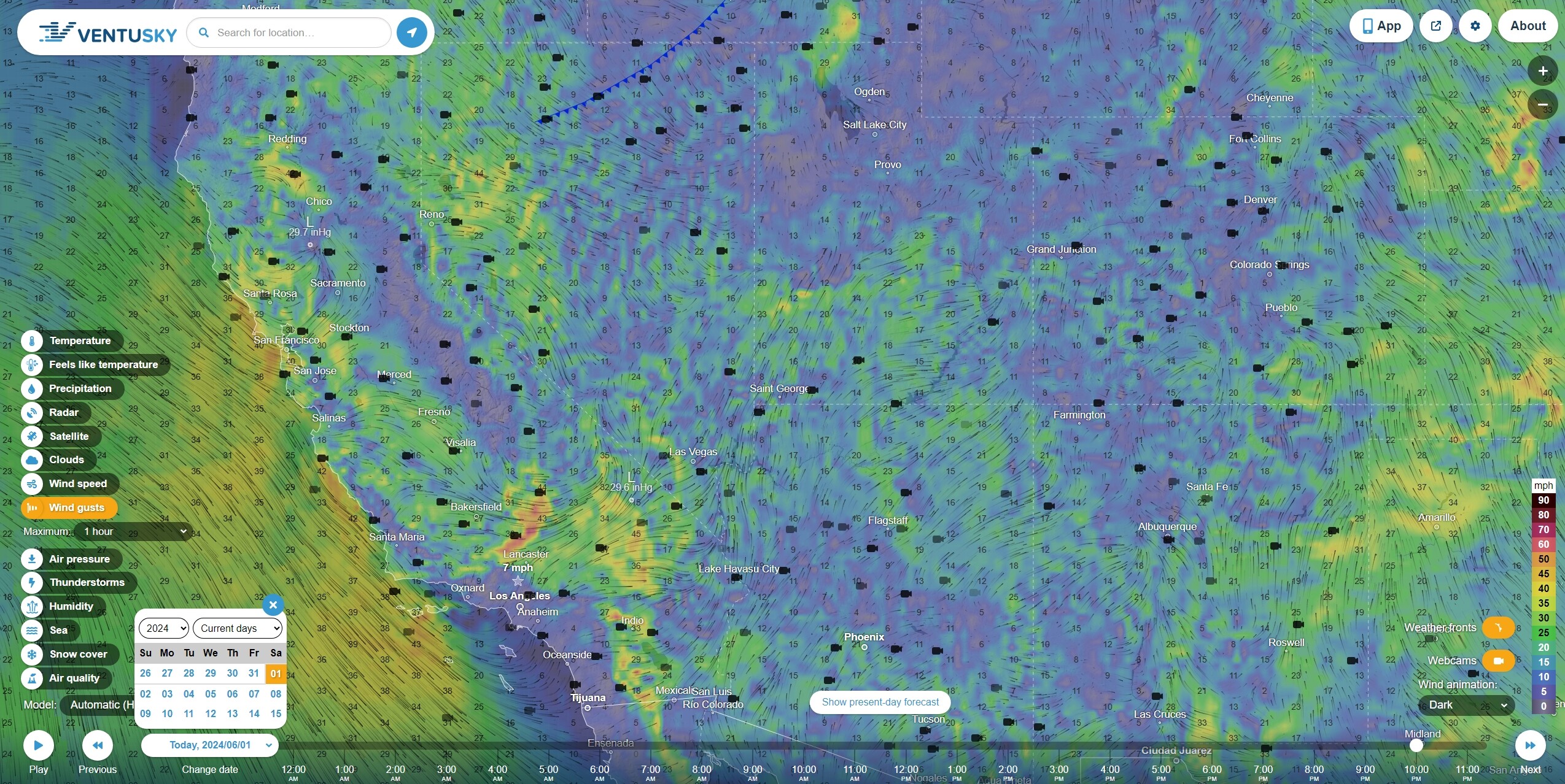
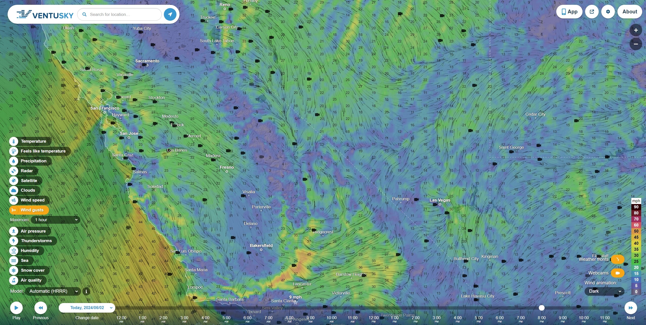
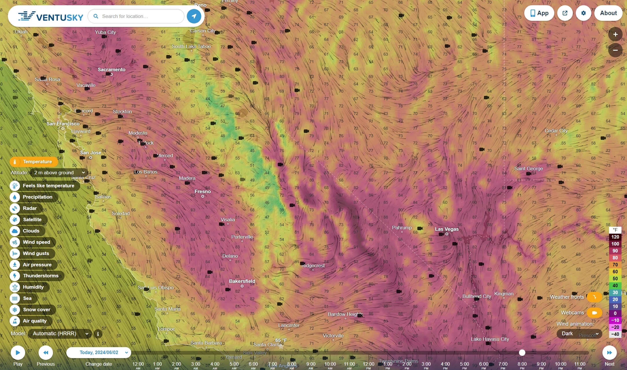
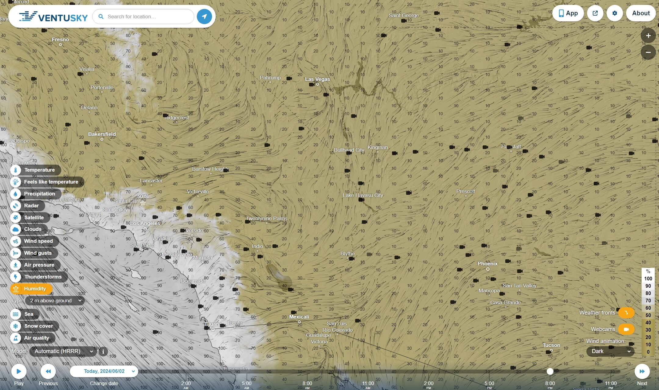
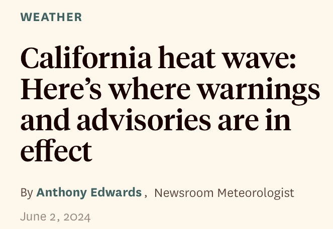
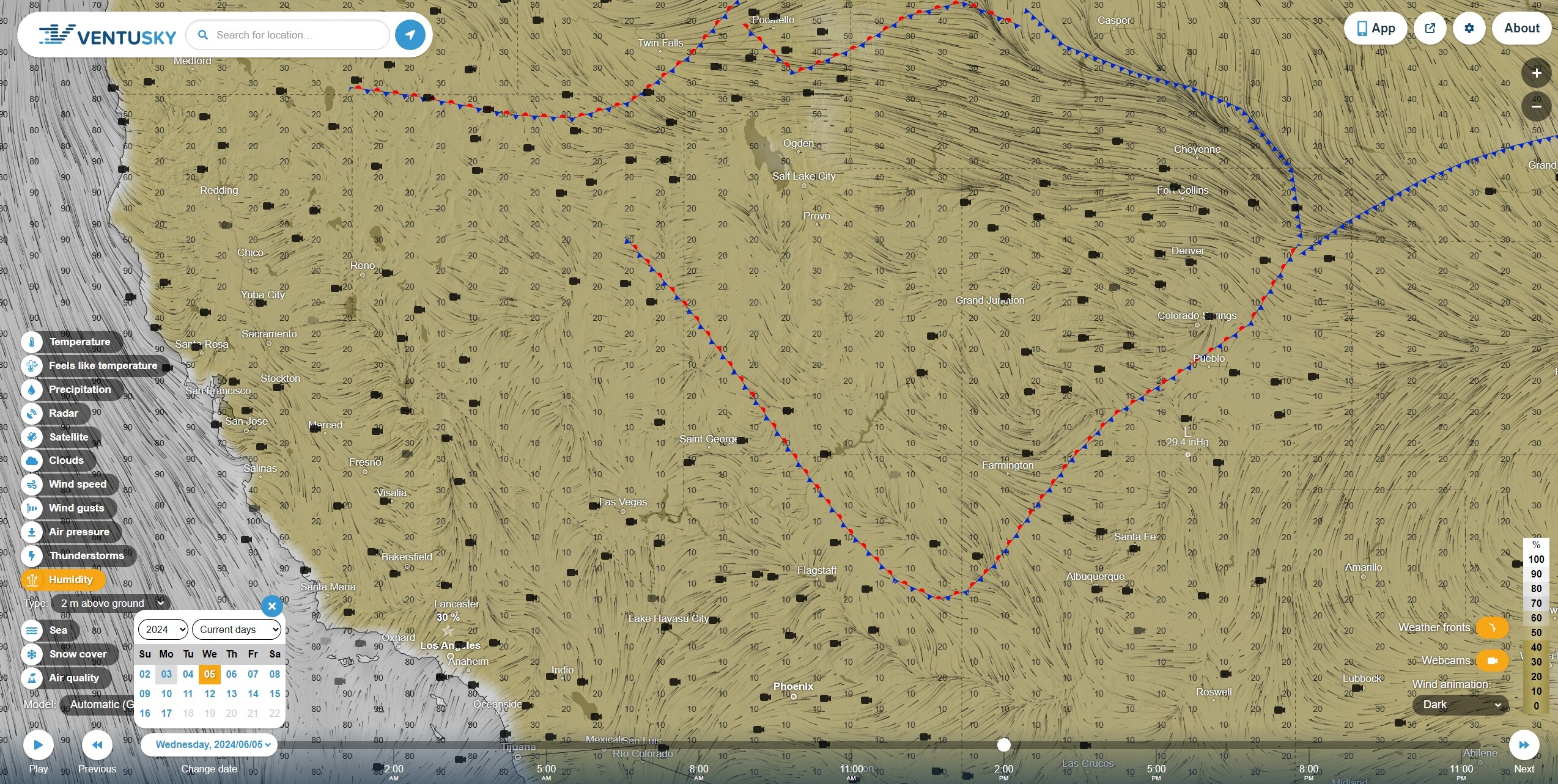
The onshore marine layer is pushing in, but running smack up against the coastal ranges, with some pretty steep gradients, possibly contributing to some unstable atmospheric conditions in the gradients.
Good overnight rH recoveries in the Central Valley; hot and somewhat more humid on the coastal range eastern slopes; to 25 mph south of Redding, around the Bay Area and Transverse Mountains.
Night flying EU CWN T1 & T3 Helicopters start the CF contract today. With Porterville getting 1 CH47 and a S64 on 6/16. The airforce will be in place for all these central valley fires that keep popping up the last week. Just in time for the heatwave that begins on Tuesday. #SlowestFireSeasonEver
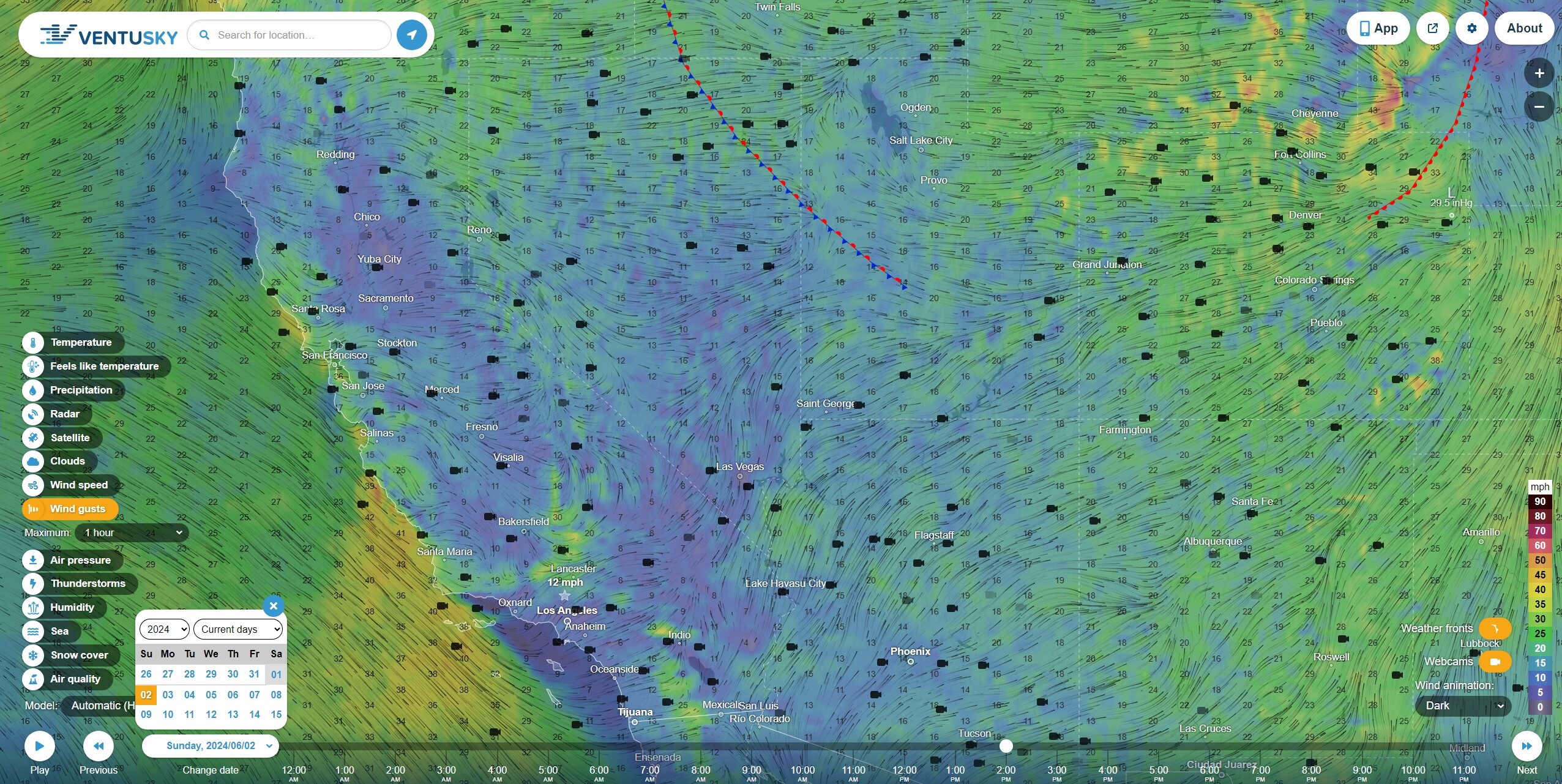
Forecasted wind gusts, temperatures and humidity for 8PM PT tonight. Pretty much the same as yesterday with significant 60 mph gusts around Palm Springs and through the I10 corridor.
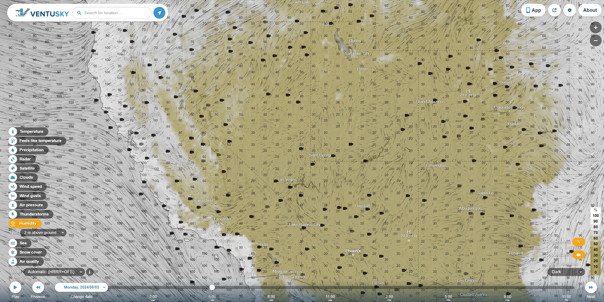
The onshore is still flowing in, but increasing temperatures with the forecasted heat wave may cause the ‘burn off’ of atmospheric moisture to occur earlier in the day and continue on into the evening with reduced overnight rH recoveries and increased transpiration of fuels, contributing to somewhat more active fire behavior for the night shifts.
A trade-off may occur if the Pacific wind current turns or calms down, reducing eastern slope winds, but also reducing humidities and the marine layer.
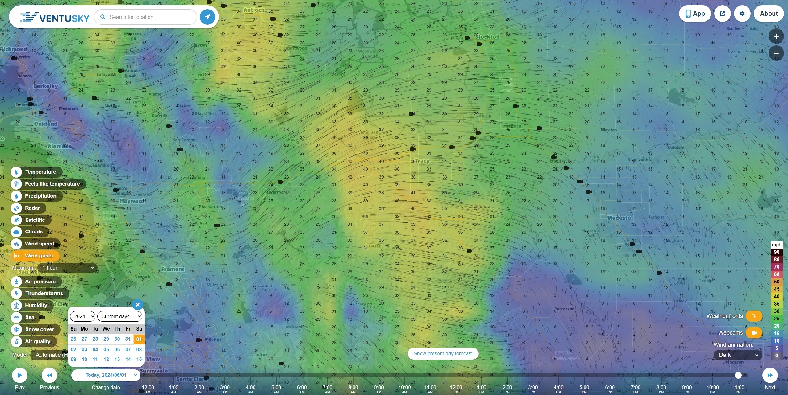
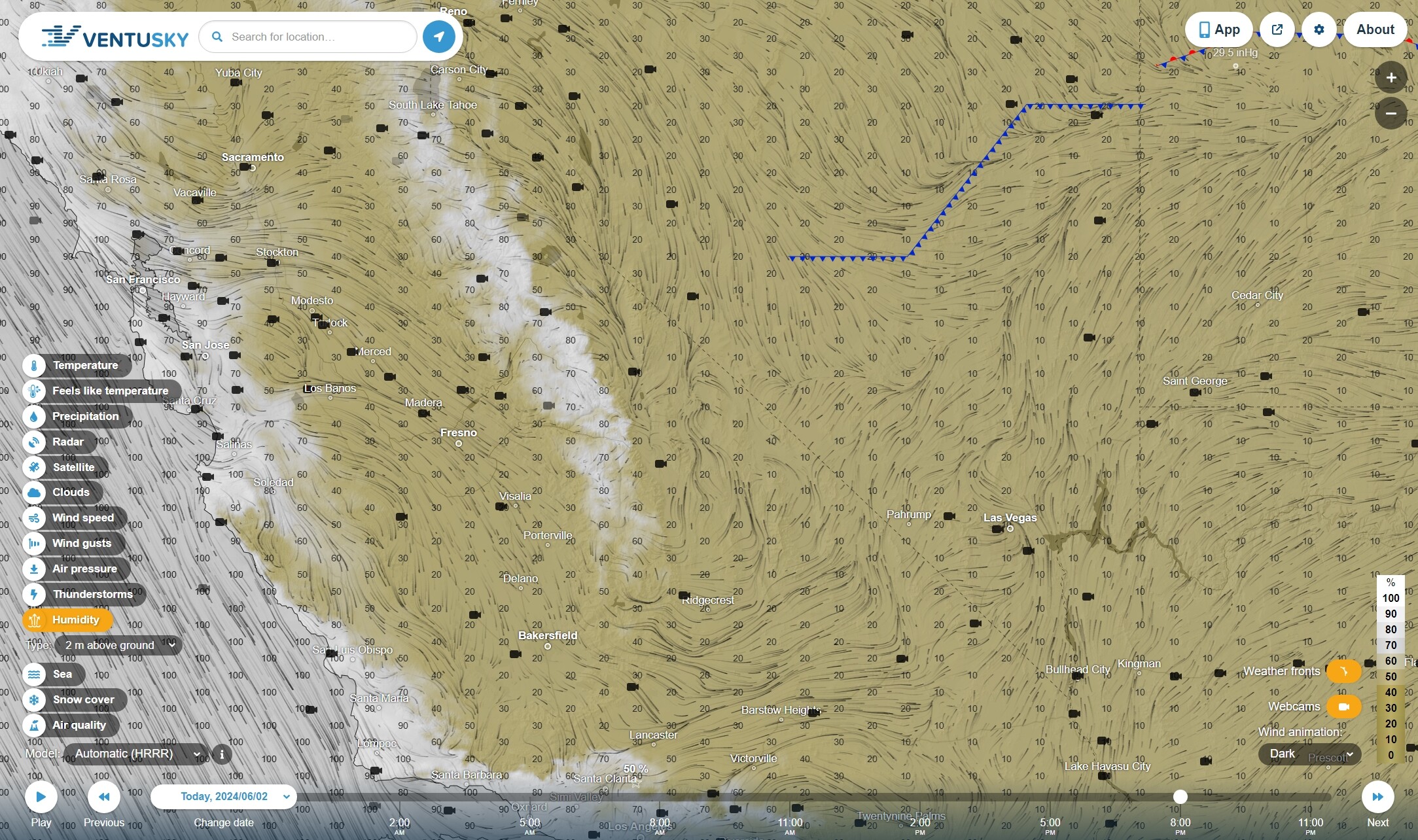
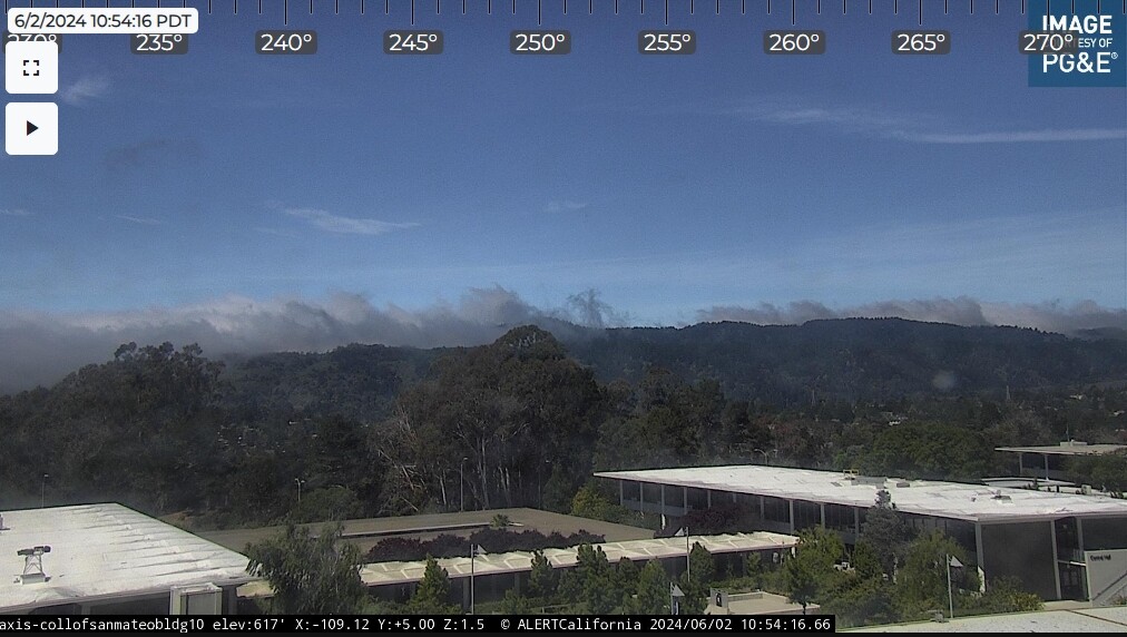
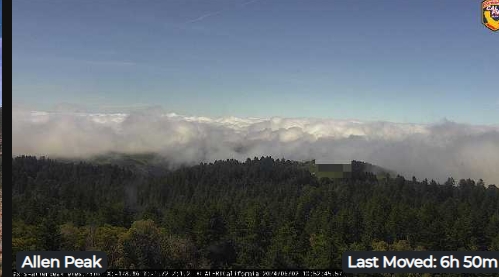
If you look at the coastal alert cams, you can see a sort of interesting phenomena, where the sky overhead is blue and breezy, but the low altitude moisture content just stops and piles up dark condensation right along the water line and on the hills, where just a couple hundred feet of altitude sorts the condensation.
A couple screen caps from the SF peninsula; its windy, but the layer just stops, piles up and drifts back and forth:
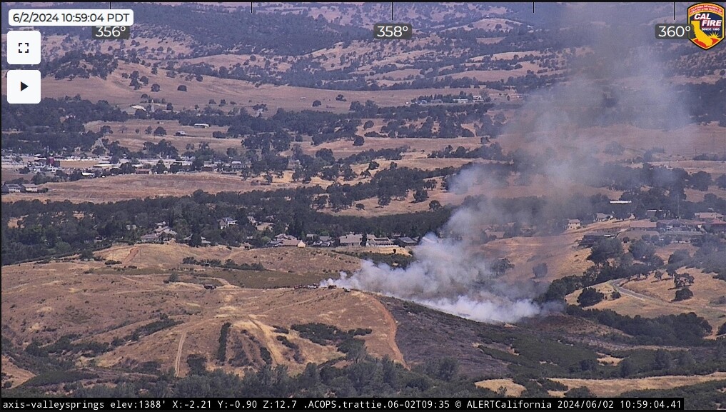
Surely, part of the local Rx. You could see them dragging along the dirt road (maybe recently dozer’d), how the black neatly wraps the scrub, and T-90 passed right over it without a drop.
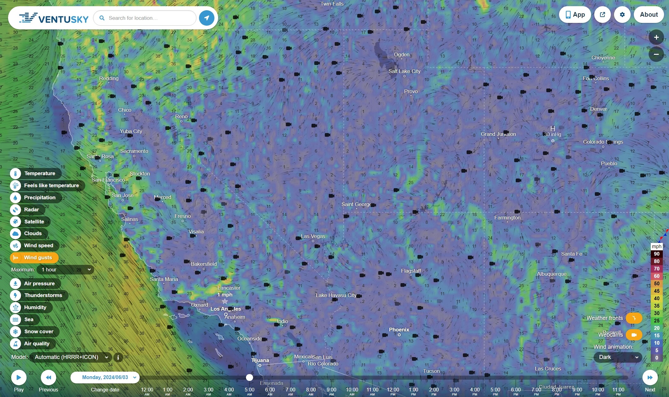
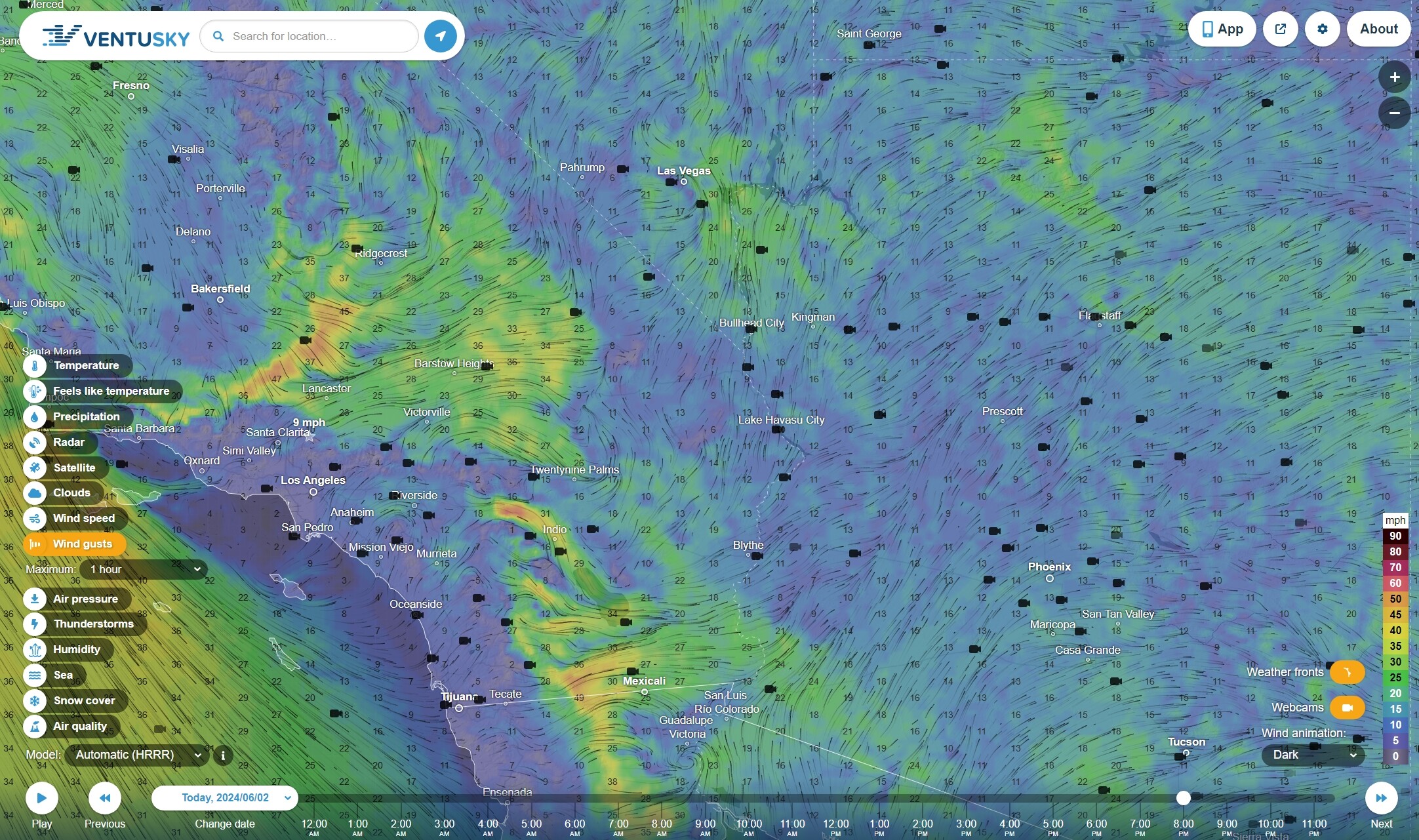
But for a forecast of sustained winds of 25+ mph over a 3 hour period, some of the rest of the criteria for Red Flag warnings may be present. I ponder whether any fuels curing will be triggered, that fuel moistures will take a hard dip come Friday. This is about as close as you get.