Information below is based on data recorded and shared by the USDA Forest Service, R5 State & Private Forestry, Aerial Detection Survey (ADS) program. Surveys are conducted to provide annual estimates of tree mortality and damage and depict broad mortality trends. Most of California’s forested areas were surveyed in 2022.
Highlights from this year’s survey:
• Total tree mortality increased significantly both in acres affected and particularly in estimated trees killed from 2021. Average severity of mortality was also significantly higher.
• Mortality consisted primarily of true fir which comprised over 77% of the total and was the largest tally ever recorded by R5 ADS. Mortality was particularly severe and widespread in the central Sierra Nevada Range.
• Mortality was particularly severe and widespread in the north interior in several conifer species where drought conditions were most exceptional.
• Mortality attributed to mountain pine beetle (Dendroctonus ponderosae) remained steady with an estimated 380,000 dead trees across 44,000 acres in 2021 to approximately 390,000 dead trees across 40,000 acres in 2022. Within this group, whitebark pine accounted for most of the mortality occurring throughout its range.
• Douglas-fir mortality (not attributed to damage by bears) increased most dramatically. However, mortality in 2021 was relatively small. 2022 Mortality was common throughout the host range but was particularly concentrated north and west of the Redding area.
• Pinyon pine mortality attributed to Ips sp. increased from an estimated 60,000 dead trees across 8,400 acres in 2021 to ~220,000 dead trees across 16,000 acres in 2022 mostly in the White Mountains of far eastern CA.
• Incense cedar mortality was quite common and is underrepresented by aerial survey based on field reports as these trees were typically smaller size class and thus hard to see from a distance.
• Tanoak mortality attributed to sudden oak death (Phytophthora ramorum) decreased substantially since dry spring weather inhibits the spread of this invasive disease.
• Oak mortality attributed to goldspotted oak borer (Agrilus auroguttatus) decreased significantly and was again concentrated primarily in and around the Palomar Ranger District, Cleveland National Forest in San Diego County.
• Oak discoloration, early leaf-drop, possible dieback and mortality was common throughout interior areas of the state. Actual mortality is difficult to detect from a distance, but significant oak mortality is possible over large areas.
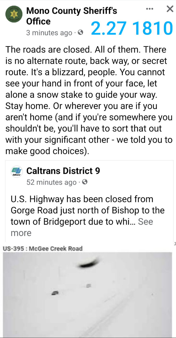
Crews have had to lug their equipment through the snow and dig to access fire hydrants, draining precious time to respond to the emergencies, according to the San Bernardino County Fire Department.
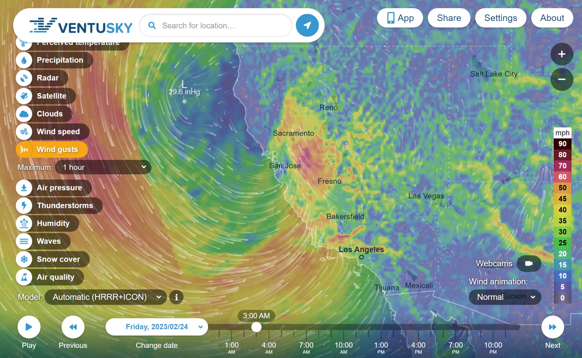
Elevated streamflows. Next week’s forecast is definitely a harbinger of a possible rain on snow event and escalation. Warmer rain may cause snow to melt and runoff at a higher rate than expected. In case it hasn’t been said enough times, flood is sneaky and accumulative. Under the surface tension is immense strength and power. Aside from isolation, gas fire and snow loading, is road conditions. If you can find some other place to be with access to essentials you might lack from more road closures, its probably a good idea. Roads are gonna be pretty sketchy.
The view of the snow covered mountains and hills is pretty to look at, but these places with unusual snow are possibly at a high risk for rain-on-snow runoff escalation and drivers in these areas more likely to encounter unexpected water.
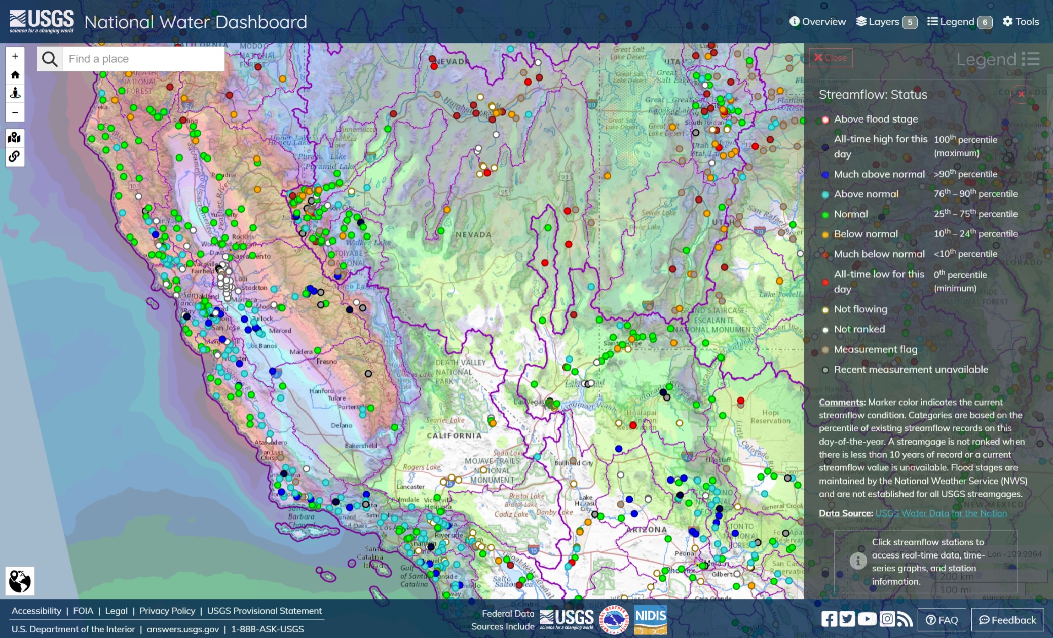
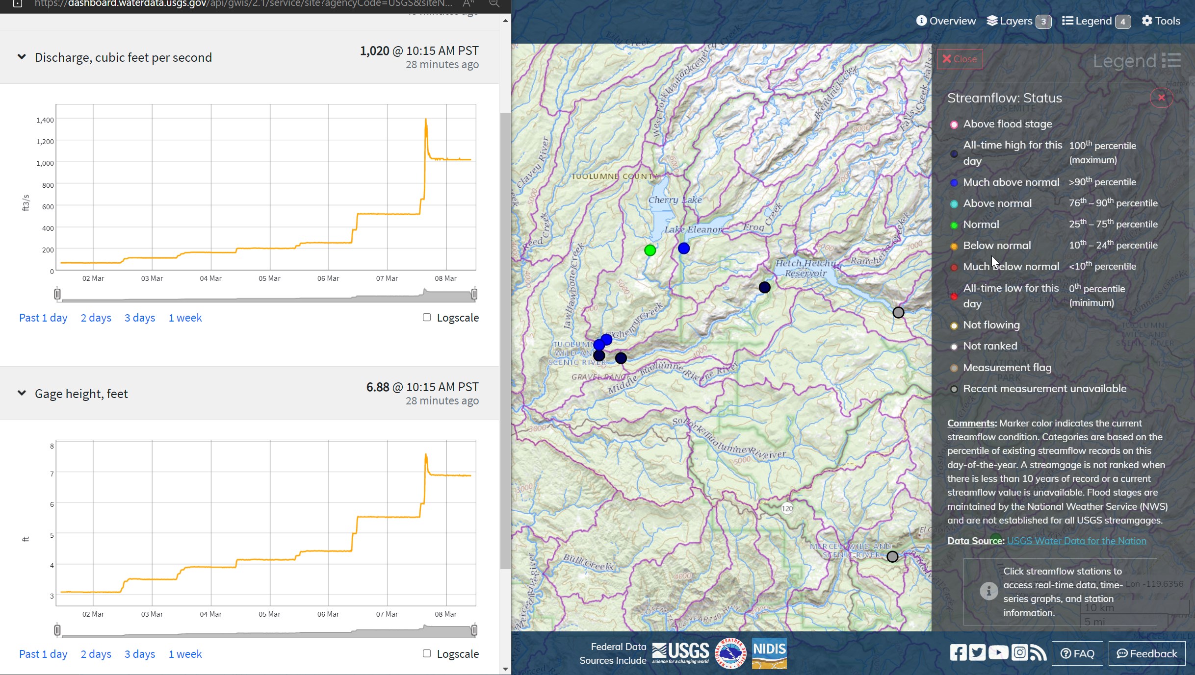
Hetch Hetchy, Tuolumne River, Lake Eleanor, Cherry Creek rolling on down to Don Pedro Reservoir and points west. After Don Pedro Reservoir, this water goes on through, with some topographical diversion to Lake McClure and the Merced River. The City of Modesto and other points along the Tuolumne should be expecting this water and a lot more over the next week.
San Lorenzo River and Salinas River. Salinas River is already elevated and although Scotts Valley and Soquel Creek are in the green, unusual snow and forecasts that show the ARs hitting this area, more or less directly, and the topography indicate flooding will be likely in those steep and narrow drainages and at the outlets, particularly at high tide.
Right now reservoir inflows run higher than they normally would due to snow melt already occurring at 3-5000 ft. I wouldn’t be at all surprised to see inflows at Millerton at over 25000 cubic feet per second Saturday morning.
There was significant concern that dams in the San Gabriel Mountains were at risk after the Dec-Jan storms (“Piper”). Santa Anita Dam, choked with debris from the Bobcat Fire, Tujunga, San Gabriel Reservoir, etc. The risk is that more atmospheric rivers will push it over the tops or chew out holes in the system. If extraordinary measures are in place there, I guess we’ll have to wait for the reporting. They seem to be holding their own, for now.
Perhaps, this storm series will be a test of the things they have been doing there the last couple months. LA County Flood Control have a lot of tools, but the cup is not infinitely deep.
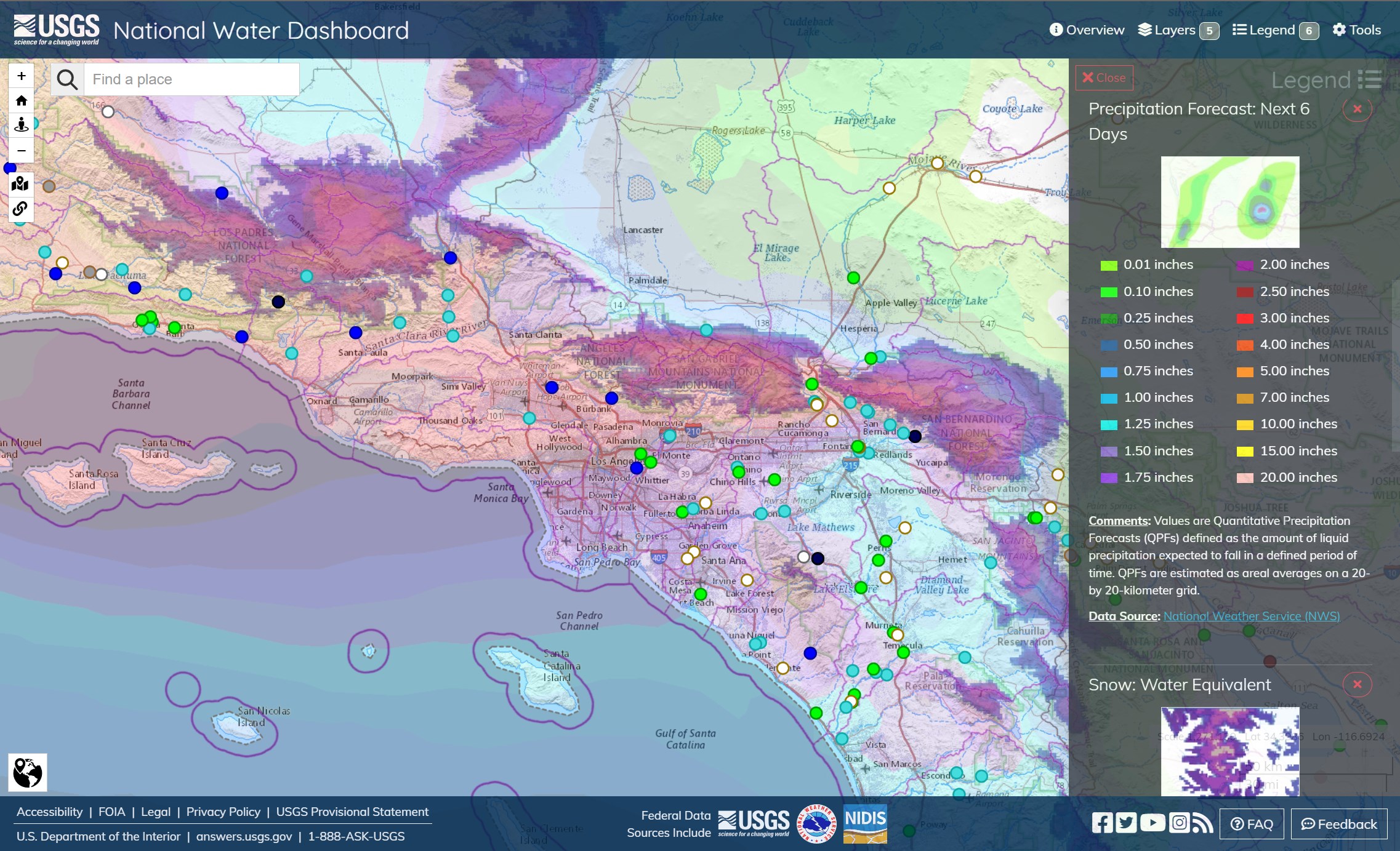
Matilija Creek, the Santa Ana River (in the San Bernadino Mountains), and the Temescal Wash appear to be the most stressed from this view, with a caveat that LACoFC is surely making some moves in anticipation of the incoming storm. This map view is looking at roughly 2" to 5" inches of rain.
It’s definitely going to be a wait and see because they are limited in capacity to catch major excess runoff not including the potential for outlet blockages.