Come Hell or High Water

To Putnam, rivers represent the very heart of those resources. “Rivers are everything, they are the lifeblood to our world,” he says. “Water is essential in everything that we do. We are so lucky to live in a place where we are surrounded by so many great rivers. I have been lucky enough over the course of time to get a chance to experience traveling by way of the river and see the world from inside the canyons.”
A Former Wildland Firefighter on Rivers and Wildlife Resilience (americanrivers.org)

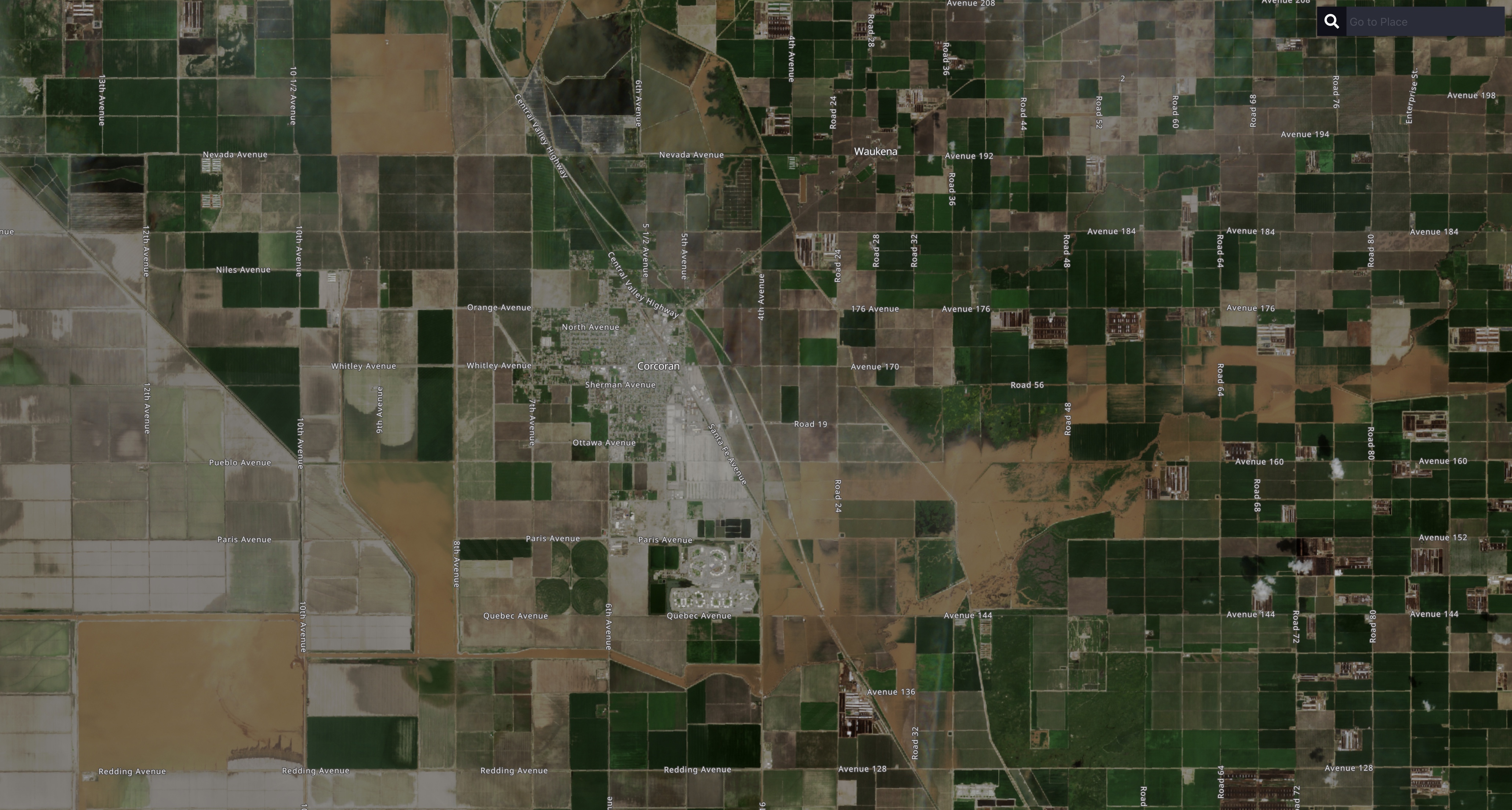
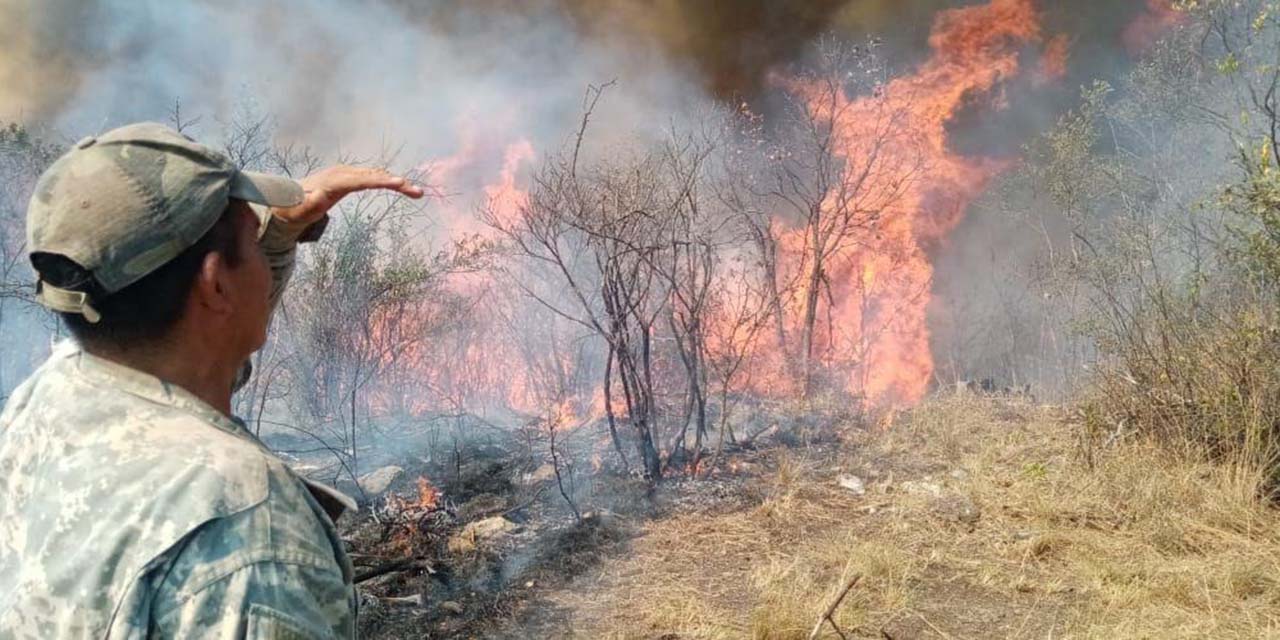
In the Spring of 1991, I had the luck to spend most days and nights in and around the American River as a swamper for Placer Crew #2. We did conservation work on the rivers and lakes of Placer, Tahoe and El Dorado. I also mobilized with Crew #2 to a fire in Shasta-Trinity, along with other members of the Construction Unit who had fire ratings.

Although, I smile to remember blue helmets floating down the river, behind me, as Corpsmembers struggled with current and moved large pieces of a disassembled structure over a crossing, and the riotous fun of rafting on the North Fork, rivers have given to and taken from me, my family and my homeland in ways I could never imagine.

From the streetcorner to the paramount, rivers bind us as a people.

And as a form of life.

The history and development of civilization can be traced around the progress of the deltas, the rivers, the creeks and the headwaters of the rivers.

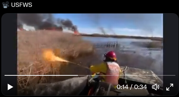
Spring unfolds around us all; crews will look to the trail, and they will discover the new things the river has in store, will walk the ground the river has claimed and renegotiate the terms on which they engage the river, and fire.

As they have always done.
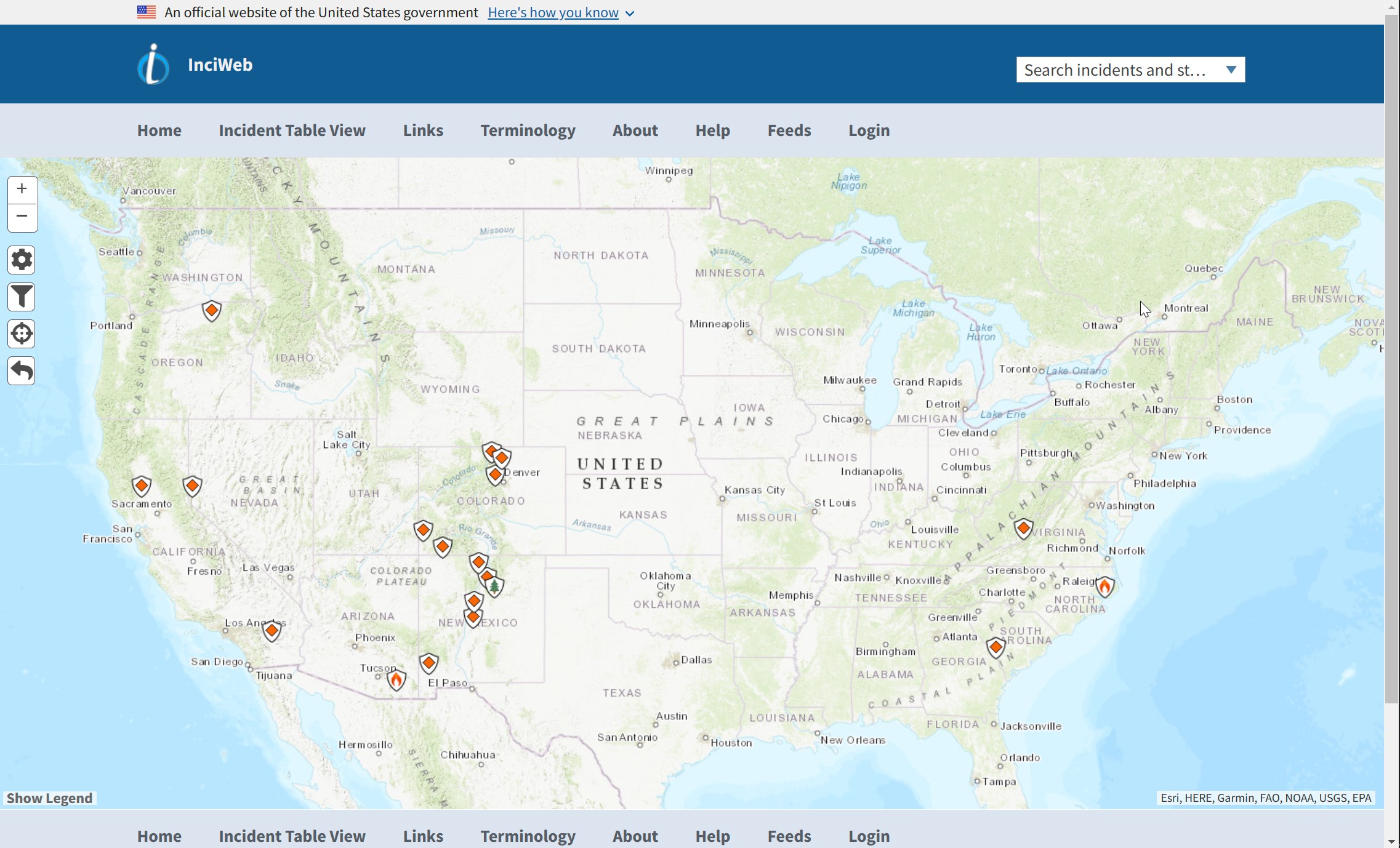
6 Likes

There are mountains of tactical gear, libraries of materials and companies of guides for the close approach to running rivers for Search and Rescue. These squads are typically run by Sheriff’s department teams and pilots, sometimes called callsign, “Henry”.

Nearly every responding agency has a basic orientation course on swift water. I think a basic kit, like, a river bag, is a good addition to a crew’s gangbox. A good knife for cutting free entanglements is one tool sometimes overlooked, throwable collars and floatation devices are fairly compact and ride nicely in transporter tool lockers.

Ropes and knots are central to the situations a wildland crew might encounter and a few other drills and exercises don’t take up too much time and make good time of opportunities that present themselves in operational pauses, like when to roll up or crawl the bottom underneath the undertow of a rapids or weir.

These skills may be in higher demand this year.

1 Like

I’ve been watching the floods progress on the satellite. LANDSAT orbits every 8 days, and Sentinel goes over every 5. These views are at the mercy of cloud cover, but you get the occasional peek at the big picture. Here are 3/13 and 3/21 LANDSAT images of the area around Corcoran and Tulare Lake.

Sentinel has 10m pixels, vs LANDSAT’s 30m (100 feet).
These images are also of Corcoran area, from 3/17. The red imagery shows near infrared light, which highlights green vegetation.


It sounds like CAL FIRE IMT3 was able to use Sentinel to get a decent perimeter of the flooding last week, but they too are at the mercy of the clouds.
Clouds, you say? No problem for Synthetic Aperture Radar! Here is a SAR image from 3/14. Harder to make pretty, but SAR is getting more popular, and commercial sources are getting a lot of development right not.
We’re kind of in a golden age for remote sensing. It’s a good time to be a map geek.

3 Likes

From the resulting vulnerability map on the right, the dark brown areas mainly seen on the central part of the state, indicate the most vulnerable areas to desertification.

Areas around Sacramento, Fresno, Los Angeles to name a few, seem to be highly vulnerable.

The dark green areas situated mostly on the northern and north-east parts of the state indicate the least vulnerable areas to desertification.
The Golden State Crisis (arcgis.com)

Let’s face some facts. Manzanita is a pain in the ass. Its difficult to work with. It often hides itself behind impenetrable thickets of scrub oak. Its vulnerable to fire.

It’s also seen as a last bastion against desertification grasses and encroachment. True in every case or not, its symbolic and sometimes stands as a proxy for budget discussion about what land can be saved, and what cannot.

Desertification is the zero-energy-input-required-Nash-equilibrium-solution favored by some, and whether its manzanita, tan oak or firs-where-we-want redwood, people choose the more energy intensive path. I find it difficult to blame people for this or question dedication to a cause.

People fight to save manzanitas; they question fire prescriptions on manzanita, and they learn to distrust climate talk and ecology that seems willing to sacrifice their lands because it would be the cheapest solution. They are high energy plants that produce sugars, home remedy and firewood. A survivor’s species. Unfortunately, they are labor intensive in brush clearing, and they burn really hot. And when they burn en masse, they burn super hot and produce extreme fire behavior in places you think fuel load is light.

It might not always be true that if the manzanita burns, it never comes back, but that is a scenario residents consider when individuals come to them saying the land cannot be saved, we must burn the manzanita, or let the desert conquer it.

I think it’s reasonable to debate how much the taxpayer is liable to fight desertification everywhere; but it’s a real fight, it gets little attention, has a tangible effect on land management, and has some bearing on the use of prescribed fire.

This probably isn’t going to be the year of the manzanita, but even if next year’s precipitation is like this one, or even if we have a less violent winter, but sufficient precipitation, the fight against desertification in California, and elsewhere, will go on at full tilt, whether its the Nash equilibria or not.

Because freedom.

4 Likes

DESCRIPTION:
California has nearly a hundred different species and subspecies of Arctostaphylos (manzanitas). This talk will attempt a few things to provide a context for this diversity. First we’ll examine their origin in the ericaceous subfamily Arbutoideae, an early diverging group of the Ericaceae named after madrones. Within manzanitas themselves, there appear to be two different lineages, which means cousins can co-occur.

Several processes appear to have been very significant for this group, not only those you might suspect like drought and fire, but also odd soil, maritime climates, polyploidy, and hybridization. While there won’t be photos of all 96 California taxa, there will be lots of pictures of different species and their beautiful features to illustrate these ideas.
Manzanitas - The Beauty and Complexity of Evolution
(Educational lecture, 1h20m)

1 Like

Your airboat, terra torch, wetlands clip, courtesy of the US Fish and Wildlife Service.

Source video

1 Like

Some 3/26 radar images of Corcoran area.

3 Likes

Summary:

  • Slow moving weather system forecast to bring moderate to locally heavy precip later today into Wednesday as it moves down along the west coast.
  • Highest precip totals expected along the northern/central CA coast, and then inland over the Shasta Lake drainage and down the length of the Sierra with totals generally ranging from 2" to 4" (local 5"). Freezing levels from 3.5 kft north to 9 kFt south, dropping to 2 kft north to 4.5 kft south as the cooler airmass moves in.
  • High flow will continue throughout the San Joaquin system due to reservoir releases.
  • Minor river rises are expected starting tomorrow morning, with some points forecasted to reach monitor stages in the next few days.

Confidence: Medium

Staffing Level: Normal

‘Fighting this clear into June.’ Epic snowpack means flooding problems are only beginning (yahoo.com)

The 19th Century called, they want their lake back. While Pine Flats is concrete, quite a few lynchpin dams are earthen, implying that if they top over seriously, they will collapse. These other dams will also have to release water, if they have a mechanism for it other than a spillway. Almost all this water ends up in the San Joaquine eventually, so the Fresno Slough has to be regulated. San Joaquine is already flooding fields farther north. There’s really no choice, no slack in the system, but to fill Tulare Lake in whatever configuration of fields solves the most problems.

In addition to things said in the article about triage measures for the meltdown is the plain fact that California is also earthquake country, and cracking one of these dams while they are full would be catastrophic and there would be no check at all on the runoff.

There have also been some studies connected to the Auburn Dam project that drew causal relationships between the movement and disposition of large volumes of water and tectonic activity. There isn’t yet much warning for earthquakes, but I think if the engineers up there start getting strange seismic readings, they should sound off about it. (edited)

1 Like

Bayes on the ropes. In his weekly Office Hours, Dr. Swain talks about; factors contributing to the West Coast’s outlier status this winter, with regard to warming patterns of the oceans; how long-term drought has lasting effects on aquifers, even in flood years; snowmelt factors for the Spring; how rarely seen weather effects produced last week’s storm that still has climate experts talking; voices of triage in the Central Valley; how warmer patterns can increase snowfall where the atmosphere carries more water into areas that remain below freezing; and other topics.

Australia’s Seismology Research Centre provides a brief set of issues contributing to the gotcha dynamics of dams, valleys and earthquakes.

Notwithstanding the California Current’s zag to the global zig(humor), Spain’s fire season is out of the gate and in a hurry.

Watch: Spain’s first big wildfire this season rages out of control | Euronews

1 Like

Summary:

  • Slow moving weather system forecast to bring moderate to locally heavy precip today through Wednesday as it moves southward along the CA coast.
  • Highest precip totals expected along the northern/central CA coast, and then inland over the Shasta Lake drainage and down the length of the Sierra with totals generally ranging from an additional 1" to 4". Freezing levels from 3 kft north to 9 kft south, dropping to 2 kft north to 5 kft south as the cooler airmass moves in.
  • High flow will continue throughout the San Joaquin system due to reservoir releases.
  • Minor river rises are expected starting today throughout most of CA due to the current storm.

Confidence: Medium

Staffing Level: Normal

Snowing like mad all afternoon here in Grass Valley, still snowing this evening.

2 Likes
1 Like

Fire season begins its slow march to the west. Not much for it, but the sound of the wheels turning in the weather room. Swollen rivers bracketing a large area around Oklahoma and the Texas panhandle under Red Flag fire conditions in areas of extreme and exceptional drought. Precipitation continues to clear drought on the west coast, but it looks like eastern Oregon is going to have to wait until later this Spring to see how much drought relief they will see.

NWS Amarillo:

Red Flag Warning

3/29/2023 12:10 PDT through 3/30/2023 23:00 PDT

Red Flag Warning issued March 29 at 2:10PM CDT until March 31 at 1:00AM CDT by NWS Amarillo TX

  • Affected Area…In Oklahoma…Cimarron and Texas. In Texas… Dallam…Sherman…Hansford…Hartley…Moore…Hutchinson… Oldham…Potter…Carson…Deaf Smith…Randall…Armstrong and Palo Duro Canyon.
  • 20 Foot Winds…For Thursday, Southwest 30 to 40 mph with gusts up to 60 mph. For Friday, West 30 to 40 mph mph with gusts up to 60 mph.
  • Relative Humidity… For Thursday, as low as 8 percent. For Friday, as low as 8 percent.
  • Red Flag Threat Index…For Thursday, 7 to 8 in the west with 4 to 6 in the central Panhandles. For Friday, 6 to 8 with the higher threat to the south.
  • Timing…Starting around noon on Thursday and could still be critical all the way through 1 AM Friday. Again from 9 AM Friday morning through 10 PM Friday evening.

    Updates
  • urn:oid:2.49.0.1.840.0.b2a979f418b0c5f9b9eb0c079a023703dd2f1b98.001.2
2 Likes

The National Weather Service usually only reports on American conditions, but there are other resources to follow for an international view, as you may know. I mean, the conditions on the border are red flag, but you’d have to ask CONAFOR how far south those conditions stretch, as far south as Tlaxcala, for all I know, at the moment. I recall having better links, but apparently my file system has swallowed them.

NASA has a list of resources for international readers.

Not a lot of news, but Oaxaca is reporting recent fire activity.

Forests of Oaxaca burn; five fires remain active; liquidated, three - World Today News (world-today-news.com)


Image source

I can’t say I’ve ever been a fan of camo on the fire line, but the Mexican armed forces seem to have a higher level of involvement with incidents, as a matter of standard operating procedure, than typical for the US. Similarly, with Spain, Portugal and France, but that may be an outcome of the unusually high amount of fire activity they have had in recent years.

2 Likes

PG&E, SCE detail plans to spend more than $23B through 2025 to prevent wildfires in their footprints | Utility Dive

Dive Brief:

  • Pacific Gas & Electric is planning to invest roughly $18 billion to protect its electric grid against the threat of wildfires through 2025, according to a plan filed Monday by the utility with California’s Office of Energy Infrastructure Safety.
  • Southern California Edison’s plan, meanwhile, estimated spending around $5.8 billion on wildfire mitigation strategies in its service territory, on measures such as installing covered conductors and transferring power lines underground in areas where the risk of fires is particularly high.
  • In 2019, PG&E filed for bankruptcy after fires caused by its power lines caused more than 100 deaths in the state, and eventually paid $25.5 billion to settle its liabilities.
2 Likes


Inciweb Snapshot 3/30/23 1150 PDT

Looks cleaner than it did yesterday. Prescribed fire on the ground in Colorado and New Mexico. They are on the edge of a large red flag zone to the east with a few initial attack fires, notably Potter County, TX. Not getting a lot of reportage on Wildfire Intel, but its hopping.

https://www.accuweather.com/en/severe-weather/california-storm-adds-to-monumental-seasonal-snow-totals-shattering-records/1505532

Storm chaser Reed Timmer near Mount Pulaski, Ill, covering tornados

SITREP - a rare HIGH RISK has been issued, and so live storm chase mode has been activated for a major tornado outbreak across 9 states. Fast-moving strong-to-intense tornadoes likely from Iowa to Illinois to Arkansas, including major metro areas like St Louis to Memphis.

Little Rock, AR, is reporting major damage.

1 Like

If you, your family or friends have been the victim of a natural disaster, an emergency involving a large area or other hazard, or are at risk of becoming so, there’s no need to be mystified or confused by the extant behavior of responding resources.

To be clear, FEMA perceives its role as a core participant in a much larger, open world of response resources involving every person, counted or uncounted. The Incident Command System (ICS) is a flashlight in what can be a foggy and dim understanding of how agencies work together to form scratch team and forward deployed capabilities that are resilient and resist structural breakdown that imperils the public.

This free, online orientation is provided by FEMA to the general public.

FEMA - Emergency Management Institute (EMI) Course | IS-100.C: Introduction to the Incident Command System, ICS 100

At the completion of this course, you should be able to:

  • Explain the principles and basic structure of the Incident Command System (ICS).
  • Describe the NIMS management characteristics that are the foundation of the ICS.
  • Describe the ICS functional areas and the roles of the Incident Commander and Command Staff.
  • Describe the General Staff roles within ICS.
  • Identify how NIMS management characteristics apply to ICS for a variety of roles and discipline areas.

Primary Audience

The target audience includes persons involved with emergency planning, and response or recovery efforts.

Prerequisites

None

IS-0100.c ICS 100 Student Manual (pdf)

2 Likes

Some new imagery of flooding in Tulare Lake, with some historical context. https://twitter.com/wildland_zko/status/1642573041438965761

2 Likes