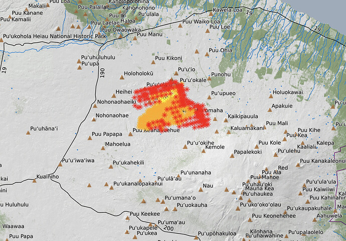
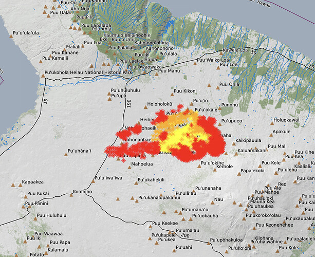
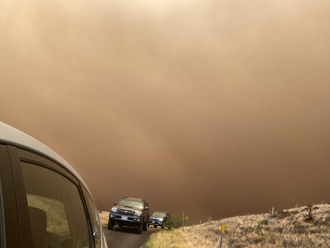
14K Acres on the Big Island
Operation Question what GACC do they fall under? Looking at map appears North Ops?
Yep. North Ops.
Thanks for the update.
The fire is currently about 6 miles from the village. Unsure of whether it has crossed 190, but they just issued an evacuation for Waikoloa Village. The are a number of two tracks between 190 and the village, however with 20 mph winds, it’s hard to create blackline ahead of the fire. In addition, HFD is not setup as much to do this tactically. The winds are supposed to abate tomorrow night and return to the normal diurnal pattern.
In my part of the village I have a lot of greenery surrounding the neighborhood in addition to noncombustible building materials. There are however some of the older sections that have 25 year old dry unpainted exposed wood. Landscaping for the most part is “noncombustible”. Average rainfall is 30+" however they are also in a drought. Doesn’t really matter as most of the fuels in that area are 10 hour type.
Spot weather forecast doesn’t look beneficial for direct engagement, with the exception of minimum humidity’s in the mid 40s. If this had CA humidity, it’d be knocking at the resorts door down by the beaches
I haven’t fought fire on the side of Shasta, so I can’t compare the two. However from my limited intrusion into some of the land next to roads up there if you go 15’ off the road grade you’re buying new tires. It’s a little better east of 190 as there has been more weather over the thousands of years to wear down the soil.
Near the roads there is an abundance of fountain grass type plants. I would guess it’s the same the farther off road you get.
Sadly, there are hundreds if not thousands of small wild goats that live all over the place up there.
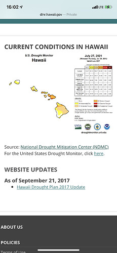
If I could ask on this thread, what is the drought condition in your really area like?
36,000 acres with some winds reported over 56mph.
Sounds like the reports were some chainsaw work 2 days ago… up higher on the mountain. Had it pinned at around 20 acres and a big wind event kicked up. Fire sounds like it’s headed downslope.
From the maps above, this appears that it would on or near the Parker Ranch, which an extremely large working cattle ranch. They supply a lot of beef for the island
Affirm, I believe the ranch southern boundary is the Old Saddle road. I’m not sure how far west they go. The midslope road (190) might be the boundary not sure. There’s military land around there for troop practice also. Again, not 100% sure, but most of the cattle I believe is in the higher elevations than where this fire is heading as there is just nothing to eat there. I’ve never seen cattle downslope when I’ve driven to Waimea. They do have the fencing though…
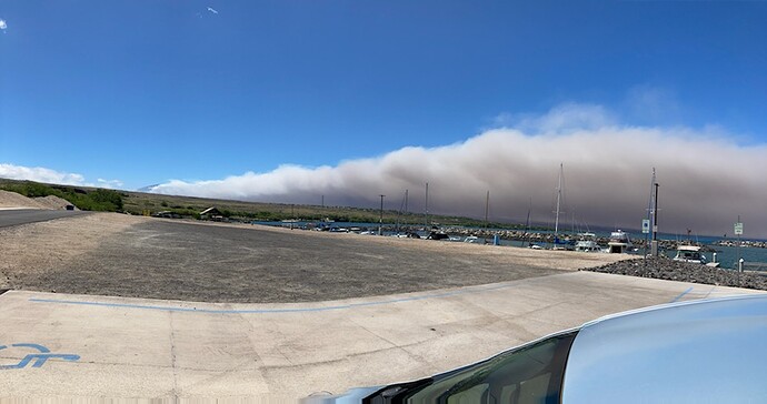
The first picture form jstacalguy looks to be Kawaihae Harbor WNW from the fire. The second looks like the usually closed fire “escape” road which to me is sketchy as heck as there is absolutely no place for refuge until you get down to the coast. It’s located at the end of Hulu Rd.
In regards to the drought, as I mentioned most of the fuels down there are 10 hour with some 100 hours sparsely mixed. So even though the area still gets 30+ inches of rain, most of it runs right through the lava down into the aquifers. So their drought issue is more a water supply issue than a fire issue.
Up in the higher elevations that might not apply (probably where the cattle are). When I was there end of March/April I didn’t notice a difference until I went up to Waimea and said, wow, warm and dry everywhere.
My buddy who is at my place says heavy coating of ash fall everywhere
Sounds like it has jumped the old saddle road about 3 miles from 190.
Webcam downwind from the fire near the coast.
The fire jumped 190 shortly before 12:30 HST.
(My timing might be late, 12:30 is when the video was edited)
I believe that is what prompted the evacuations of Waikoloa Village.
Not a ton of info, but some resources listed and a map from today I believe…
The video is also interesting to hear folks who don’t deal with a lot of wildfires. Also hearing about fire in a place I’m not familiar with having a lot of wildfires.
Some heat popping up pretty far west.
I’d guess those couple flare ups are definitely west of HWY190 

