.25 in my gauge in Twain Harte this morning. Didn’t rain long but hard. Drip line under the trees are wet.
We (West Shore of the Lake) did get a good wetting rain, starting around midnight.
.10" in Camino. Didn’t see/hear anything this far east.
Lots of holdover lighting strikes out there laying dormant for things to dry out. The rain we got, was largely inconsequential with inconsistent and superficial soil penetration and little affect on the 100-1000 hr fuels.
We’re going to need to be on our A-game this week.
Also with broad northerly flow and some offshore winds things are going to dry out very quickly.
Much of the area between Chester and Old Station got a good soaking. The dust was settled and there were still raindrops shimmering on the buckbrush at noon up by Drakesbad. Heard some people say they got 3/4" in Quincy.
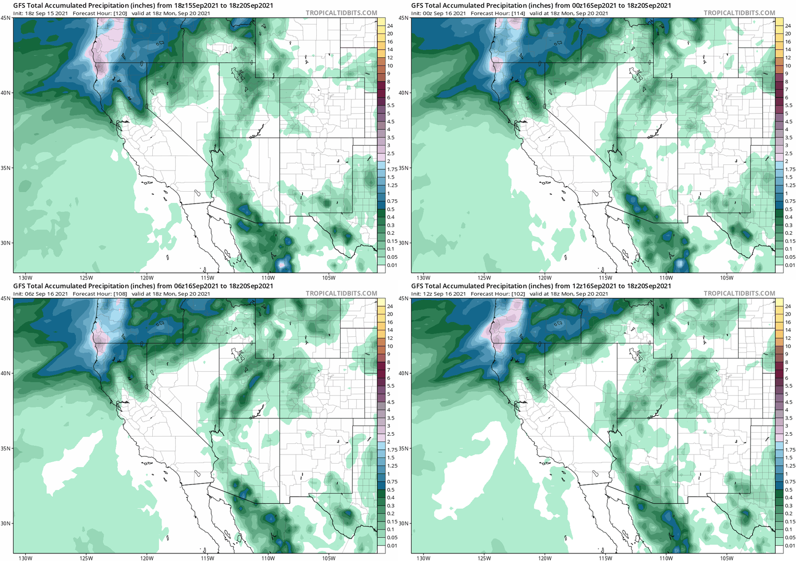
Just a reminder that for early fall low pressure systems forecast models 80% of the time show the placement too far west when forecasting 5-7 days out.
Classic early season inside slider signal with some precipitation in the Cascades.
The GFS keeps fire weather conditions elevated through the next 7 days with dry NW flow. Temperatures are not overwhelming but winds will keep things squirrely from a shortwasve undercutting the ridge this week.
In about 48 hours we can start forecasting what could be the first major Diablo wind event of the season.
Your just a peach today Anvilhead🥺
Yeah, thanks Anvil, now I need an Advil 
Seriously tho, appreciate all you do. 
NWS Fire Weather 3-8 Day Outlook
https://www.spc.noaa.gov/products/exper/fire_wx/
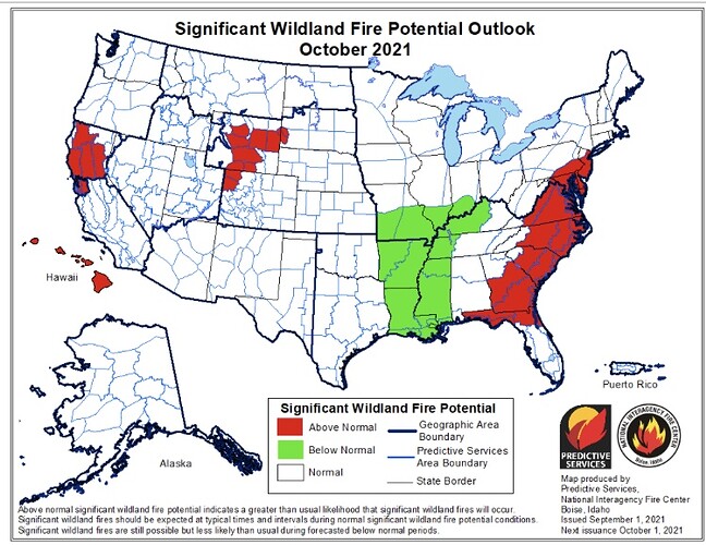
NWS October Potential:
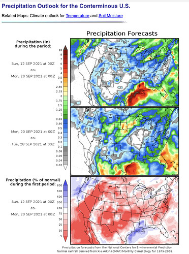
Still looking like some precip for NorCal this weekend with dry offshore winds early next week. Still a ways out to get to the nitty gritty details but definitely a change in weather is in store:
From NWS Monterey Forecast Disc. This PM:
Looking towards the weekend…WPC cluster analysis shows high confidence in an upper trough forming over the PacNW or just offshore by Sunday. This will bring significant rainfall to that region with much lower chance POPs from the Bay Area southward. As of now, CMC is most bullish with rain chances and amounts in the North Bay Sunday, with ECMWF and GFS more pessimistic, keeping most precip further north. Will be tracking model trends through the week. As of now, NBM showing slight chance POPs for North Bay with QPF measuring in the hundredths, which is reflected in our forecast. As the trough moves inland Monday over the Great Basin and a ridge builds over the EPac, a tight pressure gradient will setup over CA with some strong offshore winds possible Monday night into Tuesday in the N Bay/E Bay hills. Still too early to give any precise wind forecast at this time, but given our extremely dry fuel conditions at this time, any winds are problematic. One possible mitigating factor will be the cooler conditions, better RH relief and possible precip for the wildfire areas later this week.
Some night time thoughts for you guys.
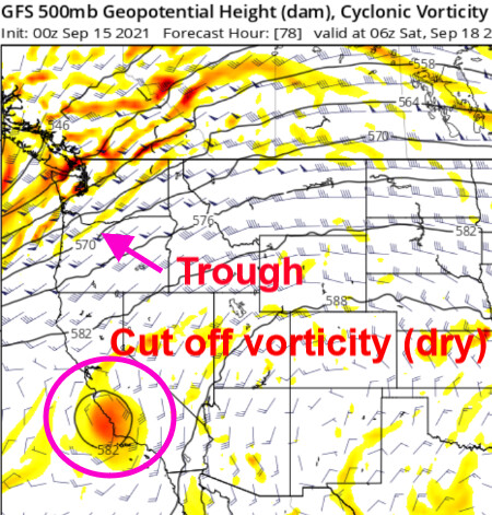
The large trough set to impact the Pacific NW into the Great Basin’ position is being dictated by a cut off low off of the coast of CA. This cut off low/vorticity is opening the door for the trough to move further south on model runs. As many know cut off features are a pain to forecast and depending on when it ejects or where it goes it could change the southern extent to troughing and potential precipitation impacts. We will watch for the trend on how far south precipitation extends, as stated before early season storms tend to be too bullish in the middle-long range of the forecast window.
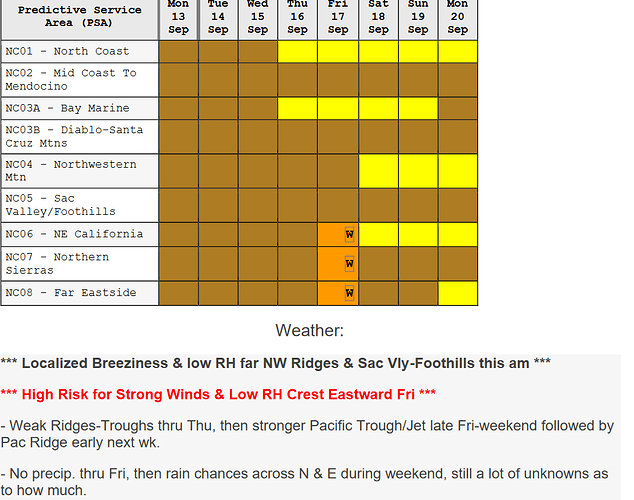
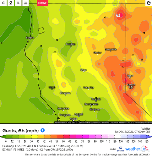
What is certain to me is not the strength of the offshore flow, but the intense onshore winds that will occur ahead of the trough Friday and Saturday. High risk days due to wind impacts have been added for zones NC06, 7, & 8 on the North Ops forecast. Any new starts during this initial onshore wind time period could see high growth despite marginal RH values.
strong onshore flow could warrant wind advisory to potentially high wind warnings for the Sierra crest.
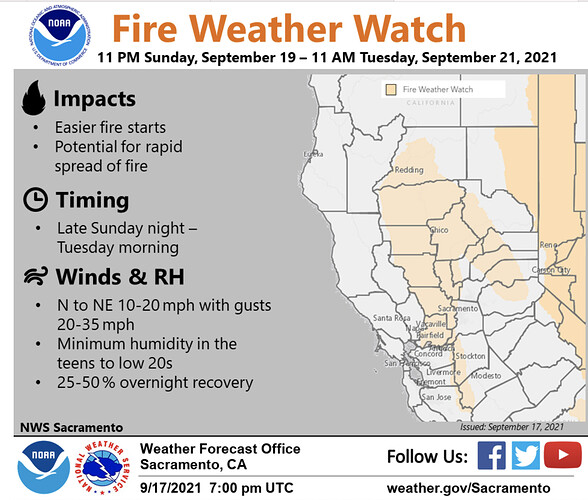
There is going to be a dramatic transition from strong onshore flow this weekend to moderate (potentially strong) offshore flow Monday-Tuesday, with rising heights high temperatures will potentially swing 30 degrees in some areas in only 36-48 hours.
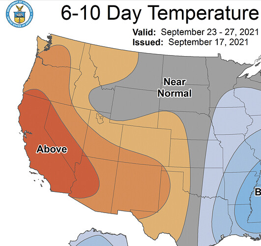
Residual offshore flow through next week will keep temperatures hot and fire weather conditions elevated. If the strong onshore flow causes large fire spread on already burning fires it will lessen the impact any precipitation that does fall on fire suppression
Some good intel on the short term as well as through the rest of the month. Some good news in the short term for NorCal especially crews working in the Klamath and then a turn to warmer dryer with continued fire weather concerns.
NWS Forecast
https://www.weather.gov/sto/
With the early season strong trough that is pretty quick moving and the north pacific ridge is going to build in behind it. The large size of both features is going to make for gradient driven offshore winds as cold air advection to the surface is pretty limited due to the track and warm air still remaining in the Great Basin at the surface. Later into the week a low pressure system could cut off at the base of the ridge and omega blocking develop. This could keep offshore gradients going for an extended period of time.
I think the big story for the next 5-7 days is not going to be necessarily very strong winds but very warm-hot temperatures and very low relative humidity plus offshore flow. If the cut off low undercutting the ridge mid week manifests it will provide mid level instability for a more dynamic plume growth situation.
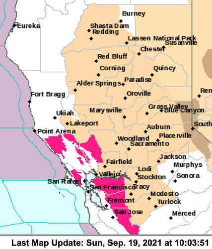
NWS: 0946 hours Sun …RED FLAG WARNING FOR DRY OFFSHORE WINDS FOR THE NORTH AND EAST BAY HILLS… The National Weather Service in San Francisco has issued a Red Flag Warning for dry offshore winds, which is in effect from 11 PM this evening to 8 PM PDT Monday. The Napa hills and East Bay hills that received less than a tenth of an inch of rain will be the areas of biggest concern. Initial burst of gusty offshore winds overnight to mid morning Monday. Drier conditions but lighter winds Monday daytime. Offshore winds ease Monday night with continued poor humidity recovery. * WINDS…Northeast 10 to 20 mph with gusts up to 40 mph. Local gusts up to 50 mph over the highest peaks. * RELATIVE HUMIDITY…Initially 30-45% tonight drying to 15-30% on Monday with little or no recovery Monday night.
