A mere 6 MPH away from qualifying as hurricane force winds…hang on to your toupee!
Mt St Helena West (PG132) Severity:92
| TIME | RH | WIND | TEMP | FUEL |
|---|---|---|---|---|
| 07:30AM | 17% | N64G77mph | 49 | |
| 06:50AM | 18% | N58G70mph | 50 | |
| 05:50AM | 27% | N58G71mph | 49 |
A mere 6 MPH away from qualifying as hurricane force winds…hang on to your toupee!
Mt St Helena West (PG132) Severity:92
| TIME | RH | WIND | TEMP | FUEL |
|---|---|---|---|---|
| 07:30AM | 17% | N64G77mph | 49 | |
| 06:50AM | 18% | N58G70mph | 50 | |
| 05:50AM | 27% | N58G71mph | 49 |
Red Flag extended until Tuesday the 11th until 1800
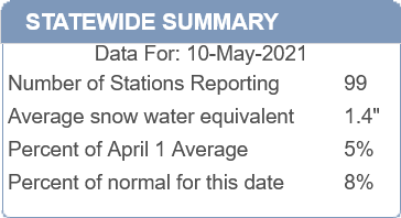
Snowpack conditions in the Sierra Nevada have fallen to 8% of normal for this day. There is an average snow water equivalent of 1.4". The average for this day is 17.4" of water equivalent.
A cut off low pressure system could lead to some convection across the Sierra with snowfall above 7,500’ this weekend. This does not look like a widespread wetting rain or snow event.
The developing trough will lead to potential Red Flag conditions across the eastern Sierra Nevada, Tahoe Basin, and desert slopes on Friday and Saturday.
There is a lot of inconsistencies in the models for next week’s weather pattern that range from weak troughing to more offshore flow.
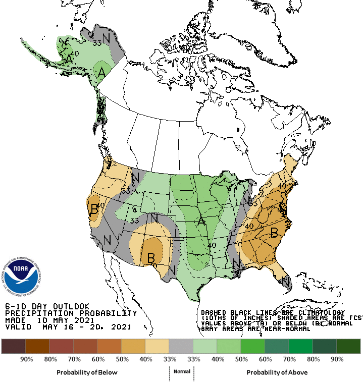
The climate prediction center indicates below average precipitation despite the upper level low next weekend.
Wonderful 
I’m not into the doom and gloom propaganda the media puts out but if this trend continues we will run out of water reserves at some point this year IMO. We haven’t had a really big heatwave yet and the only snow that is remaining is at elevations where sublimation and evaporation takes most of whatever you want to call is left.
Incredible GIF.
NE CA Red Flag for Dry LX
https://www.weather.gov/source/wrh/fwxMatrix/print.html?zone=CAZ285
Red Flag warning in Siskiyou County for lightning.
The Sierra Nevada snowpack is down to 2% of average for this date. A winter weather advisory is in effect for an unseasonably cold low pressure system that will be centered over the Tahoe Basin. Snow levels will be 5000’ with snow up to 5" at highest peaks. The issue with late season snow is the high sun angle will melt and sublimate a lot of it before it can compound into ice at higher elevations.
At least it’s something.
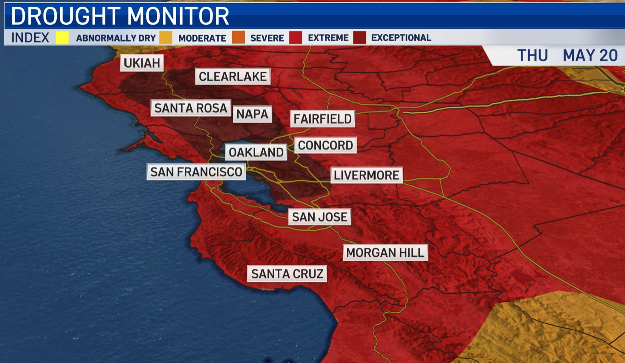
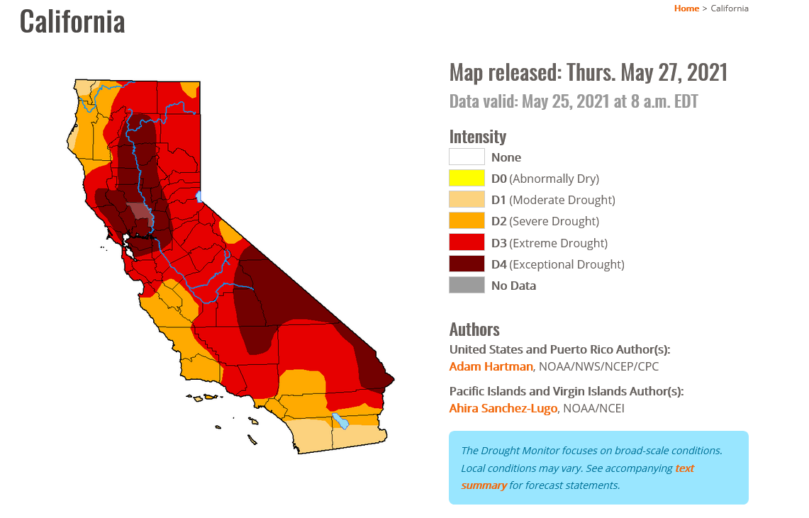
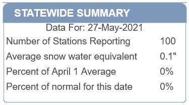
Exceptional drought increases to 26% of the state as Sierra snow pack now at 0%. 32 days until summer signals possible water catastrophe as we enter the dry season.
Not even being dramatic that’s not good.
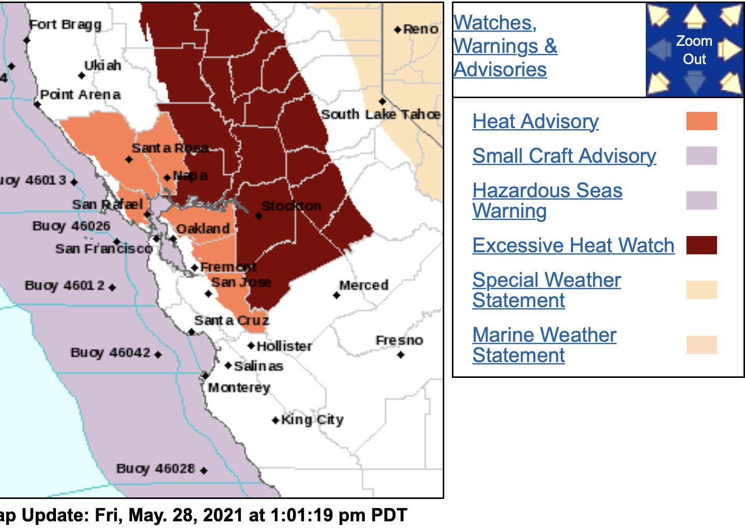
NWS San Francisco Bay Area 1241 PM Fri May 28 2021 …HEAT ADVISORY IN EFFECT FROM NOON TO 9 PM PDT MONDAY… These will be some of our hottest temperatures of the year thus far. Temperatures expected Monday in the low 90s to low 100s F in the interior North Bay and East Bay. Sea breeze will keep temperatures along the coast and bay in the 80s and low 90s. Overnight lows will be in the 60s and 70s in the hills, so expect little relief. These will be some of our hottest temperatures of the year thus far.
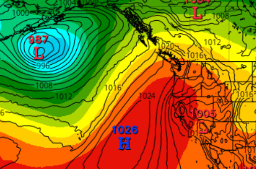
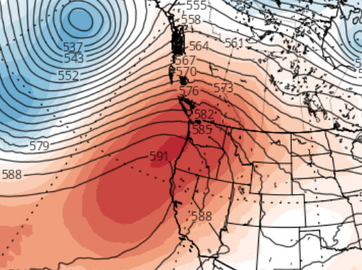
Very odd high pressure development off the coast of Oregon and Northern CA for this time of year.
What will this do?
Most likely drying out fuels quicker, which means earlier fires in relation to a “normal” fire season. Fires will also be larger earlier in the fire season with fuels so dry, due to lack of rain/moisture.
Is this the return of the Really Resilient Ridge?
High pressure doesn’t necessarily mean bigger fires. Fuels are critically dry, yes, but high pressure usually means a stable atmosphere, less plume-driven fire behavior, and milder winds. In the glory days (1980s) of CDF VMP program, long hot spells were a good time to do big aerial ignition burns in Eastern Tehama County grass and brushlands.
In regards to the abnormal high pressure, it is taking a weird track, shape, and strong for this time of year all the way up to Washington state.
Excessive heat warnings are in effect. More drying, more evaporation of water. Still 22 days until summer starts.
Yes sir! Absolutely