
Still seems to be hammering away in the Modoc-Lakeview-Bly area.
1 Like
Any precip with this?
Hitting various RAWS in the MDF area, last 24hrs:
Blue Mtn 0.11"
Devils Garden 0" (aircraft working right near here)
MDF Portable by Blue Lake 0.01"
MDF Portable near Weed Valley 0.08"
Timber Mtn 0"
Indian Well (Lava Beds NM) 0"
Tule Lake/Klamath Basin area all showing 0"
Alturas Airport - trace
Cold Springs (upper Warner) 0.02"
Bear Flat (lower Warner) 0"
I could go on, but this is getting depressing
Oregon Klamath/Lake Co
Lake Abert area 0.14"
Summer Lake area 0.37"
Beatty 0.11"
Upper Klamath Lake 0.01"
6 Likes
Looks like a strong thermal trough next week, with some sub tropical moisture coming up from the south… during what looks like a record breaking heat wave.
Boundary level winds with a thermal trough can bring some strong winds.
2 Likes
URGENT - FIRE WEATHER MESSAGE
National Weather Service Medford OR
319 AM PDT Wed Jun 23 2021
…Abundant Lightning Expected This Afternoon and Evening…
…Scattered Thunderstorms Possible over Northern California
Thursday Afternoon and Evening…
Low pressure centered southwest of the area will send a series of
disturbances into the area from the southeast. Scattered
thunderstorms on dry fuels are expected over much of western
Siskiyou County and along the Siskiyou mountains in fire weather
zones 280 and 621, as well as the Cascades in northern zone 623,
and northern and central portions of zones 624 and 625. Isolated
storms will be expected over a wider portion of Southern Oregon and
Northern California. While most storms will produce wetting
rainfall, significant lightning on dry fuels is expected.
Scattered thunderstorms are possible again Thursday, but should
remain confined to northern California.
7 Likes
Cell in bound to Lassen and Modoc counties looking at cameras
2 Likes
NWS Sacramento 3:54 AM PDT Thu Red Flag Warning for Abundant Lightning with Dry Fuels over the Shasta County Mountains and portions of Eastern Tehama and Western Plumas Counties… .A low pressure system off the coast will bring the potential for thunderstorms this afternoon and evening over portions of the mountains and foothills of interior Northern California. Scattered thunderstorms with abundant lightning are possible over the mountains of Shasta County into eastern Tehama and western Plumas counties. With the recent hot weather and very dry fuels, lightning could result in the high potential for fire ignitions. Some thunderstorms may contain gusty winds and have limited precipitation. High probability of fire starts with any lightning strikes. Any fires that develop will likely spread rapidly.


7 Likes
Red Flags from Modoc and southward . Seeing LALs of 6 in some places
2 Likes


ERC charts are showing record values for much of California, and the topic has been getting a lot of press, but ERCs sometimes feel like an abstract idea that’s hard to translate to what we might expect to see on the fireground. Does anyone working on our current fires have any comments on what fire behavior is like compared to past seasons in similar fuels and terrain?
4 Likes
Looking at the Salt fire from I 5 today I would say. POOF!
4 Likes
End of the season behavior at beginning of the season dates in NorCal fuels. Burn periods lasting 23 hrs and fires can already be mainly fuels driven instead of being predominately wind and terrain driven.
7 Likes
Watching a WNW/NW wind event that could develop in northern CA on top of extremely hot temperatures next Sunday-Tuesday time frame. A shortwave moving through Washington will tighten gradients and provide some upper level support. Example: temperatures could be in the 107-116 range near Redding with gusty winds.
Windy and hot conditions could develop as soon as Thursday, but the worst conditions look like it will be on Monday.
Found this tidbit from the NWS Medford AFD

6 Likes

Fires are moving with ease through the brush. There is a lot of spotting, but nor anything over 1/4 mile that I saw.
The dead fuels are holding spots for several days and then waking up. In most places total consumption of fuels, including the timber. On the Tenant fire when it was in alignment, it took everything. It also displayed extreme fire behavior with a rotating column and a large fire whirl making it off the continuous fuel and even out into an agricultural field.
It is not surprising when look at the ERC’s and the fuel moisture levels. We have to realize that the fuels are not just dry but they have changed. The dead component will carry fire earlier in the year and even when the RH is higher. August and September could be really rough months…
9 Likes
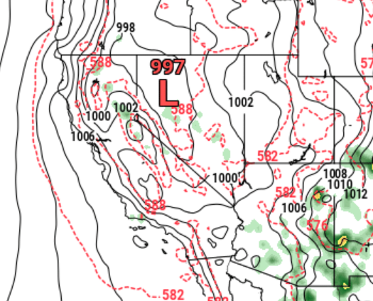
Looks like a thermal low develops near Redding.

It’s a potentially dangerous weather situation that reminds me of the Carr Fire whirl/tornado (whatever you want to call it). Any plume dominated fire will tap into some winds above the surface and could create some extreme fire behavior.
8 Likes
Boundary level winds can be tricky, potential to enhance nighttime fire behavior and bring lowering RHs to the ground level…
Your thoughts?
3 Likes

