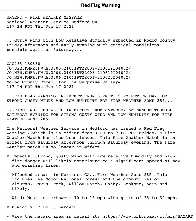
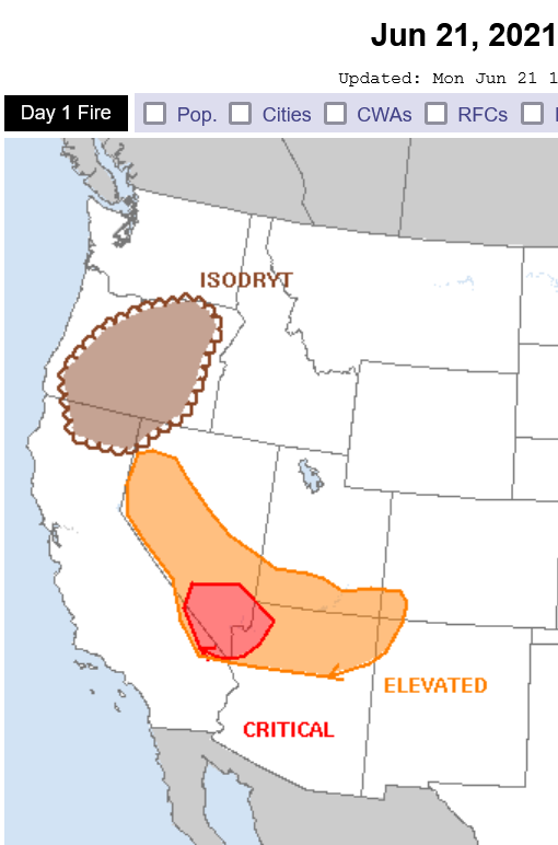
Good morning. As the trough axis slides to the north it will set up offshore gradients. Locally critical fire weather conditions will be possible Tuesday night into Wednesday as some offshore winds surface.
8 Likes
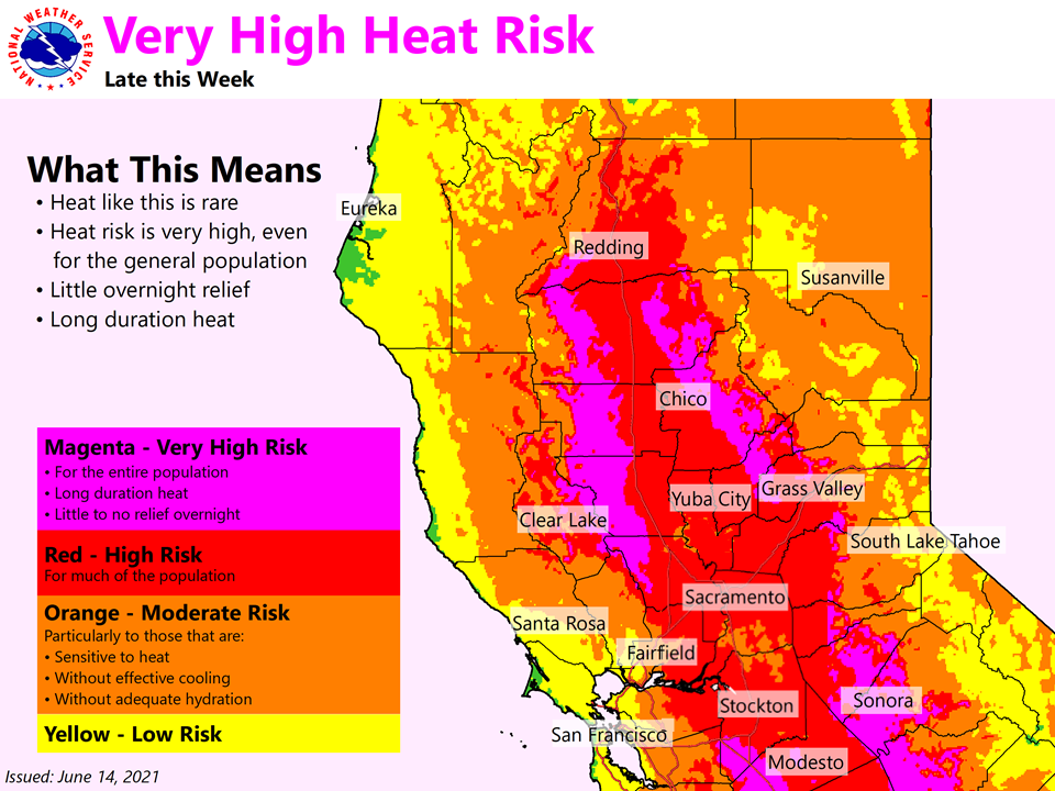
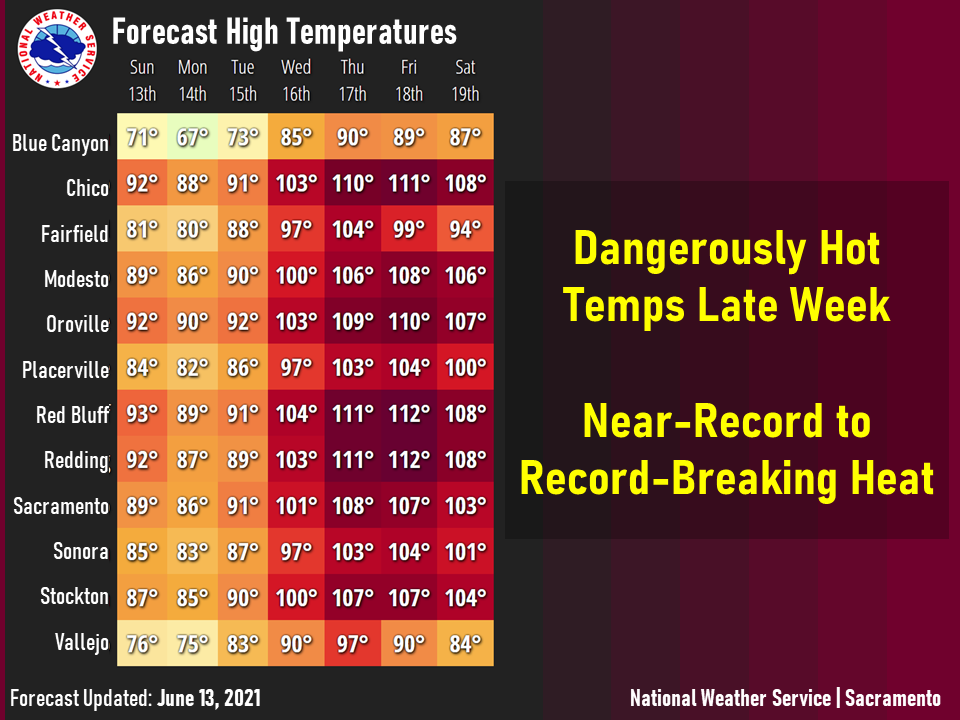
This update pertains to the entire state, but since the focus of the next heatwave will likely be North Ops I am posting here.
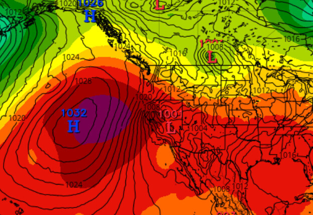
As the ridge begins to wind down a bit a trough of low pressure will encroach on Western CA through middle of next week. After the trough slides into the Great Basin, a monstrous high pressure system develops off of the Northern coast of CA. As this feature amplifies in strength, the trough over the Great Basin cuts off and retrogrades south off of the Southern CA coast at the end of next week.
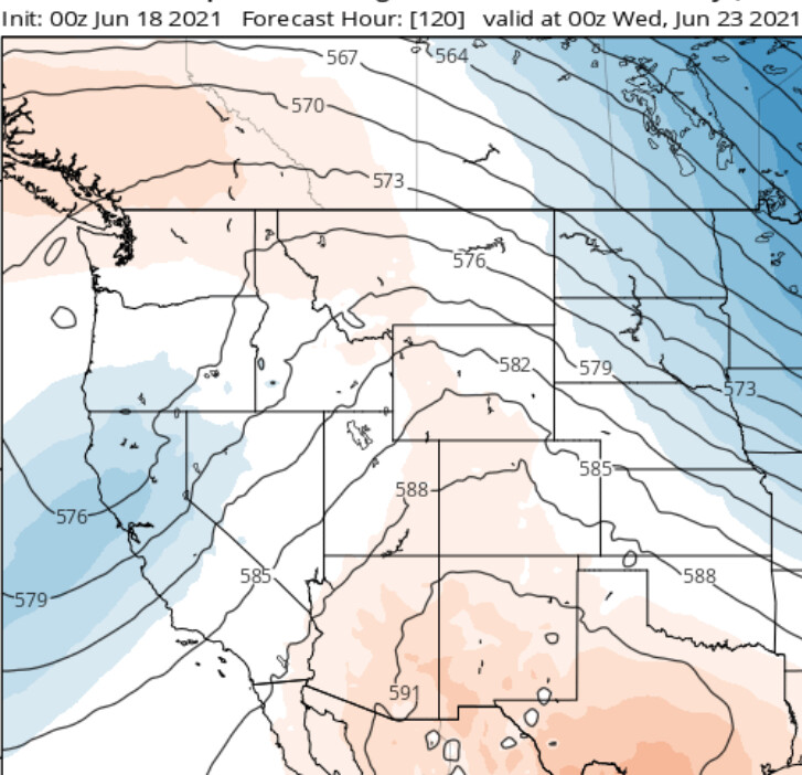
Weak troughing through the middle of next week.
As the low pressure system cuts off, it becomes a nightmare of a forecast. Cut off low pressure systems are an absolute nightmare. There is the potential for a significant heatwave in North Ops in about 7-8 days. As this low pressure system cuts off, it will likely cause offshore, downsloping flow which will aid in drying and heating temperatures up. Tonights run of the GFS goes Del Scorcho with the upper level high pressure system, and I am highlighting this because there has been some consistency.
Day 8 upper level heights
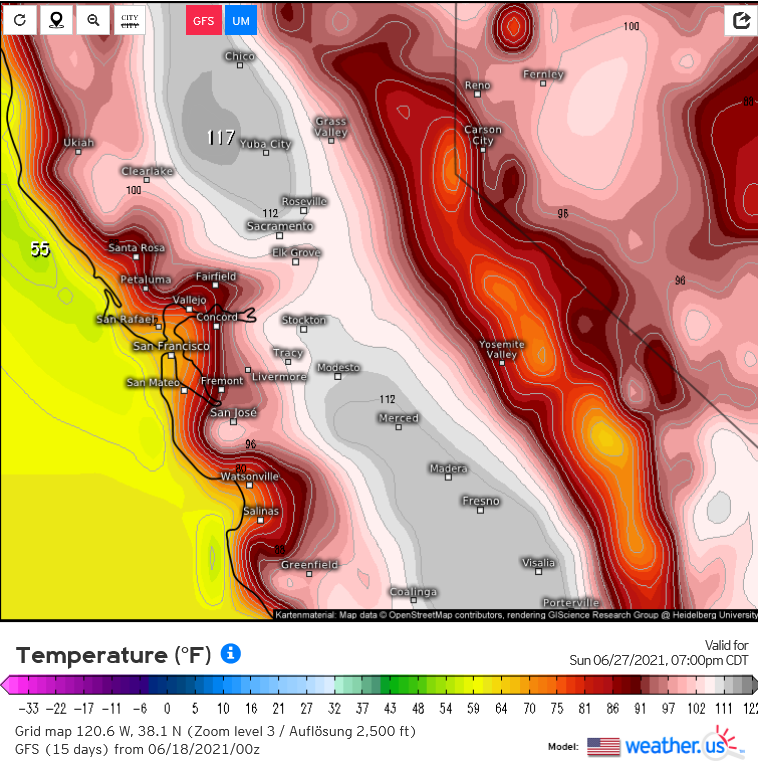
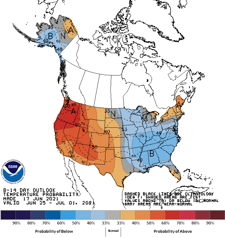
You can see in this image temperatures very hot, enhanced by the offshore flow and upper level heights. While this may not verify, at the very least another heatwave is likely on the cards. The climate prediction center gives high odds on both the 6-10 and 8-14 day outlook.
6 Likes
Anvil
You’re full of all kinds of good news. Sayings such as “hotter than the Devils Taint after eat ghost reapers” comes to mind or my new favorite “it’s gunna be a real witch burning torch festival”
Do you have any GOOD NEWS?
5 Likes
Well, since we are in the age of Aquarius now… the news for the planet only gets more good from here on.
The humans not so much
11 Likes
Another not ‘good’ update.
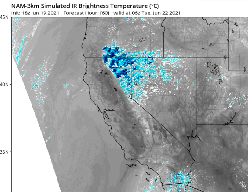
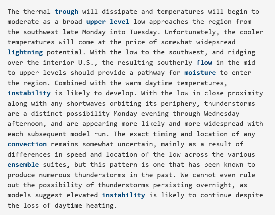
As a trough of low pressure moves towards CA, it pushes on the ridge. This opens up a stream of mid level moisture from the remnants of Tropical Storm Dolores which has just made landfall in mainland Mexico. The moisture will interact with the trough and could generate some elevated convection with dry lightning potential early next week… Monday night-Thursday time window. Best chance is NE CA.
From NWS Medford AFD
7 Likes
Any update on this and the possible lightning activity it may generate
3 Likes
I was going to ask the same question of our wildland fire intel weather experts. Any update on this?
3 Likes
The storm prediction center has issued a delineation for isolated dry thunderstorms today-tonight. Some storms will bring rain. Most widespread over Oregon.
5 Likes
Dr. Swain from Weather West addressing the unrealistic numbers the GFS is spitting out for the upcoming heat wave.
2 Likes
3 Likes
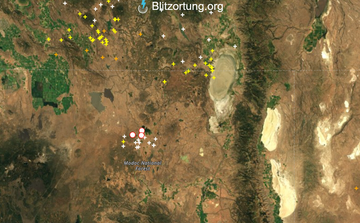
Cells building here in SW Siskiyou County but no thunder yet.
6 Likes
Look like some good build up in the Klamath Falls CA border area.
1 Like
Here is great website to track lightning.
2 Likes
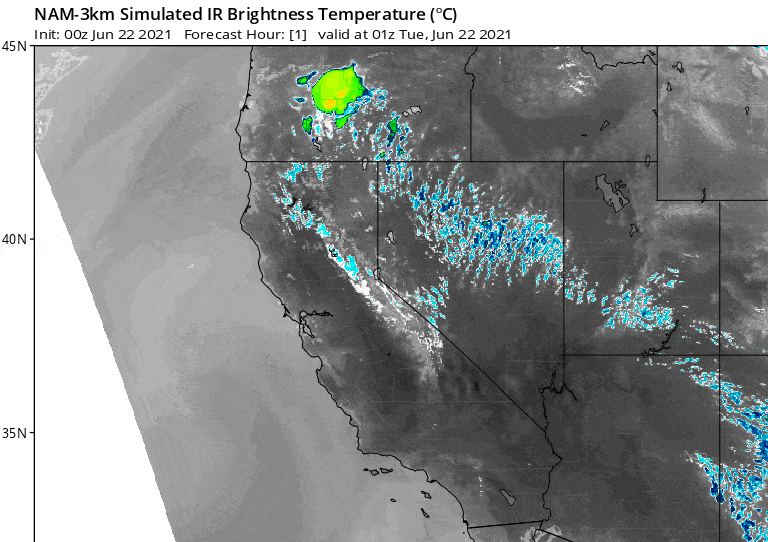
The NAM initiates nocturnal convection over the next couple hours and sets up what looks like a mortifying lightning event from Northern CA to almost all of Oregon.
3 Likes
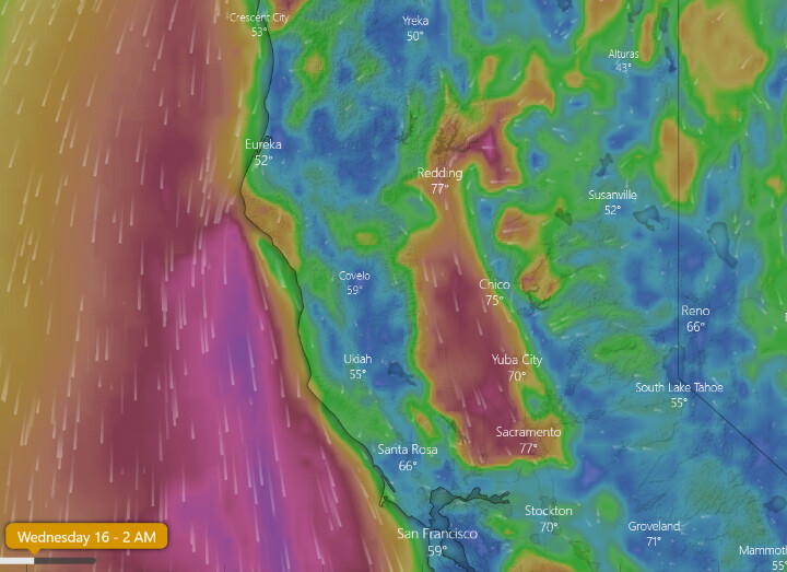
Current satellite and personal validation showing organization and vertical convection from the Shasta/ tehama county line NW thru central Sku
Verga visible over shingletown … And I-5 corridor +/- dunsmuir proper.
5 Likes
Yes saw on the cameras as well. Radar echoes starting to show up in Northern CA.
3 Likes
I truly hope this doesn’t pan out.
5 Likes