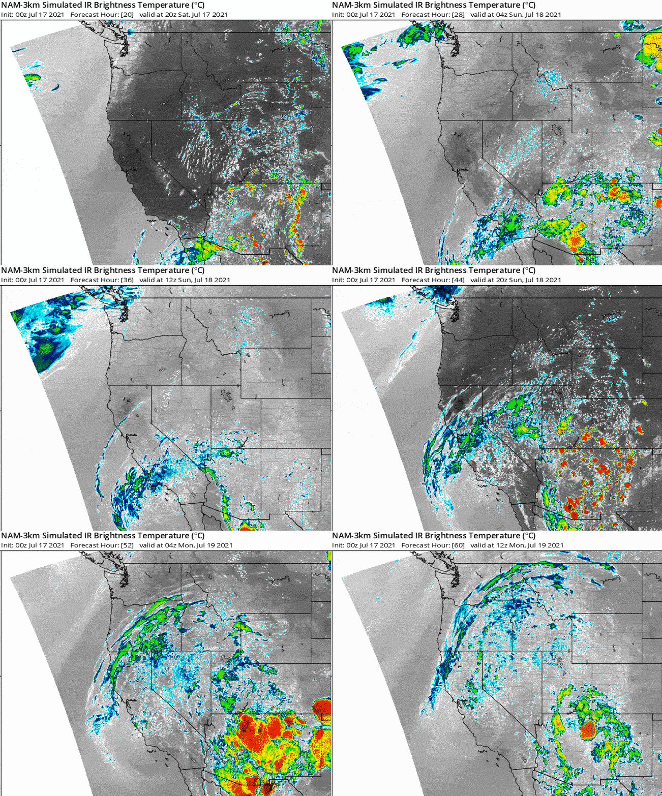
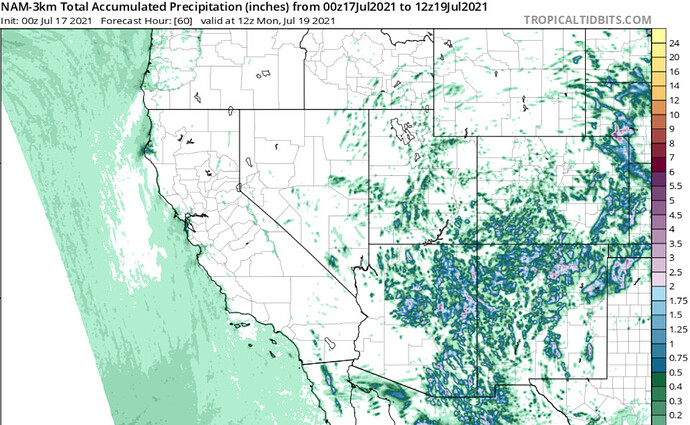
If tonight’s NAM-3KM model run comes to fruition it could be a widespread thunderstorm event. Northern CA PWV could remain under 0.85" for a few hours which would help promote dry thunderstorms. Despite the higher PWV’s the NAM generates essentially no precipitation in most areas.
NSW - SF 9:30am Saturday:
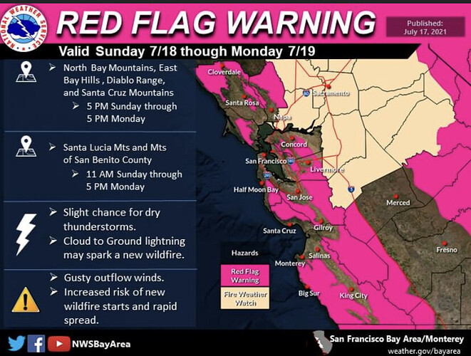
The watch will likely be upgraded to a Red Flag Warning with the afternoon package.
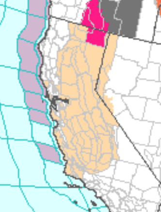
Latest 12Z model guidance continues to paint a pretty ominous picture for the Bay Area with regards to lightning. There are still noticeable differences, specifically in timing of thunderstorms, but models still show a potential beginning mid morning Sunday lasting well into Monday. Theres also a little bit of debate with wet vs dry thunderstorms. It still looks like a mix of both, but given the state of fuels over the higher terrain any lightning isnt good. The Fire Weather Watch remains currently in effect, but once all the guidance in and collaboration with fire agencies/neighboring forecast offices is complete the watch will likely be upgraded to a Red Flag Warning with the afternoon package. By no means is this scenario a slam-dunk.
Forecasting dry lightning is always a challenging forecast as many factors have to line up.
If you live in a fire prone area, regardless of the Fire Weather Watch, it`s always good to have a plan in place if a fire starts. Be weather aware through Monday as details become more clear and the forecast gets fine tuned.
I can concur, based on experience that (along the coast anyway) the worst lightning outbreaks come in from off the ocean. I saw this in HUU in 2003. We saw it coming and within an hour or two we had 65 active fires. There were also fires from Santa Cruz clear to the Oregon border. The old timers in HUU say it happens about every 10 years.
If lightning is coming in off of the ocean - heads up!
2020 August lightning event animated for a comparison.
I don’t think I’ve ever wanted forecasters to be wrong as much as I do starting now and over the next 48 hours.
The “bust potential” is high with this potential event (and you can read this either way: “forecast bust,” where’s there is very little dry lightning, and “lightning bust,” where there are a lot of dry strikes and subsequent ignitions). It’s a fine line between “(virga) showers that don’t produce much if any lightning” and “high-based thunderstorms that produce numerous CG strikes.” Satellite imagery right now suggests that we’re right on that boundary as of noon, though just on the “tall shower”/minimal lightning side. That may well change later, but my fingers are crossed there isn’t quite enough vertical development for widespread lightning. It really could go either way…
Dr. Daniel Swain’s take…pretty similar to what your thinking…
" Weather West17 minutes ago edited
Update: first wave of elevated convection is lifting into central CA. No recent lightning with this–just a lot of virga and maybe a few light showers. Expect a bit of a break later today before second wave moves in overnight into tomorrow AM.
Big question remains: will we just see “tall showers” or “shallow thunderstorms?” The line between having convective towers that have enough charge separation to produce cloud-to-ground lightning vs. not is extremely thin in dry lightning set-ups, so I don’t think anyone really knows. Clouds right now are just on the edge–a few thousand feet deeper and they will probably start producing lightning, but if they don’t get any taller than they are now then there could be minimal lightning. I honestly have no real insight into which way things will go, other than watching the radar today. Fingers crossed!"
No coincidence there…we are one and the same. 
That’s funny
Oh !!! Had no idea…I’m Jim from Watsonville on WW
The forecast models did a really bad job handling this mornings thunderstorms across Southern California, but they materialized.
We will most likely see some surface based thunderstorms form across the Sierra, then as the surface starts to cool & the cut off low interacts with vorticities and thunderstorm complexes nocturnal convection tonight into tomorrow morning that would bring the biggest chance of widespread lightning. These lighting events happen at night due to the middle levels becoming unstable and driving convection rather than the surface.
We had some dry thunderstorms across the southern Sierra Nevada as evident by the holdover fires and Peak Fire… but the widespread lightning event busted for the most part.
A large inverted trough is swinging through New Mexico and will position itself of the waters of Southern CA Saturday night. The trough will be negatively tilted and this will allow for easterly waves to rotate around it through Tuesday. As the moisture ascends north there should be some thunderstorms that develop as the easterly waves interact with the trough. There should be a mix of dry and wet thunderstorms.
The trough will lift north off of the waters of the Pacific ocean Tuesday night-Thursday and this will likely be the highest chance of elevated thunderstorms with widespread dry lightning across North Ops.
The trough will be a bit stronger than the last one, and its over water position should lead to drier air at the surface.
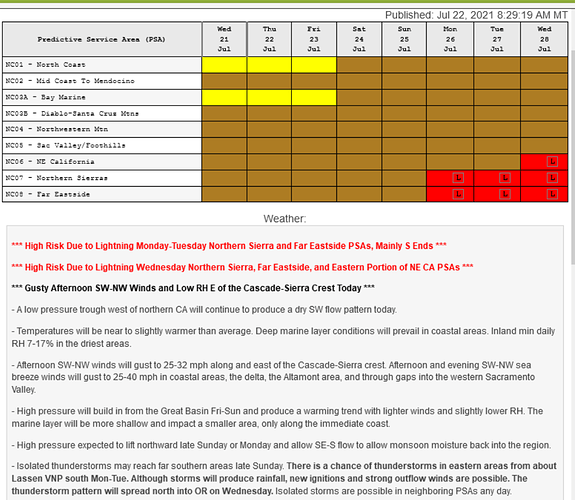
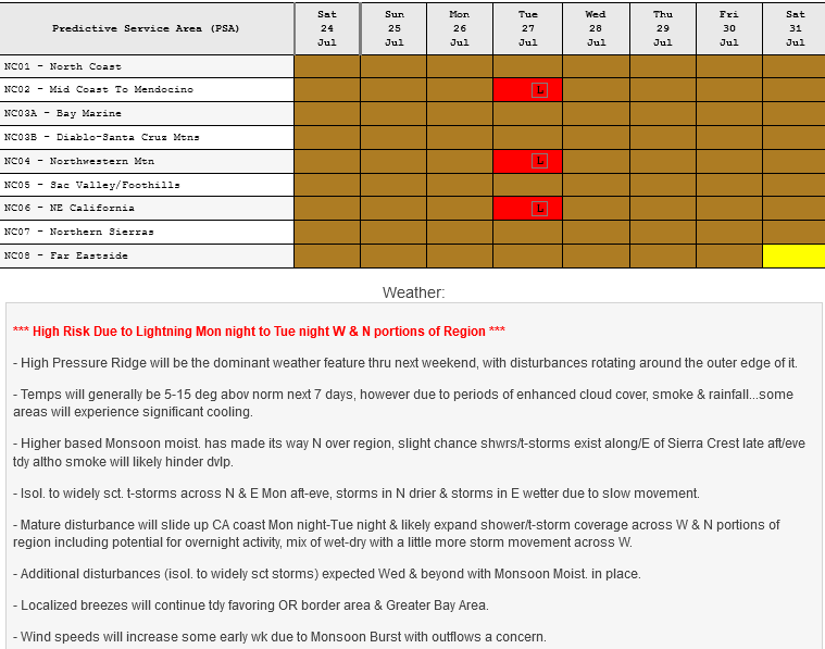
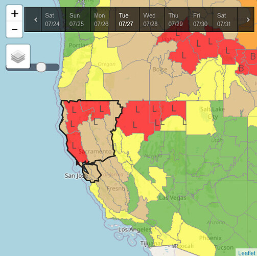
High risk lightning days have been added by North Ops predictive services for the following:
Any update on the severity of the possible lightning that was forecasted?
Some thoughts from this AM:
The NAM is pretty bullish for thunderstorm activity especially in the far north of the state. I think the greatest threat of dry strikes will be in Oregon. There is more mid level ascent and overlap of drier conditions there.
It’s probably going to be a mix of elevated thunderstorms and a banding feature with rain. Best chance of dry lightning will be in what you’d call the warm zone ahead of the trough axis in the elevated convection.
LAL’s of 3 for much of NE CA today.
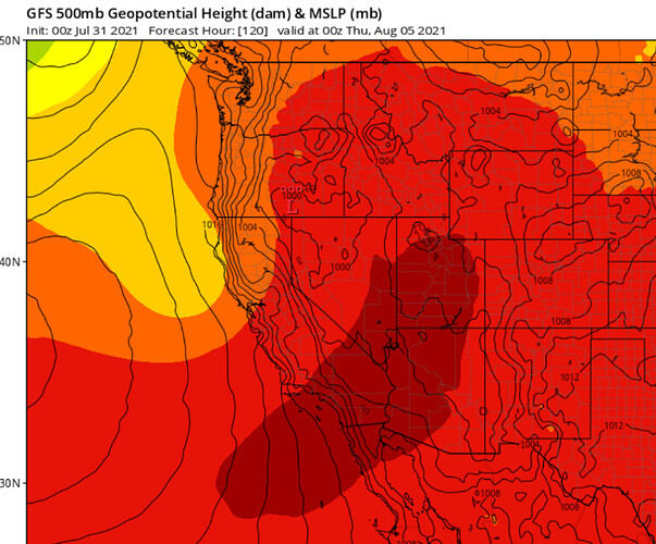
To go along with the dry lightning threat and any holdover fires the next few days, the GFS shows an upper level shortwave significantly increasing onshore winds next week.
From SPC
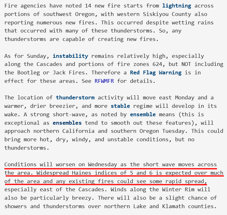
From NWS Medford…
Reinforcing the above thought process, strong shortwave is going to move across Northern CA bringing onshore winds and potentially explosive fire conditions.
Wednesday looks pretty bad.
To make things even more interesting, in even more vigorous shortwave trough drops out of Canada on Friday and increases winds again into next weekend. Will have to keep an eye on that and not overforecast that right now.
