…Gusty Winds and Very Low Humidity Will Bring Critical Fire
Weather Conditions Wednesday Afternoon Through Early Thursday
Evening…
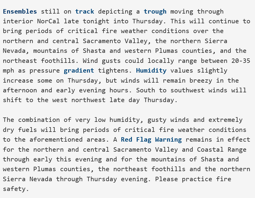
.A dry system will move onshore late Wednesday into Thursday. Gusty
winds will combine with very low humidity and extremely dry fuels
to bring elevated to locally critical fire weather conditions
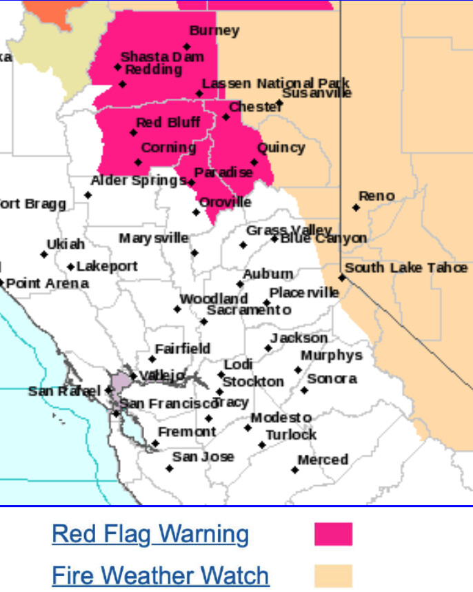
over the northern Sacramento Valley, mountains of Shasta and
western Plumas counties, and the northeast foothills. Winds in the
northern Sacramento Valley peak Wednesday afternoon and early evening. Relative humidity levels gradually increase over low
elevations on Thursday, with ridges remaining dry and afternoon
winds increasing again, and continuing into the evening.
WIND…Southwest 10 to 20 mph with local gusts up to 35 mph.
Strongest wind expected later afternoons and evenings. Winds
shift to the west northwest late day Thursday.
HUMIDITY…Minimum humidity in the single digits to mid teens.
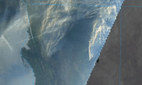
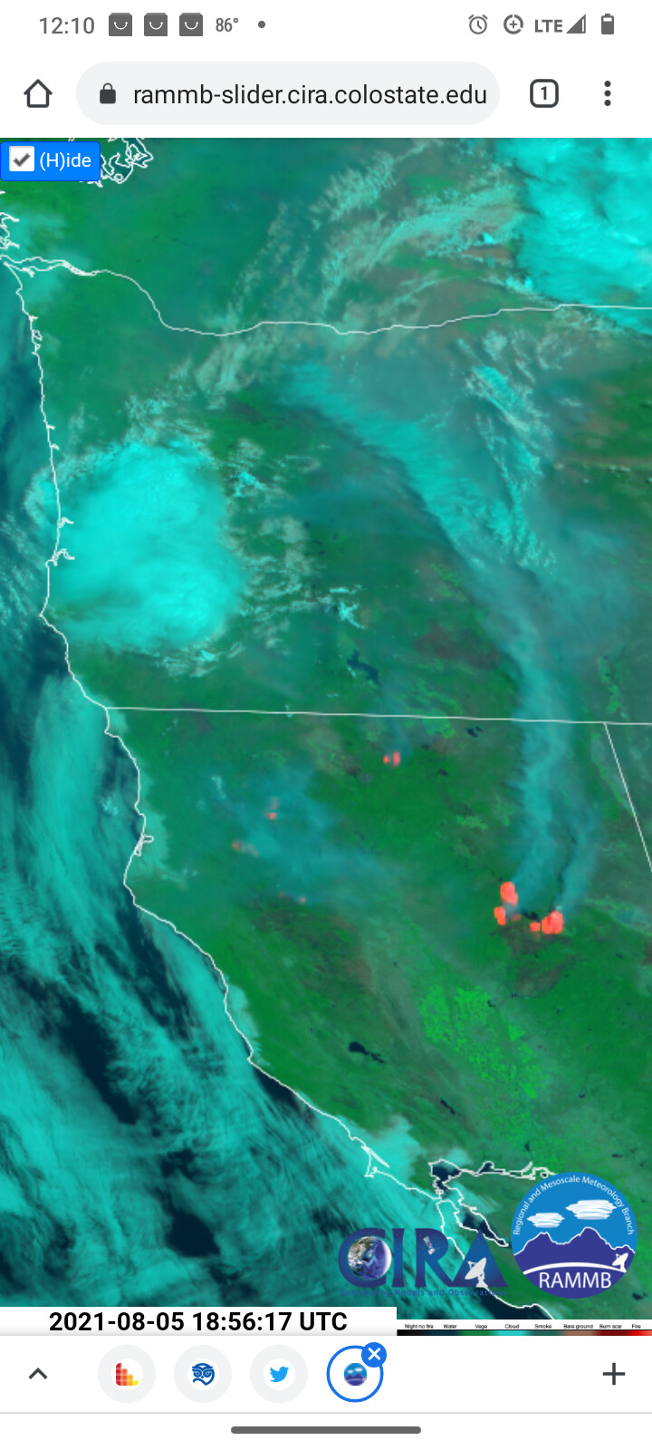
FIRE WEATHER…Updated 825 PM PDT Aug 4 2021…A challenging weather scenario is expected over the next 24-36 hours. The region will quickly transition from hot, very dry, windy with unstable conditions through early Thursday afternoon, to cooler conditions with improving humidities, strong shifting winds and thunderstorm potential Thursday afternoon and evening. During this 24-36 hour period, the weather pattern will shift from high pressure over the Four Corners/Nevada Region with low pressure offshore today to low pressure to the east and a more zonal flow pattern over the region. Increasing winds today were in response to an upper leveltrough offshore approaching the region, tightening pressure gradients and pushing the thermal trough farther inland. This upper trough will move through the region on Thursday and will result in another critical fire weather day, though critical for different reasons compared to today. Afternoon temperatures will drop by 10 to 20 degrees compared to todays readings and this will help bring up humidities as well. However, there will be a transition period during the early afternoon where strong winds/low RH result in critical conditions across the East Side and Modoc before the concern transitions to thunderstorms. Weve upgraded the Fire Weather Watch to a Red Flag Warning, and its sort a hybrid product. The first few hours of the [Red Flag Warning](https://www.weather.gov/glossary/index.php?word=RED+FLAG+WARNING) (its valid from noon to 10 pm Thursday) will be for strong winds with low RH, then transition to abundant lightning on dry fuels. This Warning is for FWZ 624, 625 and 285, including the Bootleg Fire. While each zone may not see both abundant lightning and/or strong winds with low RH, theres no arguing that tomorrow is a critical fire weather day and the wind element is the most concerning. First with the low humidities anticipated during the earlier portion of the day, then with shift in [wind direction](https://www.weather.gov/glossary/index.php?word=WIND+DIRECTION) anticipated during the afternoon (from southwest to west/northwest), to strong gusty and erratic [outflow](https://www.weather.gov/glossary/index.php?word=OUTFLOW) winds with any thunderstorms. Regarding the [thunderstorm](https://www.weather.gov/glossary/index.php?word=THUNDERSTORM) potential, isolated thunderstorms are certainly possible from the Cascades eastward and across northern California. Scattered coverage seems most likely across FWZs 624 and 625, maybe even into the northern portions of the Modoc. This is where the SREF calibrated [thunderstorm](https://www.weather.gov/glossary/index.php?word=THUNDERSTORM) guidance highlights a 20-30% chance of thunderstorms across the aforementioned areas, so we have added a slight chance of thunderstorms for those areas. The [SPC](https://www.weather.gov/glossary/index.php?word=SPC) HREF is also concentrating the strongest [convection](https://www.weather.gov/glossary/index.php?word=CONVECTION) in these areas. Of course the wildcard in all of this is the concentration of [smoke](https://www.weather.gov/glossary/index.php?word=SMOKE) across the region. If thick enough, it can inhibit surface heating thus limiting [instability](https://www.weather.gov/glossary/index.php?word=INSTABILITY) and weve also seen smoke be an inhibiting factor in thunderstorm development. However, there are some strong dynamics associated with this trough, and it difficult to ignore this. Therefore, have gone ahead with the abundant lightning on dry fuels for Thursday
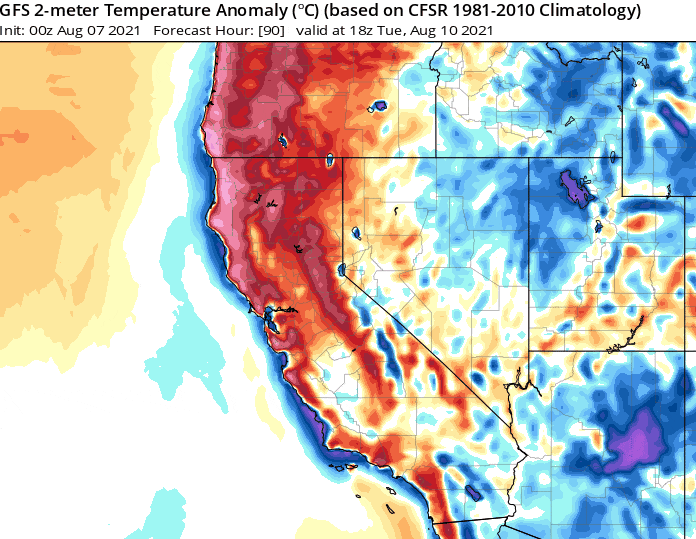
Without getting scientific, it’s going to be hot as hell.
There is going to be some mid level moisture present. Extremely dry at the surface. So instead of the inversion squashing plume potential there should be pyrocu growth during this time period.
On Monday an area of low pressure cuts off west of San Francisco. On Wednesday and Thursday an inverted trough over Southern CA advects mid level moisture into the area and interacts with said cut off trough. For North ops the deep moisture remains south and east so there will be a threat of dry lightning across the Sierra’s, Mendocinos, and Klamaths.
The soundings don’t show overwhelming instability but worth watching for more fire starts.
Coming up on one year since the historic lighting event last year. What are the models suggesting for the coming weeks, month? Any significant weather events being set up?
More mid level moisture and instability, inversion already breaking, it could be quite the day.
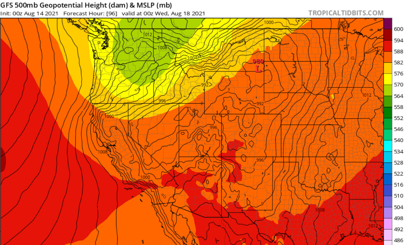
The ridge strengthens through tomorrow… then an intense trough drops out of Canada on Monday. Monday and Tuesday look explosive as onshore winds of 20-30 MPH will be widespread… with local gusts up to 45 mph. The hot-dry-windy index will reach above the 90th percentile.
Tonight’s GFS run is very bullish for gusty onshore winds as it allows the trough to undercut the ridge all the way into Northern CA
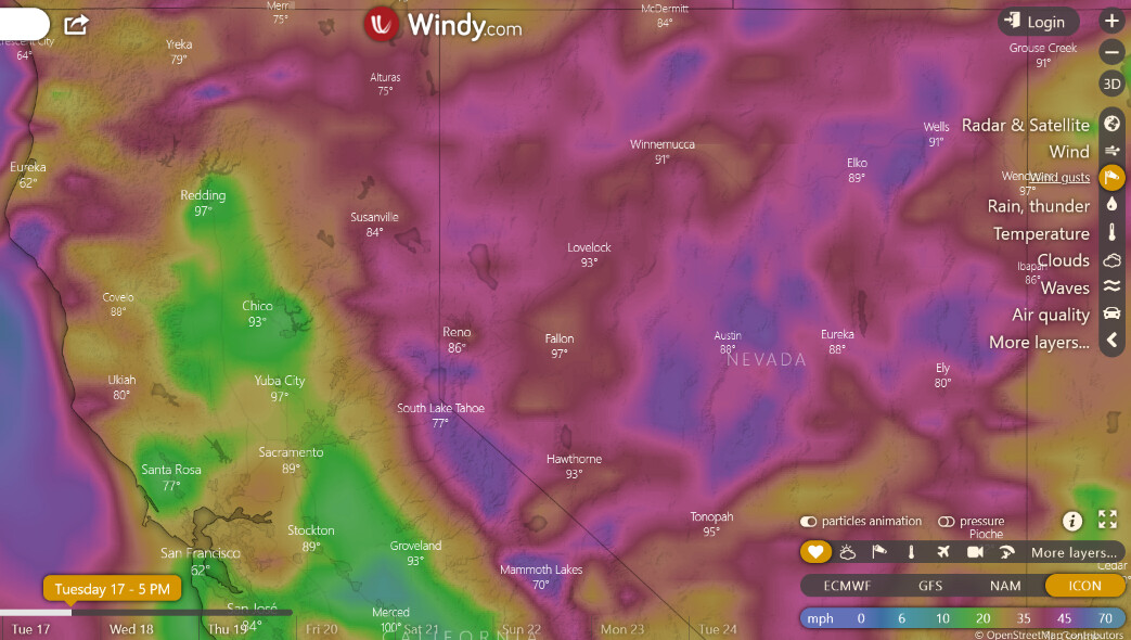
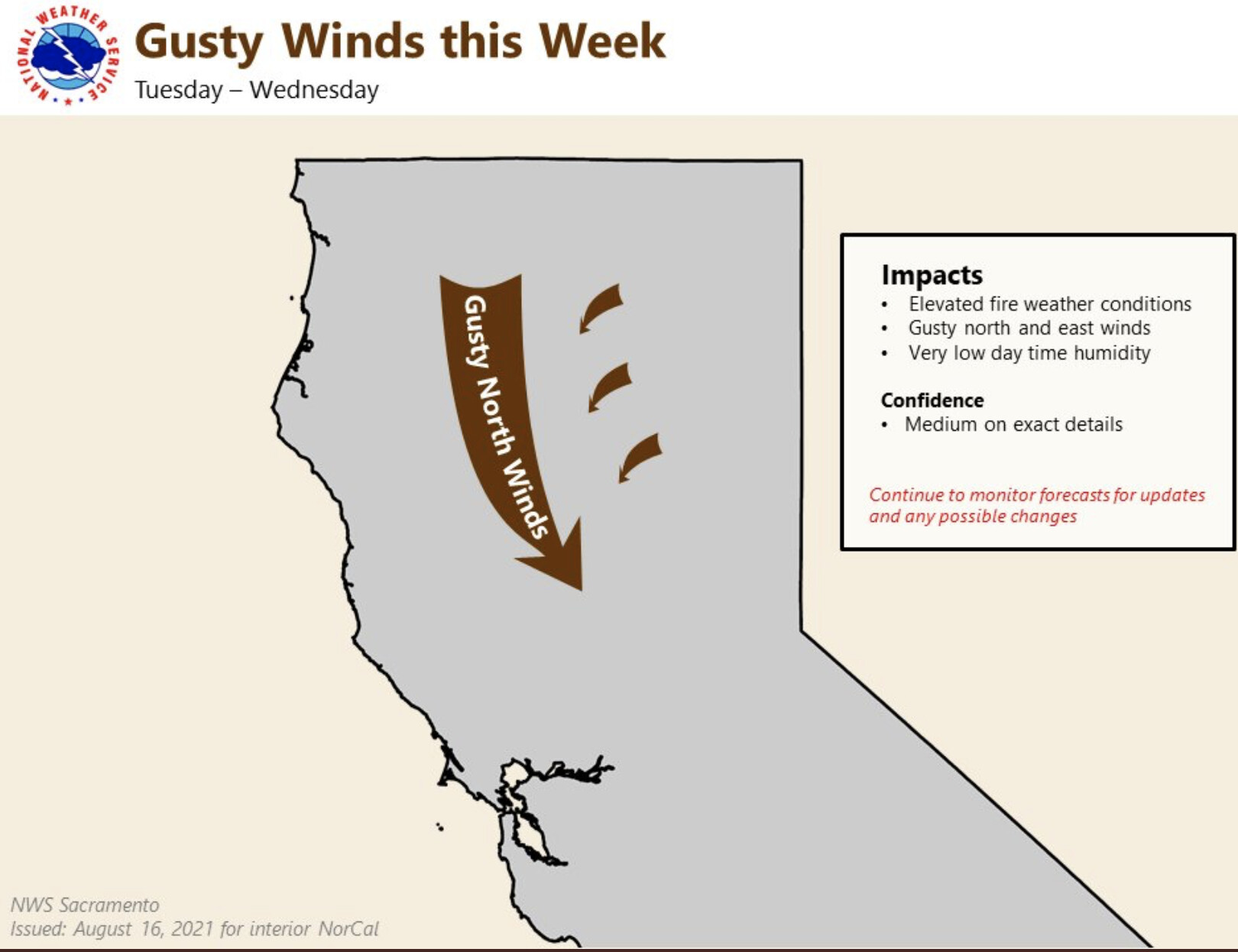
Gusty winds are forecast Tuesday - Wednesday for portions of the Sacramento Valley, foothills, & higher elevations which will cause elevated fire weather conditions.