One of the few times where just kind of lost with this pattern. The upper level low over Southern CA and Arizona tomorrow will take on some subtropical storm characteristics as it passes over the Gulf of California and produce a big rain/flood event for the deserts down here. Theoretically this below average 500 mb heights in this area should open the door for a very sharp inside slider, should a trough move into the Great Basin.
I would agree. Not that often that the PNW is experiencing large fires and fire weather and SOPS is experiencing flooding in October…
If the models continue to trend the way they have( and they could flip back), the pattern for 21-24 of October could bring in a strong( strongest of the year) wind event.
Strange to see LP causing strong storms each day across the deserts and even coast ranges of Socal…
Howard is a realtor and a weather enthusiast. We love him, but he is not the weather service. Prognostications are fun but come on now.
Well, I believe he’s been a heck of a lot better than the weather service multiple times IMO. Use Howard as a source for information, there are no guarantees with weather forecasting. I’ve seen many different weather enthusiasts on this page use them as a resource to compare with the weather service
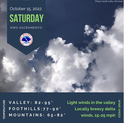
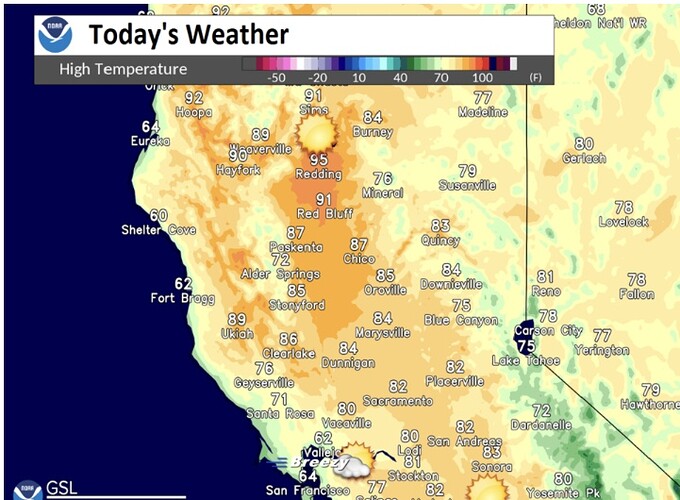
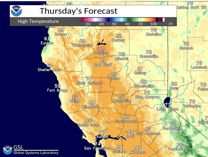
Roller coaster pattern unfolding. As was discussed last week, our first north wind event of the season is on its way. First, warm and dry will be the program for the next two days. HP builds back in and warms temps back above normal. Down slope and down canyon winds will be present and will keep temps up. Yesterday once that flow established temps went flat after sunset and actually rose in a few spots as the adiabatic warming took over with the wind.
Low RH and poor recovery will take place each day through Friday.
Friday will be a change day. LP will approach the PNW and bring some much needed rain to them. Best chances for us will be north of Redding, with most of the rain being in the higher elevations. Maybe .25 inches in SKU. HUU will get a little more.
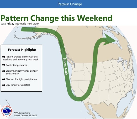
Once the front moves through( quickly) the flow will change from the NW to a more N pattern.
Friday could be a tricky day with clouds, increased RH’s and some stronger winds ahead of the front.
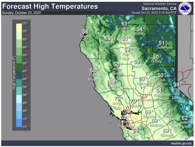
By Saturday night flow will become more typical north wind pattern. The cold air in the Great Basin and jet stream location will give the pattern the support it needs to mix the winds down. This would allow winds to work down into the valley and most likely prohibit any inversions being established.
Sunday and Monday should see the peak of the winds, might reach close to advisory levels at times.
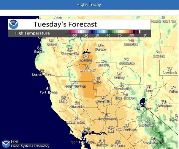
Tuesday HP moves east and sets up shop… but it appears only for a brief period of time.
Still a ways out, but it does look like another similar system will approach by Wednesday. If it takes a more western track… more rain and some decent snow. If it takes a more northern and eastern track… more wind.
Some signal for a moderate Santa Ana as well.
I am not a meteorologist… just a strap hanger.
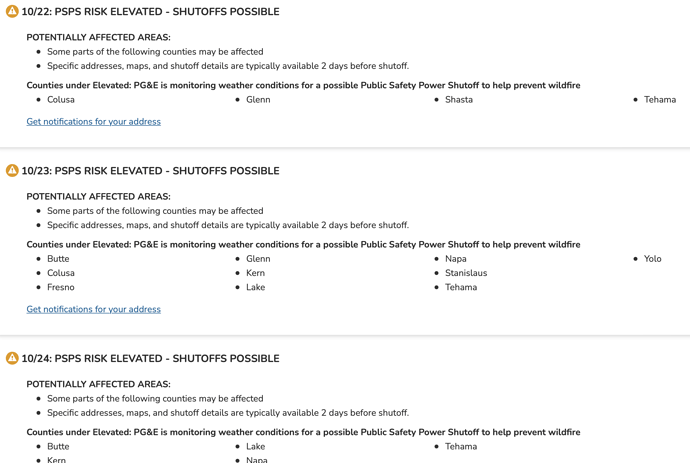
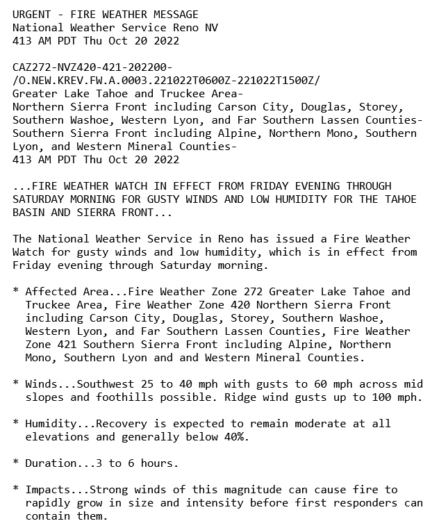
a potential PSPS event Saturday through Sunday and the forecast now shows multiple counties in elevated status for PSPS Potential. . High pressure will remain across the territory today and tomorrow with above normal temperatures expected . High pressure begins to break down late tomorrow into Friday, onshore flow will return, and cooler weather for the weekend. A weather system will begin to drop south towards the territory on Friday, then move onshore across the Pacific Northwest/Northern California Saturday before moving into the Great Basin region Sunday. As the system digs south, light rain showers will be possible across the elevated far North and terrain in the East, mainly north of Lake Tahoe. On Saturday, breezy north to northwest winds will push in along the coast, through the Bay/Delta, and into the Sacramento Valley before spreading across the state. Outside of the Coast/Delta, breeziest conditions are expected across elevated terrain and favored gaps and peaks, beginning across the North on Saturday before spreading south on Sunday. As the system swings through the region and into the Great Basin by late Saturday into Sunday, drier air will filter in across portions of the territory, dropping relative humidity levels and increasing fire danger concerns as breezy to locally gusty winds continue across the region late Saturday and through Sunday. While details around the exact track and strength of this system remain unclear at this time, confidence is growing that breezy to locally gusty winds will impact the territory Saturday and Sunday. Next week, a second weather system will approach the territory by mid-week, and another round of showers and breezy winds will be possible across portions of the territory.
So, if I am reading this correctly, it’s a cold offshore wind event, like Camp Fire, not a warm weather event?
Yes. Not nearly as strong as the 11/8 date. Initially it was shaping up a lot like that day( including SOPS Santa Ana). This won’t be near as strong and will be followed by some cooler weather the following week.
What is the most concerning is the really dry pattern we have been in and the ERC’s that are still in the 90% for several of the PSA’s.
Temps will warm briefly on Wednesday before the next system begins to make it presence known.
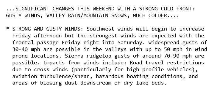
First Diablo event of the year set for this weekend. This is about 3 weeks later than what would be expected. The story of this first storm may very well be the strong onshore winds. The track of the storm system will lead to very strong onshore gradients, then shift to weaker winds out of the north. Top onshore wind gusts in the Sierra could reach above 9
0 MPH. The cold air that moves into the Great Basin will act to cool the ground, which will prime the area for future cold snaps as the season changes. The persistent longwave trough pattern could move further west from the east coast to the intermountain west as we head into November. This would bring the potential for inside sliders into the already cooled Great Basin, enhancing the threat of strong winds.
This event will cause a great deal of leaf fall… so this is the one you want to use to make sure your clearance is good, gutters are cleared of debris, and evacuation plans are set.
NWS - SF 3pm Thursday
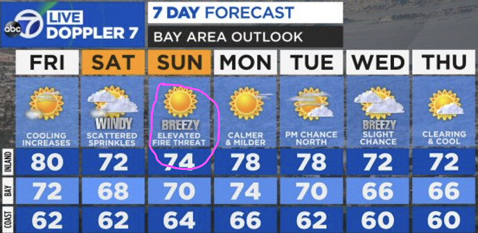
As the mid/upper level trough shifts inland on Sunday, winds will
turn more northerly and potentially northeasterly across the higher
elevations of the interior North Bay and East Bay. **Gusty winds and **
**lowering humidity will result in elevated fire weather conditions **
over the North Bay Interior Mountains and East Bay Hills/Mountains
Sunday afternoon and evening, yet confidence remains low for
widespread critical fire weather conditions to be met. As always, we
will closely monitor conditions as fuels remain critically dry.
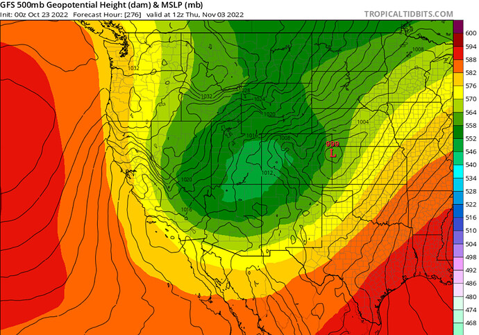
The GFS has consistently shown an aggressive inside slider moving into the Great Basin during this time frame I listed above. So now moving from deductive reasoning to actual model forecasting… It is timed perfectly for the next troughing cycle, and could be a high wind warning event if it materializes. This is still in once in a red moon territory forecasting wise. Updates to follow next week.
