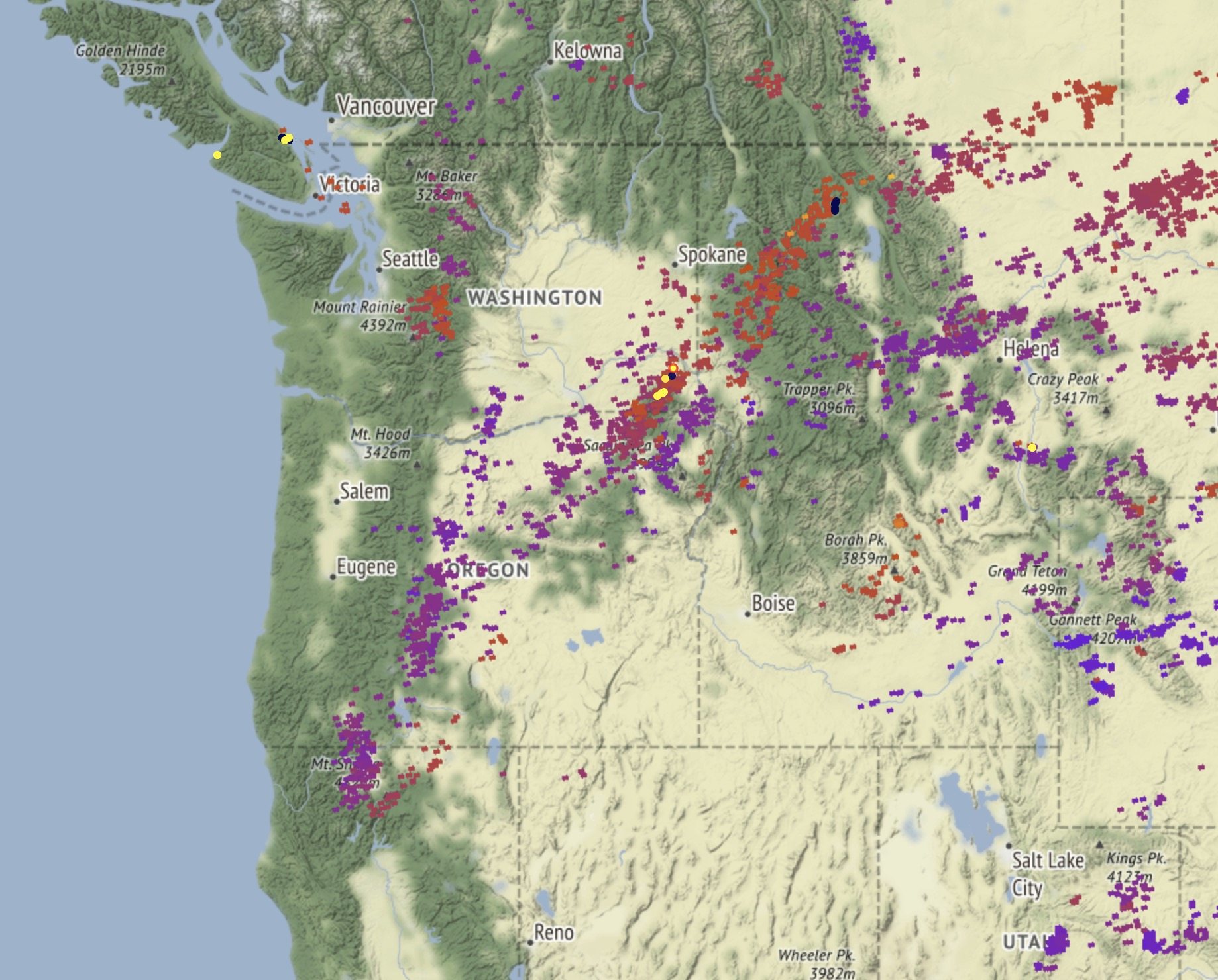
There was an interesting phenomenon this spring when the leaves all came out green and then a very hard freeze killed them all. The oaks stayed like this a while and then new leaves came. But lots of dead leaves are still frozen up there in the air. I wonder if that has any effect on fire behavior.
7 Likes
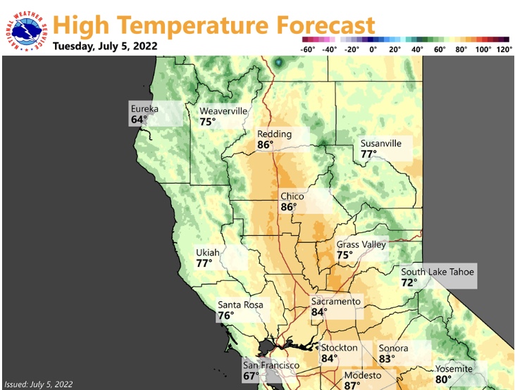
Forecast models continue to advertise an excessive heat warning event July 7th-July 12th. We are about 48 hours away from near certainty on this forecast. This has the potential to be one of the strongest high pressure systems in United States history. The shape of the ridge, being inland over the desert means that the sea-breeze should be able to regulate temperatures in some areas during the afternoon.
Although many people will focus on the heat wave, in my opinion the most critical time will be when this ridge breaks down… as strong onshore winds on top of a very dry and hot airmass could produce explosive fire growth.
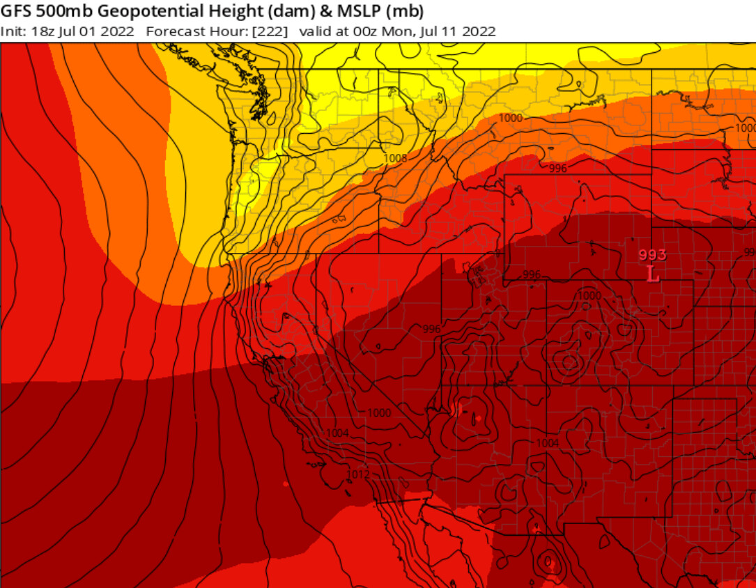
GFS 18z depiction of the giga-ridge breaking down, with tight isobars indicating strong onshore winds.
14 Likes
Was up in south central Oregon camping a month or so ago and noticed large areas of frost killed snow brush. This was just on the eastern side of the 395 corridor between Chiloquin and K. Falls…
5 Likes
Is this setting up a similar pattern that occurred when the Carr fire started?
4 Likes

Any updates on the warming 7/7?
1 Like
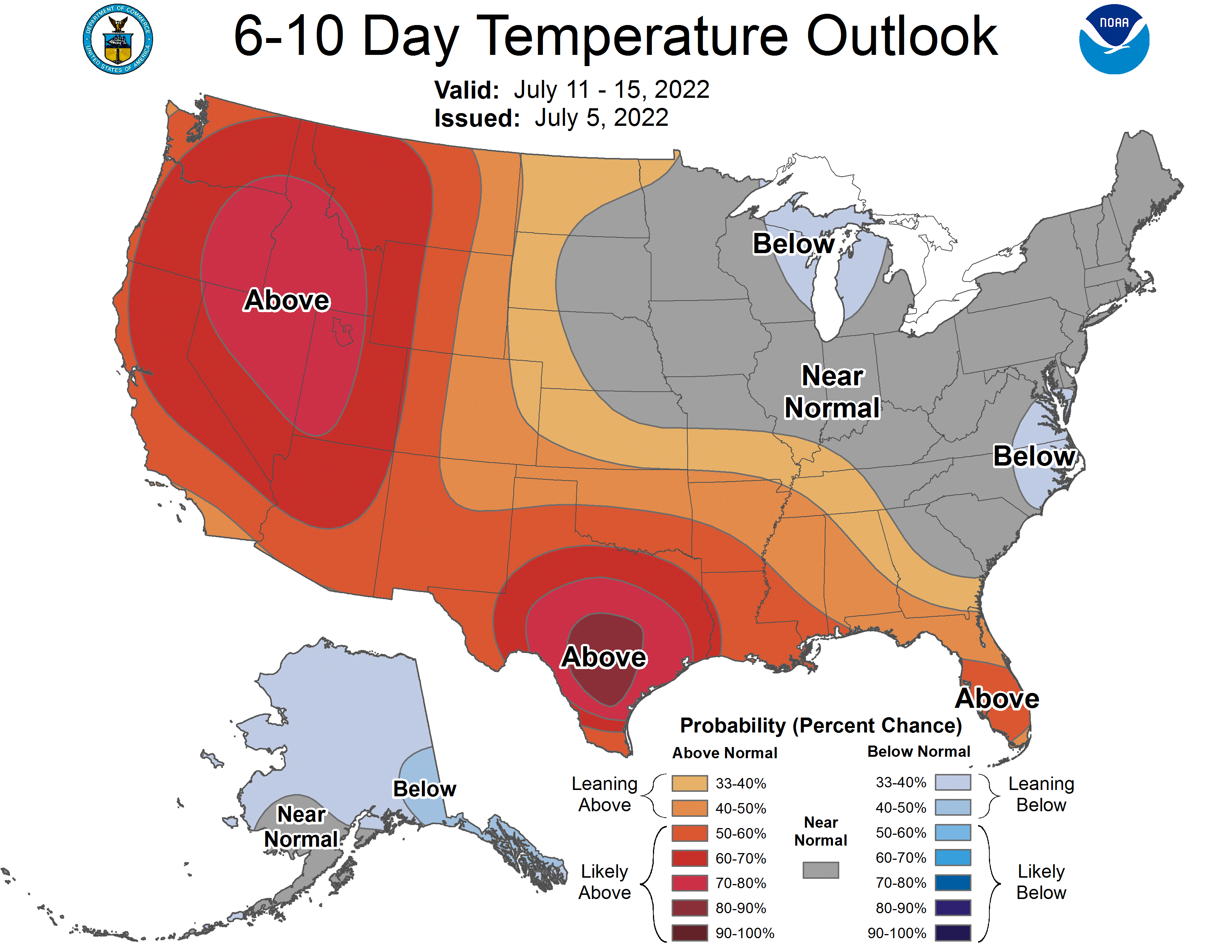
It looks like there is still a solid chance of a heatwave, just pushed back 24-36 hours. Some troughing will undercut the strong ridge, and as soon as the shortwave trough exits this weekend the high center will likely move right over CA. So 7/8 / 7/9 looks like the beginning of a heatwave
10 Likes

Dang paywall
4 Likes
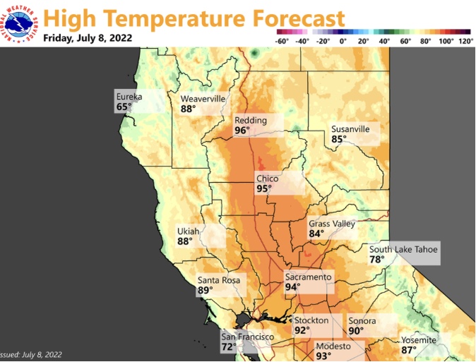


GFS is showing a another breakdown of the mini heat wave this week followed by another modest heat wave through the weekend for NOPS.
Another cool down comes and then a possible larger warm up. The GFS shows some much above temps moving into the last week of the month.
Something to watch… a low appears in the Socal deserts and works its way up to the Southern Sierra’s.
This then ushers in some monsoonal moisture. Not sure if some of the more weather educated are seeing this.
It is still 14-16 days out… but from a climate perspective this would be considered normal. The heat may be the most intense that we have sen this summer if it verifies. The Euro model does support the heat as well.
I would say that the GFS has been consistent in forecasting extreme heat events lately a week or so out, but then dialing them back in intensity and length. Will be something worth watching as we head into the heat of the Monsoon season.
8 Likes
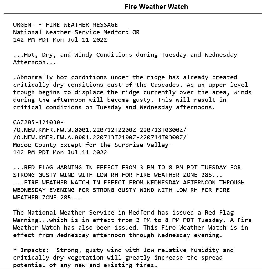
An upper level high pressure system is centered over Southern Utah, a thermal low is over Yuma, and a 594 DM ridge extends to Point Conception. Zonal flow around the ridge continues across North Ops with warm temperatures inland. As the ridge expands westward over Southern CA a shortwave is moving into Northern CA and this will produce a non zero chance of dry thunderstorms through tonight in far Northern CA. The traversing shortwave will keep afternoon winds elevated for the chance of critical fire weather conditions during the afternoon tomorrow. The shortwave will also increase the chance of convection, near the lee of the Sierra tomorrow, and if thunderstorms develop most likely storms will be dry as PWV are only in the .50-.65 range. The SPC keeps the dry risk further east into the Great Basin.
A potent and compact upper level low may move into the Pacific NW Sunday, breaking down the ridge and zonal flow over Northern CA. This upper level support and breakdown of the ridge has the potential for some onshore winds with serious fire weather concerns. The ridge has been very long lasting and it’s return shortly after may occur.
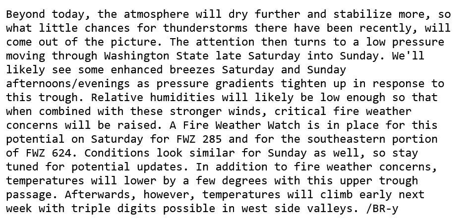
From NWS Medford Fire WX discussion
8 Likes