The National Weather Service delivered disappointing news Thursday for anyone hoping for drought relief this fall or early winter.
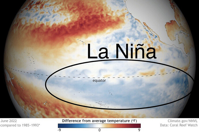
According to the weather service’s Climate Prediction Center, there’s a 62% to 66% chance that La Niña conditions will prevail in the Northern hemisphere until at least the end of 2022, marking the third straight year of the weather pattern.
La Niña conditions, measured by surface temperatures in the Pacific Ocean, typically mean that there will be drier conditions in California, especially in the southern part of the state, though no one knows for certain. What a La Niña means for the Bay Area is less certain since the central part of the state has had rainy weather during La Niñas in the past.
“We really don’t know, we’re in the middle here,” said Jan Null, a meteorologist who runs Golden Gate Weather Service, referring to the Bay Area’s location between the rainy Pacific Northwest and dry Southern California. “We’re in the zone where it’s almost a coin flip. We’re in a unique position.”
Only twice since the 1950s — from 1973 through 1975 and 1998 to 2001 — has the state had to deal with three consecutive La Niña’s, Null said.
“With only two previous instances, I’m not going to make any predictions,” he said.
Last year, despite La Niña’s presence, the Bay Area and Northern California were inundated with precipitation at the end of the year, with little rain or snow for the rest of the winter.
La Niña events feature ocean surface temperatures cooling over the tropical Pacific — a sign that a dry winter could lie ahead for California. La Niña’s sibling, El Niño, marks warming waters and often indicates a wet winter.
El Niños and La Niñas have often defied predictions by falling flat or producing unremarkable results. But in the public eye, La Niña has come to signify a bone-dry winter and an El Niño that it’s time to batten down the hatches.
A third consecutive dry winter could spell serious trouble for California, where the parched hillsides and forests have been ravaged by fires of unprecedented size, number and intensity the past two years.
Another year of subpar rainfall could also further deplete the state’s reservoirs, worsening water shortages and spurring more restrictions on water use.
Not taking shots at anyone but prediction is just a big word for guess. 
I feel like there’s more than a non-zero chance you are correct, Sir! \m/
New updates
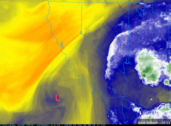
It is worth watching a cut off low pressure system, currently located 200 miles off of the coast of Southern California… for a potential convective outbreak early next week.
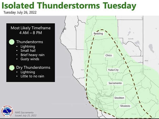
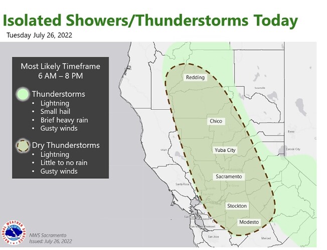
PWV’s on the outer fringes of this moisture plume may support isolated dry lighting strikes Tuesday before deeper moisture arrives.
From North Ops fire weather outlook:
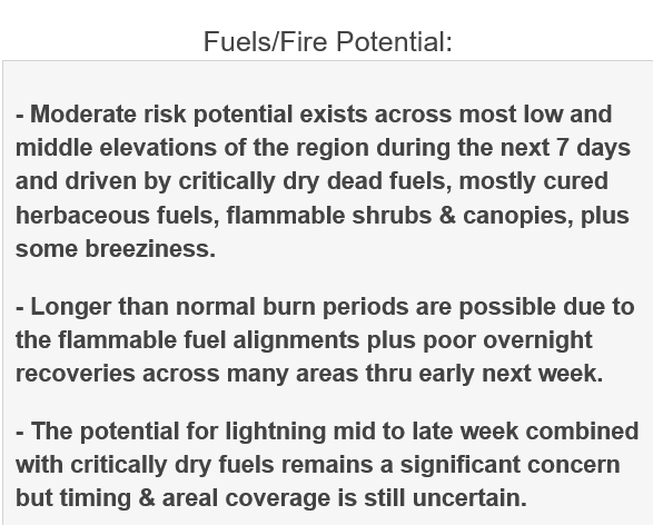
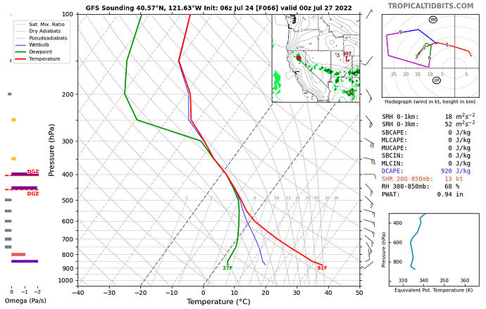
The NAM sounding is a bit drier. I think that the greatest chance will be on the outer edges of the moisture plume. This will likely favor Oregon as that is where most of the dynamics and less moisture will be located. Lightning that strikes timber can burn in the tree from the inside out and it has dried sufficiently to support fire in those fuel types, so even though there may be some precipitation we are in that season where it is always worth noting lightning.
Looking like we may see a window of higher based storms over the central valley and foothills Monday-Tuesday. The low seems to have a more defined track now. Will be interesting to see if PDS issues any high risk by tomorrow. Most of the offices AFD’s are not that bullish on it, but they are starting to coalesce to a 10-15% chance… so “scattered” to “widely scattered”.
Sonora and the surrounding areas getting a light sprinkle. Hear an occasional thunder up the hill.
