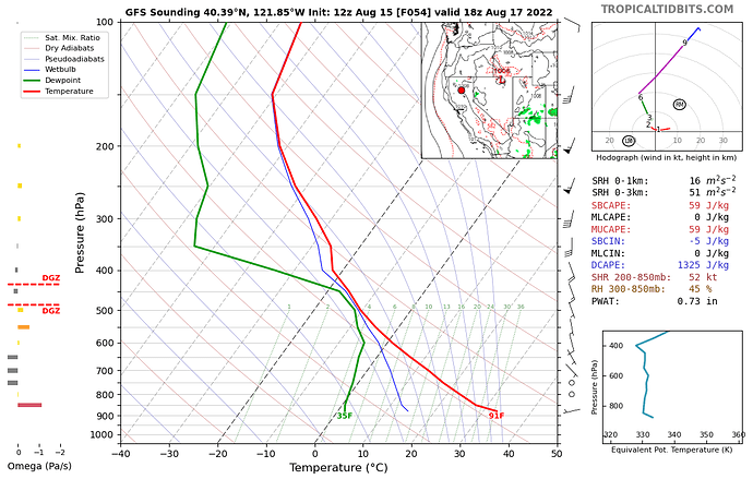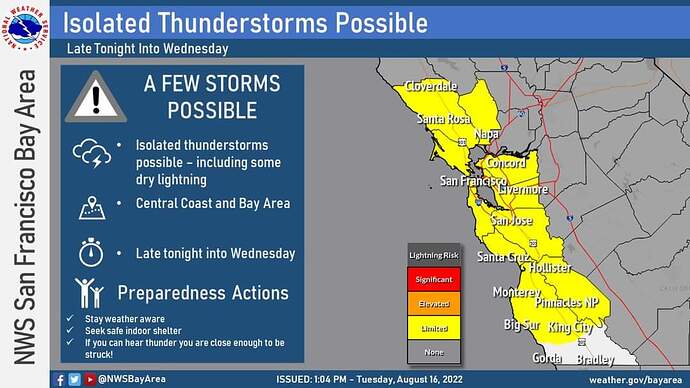
Conditions mod to late week look similar to two weeks ago when we had lightning ignitions. Mid level moisture will be present, warm temperatures that will assist in orographic lift will be present, several disturbances will rotate off the coast to provide lift( Cape in the 200-500J/KG) and low PWATs in place.
Storm motions may be slower allowing some stronger storms to dump rain within the cores.
PWATs look to increase later in the week could lead to stronger and wetter storms. This would also lead to stronger outflow winds. Any established fires could be impacted by strong outflows from these storms.
Haines of 6 will allow any fire that becomes established to become plume dominated.
Higher temps and low RH will be of the average expected for this time of the year, but with warm temps in the thermal belts overnight.
Right now the most likely areas( according to the models) for activity would be Redding north for SHU, Trinity County near the “horn” and LMU- with more of a focus on Modoc.
SKU and KNF could also be impacted.
Medford did issue a FWW.
There does exist the chance of nocturnal storms as well. These could be problematic because once the heating of the sun is gone, the storms have less energy to lift and can contain less of the mechanisms necessary to cause the storms to become stronger( wetter).
With all of that… in my opinion( not an IMET) it does not look to be a widespread event. But, even a few dozen strikes in the right places can produce significant outcomes.
PDS has updated the 7 day. Confidence is growing in increased chance of lightning. The change includes increases in geographic coverage and percent coverage. The FWW has been upgraded to a RFW for much of the CNR region…
Excessively hot temperatures at the surface, combined with mid level instability, and highly receptive fuels could lead to an interesting 48 hours.
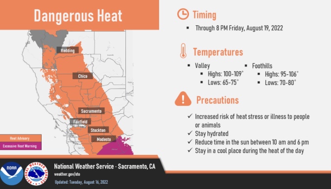
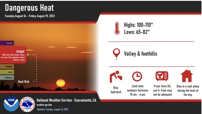
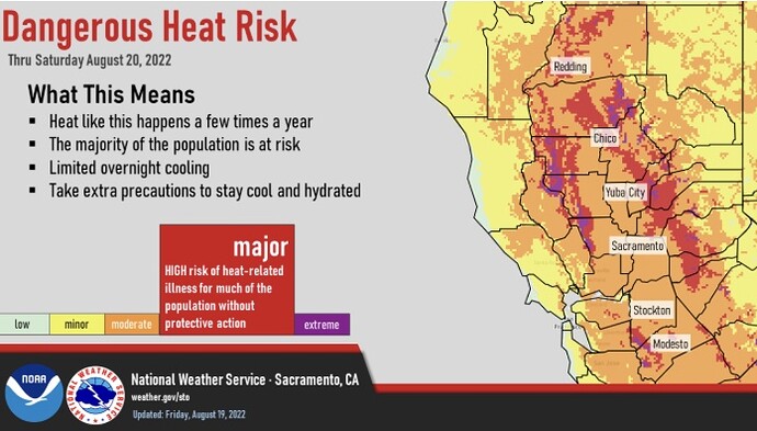
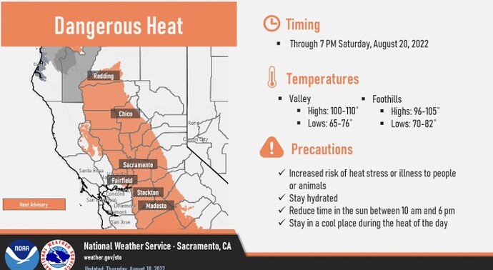
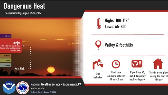
The difference between this event and the lightning events previously this year is, there will be very warm temperatures with heat advisories and excessive heat warnings in place. This lends potential to more receptive fuels, and higher overnight temperatures.
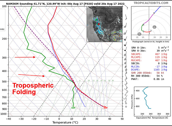
Also, this event is fueled by a perturbation in the monsoon trough rather than a closed upper level low. A closed low fueled the previous lightning events. The NAM 3KM sounding does show some tropospheric folding, which is the ingestion of dry air into the thunderstorm. So these factors could increase the probability of dry strikes.
A little bit of dopamine for your Sunday.
I won’t use the S word but let’s say the restricted part of the season is probably coming to an end. A weak trough currently over the Pacific NW, which has taken forever to fully move inland looks like it is going to break down the ridging into British Columbia.
The weakness in the ridge is going to open the door to a potential very unseasonably strong trough into the Great Basin at the end of the month. This action would shunt the monsoon moisture east and significantly increase wind speeds.
It is my opinion that it’s almost near certainty that September as a whole will have chaotic weather across the US.
The anomalously strong ridging and split flow pattern across the US is ending and the third law or should we say sixth law states that for every force there is an equal in the opposite direction. So perhaps a transition to longwave trough pattern across the Great Basin with gusty onshore winds.
Yes, shut off the monsoon please. Although it’s been great to temper significant fire activity through most of the West.
Throw a Cat 5 hurricane in to disrupt things as well…
What is the S word? Storm? Santa Ana? September? Something else?
It’s that word uttered while in the doldrums that is sure to bring on a flurry of activity.
Slurpee’s …… definitely slurpees
Back to the mission…
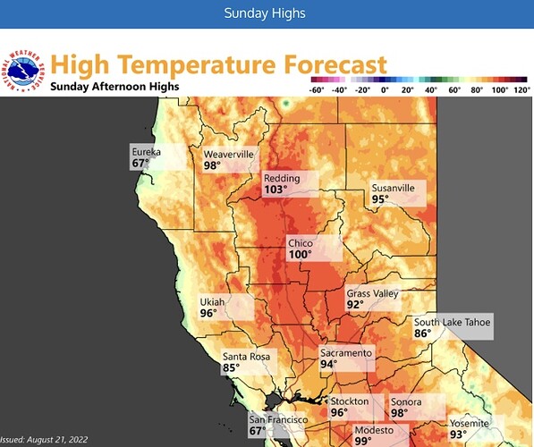
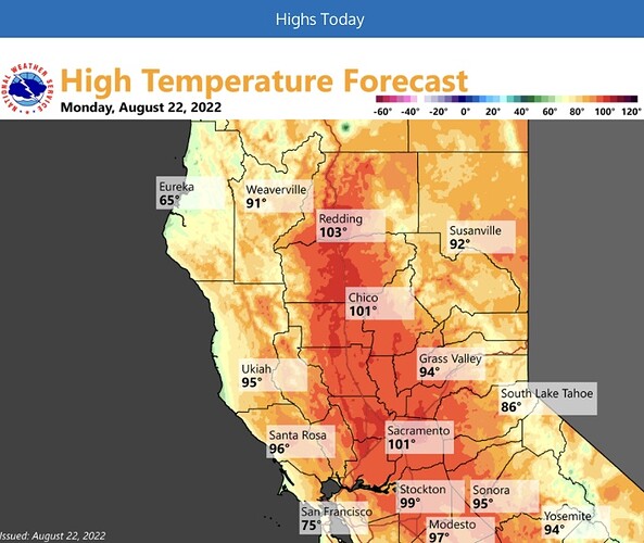
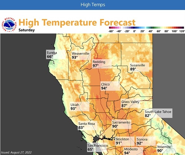
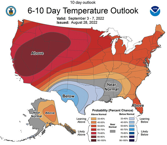
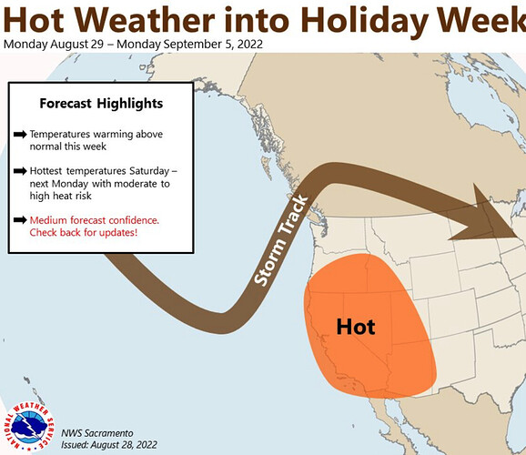
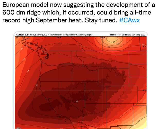
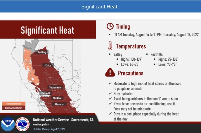
Looks like an extended significant statewide heat wave beginning this next week. This might actually be the warmest temps of the summer. A HP ridge will dominate the pattern and only see minor changes from passing cold fronts to the PNW.
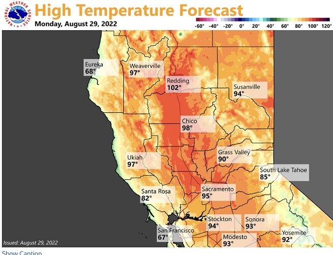
Very warm temperatures exceeding 100 degrees will be the standard and will remain around there for the better part of 10 days.
This could actually extend longer than that.
Models do show a few days in the Sacramento and San Joaquin Valley that dip to 99 only to go above 100 again the next day.
Highest temps will be near 110 in both Fresno and Redding.
There will be some downslope winds from the HP with an offshore component. Right now I do not see any really strong winds, but strong enough to cause some issues.
I would not be surprised to see some FWW for really low RH as well over some of the PSA’s.
Two tropical systems will form during that time frame as well. Earlier the models wanted to bring one of them into the Gulf of Mexico as a strong storm. Right now the GFS has tracked the storm closer to land fall in Mexico, where it is sheared apart( most likely by dry air from our HP- my guess).
The remnants of this system track all the way to Socal at the end of the run… that would need to be watched.
In between now and then… really warm and really dry.
NWS Bay Area Sunday: Confidence is
high regarding the significant warming trend in the extended with
both deterministic and ensemble guidance indicate the strengthening
of the ridge. ECMWF Extreme Forecast Index (EFI) indicates values
of 0.70 to 0.95 for much of inland California with the lower end
values approaching the coast. That said, we will continue to monitor
the situation in the coming days to iron out the details.

