A couple of models ( GFS and ECWMF) are showing some chances for thunderstorms in the northern LNU/MEU area and Lake Shasta northward.
The soundings show a mix of wet and dry signatures. This is from a short wave moving through today before the HP ridge begins building in. It is mentioned in the 7 day as well. There was a line of capped convection visible on the satellite image spanning from the valley towards the coast range.
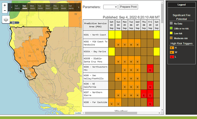
It goes without saying that any lightning ahead of the heat and transition wind that we are forecast to receive would not be good.
Anyone else seeing that?
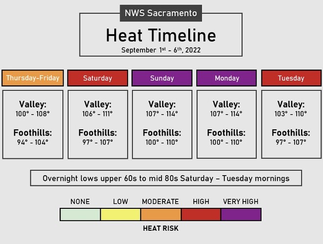
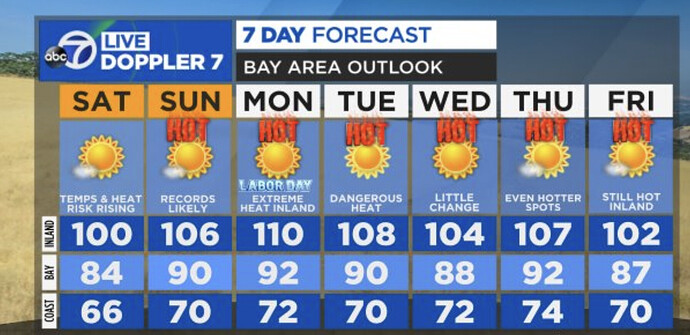
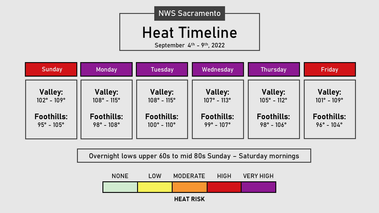
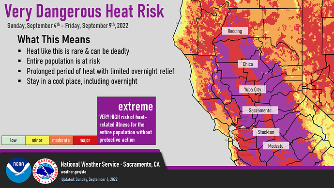
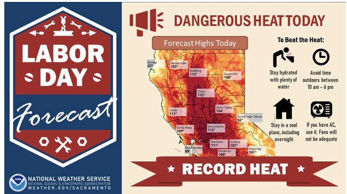
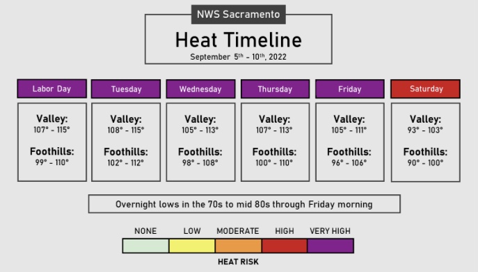
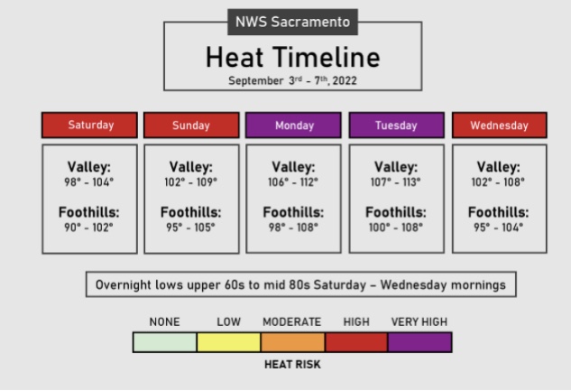
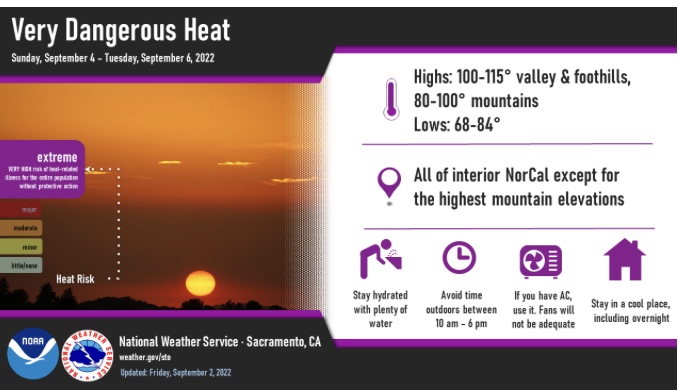
Quite a cool down from the forecast of 109° on Sunday in Chico
I actually think 109 might be conservative. Certainly by Monday, the North Valley could be pushing 112.
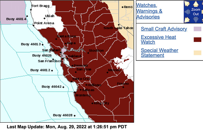
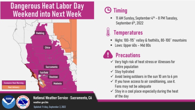
NWS SF: 100 PM PDT Mon Aug 29 2022 …EXCESSIVE HEAT WATCH IN EFFECT FROM SATURDAY MORNING THROUGH MONDAY EVENING…
-
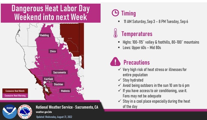
WHAT…Dangerously hot conditions with temperatures in the upper 90s up to 110 possible, particularly across the interior. Overnight temperatures cooling only into the 60s in lower elevations and 70s to 80s in the higher terrain.
-
WHERE…The entire San Francisco Bay Area and Central Coast. *
WHEN…From Saturday morning through Monday evening. *
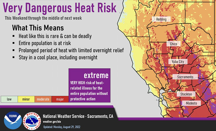
IMPACTS…Extreme heat will significantly increase the potential for heat related illnesses, particularly for those working or participating in outdoor activities.
- ADDITIONAL DETAILS…The hottest temperatures will occur across the region`s interior and in the higher terrain each afternoon with mild to warm overnight temperatures providing little relief from the heat. Onshore winds and marine influences from the Pacific Ocean may limit daytime heating near the coast with afternoon highs in the 70s to 80s, ultimately reducing heat related risks.
Currently have some build up over the Carson range, moving NW. not much in the way on convected activity, but really I think the last remnants of the LP moving out. T-storm chances are fairly low, but these are quick movers with high bases so dry strikes are more likely but isolated at best.
Lake County had some dry downstrikes around 11:30. Currently suppressing a small fire on Mt Konocti.
Scattered brief showers in MEU, no electricity yet though, just precip and cloud cover.
If that is verifying, I would watch the area north of Shasta lake up through SKU later today and tonight.
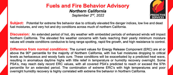
Have not seen this before: https://www.predictiveservices.nifc.gov/fuels_fire-danger/Fuels_Fire_Behavior_Advisory_ONC_20220902.pdf
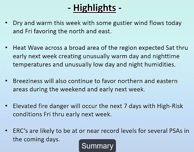
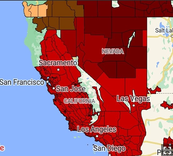
North Ops fire weather forecast:
Been a hot minute (no pun) but the advisories seemed fairly frequent in NOPS about 2005-2008.
These have come out every year for at least the last 5-6 years. The difference this year is that it was issued in September versus previous years they’ve been issued as early as early June.
I cannot find anything+ that describes this week in terms other than dangerous or extreme… cross your fingers and hope for the best
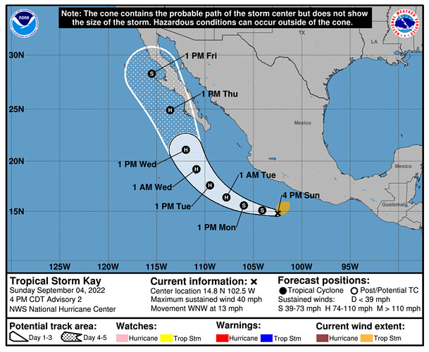
What is really concerning is what follows in the 7-10 days post record breaking heat. With the fuels kiln dried, monsoonal flow with any accompanied lightning advecting into CA will be problematic to say the least.

