Just released: https://gacc.nifc.gov/oncc/predictive/weather/brief_files/brief.mp4
Still looks like a decent chance of dry lightning and then offshore flow over the next 48-72 hours. This looks to be centered somewhere north of Lake Shasta. Models show activity around Trinity/Shasta and Humboldt counties.
A ridge builds in after with some moderate offshore flow…
I think someone already posted this several days ago but really some good material to review as the ridge breaks down and the extreme heat ends.
Tropical Storm Kay is expected to remain off of the coast of Southern CA for the next couple of days, as the storm degenerates, the ridge will rebuild from northern WA down to Arizona. Surface high pressure will lead to drying at the surface, and the low level moisture from Kay will be shunted away and mixed out. Forecast models bring a shortwave through far Northern CA early next week, and this shortwave will pick up the mid level moisture from Kay… which will lead to additional dry lightning potential. PWV’s are low especially the further north you go… it is not looking good for wetting rain potential.
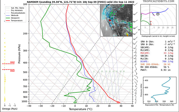
Look at this inverted V profile with tropospheric folding. Classic dry thunderstorm sounding.
Starting tomorrow… As a series of dry cold front shortwaves move in they will pick up mid level moisture from TS Kay. This will likely lead to a situation where the smoke is cleared out with the onshore winds, and the instability and mid level moisture leads to large column growth. The most dangerous fire situations can occur when offshore wind patterns shift to onshore winds.
North Ops fire weather outlook has added a High Risk day for the Northern Sierra Nevada on Sunday for Dry Lightning. Additional areas of concern are being assessed.
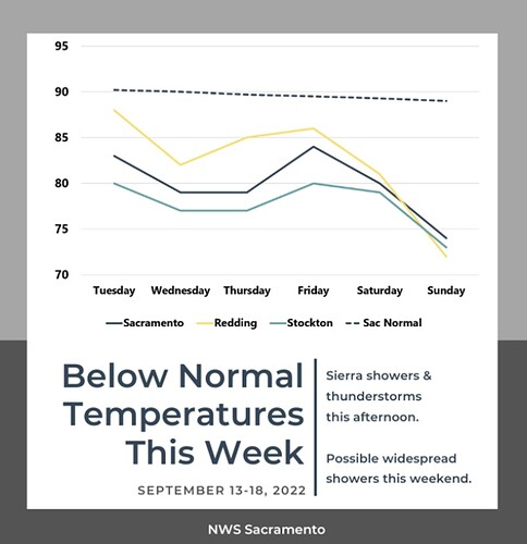
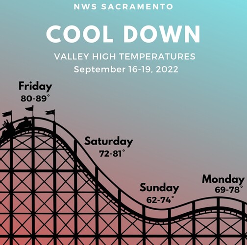
The troughing should continue until late next week, then the ridging cycle returns with a likely return to a heatwave.
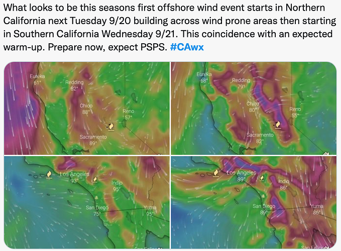
We have observed the first inside slider of the season, which is causing an offshore wind event in Oregon and Washington. The dominant split flow pattern over the US, the timing of the ridging cycle, and the GFS lend me to think the first appreciable Diablo wind event could occur around September 23rd, which would not be a good think given the lack of precipitation and large active fires.
Not necessarily North Ops, but….
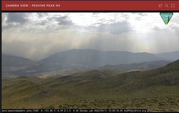
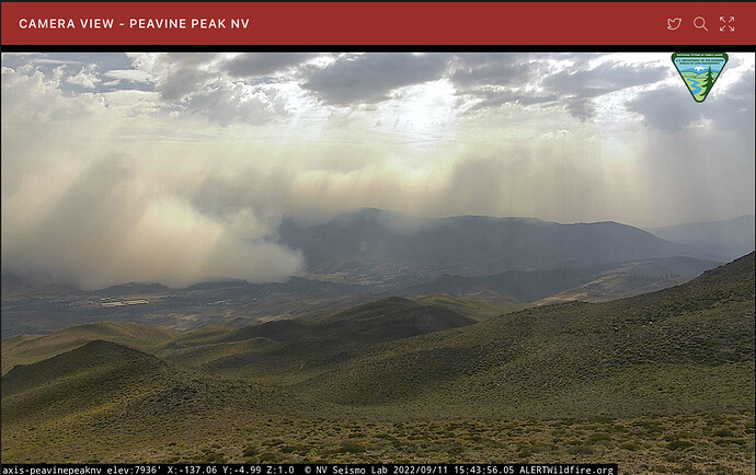
Interesting time lapse (9/11 @ 15:30 ish) on the Peavine (NV) cam showing the outflow dragging the smoke along…
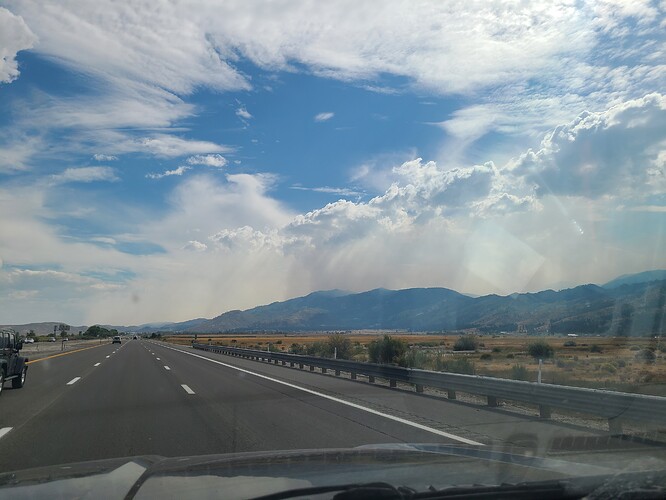
And this one, from a different Reno Cam:
Was very cool in person driving from north reno to carson. All the smoke in the valleys cleared out now pushing through carson into dayton thick
Edit 18:13 200ft visibility in Dayton valley now
Nice light rain on and off past 30 minutes (8:30am) here in Chico.
Just had a little rain shower here in Soulsbyville above Sonora and it’s 75 and cloudy
What model are you using for the predicted winds? Not questioning just curious for my learning
Looks like the windy app
Highlighting an ultra complex forecast.
Many factors are complicating model consistency.
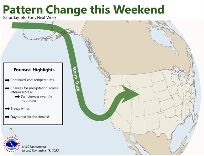
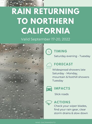
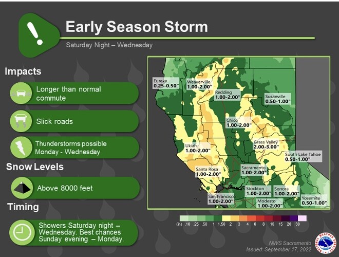
A cut off low will drop off of the coast of San Francisco this weekend. This will bring a decent amount of rain to widespread areas across central and northern California. This will be a season slowing event but after the heat wave the vegetation is still receptive. There will likely be a grass crop from the rain like is occurring now in South Ops.
Extratropical Cyclone Merbok is forecast to move into the Bering Sea at an all time September strength of 940 MB. This condition will destabilize the airmass in the north.
A tropical cyclone in the Atlantic ocean still does not have a consensus on it’s exact path, and two tropical disturbances in the eastern pacific are also another cherry on top of affecting the ability to put a solid forecast together.

