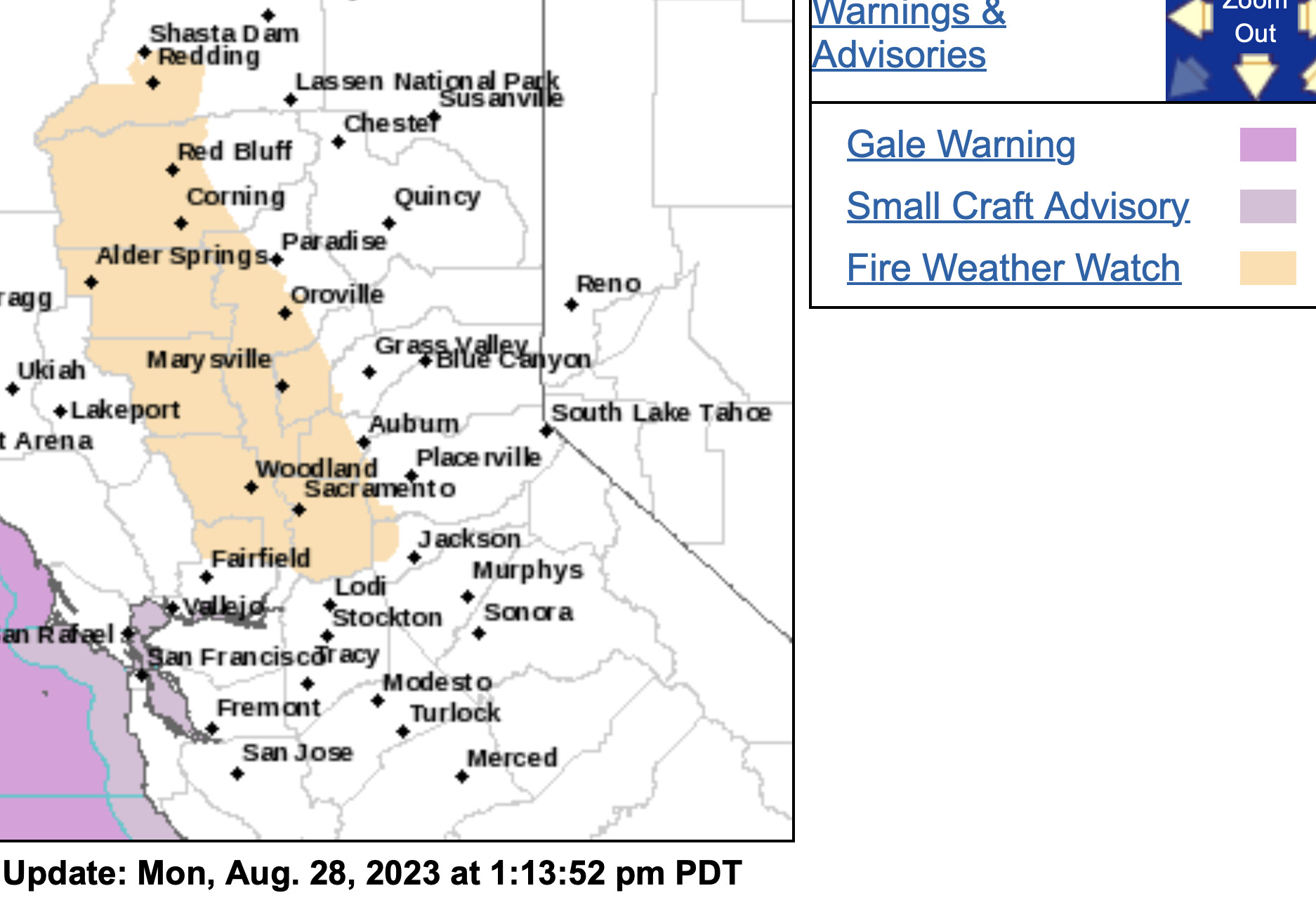
Critical fire weather conditions likely in the Cascades starting early next week, as ridging builds in and breaks down as a potent but dry low pressure system moves into BC.
Onshore winds, instability, heat, high Haines indexes. Will not be good in the event of any new starts and existing fires establishing themselves.
Active lightening, thunder, light rain and strong erratic winds in Happy Camp over the last hour or so. Word is they pulled some resources off the line up here due to weather concerns.
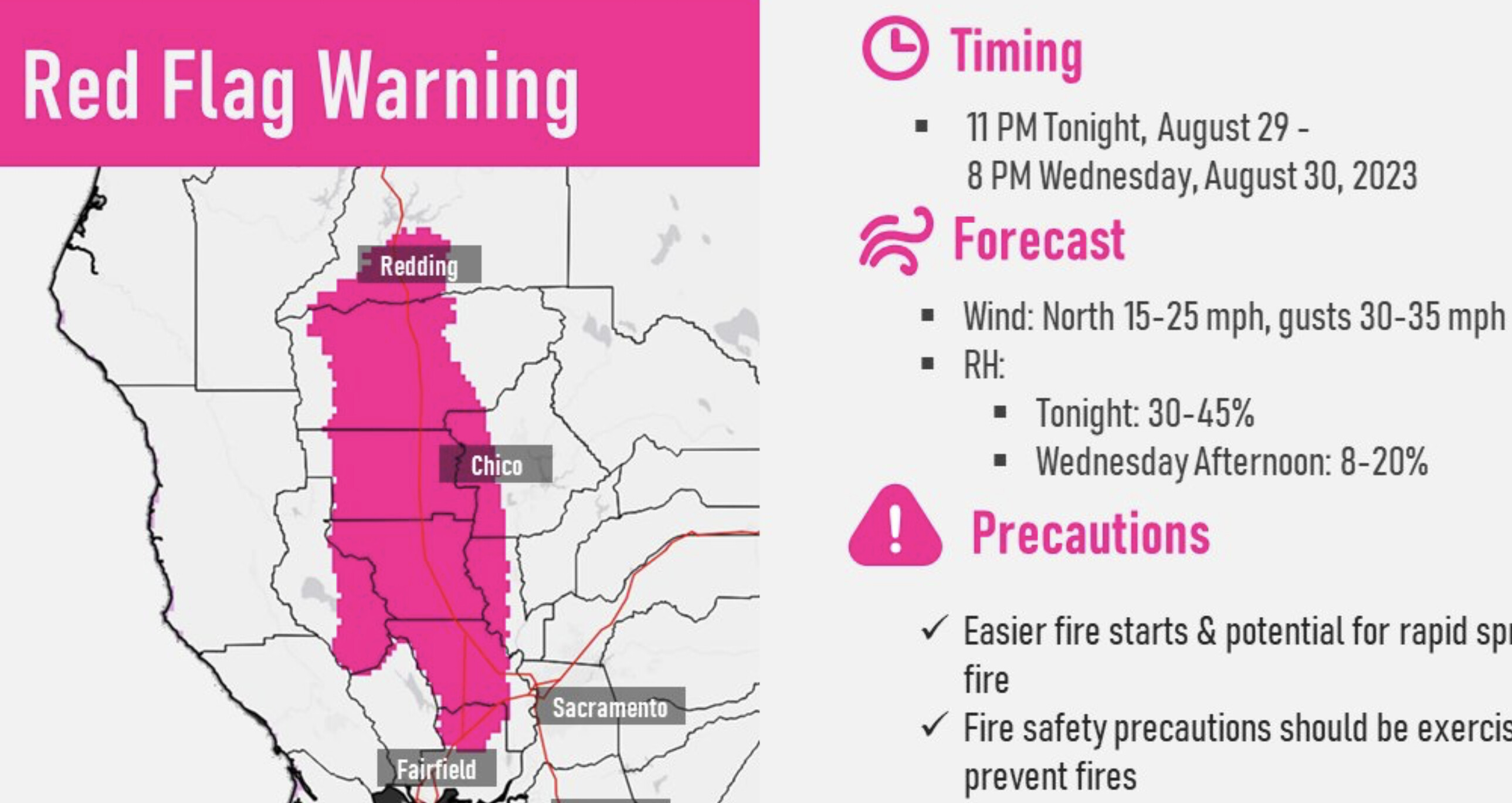
NorthOps weather Friday am: Gusty N to NE winds will develop Tue night favoring the Sac Vly as well as ridges and channeled terrain areas from the Cascade/Sierra crest westward with dry & breezy offshore winds continuing Wed & Thu and overnight RH recoveries becoming poor to very poor.
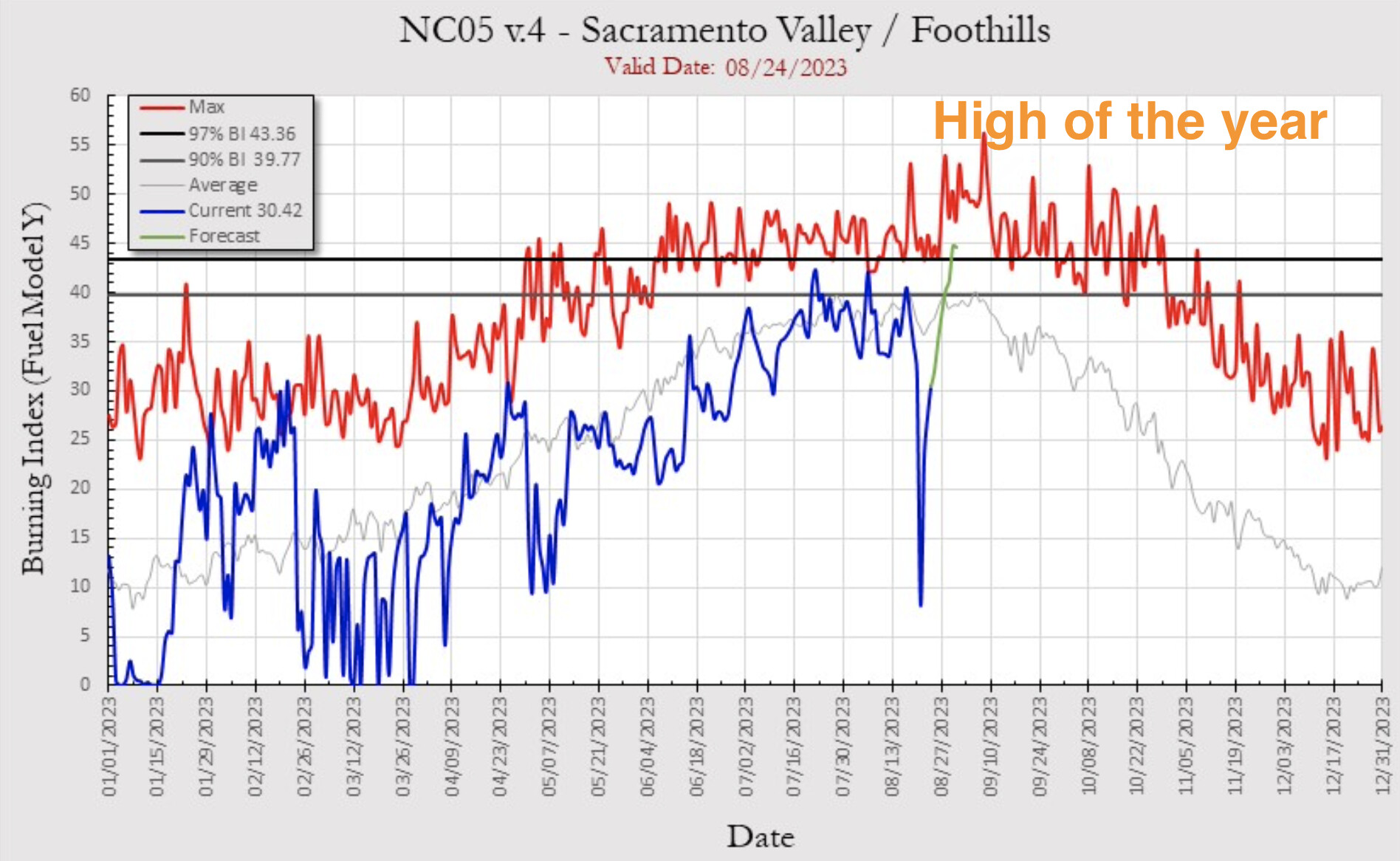
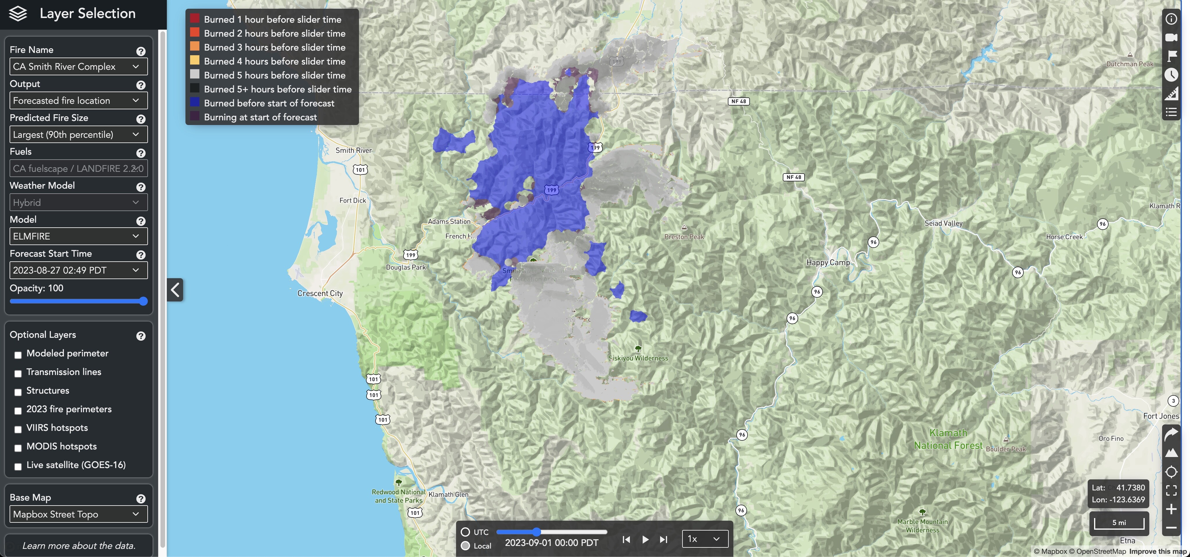
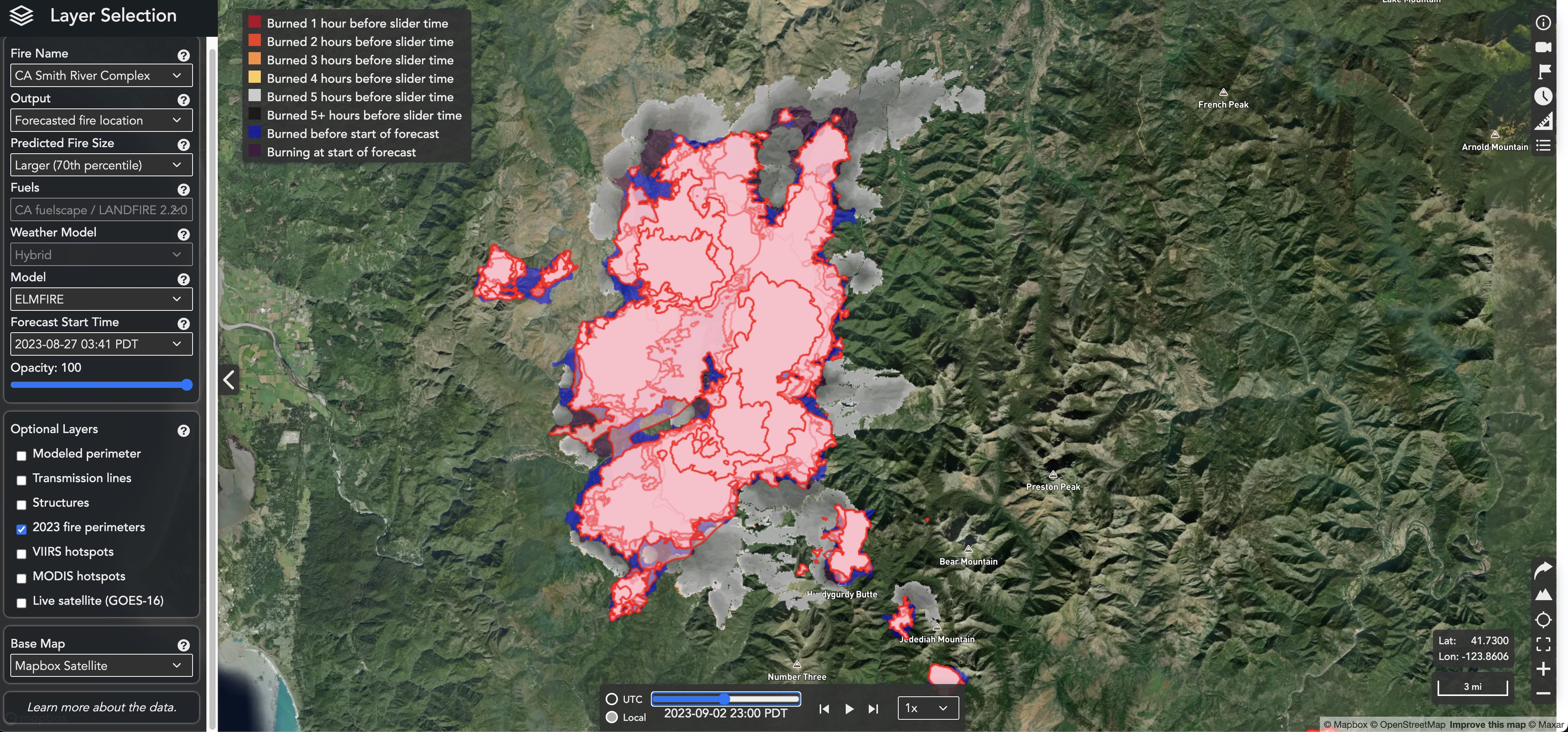
Looking like possibility of NW winds starting Tuesday and transitioning to N winds Weds morning over the Smith River Complex. With lots of areas to S and SE that haven’t had fire for a long time, looks like there is some potential for major growth on these fires to the south and east. Anyone been running the Pyrecast spread models? Pyrecast is being developed by SIG with funding from CPUC. I’ve been testing it for them on wildfires for the past 3 seasons, and it called the Bear Fire’s big blowup in 2020 pretty well about 3 days beforehand. It has some pretty grim runs for Smith River Complex at the higher percentile runs. pyrecast.org - runs best in Chrome.
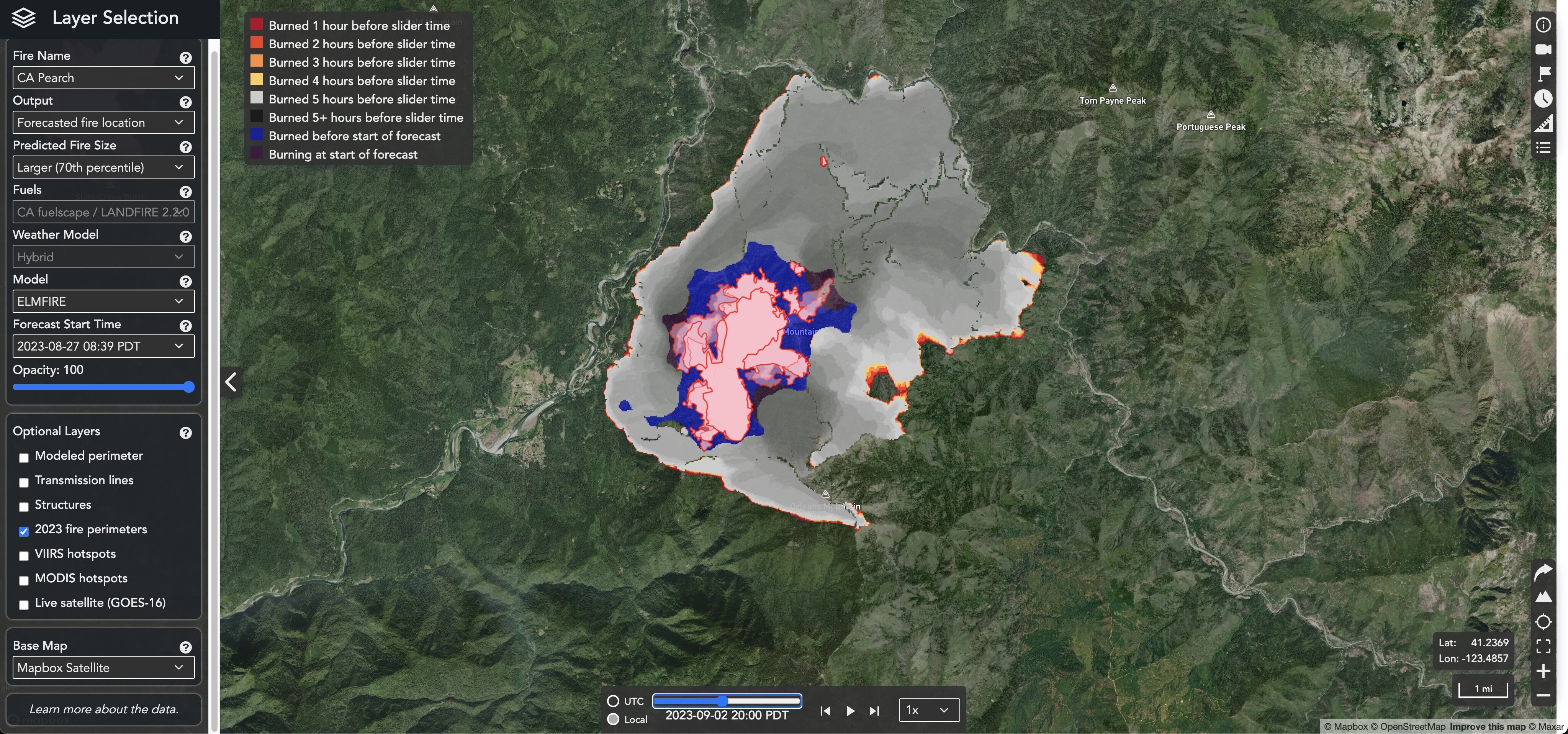
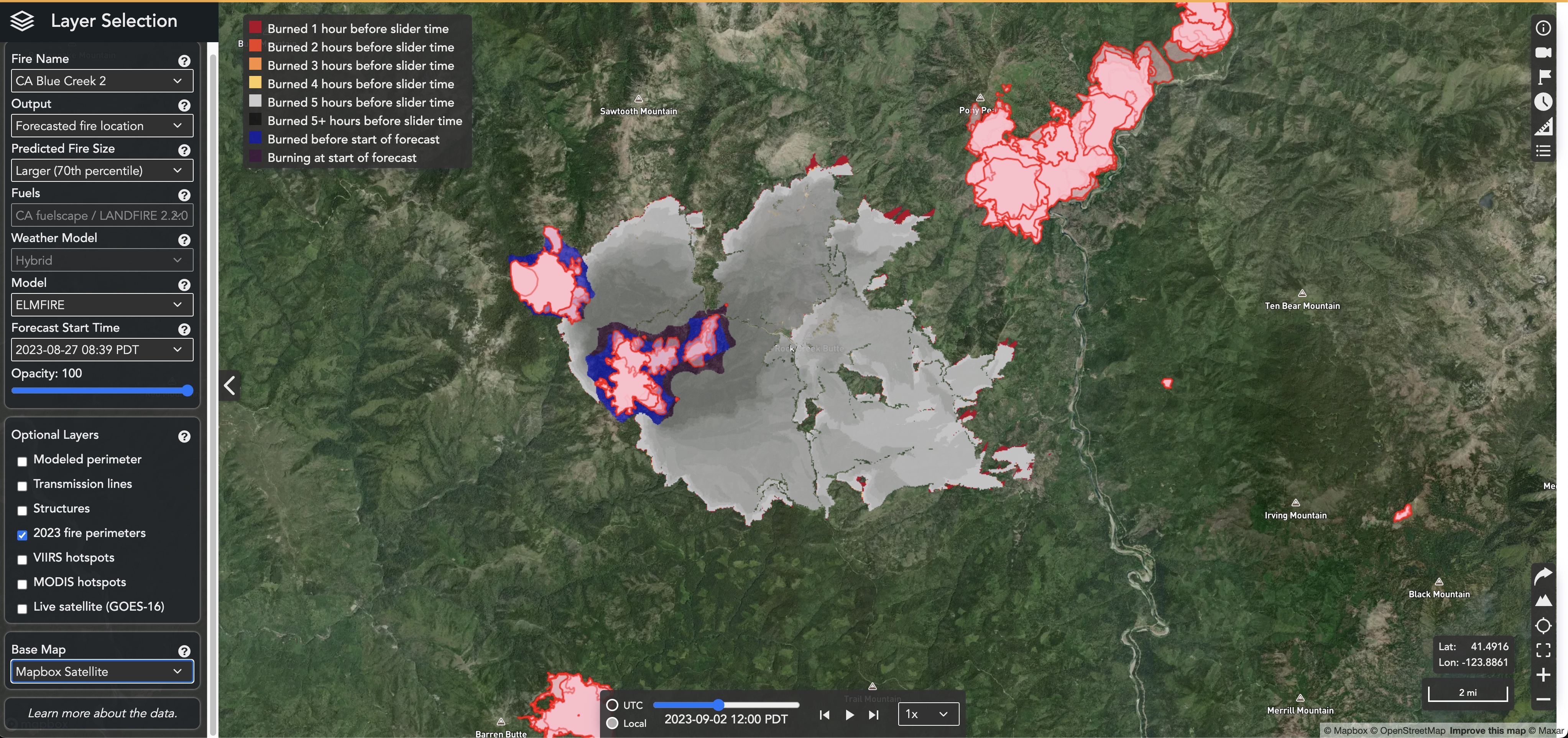
The Pearch Fire shows potential for a strong eastward push by Weds afternoon on the same model.
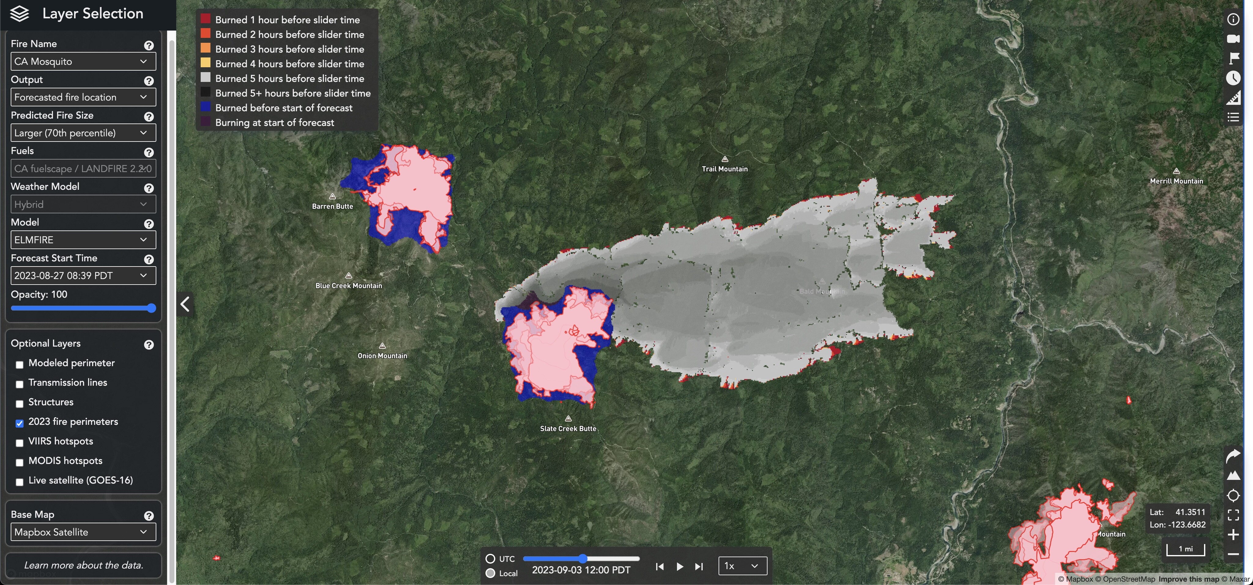
A lot of good firefighting has been happening on the Mosquito and Bluff Fires, north of Weitchpec, especially on the eastern flanks, and they’ve been cooling down quite a bit past few days, but model shows north end of Mosquito blowing out and running toward Somes Bar.
This model uses a blend of HRRR, NAM 3 km, and GFS 0.125° models. I’ve ran it as part of the development team over the past 3 years. It did pretty well predicting a couple of the major runs on the Dixie Fire, including the one early in the fire which screamed up the N Fk. Feather thru Tobin on its way to Twain (it underestimated the time it would take, but got the extent pretty well - said it would take 4 days to do what it did in 2). It also did a good job predicting the major SE run on the Mosquito Fire on ENF last year that pushed hard on Blodgett Forest. During 2020 Bear Fire, it predicted the run which eventually would push all the way to Lake Oroville would stop at Brush Creek, but still called 15 miles of that 30+ mile run.
Like all of our current models, it falls short in dealing with effects of inversions and our inability to accurately predict when they’ll break, so it does best when we have conditions which clear out the inversion for an extended period of time so the fire can just run. It doesn’t seem to do very well with backing fire, either.
One big selling point of this project is that it is all open source, and free to use. The development falls under the larger ‘Pyregence Project’, which also is looking at more accurate wind forecasting, long-range climate change/wildfire interactions, and putting all these pieces together into better models. http://pyregence.org
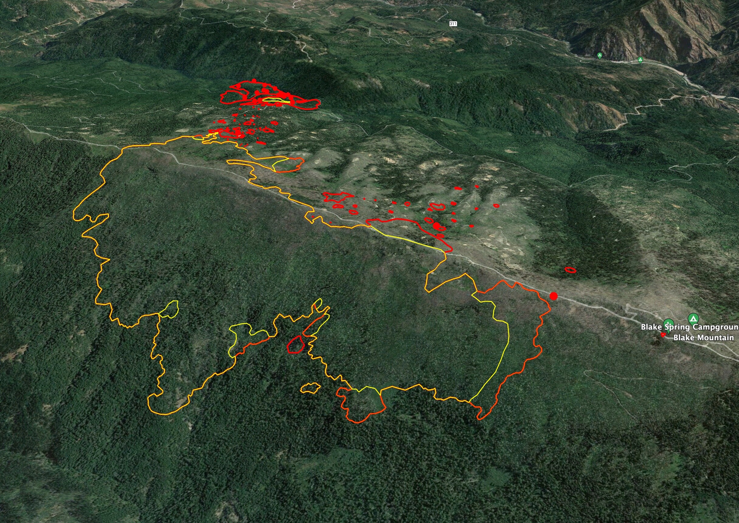
Looks like the 3-9 Fire, in South Fork Complex…
Last night’s IR showed active fire on the southern flank. The rest of the fires have looked pretty subdued/wrapped past few days.