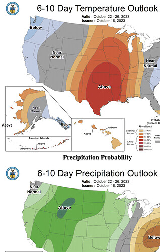
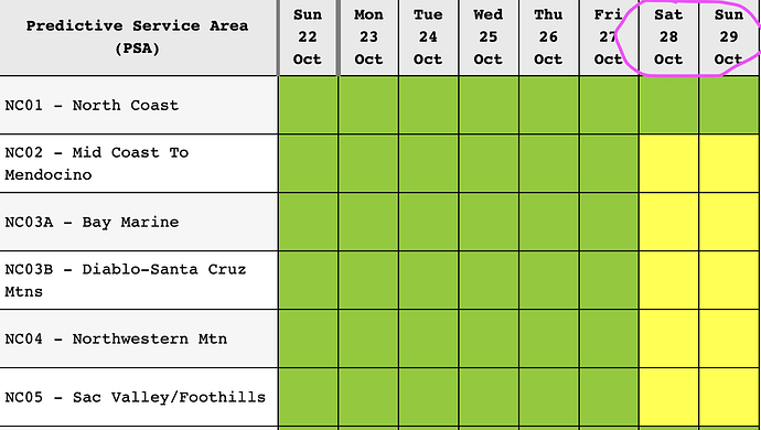
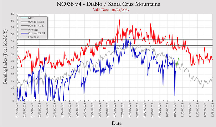
North Ops - Monday … the next 7 days with ERCs in the below normal category most of the period though increasing to near to a little above seasonal averages by late week as a significant warming and drying trend Wed-Fri dries dead fuels and live fuels remain flammable. More widespread moistening of fuels looks likely to follow next week in the Tue & Wed time frame and has the potential to significantly decrease fire danger levels…and perhaps may bring the end of fire season.
NWS SF Wed Thursday:
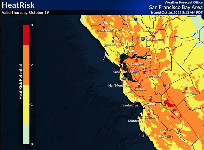
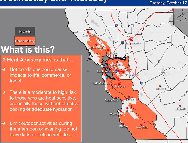
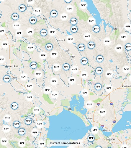
The center of the upper ridge will shift to our east, however warm low-level thicknesses and offshore - downsloping flow will be the rule. Given the rather warm start during the morning, expect temperatures to skyrocket during the morning to early afternoon hours. This will be the peak of the heat event, and look for high temperatures to reach the 80s to around 90 along the coast, with 80s to mid 90s for most inland areas. Given the climatology of this late- season heat event, HeatRisk values will reach the moderate to high range across much of the region. And for this reason Heat Advisories will remain in effect for much of the area into Thursday evening.
North Ops weather Monday: Another trough with more classic inside slider characteristics will bring the potential for stronger and more widespread N to NE offshore winds Sat & Sun with lighter winds and ridging following early next week.
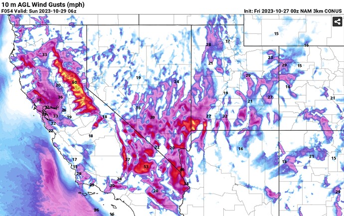
The moderate to strong N to NE offshore wind event this weekend looks to have the potential to be fairly significant from a wind & RH perspective though will be largely offset by dead fuel moistures remaining well below critical levels and balancing out to low risk conditions west of the crest Sat & Sun.
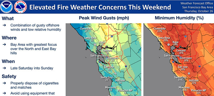
North Ops weather Wednesday: Another trough with more classic inside slider characteristics will bring breezy to locally windy N-NE winds beginning Sat, increasing & peaking Sat night into Sun expanding warming & drying W to the coast
- Moderate to locally strong N to NE offshore wind event this weekend into early next week looks to have the potential to be fairly significant from a wind & RH perspective for the S Sac Valley, Mt Diablo-Santa Cruz Mtns PSA, &, possibly, the bay area centered on Sun.
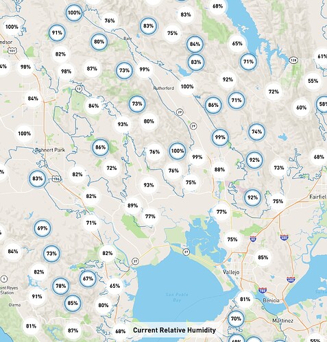
High humidity for sure.
North Ops Thursday:
Strongest Offshore Wind event of the Year likely during the weekend
-
Inside Slider Troughing with near Offshore Ridge thru Sat then dominant Ridging Sun thru mid-week before Ridge weakens/breaks-down late next week.
-
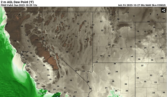
Increasing N-NE-E winds Fri night peaking Sat-Sat night with widespread max gusts 25-50 mph and several readings +60 mph favoring the western Sacramento Vly and higher ridges of the Coastal Range-Bay Area accompanied with rapidly lowering RH into the upper single digits/teens & 20s during Sat afternoon.
-
This appears to be a “Cold Air Advection” Offshore Wind event therefore allowing more elevations of the Greater Bay Area to be impacted by the gustier-drier winds.
-
However, recent rainfall has created a mosaic of dead fuel moisture conditions, especially within the heavier fuel types, although shrub moisture levels are still fairly flammable across the landscape and herbaceous fuels are in a mixed stage of either green-up or fully cured making for a mosaic of fire danger.
-
Fire danger could noticeably increase again late next week ahead of a moist cold frontal passage but likely not to the degree compared to this weekend.
-
Fire business could increase this weekend with the possibility of residual effects into most of next week.
Starting - North to South possibly:
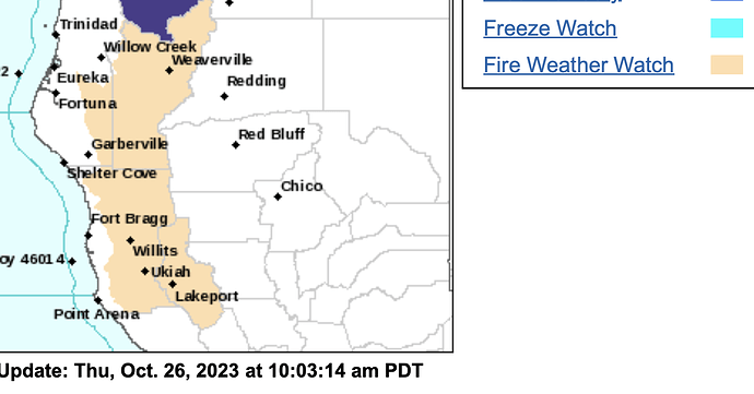
Critical Fire Weather Conditions Expected This Weekend…
.An exceptionally dry airmass will spread south across Northern
California this weekend. In addition, east-northeast winds gusting
from 30 to 50 mph are forecast to develop across the ridges of
Northwest California. The dry air and strong winds will yield a
critical fire weather threat Saturday morning through Sunday
afternoon, particularly from southern Trinity County south across
Lake and eastern Mendocino Counties.
…FIRE WEATHER WATCH IN EFFECT FROM LATE FRIDAY NIGHT THROUGH
SUNDAY AFTERNOON…
-
WIND…East-northeast ridgetop winds with frequent gusts ranging
from 30 to 50 mph. -
HUMIDITY…Minimum relative humidity values in the teens with
very poor overnight recoveries.
Should be a spicy weekend. I pray the crews remain safe during the event.
I don’t see a threat at all here in Butte County. We are heavy into greenup, got good showers last Sunday, and it’s cool and wet. I’m wearing a down jacket in my office shack at 2pm.
NorthOps says ‘ERC’s are not expected to be critically high during the next 7 days’.
Am I missing something here?
I don’t think you are missing anything. 
If I’m not missing anything, why are you telling people you think it’s going to be a ‘spicy weekend’?
Sustained winds in the 20-30 mph range with some higher gusts. Winds shift from the NE Saturday night with favored canyons seeing winds possibly reaching higher than 40 mph.
RH will drop Friday and remain low with RH reaching critical levels by Saturday( possibly single digit). By Sunday winds will diminish across the west side and the valley but remain gusty overnight in the Sierra’s.
I would expect IA to increase by Saturday and it might even get busy. I would not expect a large scale fire to get established but there could certainly be some damaging fires in areas below 2500 feet. Overlay hunting season and burning being allowed and you have the ingredients for increased IA and the potential for damaging fires. FM levels are up based on precip but the 1 and 10 hour fuels do not care about that…
From PDS at NOPS… " possibly the strongest wind event of the last two years".
The CURRENT fire weather watches for both north and south ops make for some unpredictably. I’ve had some weird October fires that defy logic.
Speaking of spicy! FYI, thing’s appear & smell like they are burning just fine…
If nothing else, a few days of north winds should help open back up a burn window here in Butte County that closed with the recent rains. Most years, we need an event like this to get back into prescriptions after early rains, especially on the north slopes.
