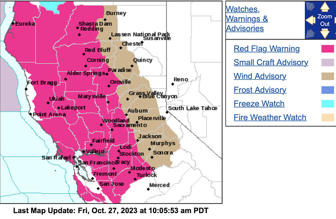
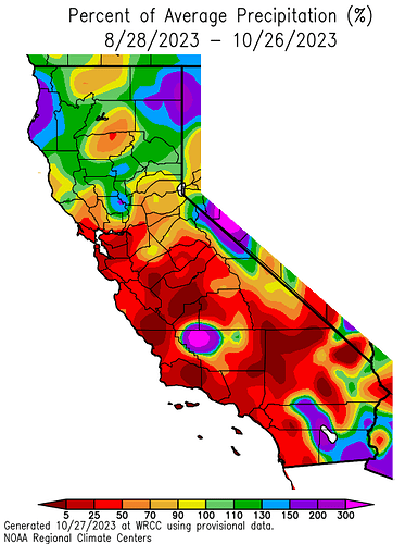
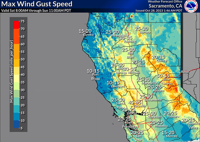
I would argue that critical fire delineations are warranted for the Southern Bay Area mountains as very efficient cold air advection drives widespread gusty winds into locations that may not typically get strong winds. This area is running a significant precipitation deficit for the past 60 & even 90 days. I am not sure why the SPC is precluding this area.
Moreover, critical fire weather conditions should exist in these low elevation areas that tend to have a flashy fuel component and mixed oak as opposed to timber in higher elevations.
North Ops Saturday:
-
Fire danger, including Burn Index values, will noticeably increase Today and Sun due to likely the strongest offshore wind-low RH event of the past 2 years.
-
High Risk for lower portions of the Sac Vly and Greater Bay Area due to a potent Offshore Wind & very Low RH event Sat night-Sun
-
Classic Inside Slider Trough passage will allow a dry cold front to sweep across the region Today-Tonight and produce widespread peak gusts of 25-50 mph with several readings +60 mph in the wind prone areas found across the higher ridgelines of the N and E Bay Hills with rapidly lowering RH including single digits/teens & 20s.
-
The weekend event will be a “Cold Air Advection” Offshore Wind event therefore allowing more elevations of the Greater Bay Area to be impacted by the gusty-dry winds including the Valley bottoms.
Fuels/Fire Potential:
-
The Oak Woodland and grass fuel types found across the Greater Bay Area and Sac Vly-Foothills where significant rain hasn’t fallen the past 7 days will be most susceptible to fire spread this weekend with Burn Index values approaching or nearing critically high values although the “flash” drying effects from the unusually dry airmass originating from northern Canada will rapidly dry fine fuels including needlecast in the timbered areas.
-
Live Woody Brush-Shrubs & Tree Canopies have generally bottomed out in moisture content with most of the elevations heading towards dormancy. Some recent sampling has indicated a slight bump up in values likely due to recent rainfall events and absorption within the needles/leaves. Sampling indicates near to above normal values for the time of year although readings are quite flammable in species like Chamise, Sage and Manzanita depending on elevation & aspect.
-
Fire danger should bump up again later in the week, especially Thu, ahead of a moist cold frontal passage but likely not to the degree compared to this weekend.
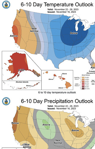
A Daiblo - North wind event is still possible. The current storm produced very little rain and after Saturday it looks dry:
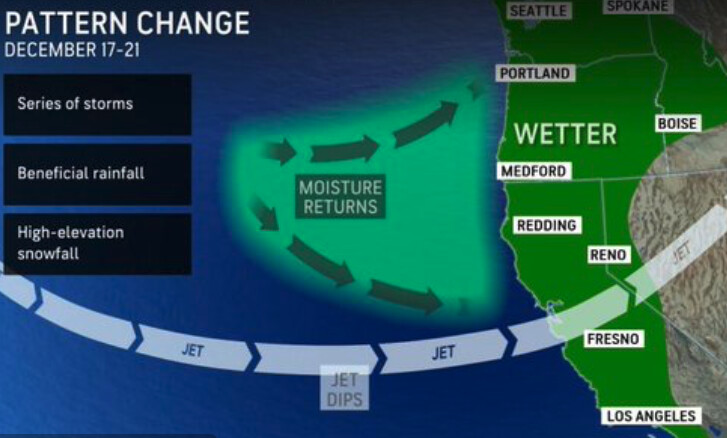
NWS SF Friday: The weekly total QPF forecast has been holding remarkably steady over the last few days, and the global model ensemble spread is relatively tight around 2-3 inches for most locations. As the confidence seems to grow, one outlier in the probabilistic guidance is the NBM10/NBM90. This guidance is suggesting a range between 0.10" and 18.00". That is not a typo, the NBM is telling us there is a 10% chance we get more than 18 inches! None of the global ensemble members get anywhere near half of that upper end. Needless to say, this guidance appears to be quite over- dispersed and was left out of our official probabilistic messaging for partners and social media, which keeps the 10/90% interval range between 0.5-6 inches or so. It should also be noted that some of this spread is location dependent, with rain shadowed areas like the Santa Clara and Salinas Valley on the low end, and the coastal mountains on the high end.
