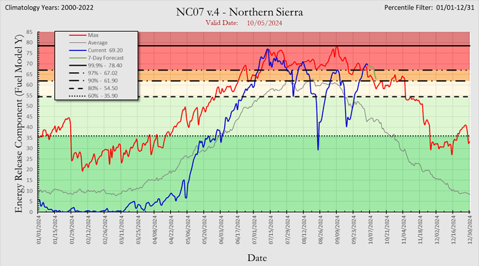
We have historically bad fires in October and November in North Ops. With the inversion layer in the Sierra some of them still rip day or night. The ERC in the Sierra is at a high right now.
I can’t think of one.
The conditions today are similar 1991 Oakland Hills fire that started on October 19. We definitely have large fires in the fall.
The Camp is one….
Does the Camp Fire, BTU, November 2018 ring a bell? Ever been to Paradise?
Past November is what I said.
Conditions in Nor Cal are entirely weather dependent. If we do not see season ending weather, conditions will continue to get worse.
Totally agree. Back in the olden days when we used to wear green jeens to work, we were lucky to stay on the job until Oct 15th. After that time the days get shorter, cooler, more RH and then it starts raining. There is always the rare possiblity of a rouge fire that is out of the norm. If you check Cal Fire’s stats of largest fires, there are only 3 of the top 20 that happened between Oct and December. The Witch, Cedar, and the Thomas fires. There are no record setting fires between Jan and May. Most big fires occure in July and August. It is trendy to say that there is not a fire season, however the stats say different. There may not be a hard date when the season starts and ends, but fire season is between the end of Spring and the Fall.
Statistics quantify the past. They do not predict the future.
You in CNR are now more readily available to begin the annual tracks to CSR for the rest of CAL FIRE’s year round mission
Can we please get this thread back on the topic at hand. Start a new thread for fires after November if it’s really that important.
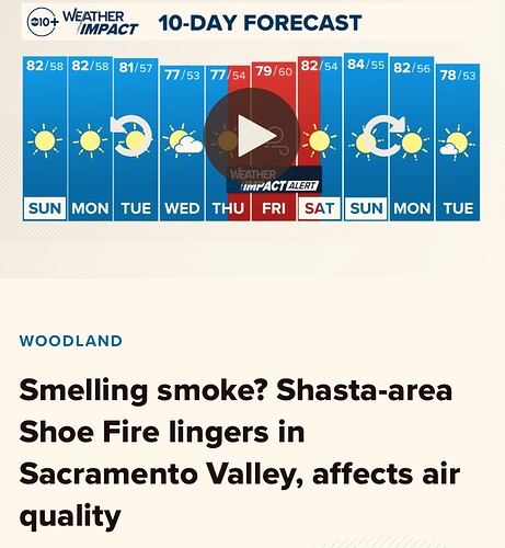
And end to above normal temps will arrive by Tuesday. Instead of 15-20 degrees above normal it will only be 3-10 degrees above normal.
Big picture… fall weather will return with some cooler temps and onshore flow. Models have been waffling on extent and amount of precip from a quick moving wave which was showing to arrive on Friday and now more like maybe Saturday/Sunday. My uneducated guess would be a weak cold front coming into a dry airmass and coming off a record period of dryness and heat would mean an anemic cold front.
If any moisture were to wring out it would be confined to the coastal hills.
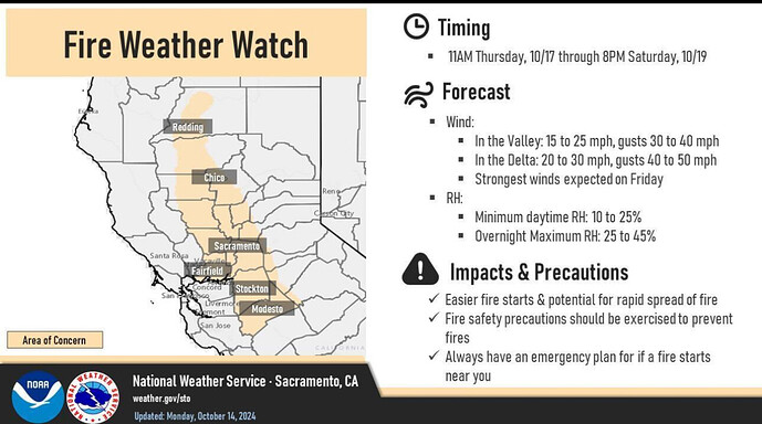
Beyond that a quick transition to HP with some light offshore winds, but no real strong signal of an major offshore wind event. There is a stronger possible event late in the runs, but that is fantasyland…but also lines up with climatology. So a good bet one is coming maybe around the 20th( will make the rice farmers happy).
One thing to watch… PDS mentioned and it shows up on the HRRR hi res models… there is a possibility of some elevated convection today from about Chico north. Not great parameters for storms, but enough that some could form. The soundings would indicate at least the possibility for some dry lightning… coming on the heels of a record setting heat wave in October… why not throw in a dry lighting outbreak?
Guess we will see…
Dang that HRRR! No wonder it feels & looks like the dogdays of October today…
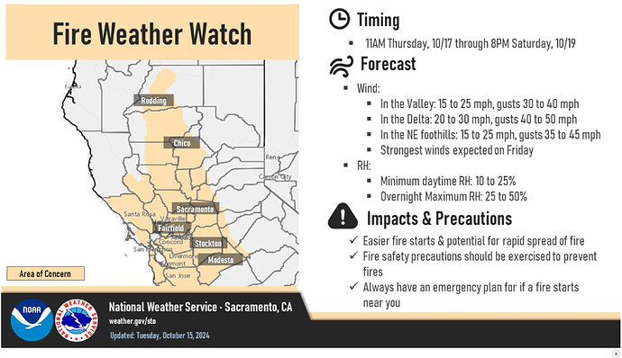
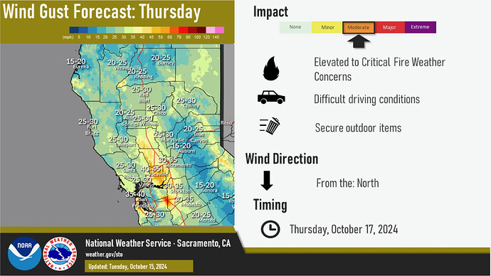
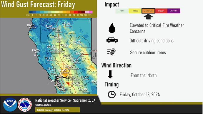
Fire Wx Watch now covering the Bay Area as well Thursday through Saturday: National Weather Service
A post was merged into an existing topic: California Fire News & Weather
