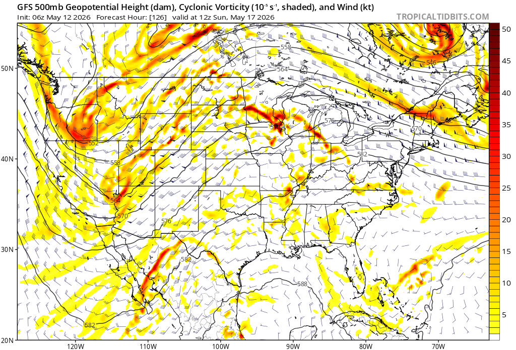
First offshore event of the season with fire weather implications.
13 Likes
Can anyone translate what this offshore event means? Hot and windy ?
2 Likes
Yes, a weak front will pass through to the north of the state. By Friday a weak ridge will build in and then strengthen. As it does a typical offshore pattern will set up. I have not looked too closely but it seems like at the minimum winds in the valley reaching 18-20 mph. Temps will bump up and RH will drop down accordingly. Most likely only an issue for the areas in the coast range and
valley where the first grass crop has dried out. But this will help to accelerate drying of the grass.
13 Likes
I drove Hwy 36 west out of Red Bluff on Sunday and grass in the Valley/coast foothills was fading slightly, but still green. Burning this week between Hyampom and Hayfork and fire isn’t carrying in the grass, but RH fell off a cliff midday, dropping from 30% to 18% in about an hour this afternoon with temps in mid 80s and we had to hang things up.
10hr fuels and heavies are very receptive right now! Live FM is high in brush, but we torched some manzanita and ceanothus where there were heavy surface fuels under them.
12 Likes
Thanks for clarifying
2 Likes
Offshore flow with the very long days drops fuel moistures very quickly. It will be the “kick off” of fire season in north ops. Will give you guys another longer term tidbit like I did in the South Ops thread previously: This is several weeks away, but June 29th and the first week of July looks like an interesting fire and heatwave related time period. I would expect an extreme heatwave to manifest around that time. So maybe June 29th-July 7th time period.
10 Likes
Perfect. 4th of July. Great timing lol.
6 Likes
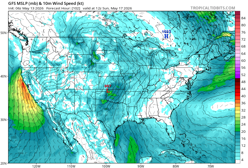
It looks like and has been confirmed by NSW discussion that the current trough will take a more “inside slider” path across Oregon and then slide down towards the Great Basin. This will help to re-force the pressure differential between that departing area of LP and the HP which will set up behind it.
That differential translates into wind moving “downhill”. In doing so we will see wind and low RH and then warming once the HP takes up residence.
The trough will move across the state this afternoon and into Thursday. Winds will shift from onshore and up valley( Delta Breeeze) to a cool NW flow. Eastern Oregon will see some very strong winds approaching “high wind” criteria.
By Saturday the winds will turn to the North and North East.That will be the set up for our classic offshore flow pattern. The winds will be near advisory levels. I would not be surprised to see a wind advisory posted for areas of the SV and lower Coast Range areas around the BA by Saturday/Sunday.
The peak looks to be Sunday into Monday.
While not an overly critical event it will be easy to feel the difference. As was said, for the most part the fuels will not support large fire growth. But this will be the first event where it will not be followed by some precip and will most certainly serve to start a more pronounced drying cycle.
12 Likes
We shall see….Super Mega Godzilla El Niño is upon us.
1 Like

3 Likes
Gigachad El Nino. Think in terms of food.
7 Likes

Edit: 5/15
Upgraded to RFW..

5 Likes

3 Likes
10 Likes